Steve MacFeely, Head of Statistics and Information, United Nations
Vimeo
In my opinion, being part of the ISI family gave me the courage and marked a significant milestone in my path towards the development of statistics.
Ola Awad, ISI Council member (2017–2021)
International Statistical Institute - Who. What. Mission.
Vimeo
The international statistical community has provided me with robust challenge and support throughout my career. That's what colleagues do! And that's what you will find at the ISI.
Stephen Penneck
ISI President (2021-2023)
I'm an ISI member to demonstrate my support for the statistics community; to stay connected to the last advances in statistical techniques and practices; and to play my part to promote the importance of high quality statistics worldwide.
Marcel van Kints
General Manager, Australian Bureau of Statistics
My perspective as a statistician has been enriched by my interactions with international colleagues since joining ISI. It is a pleasure to connect and collaborate with statisticians from around the world.
John Bailer
ISI President (2019-2021), University Distinguished Professor and Chair, Department of Statistics, Miami University
The ISI is an outsanding international statistical body, serving, connecting, building, impacting and reshaping our globe for a better world. The ISI World Statistics Congress is just one of a kind I always look forward to. It is a pleasure to connect with statisticians from around the world.
Oyebimpe Adeniji
President West African Young Statisticians Association / INEC Nigeria
The ISI is an international statistical society which provides the community with a place to connect and meet with other statisticians worldwide. More importantly, joining the ISI has enhanced and widened my ability and knowledge in the area that I am passionate about.
Yuanyuan Zhang
Post-Doctoral Researcher, University of Manchester
Father of Cryptanalysis (statistical cryptography)
Famous for model selection
Photo Credits: The Institute of Statistical Mathematics
Famous for test of hypothesis of gender ratio
Coined German word Statistik
Stuart A. Rice
Stuart Rice strived to make the ISI the umbrella for all kinds of statistical interests and activities, which is reflected by the current seven ISI Associations as well as the breadth of conferences, meetings and publications.
USA
Joining the ISI has enriched my professional life and offered a platform to expand my network of research collaborations.
Ksenija Dumicic
Leader of Postgraduate Study in Statistics, University of Zagreb, Faculty of Economic and Business
The study and advancement of statistics naturally occurs on an international scale!
What better way to contribute to our discipline than by networking and collaborating with others from around the world. This can be concisely achieved by joining the ISI.
Kimberly F. Sellers
Associate Professor of Statistics, Georgetown University
Joining the ISI has not only widened my statistical scope but has also lead to lots of statistical friendships all over the world. Do not hesitate and join the ISI and the WSC2021!
Eric Schulte Nordholt
NOC Chair of the WSC 2021, Statistics Netherlands
ISI meetings are the only place for panels with contributors from vastly different areas of statistics, each drawing their own audience who would not otherwise participate in a discussion together.
Peter Guttorp
Vice-President (2019-2021), ISI
The International Statistical Literacy Project is a project initiated by the International Association for Statistical Education (IASE), which is the education section of the ISI.
The main objective is to contribute to promoting statistical literacy across the world, among young people and adults, in all walks of life. To this end, it provides:
Criteria to assist in selecting World Statistics Congress (WSC) future hosts
Affirmed by ISI Council in August, 2019
ISI membership helps me stay connected with peers, and be informed of the latest research.
Andreea Luisa Erciulescu
Senior Statistican, Westat
The ISI provides an important forum, bringing together statisticians from around the world, from academia, government and the private sector, to further our profession. I am honored to be an elected member.
Steve MacFeely
Head of Statistics and Information, United Nations
ISI creates conducive environment for the statistical family to always meet, interact, and improve the knowledge of statistics and related disciplines.
Olawale Akanbi
Lecturer, University of Ibadan, Nigeria
Collegiality and communication of statistics have been at the heart of all my work. To me, the ISI family are the pinnacle of these – across its inspirational people and the world, across statistics and across the years
Helen MacGillivray
President (2017-2019), ISI
Joining the ISI has broadened my outlook, advanced my knowledge and expanded my professional connections. I am truly proud to be a part of the ISI family!
Tamanna Howlader
Professor, University of Dhaka
I have experienced my self to be professionally capable of handling problems with the shared experience of statistics professionals from around the world.
Dereje Danbe Debeko
Assistant Professor, Hawassa University
Being a member of ISI is a gateway to the international statistical community in all disciplines, providing unlimited networking and communications to face future challenges in statistics and data science.
Natalie Shlomo
Council Member (2017-2021), ISI
Joining the ISI was a life changing experience. I developed connections which have enabled me to advance my education and career, as well as to bring home the benefits of belonging to such a vibrant and generous community.
Pedro Silva
President (2015-2017), ISI
Joining the ISI has cultivated me like a seedling. I’ve met experienced people, expanded my network, and thus realized my dream. Serving the ISI community brings me satisfaction and makes me a better person.
Haimanot Atinkut Bazezew
PhD Student, Huazhong Agricultural University
I am an Elected ISI Member, which is a great honour. It motivates me even more to continue my professional activities on a daily basis.
Michal Ordak
Assistant Professor, Medical University of Warsaw
Statistics makes life better.
Ning Yang
Assistant Professor, Cornell University
Joining the ISI has enriched my professional life and offered a platform to expand my network of research collaborations.
Kazeem Osuolale
Lecturer, University of Ibadan, Nigeria
Being a member of the ISI helps me to interact with statistical community all over the world and to improve statistical literacy in my country Ethiopia.
Demisew Gebru Degefu
Lecturer, Hawassa University
Joining the ISI has broadened my horizon. I have met many inspiring people and visited amazing places. Serving the ISI community has enriched my professional life.
Ada van Krimpen
Former ISI Director, ISI
Being a member of ISI and its ISBIS association since 2014 has allowed me to strengthen my skills in agricultural statistics and develop a dynamic professional network.
Lao Kenao
Coordinator of SAKSS, Ministry of Agriculture of Togo
ISI was my gateway to the international statistics community. I met many wonderful people and made lifelong friendships at the World Statistics Congresses.
Vijay Nair
Head, Statistical Learning and Advanced Computing, Wells Fargo
Linda J. Young is Chief Mathematical Statistician and Director of Research and Development of USDA’s National Agricultural Statistics Service (NASS). She is an emphasis editor for the Statistical Journal of the IAOS and past editor of the Journal of Agricultural, Biological, and Environmental Statistics.
Caio Gonçalves is a Researcher at João Pinheiro Foundation, Regional Statistical Office of the state of Minas Gerais in Brazil. PhD Candidate in Population, Territory and Official Statistics at the National School of Statistical Sciences (ENCE) from the Brazilian Institute of Geography and Statistics (IBGE).
His developing thesis is about producing labour force model-based figures with higher frequency and small domains using time series analysis for repeated surveys.
Denise Silva is retired and voluntary Principal Researcher of the National School of Statistical Sciences (ENCE) from the Brazilian Institute of Geography and Statistics (IBGE) and Senior Associate Researcher at the Society for the Development of Scientific Research (SCIENCE).
She completed her PhD in Statistics at the University of Southampton and has been working as a survey methodologist for more than 35 years as well as a lecturer at graduate and undergraduate levels.
ISI Regular
For anyone who shares the values and objectives of the ISI.
Benefits
As a member of the ISI you will:
For individuals who share our values and objectives and are established in their statistical careers.
Benefits
Unique benefits:
- Be recognised internationally for your contribution to statistics.
- Get one free ISI Association membership.
+ Same benefits as for ISI Regular members:
As a member of the ISI you will:
For national, regional, and international statistical institutes and agencies to assist in furthering the cause of statistics internationally and nationally.
Benefits
As a member of the ISI you will:
For national and regional statistical societies and associations.
Benefits
As a member of the ISI you will:
International Statistical Institute - Who. What. Mission.
Vimeo
International Prize in Statistics 2021 Lecture — Nan Laird
Vimeo
The ISI Service Awards are presented to members who have made outstanding contributions to the ISI and the international statistical community. They are selected every two years by the ISI Executive Committee and are presented at the Awards Ceremony during the World Statistical Congress (WSC).
Ministry of Finance and Economy – Statistics Division
1st Floor
ACT Building
Market and Church Streets
St. John’s Antigua
Contact: Mr. Statchel Edwards, Chief Statistician
Tel. 001-268-462 4775
VISIT WEBSITE
Antigua and Barbuda
Bahrain Statistical Society
P. O. Box - 40655
Contact: Mr. Jalal Naser, Chairperson and Founder
Tel. +973 39575127
VISIT WEBSITE
Bahrain
Bangladesh Statistical Association
c/o Institute of Statistical Research and Training
University of Dhaka
Dhaka 1000
Contact: Prof. M. Nurul Islam, Secretary General
Tel. +880 2 505812, 501274
VISIT WEBSITE
Bangladesh
Statistical Service
3rd Floor, NIS Building, Fairchild Street,
Bridgetown, BB11122
Contact: Mr. Aubrey Victor Browne, Director
Tel. +1-246-4277396
VISIT WEBSITE
Barbados
Statistics Flanders
Departement Kanselarij En Bestuur
Vlaamse Statistische Autoriteit
Departement Kanselarij en Buitenlandse Zaken
1000 Brussel
Havenlaan 88, bus 100
Contact: Mr. Roeland Beerten, Chief Statistician
VISIT WEBSITE
Belgium
Brazilian Statistical Association
Rua do Matão, 1010 - Sala 250A
05508-090 SÃO PAULO - SP
Contact: Professor Flavio Ziegelmann, President
VISIT WEBSITE
Brazil
Department of Agriculture statistics and Information, Ministery of Agriculture and Livestock
P.O. Box 1850 Bujumbura
Contact: Léonard Ntakirutimana, Director
Tel. +257 22 21 88 60
VISIT WEBSITE
Burundi
Association des Statisticiens du Cameroun
Ministère du Plan et de l'Aménagement du Térritoire, B.P. 660, YAOUNDÉ
Contact: Mr. Isaac Njiemoun, President
VISIT WEBSITE
Cameroon
Economics & Statistics Office
Economics and Statistics Office
Government Admin. Building, Grand Cayman KY1-9000
Contact: Ms. Maria Zingapan, Director
Tel. +1-345 949-09-40
VISIT WEBSITE
Cayman Islands
Division des Statistiques et des Études Économiques (DSEE)
Ministère de l’Économie du Plan des Statistiques et des Études Économiques (MEPSCI), B.P. 696, BANGUI
Contact: Mr. Félix Moloua, Director
Tel. +236-61 45 74
VISIT WEBSITE
Central African Republic
Direction de la Statistique, des Études Économiques et Démographiques
Ministère du Plan et de la Coopération, B.P. 453, N’DJAMENA
Contact: Mr. Ousmane Abdoulaye Haggar, Director
Tel. +235-51 45 49
VISIT WEBSITE
Chad
Direction Générale du Plan
B.P. 131, MORONI
Contact: Mr. Bastoine Msoma, Director of Statistics
Tel. +269-74 42 34
VISIT WEBSITE
Comoros
Institut National de la Statistique (INS)
Délégué Général, B.P. 20, KINSHASA-GOMBE
cable Insbp 20 Kingombe
Contact: Mr. Grégoire Ebulelang Kankwanda, President
Tel. +243-12-30 693, 31 313, 30 613
VISIT WEBSITE
Congo, Democratic Republic
L' Association des Statisticiens du Congo (ASTACO)
PO Box 13.040
Kinshasa
Contact: Prof. Alexis Lukaku Nzinga, President
Tel. +2431233312 ou +2431233313
VISIT WEBSITE
Congo, Democratic Republic
Central Statistical Office
Ministry of Finance, Industry and Planning, Kennedy Avenue, Roseau
Contact: Mr. Prayma Carrette, Chief Statistician
Tel. +1 767 266 3400
VISIT WEBSITE
Dominica
Egyptian Young Statistician Association (EYSA)
3 Salah Salem St, Nasr city, Cairo
P.O. BOX : 2086
Contact: Mrs. Reem Ismail ElSebaey + Mr. Mahmoud Mohamed ElSarawy, President + Executive Director
Tel. +20 100 23 89 171
VISIT WEBSITE
Egypt
National Statistics and Evaluation Office (NSEO)
Ministry of Finance and Development, P.O.Box 5838, Asmara
Contact: Mr. Aynom Berhane, Director General
Tel. +291-1-120 091
VISIT WEBSITE
Eritrea
Association de Compatibilité Nationale (ACN)
Direction Générale de l'INSEE
Département des Comptes nationaux
15 Boulevard Gabriel Péri, BP 100, 92244 MALAKOFF Cedex
Contact: Jacques Bournay, Secretary
Tel. +33-1-41 17 37 03
VISIT WEBSITE
France
Georgian Centre of Population Research
43, Kostava Street 0109 Tbilisi, Georgia
Contact: Ms. Irina Badurashvili, Director
Tel. +995-32-92 37 31
VISIT WEBSITE
Georgia
Georgian Statistical Society
11, ft. 3 V,m/r, b, Nutsubidze Sp.
Vake-saburtalo district, Tbilisi
Contact: Ms. Lia Mdinaradze, Chairperson
Tel. +995-32-71 75 05 88
VISIT WEBSITE
Georgia
State Department for Statistics of Georgia
4, Pekini str., 0115 Tbilisi, Georgia
Contact: Mr. Grigol Pantsulaia, Chairperson
Tel. +995-32- 36 72 10
VISIT WEBSITE
Georgia
Deutsche Gesellschaft für Demographie (DGD)
Contact: Prof. Dr. Birg + Prof. Dr. Eckart Elsner, President + Vice-President
VISIT WEBSITE
Germany
Ghana Statistical Association
Contact: Dr. Philomena Efua Nyarko, President
Tel. +233-21-51250321
VISIT WEBSITE
Ghana
Greek Statistical Institute
5, Solomou Street
106 83 Eksarchia
Athens
Contact: Prof. Takis Papaioannou, President
Tel. +30 210 3303909
VISIT WEBSITE
Greece
Central Statistical Office
The Financial Complex
Ministry of Finance
The Carenage, St George’s
Contact: Mr. Hakim Brizan, Acting Director
Tel. +1-473-440 1369, 440 2731
VISIT WEBSITE
Grenada
Secretaria de Estado de Plano et Coopéraçao Internacional
C.P.- 6, BISSAU
Contact: Mr. Carlos Mendes da Costa, Director General of Statistics
Tel. +245-21 53 58
VISIT WEBSITE
Guinea-Bissau
Indian Society of Agricultural Statistics
c/o I.A.S.R.I. Campus
Library Avenue
New Delhi 110 012
Contact: Dr. S.D. Sharma, Secretary
VISIT WEBSITE
India
The Calcutta Statistical Association
New Science Buildings (5th Floor)
35 Ballygunge Circular Road
Calcutta-700019
Contact: N.K. Mandal
Tel. +91 33 475368082
VISIT WEBSITE
India
Indonesian Statistical Society
c/o Central Bureau of Statistics
Jalan Dr. Sutomo No. 6-8, Jakarta 10710
Contact: Mr. Rusman Heriawan, Director General
Tel. +62-21-3846304
VISIT WEBSITE
Indonesia
Association des Statisticiens et Démographes du Côte d'Ivoire
01 B.P. V55 Abidjan 01
Contact: Mr. Ettien Amoikon Dihyé, President
VISIT WEBSITE
Ivory Coast
Japan Statistical Society
c/o SINFONICA
Nohgakushorin Building 5F
3-6 Kanda Jimboucho Chiyoda-ku
TOKYO 101-0051
Contact: Professor Tomoyuki Higuchi, President
VISIT WEBSITE
Japan
Agency of Statistics
Astana 010000, Orinbor street-8, Dom Ministerstv, 4th entry
Contact: Mr. Alikhan Smailov, Chairperson
Tel. 007 7172 749338
VISIT WEBSITE
Kazakhstan
Kenya National Statistical Society
School of Mathematics, University of Nairobi
P.O. Box 62000, 00200 Nairobi
Contact: Dr. Joseph Mung’atu, Chairman
Tel. +254 720 824 708
VISIT WEBSITE
Kenya
National Statistics Office
Ministry of Finance, P.O. Box 67, Bairiki, Tarawa
Contact: Mr. Tekena Tiroa, Government Statistician
Tel. +686-21 816
VISIT WEBSITE
Kiribati
Central Bureau of Statistics
General Bureau of State Statistics
Inhung-dong
Moranbong District, Pyongyang City
Contact: Mr. Kim Chang Su, Director General
Tel. +850-2-3814416
VISIT WEBSITE
Korea, Democratic People-s Republic of
National Statistical Association
Contact: Ju-Dae Sun, President
Tel. 82-2-3443-7954/6
VISIT WEBSITE
Korea, South
Latvian Statistical Society
Contact: Prof. Biruta Sloka, President
VISIT WEBSITE
Latvia
Libya
Secretariat of Planning, P.O. Box 600, Tripoli
Contact: Mr. A.S. Zoghni, Director General
VISIT WEBSITE
Libya
National Corporation for Information and Documentation
P.O. Box 2313
Tripoli
Contact: Mr. Salem Abu-Aisha, Director
Tel. +218-21 4446131
VISIT WEBSITE
Libya
European Free Trade Association (EFTA)
Bech Building F2/908
Rue Alphonse Weicker
L-2920 Luxembourg
Contact: Ms. Andrea Scheller, Director, Head of the EFTA Statistical Office
VISIT WEBSITE
Luxembourg
Service Central de la Statistique et des Études Économiques (STATEC)
Centre Administratif Pierre Werner
13, rue Érasme
L - 1468 Luxembourg
B.P. 304
L-2013 Luxembourg
Contact: Mr. Serge Allegrezza, Director
Tel. +352-247 84333, 84219
VISIT WEBSITE
Luxembourg
Association Malagasy des Ingénieurs de la Statistique (IMIS)
Contact: Mr. Eric Jean Michel Rakotomanana, President
VISIT WEBSITE
Madagascar
Malaysia Statistical Society
Contact: Prof. Dato Jamil Osman, President
VISIT WEBSITE
Malaysia
Association Malienne de Statistique (AMSTAT)
Ministère du Plan, B.P. 12, Bamako
Contact: Aboumé Diane Toure, President
VISIT WEBSITE
Mali
Direction Nationale de la Statistique et de l'Informatique (DNSI)
Ministère du Plan, B.P. 12, Bamako /
Rue Archinard, Porte 233, Bamako
Contact: Mr. Seydou Moussa Traoré, National Director
Tel. +223-222 2455, 222 4873
VISIT WEBSITE
Mali
Association des Statisticiens de Mauretanie (ASM)
Contact: Mr. Mamadou Cissoko, President
VISIT WEBSITE
Mauritania
Direction de l'Expansion Economique,
la Division de Statistiques et des Etudes Economiques
9, rue du Gabian, MC 980000 Monaco
Contact: Ms. Catherine Orecchia-Matthyssens, Director
Tel. +377 98 98 88 12
VISIT WEBSITE
Monaco
Association Marocaine des Ingénieurs Statisticiens (AMIS)
Institut National de Statistique et d'Économie Appliquée (INSEA)
BP 6234, Rabat
Contact: Abdelilah Zerrou, President
VISIT WEBSITE
Morocco
Statistical Association
Contact: Mr. Muemed Cassimo
VISIT WEBSITE
Mozambique
Central Bureau of Statistics
Fort Amsterdam, Willemstad, Curaçao
Contact: Mr. Francis G. Vierbergen, Director General
Tel. 00 599-9 4611031 / 4630156
VISIT WEBSITE
Netherlands Antilles
Association des Statisticiens et Démographes du Niger
Contact: Mr. Alichina Idrissa Kourguéni, President
VISIT WEBSITE
Niger
Statistical Centre for the Cooperation Council for the Arab Countries of the Gulf (GCC Stat)
P.O. Box 840, PC 133, Muscat, Oman
Contact: Mr Sabir al Harbi, Director
VISIT WEBSITE
Oman
Federal Bureau of Statistics
Statistics Division, Government of Pakistan,
5-SLIC Building, F-6/4, Blue Area, Islamabad
Contact: Mr. Shahid Rashid, Secretary
Tel. +92-51-920 8489
VISIT WEBSITE
Pakistan
Pakistan Statistical Association
c/o Dept. of Statistics
University of Peshawar
Peshawar
Contact: Dr. Muhamad Iqbal, Vice-President
VISIT WEBSITE
Pakistan
Planning and Statistics Authority (PSA)
P.O. Box 7283, Doha
Contact: Dr. Saleh M. Al Nabit, Minister
Tel. +974-445 94555
VISIT WEBSITE
Qatar
Romanian Statistical Office
Academia de Studii Economica,
6, Piata Romana
Bucharest
Contact: Prof. M. Bulgaru
VISIT WEBSITE
Romania
Romanian Statistical Society
Bucharest University of Economic Studies
Contact: Prof. Dr. Constantin Mitrut, Vice-rector
Tel. +40-213192022
VISIT WEBSITE
Romania
Ministry of Finance, Technology and Sustainable Development
Church Street, P.O. Box 186, Basseterre, St. Kitts
Contact: Ms. Beverly Harris, Director of Statistics
Tel. +1-869-465-2521 Ext. 1063
VISIT WEBSITE
Saint Kitts and Nevis
Association Senegalaise pour la Statistique (ASTAT)
Contact: Amadou Talla Gueye, President
VISIT WEBSITE
Senegal
Statistical Society of Serbia
c/o University of Belgrade
Faculty for Traffic and Transport Engineering
Vojvode Stepe 305
10000 Belgrade
Contact: Dr. Ranko Nedeljkovic, President
Tel. +381 63 439593
VISIT WEBSITE
Serbia
Directorate of Statistics
Ministry of National Planning
P.O. Box 1742, MOGADISHU
Contact: Mr. Mohamed Ali, Director General
Tel. +252-1-80 384/87
VISIT WEBSITE
Somalia
Department of Statistics
Ministry of Planning, P.O. Box 700, KHARTOUM
Contact: Mr. Omer Ahmed El Tay, Director-General
VISIT WEBSITE
Sudan
Central Statistical Office
P.O. Box 456, MBABANE
Contact: Ms. Isabella Hlophe, Director of Statistics
Tel. +268-42 151/4
VISIT WEBSITE
Swaziland
Conference of Regional Statistical Offices
c/o Statistisches Amt des Kantons Luzern
Burgerstr. 22
CH-6002 Luzern
Contact: Gian Antonio Paravicini, President
Tel. +41 41 228 56 36
VISIT WEBSITE
Switzerland
Schweizerische Gesellschaft für Statistik und Volkswirtschaft
c/o Volkswirtschaftliches Institut
Universität Bern
Vereinsweg 23
CH-3017 Bern
Contact: Prof. Ernst Baltensperger, President
Tel. +4131 6318081
VISIT WEBSITE
Switzerland
Swiss Statistical Society (SSS)
c/o Statistische Beratung und Universitäre Forschung
Pädagogische Hochschule Luzern
Universität Luzern
Brauerstrasse 108
8004 Zurich
Contact: Dr. Rodolphe Dewarrat, Contact person (facility in Bern)
Tel. +41 44 350 03 41 (Dr. Rodolphe Dewarrat, in Bern)
VISIT WEBSITE
Switzerland
Thai Statistical Association
Contact: Prof. Adisak Pongpullponsak, President
VISIT WEBSITE
Thailand
Association des Statisticiens et Démographes
Contact: Mr. Kponton Anani Théodore, President
VISIT WEBSITE
Togo
Tunisian Association of Statistical Engineers (TASE)
6, Rue des Métiers
Charguia II-2035, Tunis
Contact: Mr. Wajdi Sfaihi, President
VISIT WEBSITE
Tunisia
Service de la Statistique
Mata Utu, Immeuble Pukavila, RT1 - Falaleu, 98600 - Wallis
Contact: Mr. Jean Paul Goepfert, Chief of Service
Tel. +681 72.24.03
VISIT WEBSITE
Wallis and Futuna
Central Statistical Organization (CSO)
P.O. Box 13434, SANA’A
Contact: Mr. Ahmed Mohammed Eshaq, Chairperson
Tel. +967-1-25 01 08
VISIT WEBSITE
Yemen
Central Statistical Office
P.O. Box CY 342, Causeway, HARARE
Contact: Mr. Moffat Nyoni, Director of Census and Statistics
Tel. +263-4-70 66 81/8
VISIT WEBSITE
Zimbabwe
Zimbabwe Statistical Association
Contact: Dr. Gibson Mandishona, President
VISIT WEBSITE
Zimbabwe
In this document:
- Historical Commentary
- Codes of Ethics: Selected Statistical Associations
- Codes of Ethics: Selected Non-statistical Associations
- Bibliography
HISTORICAL COMMENTARY
The following discussion reflects an extensive dialog among the architects of the initial Declaration on Professional Ethics from 1985. It is archived here for reference as much of its value remains relevant.
The course teaching activity should be seen as a service to the international statistical community and a contribution to professional development and statistical capacity building for ISI members and the larger community.
The course teaching activity should be seen as a service to the international statistical community and a contribution to professional development and statistical capacity building for ISI members and the larger community.
Marcel de Toledo Vieira, born in 1976 and winner of the 2007 Cochran-Hansen Prize of the International Association of Survey Statisticians (IASS), is currently Associate Professor of Statistics, at the Department of Statistics of the Federal University of Juiz de Fora, in Brazil.
He has been a member of the IASS since 2007 (Council Member between 2011 and 2015) and was elected Member of the International Statistical Institute in 2013.
Delia is Professor in Statistics at, and Dean and Head of, the School of Mathematics, Statistics and Computer Science at the University of KwaZulu-Natal in South Africa.
She has over 30 years of experience in teaching Statistics, and has become a leading figure in Statistics Education circles, nationally and internationally (Chair: South African Statistical Association Education Committee for 17 years; Vice President: International Association of Statistics Education; Master Trainer: Maths4stats for schools).
Edward is Professor of Statistics at Virginia Commonwealth University in Richmond Virginia USA, and has been teaching Statistics for 17 years.
He has been very active in researchin Statistics as has a passion for teaching. Learning should be fun and complex ideas should be presented first from an intuitive approach.
He is currently the Publications Officer for the Section onStatistical Consulting of the American Statistical Association and the President Elect for the Southern Regional Council on Statistics.
Ashley Steel worked as a statistician and an ecologist for the US Government from 1999 – 2018.
She served as Team Lead for Landscape Ecology and Recovery Science (National Oceanographic and Atmospheric Administration, NOAA) and Lead Statistician for the PNW Research Station (US Forest Service).
She recently entered the world of official statistics at the Food and Agriculture Organization of the United Nations (FAO) where she works in forest product statistics.
Martin Liermann has worked at the National Marine Fisheries in Seattle as a quantitative ecologist since 1997 and is affiliate faculty in the University of Washington’s Statistics department. He received a BA in mathematics, and an MS in mathematics and environmental sciences at Humboldt State University (Arcata California) in 1989 and 1991. He completed his Ph.D. in quantitative ecology and resource management at the University of Washington (Seattle Washington) in 1999.
Jim Albert is Emeritus Professor at Bowling Green State University.
Jingchen (Monika) Hu is Associate Professor at Vassar College.
The webinar course was supported by the Latin American Regional Section of the International Association for Statistical Computing (IASC-LARS), the International Association for Statistical Computing (IASC), the International Statistical Institute (ISI), the World Bank, and the Statistical Capacity Building Program.
Geostatistical Functional Data Analysis
23–25 February 2021
The ISI has organized a series of Workshops on Leadership and Management for Heads of NSOs in Africa and Asia.
ISI/IFC High Level Meeting on Data Governance
Tunis, Tunisia, 22 November 2019
A membership year runs from 1 January – 31 December.
The annual fees for organizational memberships are determined by the ISI Executive Committee. If you want to find out the annual fee for your organization before you join, please contact the ISI Permanent Office.
Please be sure to inform your bank that all transaction costs are at your own expense.
The Netherlands
Two options:
ING
Postbus 94780
1090 GT Amsterdam
Account number: 239932
BIC: INGBNL2A
IBAN: NL36INGB0000239932
Or:
ABN AMRO Bank N.V.
Postbus 19510
2500 CM The Hague
Account: 51.15.39.258
BIC: ABNANL2A
IBAN: NL71 ABNA 0511 5392 58
|
Saw, Prof. Swee Hock
|
1931 |
1974 |
2021-02-16 |
|
Ntozi, Dr. James P.M.
|
1945 |
1992 |
2021-05-18 |
|
Folks, Dr. J. Leroy
|
1929 |
1982 |
2021-06-05 |
|
Nyoni, Moffat
|
1949 |
2011 |
2021-10-28 |
|
Bond, Prof. Derek
|
1951 |
2000 |
2021-11-26 |
|
Dagnelie, Prof. Pierre
|
1933 |
1967 |
2022-03-12 |
|
Winkler, Em. Othmar W.
|
1923 |
1991 |
2022-08-14 |
|
Franz, Prof. Dr. Alfred W.
|
1939 |
1987 |
2021-01-14 |
|
Boeri de Cervetto, Mrs. Lelia I.
|
1932 |
1984 |
2021-01-03 |
|
Regier, Dr. Mary H.
|
1926 |
1973 |
2020-12-28 |
|
Fraser, Dr. Donald A.S.
|
1925 |
1962 |
2020-12-21 |
|
Iosifescu, Professor Dr. Marius
|
1936 |
1970 |
2020-12-09 |
|
Van Sinderen, Prof. Dr. Jarig
|
1953 |
2005 |
2020-09-22 |
|
Jolliffe, Mrs. Flavia R.
|
1942 |
2002 |
2020-08-07 |
|
Simchera, Prof. Vassily
|
1940 |
2001 |
2020-06-15 |
|
Spiegelman, Prof. Clifford H.
|
1948 |
1993 |
2020-05-13 |
|
Whitfield Cobb, Prof. George
|
1947 |
2018 |
2020-05-06 |
|
Goldstein, Prof. Harvey
|
1939 |
1986 |
2020-04-08 |
|
Lesourne, Jacques F.
|
1928 |
1974 |
2020-03-01 |
Sociéte Francaise de Statistique
The Finnish Statistical Society
UN Economic Commission for Africa (UNECA)
National Statistics Office
Danish Society for Theoretical Statistics
Statistical Service of the Republic of Cyprus
Sociedad Colombiana de Estadística (SCE)
National Bureau of Statistics of China
UN Economic Commission for Latin America and the Caribbean (ECLAC)
National Statistical Society of China
UNESCO Institute for Statistics (UIS)
National Statistical Institute of Bulgaria (NSI)
Associação Brasileira de Estatística
Vlaamse Statistische Autoriteit (VSA)
Barbados Statistical Service
United Nations Industrial Development Organization (UNIDO)
Oesterreichische Nationalbank
Statistical Society Australia Inc.
Census & Statistics Department
Hungarian Central Statistical Office
Hungarian Statistical Association
The Statistical Bureau of Iceland
Ministry of Statistics & Programme Implementation
Central Statistics Office
Società Italiana di Statistica
African Development Bank Group
Statistical Institute of Jamaica
Japan Statistical Society
ISI Regional Statistical Conferences aim to bring statistical value to a region by:
- Increasing awareness of ISI in the region, and promoting regional and individual participation in ISI.
- Promoting and advancing regional cooperation and development in statistics.
- Encouraging the participation of early career statisticians and data scientists in the region.
In order to achieve this:
Ministry of Internal Affairs and Communications
Statistical Research and Training Institute (SRTI)
Statistics Bureau of Japan
The National Statistics Center of Japan
UN Statistical Institute for Asia and Pacific (SIAP)
Arab Institute for Training and Research in Statistics (AITRS)
Bank of Korea
Korea, Democratic People-s Republic of
Statistics Korea
Korea, Democratic People-s Republic of
Central Statistical Bureau
UN Economic and Social Commission for Western Asia (ESCWA)
European Free Trade Association, Statistical Office (EFTA)
Luxembourg Statistical Society
Service Central de la Statistique & Etudes de la statistique et des études économiques (STATEC)
Direçcão dos Serviços de Estatística e Censos
Department of Statistics Malaysia
Maldives Monetary Authority
Instituto Nacional de Estadística y Geografía (INEGI)
National Statistical Office
Statistical Office of Montenegro
Directorate of Statistics/HCP
Statistics Netherlands (CBS)
New Zealand Statistical Association
National Bank of the Republic of North Macedonia
Palestinian Central Bureau of Statistics (PCBS)
Inter-American Statistical Institute (IASI)
Philippines Statistics Authority (PSA)
Central Statistical Office of Poland
Polish Statistical Association
Instituto Nacional de Estatística (INE)
Sociedade Portuguesa de Estatística (SPE)
Ministry of Development Planning & Statistics
National Institute of Statistics
Romanian Statistical Society
Central Bank of the Russian Federation
Federal State Service Statistics (Rosstat)
General Authority of Statistics (GAStat)
Statistical Office of the Republic of Serbia
Singapore, Department of Statistics
Statistical Office of the Slovak Republic
Some historical statistical scientists outside of Europe and North America
Selection criteria:
• Not living.
• Spent most of their career outside of Europe, USA or Canada.
• Of historical importance.
• Nationalities are by the current English language name of the country of origin.
Africa
South Africa
Danie Krige (1919-2013)
Invented the spatial estimation method called kriging.
https://www.nap.edu/read/21785/chapter/35
Statistical Society of Slovenia (SSS)
Institut d'Estadistica de Catalunya (IDESCAT)
Instituto Nacional de Estadística (INE)
Spanish Statistics and Operations Research Society (SEIO)
General Bureau of Statistics
Bank for International Settlements, Monetary and Economic Department (BIS)
Federal Finance Administration (FFA)
Federal Statistical Office (BFS)
International Labour Organization (ILO)
Schweizerische Nationalbank
Swiss Statistical Society (SSS)
UN Economic Commission for Europe (UNECE)
World Health Organization (WHO)
World Trade Organization (WTO)
Chinese Statistical Association (Taiwan)
National Statistical Office
UN Economic and Social Commission for Asia and the Pacific, Statistics Division (ESCAP)
Institut National de la Statistique
Central Bank of the Republic of Turkey
Turkish Statistical Institute
Uganda Bureau of Statistics
UK Statistics Authority (UKSA)
Federal Competitiveness & Statistics Authority
Statistics Centre Abu Shabi (SCAD)
American Statistical Association
Bureau of Economic Analysis
Bureau of Labour Statistics
Environmental Systems Research Institute (Esri)
International Monetary Fund (IMF)
Iowa State University, Department of Statistics
National Agriculture Statistics Service (NASS)
National Center for Health Statistics (NCHS)
United Nations Population Division
United Nations Population Fund (UNFPA)
United Nations Statistics Division
United States Census Bureau
University of Washington, Department of Statistics
Bella Struminskaya is Assistant Professor at the Department of Methodology & Statistics. Prior to joining Utrecht University, she was a senior researcher at GESIS - Leibniz Institute for the Social Sciences at the Department Survey Design and Methodology. She holds a PhD in Survey Methodology from Utrecht University (2014) and MA in Sociology from the University of Mannheim (2010).
Paula is an Assistant Professor of Statistics at King Abdullah University of Science and Technology (KAUST), and the Principal Investigator of the Geospatial Statistics and Health Surveillance (GeoHealth) research group. Her research focuses on the development of innovative statistical methods and computational tools for geospatial data analysis and health surveillance.
Italian National Institute of Statistics · Department of Social and Environmental Statistics
|
Prigly, Mr. Béla
|
1928 |
1994 |
2019-03-31 |
|
Grohmann, Prof. Dr. Heinz
|
1921 |
1976 |
2018-12-06 |
|
Finney, Prof. David John
|
1917 |
1951 |
2018-11-12 |
|
Mentz, Prof. Raul Pedro
|
1932 |
1973 |
2018-07-17 |
|
Hadzivukovic, Prof. Dr. Stevan
|
1926 |
1974 |
2018-05-09 |
|
Heyer, Dr. Herbert K.
|
1936 |
1981 |
2018-02-08 |
|
Steutel, Prof. Fred W.
|
1931 |
1977 |
2017-05-31 |
|
Wago, Prof. Dr. Hajime
|
1943 |
1998 |
2016-12-04 |
|
Piesch, Prof. Dr. Walter
|
1931 |
1979 |
2016-10-12 |
|
Bailar, Prof. Em. John Christian
|
1932 |
1982 |
2016-09-05 |
Jean Opsomer, PhD, is a senior statistician with 25+ years of experience applying statistical methods to answer research questions. He is currently responsible for the statistical methodology of several large-scale Westat survey projects. He has served on 6 panels of the National Academies of Sciences, Engineering, and Medicine and is a current member of the Statistics Canada Advisory Committee on Statistical Methods. He is the Chair of the Survey Research Methods Section of the American Statistical Association and Associate Editor for Survey Methodology.
|
Lippe, Prof. Dr. Peter von der
|
1942 |
2005 |
2016-07-21 |
|
Heathcote, Prof. Christopher Robin
|
1931 |
1972 |
2016-07-17 |
|
Sicron, Prof. Moshe
|
1928 |
1982 |
2016-04-17 |
|
Dunne, Prof. Timothy Terence
|
1948 |
2003 |
2016-04-16 |
|
Suzuki, Prof. Dr. Yukio
|
1929 |
1976 |
2016-02-20 |
|
Weichselberger, Prof. Kurt
|
1929 |
1968 |
2016-02-07 |
|
Zanella, Prof. Angelo
|
1932 |
1977 |
2015-12-03 |
|
Wolters, Prof. Dr. Jürgen
|
1940 |
1992 |
2015-11-21 |
|
Basu, Prof. Em. Asit P.
|
1937 |
1984 |
2015-10-18 |
|
Iglewicz, Prof. Boris
|
1939 |
1984 |
2015-08-24 |
|
Wicklin, Mr. Brian R.
|
1939 |
1995 |
2015-07-16 |
|
Méraud, Prof. Jacques
|
1926 |
1972 |
2015-07-08 |
|
Gänssler, Prof. Em. Peter
|
1937 |
1976 |
2015-06-16 |
|
Oosterhoff, Prof. Jacobus
|
1933 |
1975 |
2015-05-26 |
|
Walczak, Prof. Dr. Tadeusz
|
1929 |
1987 |
2014-12-23 |
|
Rustagi, Prof. Jagdish S.
|
1923 |
1972 |
2014-09-20 |
|
Sosic, Prof. Ivan
|
1939 |
1986 |
2014-08-30 |
|
Damiani, Mr. Paul E.
|
1926 |
1978 |
2014-08-25 |
|
Royer, Prof. Jacques
|
1922 |
1971 |
2014-08-23 |
|
Bayarri, Prof. M.J. (Susie)
|
1956 |
1997 |
2014-08-18 |
|
Gollnick, Prof. Heinz G.L.
|
1926 |
1971 |
2014-07-18 |
|
Seiden, Prof. Esther
|
1908 |
1976 |
2014-06-03 |
|
Naeve, Prof. Dr. Peter
|
1937 |
1994 |
2014-05-21 |
|
McLenaghan, Mr. John B.
|
1935 |
1994 |
2014-04-14 |
|
Barnett, Prof. Vic D.
|
1938 |
1973 |
2014-02-16 |
|
Barnett, Prof. Vic D.
|
1938 |
1973 |
2014-02-16 |
|
Barnett, Prof. Vic D.
|
1938 |
1973 |
2014-02-16 |
|
Wroe, Mr. David
|
1942 |
1995 |
2014-02-02 |
|
Preece, Prof. Donald A.
|
1939 |
1976 |
2014-01-06 |
|
Strecker, Prof. Dr. Heinrich
|
1922 |
1967 |
2013-10-16 |
|
Prokhorov, Prof. Yuri V.
|
1929 |
1965 |
2013-07-15 |
|
Bardos, Prof. Mireille
|
1942 |
1996 |
2013-05-31 |
|
Tüü, Dr. Stefania
|
1930 |
1993 |
2013-05-20 |
|
Douglas, Prof. James B.
|
1923 |
1983 |
2013-02-21 |
|
Desrosières, Mr. Alain P.B.
|
1940 |
1989 |
2013-02-15 |
|
Raghavarao, Prof. Damaraju
|
1938 |
1975 |
2013-02-06 |
|
Lamel, Mr. Joachim
|
1942 |
2004 |
2013-01-30 |
|
Antoine, Mr. Jacques
|
1928 |
1973 |
2012-12-25 |
|
Yoshizawa, Prof. Em. Tadashi
|
1939 |
1985 |
2012-12-17 |
|
Fielding, Prof. Dr. Antony
|
1944 |
2004 |
2012-10-29 |
|
Naik, Dr. Dayanand N.
|
1952 |
2005 |
2012-10-25 |
|
Nolan, Dr. Frank
|
1953 |
1999 |
2012-10-15 |
|
Huang, Prof. Deng-Yuan
|
1938 |
1986 |
2012-08-30 |
|
Binder, Dr. David
|
1949 |
1984 |
2012-06-02 |
|
Martin, Ms. Margaret E.
|
1912 |
1973 |
2012-05-15 |
|
Singh, Prof. Dr. Kesar
|
1955 |
2005 |
2012-05-15 |
|
Hruschka, Prof. Dr. Erhard
|
1931 |
1989 |
2012-02-03 |
|
Jowell CBE, Prof. Sir Roger
|
1942 |
1982 |
2011-12-25 |
|
Engel, Dr. Jan
|
1952 |
1982 |
2011-11-19 |
|
Sauvageot, Dr. Claude
|
1945 |
1993 |
2011-10-21 |
|
Cal, Dr. Jesús de la
|
1951 |
1997 |
2011-08-24 |
|
Huyberechts, Prof. Simone V.J.
|
1930 |
1971 |
2011-08-16 |
|
Meier, Prof. Paul
|
1924 |
1971 |
2011-08-06 |
|
Skorokhod, Prof. Anatoli V.
|
1930 |
1991 |
2011-01-04 |
|
Govindarajulu, Dr. Zakkula
|
1933 |
1974 |
2010-12-05 |
|
Witting, Prof. Dr. Hermann
|
1927 |
1975 |
2010-10-04 |
|
Zellner, Prof. Arnold
|
1927 |
1978 |
2010-08-10 |
|
Rümke, Prof. Christian L.
|
1922 |
1976 |
2010-08-10 |
|
Ashworth Nelder, Dr. John
|
1924 |
1968 |
2010-08-06 |
|
Besag, Prof. Julian E.
|
1945 |
1984 |
2010-08-05 |
|
Blackwell, Prof. David H.
|
1919 |
1957 |
2010-07-07 |
|
Kanji, Prof. Dr. Gopal K.
|
1938 |
1982 |
2010-05-27 |
|
Sakura, Prof. Itasu
|
1924 |
1976 |
2010-05-02 |
|
Ferreri, Prof. Carlo
|
1931 |
1978 |
2010-04-28 |
|
Kotz, Prof. Dr. Samuel
|
1930 |
1974 |
2010-03-16 |
|
Harter, Dr. Harman Leon
|
1919 |
1977 |
2010-03-03 |
|
Griffin, Mr. Tom
|
1937 |
1999 |
2010-01-31 |
|
Harewood, Prof. Rupert Jackson (Jack)
|
1921 |
1966 |
2010-01-27 |
|
Arcones, Dr. Miguel
|
1963 |
2005 |
2009-12-30 |
|
Lagakos, Prof. Stephen W.
|
1946 |
1980 |
2009-10-11 |
|
Fisk, Mr. Peter Reginald
|
1929 |
1971 |
2009-10-01 |
|
Oktaba, Prof. Em. Wiktor
|
1920 |
1975 |
2009-09-05 |
|
Krótki, Prof. Dr. Karol Józef
|
1922 |
1977 |
2007-07-05 |
|
Statulevicius, Prof. Vytautas
|
1929 |
1976 |
2003-11-23 |
zzz
Soham Sarkar,
Victor M. Panaretos
zzz
Thomas Verdebout,
Davy Paindaveine
zzz
Camilo Andrés Méndez Coronad,
Juan Daniel Oviedo,
Julieth Alejandra Solano
zzz
David Métivier,
Emmanuel Gobet,
Sylvie Parey
zzz
Ta-Hsin Li,
Gigi Yuen,
Thomas Halvorson,
Huijing Jian
zzz
Johané Nienkemper-Swanepoel,
Sugnet Lubbe,
Niël Le Roux,
Carel Van der Merwe
zzz
M. Carmen Robustillo,
Carlos J. Pérez,
M. Isabel Parra
zzz
Ahmad Risal,
Nurul Solikha Nofiani
zzz
Dale A. Rhoda,
Caitlin B. Clary,
Becca Robinson,
Mary Kay Trimner,
Shiraz Johnson
zzz
Juhyun Park,
Nicolas Brunel,
Perrine Chassat
zzz
M. Oliva,
C. Amado,
P. Soares,
B. Oliveira
zzz
Wlodzimierz Okrasa,
Dominik Rozkrut
zzz
Hugo Kenji Pereira Harada,
Lucia Pereira Barroso,
Julia Maria Pavan Soler
zzz
Ichi Souad,
El Maroufy Hamid
zzz
Maarten Kampert,
Jacqueline J. Meulman,
Jerome H. Friedman
IPS 179
Salomé Flores Sierra Franzoni
IPS 011
Zagorka Lozanov Crvenkovic
IPS 153
Juan Manuel Valderas-Jaramillo
A welcoming, supportive and harmonious community is critical to the productivity of any organization.
Expected Behaviour
In accordance with ISI Community Principles, it is the policy of ISI, ISI Associations and all ISI groups, that all members of ISI and ISI Associations and all participants in ISI and ISI Association activities will engage responsibly in a professional and productive environment free from discrimination, harassment and retaliation.
Background Note
The involvement of the International Statistical Institute in establishing a declaration on professional ethics has extended over seven years. The Bureau of the Institute, in response to representations by members and a proposal by the Institute’s Committee on Future Directions, established a Committee on a Code of Ethics for Statisticians, in 1979, during the 42nd ISI Session in Manila.
2021: Division A - 1st Prize, Jie Li
2021: Division A - 1st Prize, Jie Li
Paper: Prediction Interval of Air Pollutants Concentration by Nonparametric Regression Analysis
China
2021: Division A - 1st Prize, Qirui Hu
2021: Division A - 1st Prize, Qirui Hu
Paper: Prediction Interval of Air Pollutants Concentration by Nonparametric Regression Analysis
China
2021: Division B - 1st Prize, Mozhgan Taavoni
2021: Division B - 1st Prize, Mozhgan Taavoni
Iran, Islamic Republic of
Winner of the 2019 ISI Jan Tinbergen Awards
2019: Division A - 1st Prize, Jetrei Benito
Paper: Modeling the Financial Market Indicators with Semiparametric Volatility Model with Varying Frequency
Philippines
Winner of the 2017 ISI Jan Tinbergen Awards
2017: 1st Prize, Marcelo Bourguignon Pereira
Paper: Modelling time series of counts with deflation or inflation of zeros
Brazil
Winner of the 2017 ISI Jan Tinbergen Awards
2017: 2nd Prize, Christian Eduardo Galarza Morales
Paper: Robust logistic quantile regression models using skewed heavy-tailed distributions
Brazil
Winner of the 2015 ISI Jan Tinbergen Awards
2015: 1st Prize, Ajmery Jaman
Paper: A Bias-Corrected Approach to Rotnitzky-Jewell Criteria for Appropriate Correlation Structure Selection in Generalized Estimating Equations
Bangladesh
Winner of the 2015 ISI Jan Tinbergen Awards
2015: 2nd Prize, Arun Kumar Kuchibhotla
Paper: Testing in Additive and Projection Pursuit Models
India
Winner of the 2015 ISI Jan Tinbergen Awards
2015: 2nd Prize, Katiane Silva Conceição
Paper: Zero-Modifed Models for Count Data
Brazil
Winner of the 2019 ISI Jan Tinbergen Awards
2019: Division B - 1st Prize, Edvira Malliedje Fokam
Paper: Intra household resource allocation and gender relation in Côte d’Ivoire : a way for facing non inclusive growth situation
Ivory Coast
Winner of the 2013 ISI Jan Tinbergen Awards
2013: 1st Prize, Abhik Ghosh
India
Winner of the 2013 ISI Jan Tinbergen Awards
2013: 3rd Prize, Iris Ivy Gauran
Philippines
Winner of the 2013 ISI Jan Tinbergen Awards
2013: 3rd Prize, Maria Sofia Criselda A. Poblador
Philippines
Winner of the 2013 ISI Jan Tinbergen Awards
2013: 2nd Prize, Lu Han
China
Winner of the 2019 International Prize in Statistics
2019: Professor Bradley Efron
The International Prize in Statistics has been awarded to Bradley Efron, professor of statistics and biomedical data science at Stanford University, in recognition of the ‘bootstrap’, a method he developed in 1977 for assessing the uncertainty of scientific results that has had extraordinary impact across many scientific fields.
See more information on the dedicated website.
United States
Winner of the 2017 International Prize in Statistics
2017: Sir David Cox
Prominent British statistician Sir David Cox has been named the inaugural recipient of the International Prize in Statistics. Dr. Cox is a giant in the field of statistics, but the International Prize in Statistics Foundation is recognizing him specifically for his 1972 paper in which he developed the proportional hazards model that today bears his name.
See more information on the dedicated website.
United Kingdom
Recipient of the 2021 ISI Service Awards
2021: Nalini Ravishanker
For outstanding and dedicated leadership and service as SPC Chair for the Virtual ISI World Statistics Congress 2021.
United States
Recipient of the 2021 ISI Service Awards
2021: Ananda Sen
For serving as Book Reviews Editor for International Statistical Review.
United States
Recipient of the 2021 ISI Service Awards
2021: Michael Steiner
For serving as Committee on Agricultural Statistics Chair.
Recipient of the 2021 ISI Service Awards
2021: Peter Guttorp
For his invaluable efforts in organizing the Public Voice Initiative.
United States
Recipient of the 2021 ISI Service Awards
2021: Megan Higgs
For her Editorial Leadership for the Statisticians React to the News blog.
United States
Recipient of the 2019 ISI Service Awards
2019: Yves Grize
For outstanding and dedicated leadership and service as SPC Chair for ISI 2019, 62nd WSC.
Switzerland
Recipient of the 2019 ISI Service Awards
2019: Ray Chambers
For serving as Co-Editor-in-Chief of ISI’s flagship journal International Statistical Review from April 2015 – August 2018.
Australia
Recipient of the 2019 ISI Service Awards
2019: Marc Genton
For serving as Editor-in-Chief of the journal Stat from January 2015 – December 2017.
Saudi Arabia
Recipient of the 2019 ISI Service Awards
2019: Pedro Silva
For his invaluable efforts in organising ISI 2015, the 60th WSC in Rio de Janeiro.
Brazil
Recipient of the 2017 ISI Service Awards
2017: Fabrizio Ruggeri
For outstanding and dedicated leadership and service as Scientific Programme Committee Chair ISI2017, 61st WSC.
Italy
Recipient of the 2017 ISI Service Awards
2017: Belkacem Abdous
For outstanding and dedicated leadership and service as Local Programme Committee Chair ISI2017, 61st WSC
Morocco
Recipient of the 2017 ISI Service Awards
2017: Hasnae Fdhil
For outstanding and dedicated service to ISI2017, 61st WSC.
Morocco
Recipient of the 2017 ISI Service Awards
2017: Irena Krizman
For outstanding and dedicated leadership and service to ISI and the international statistical community, in Statistical Capacity Building developments and innovations, including: ISI leadership workshops and meetings across Africa, Global Partnership for Sustainable Development Data, UN World Data Forum in Cape Town, January 2017, and ISI side events to UNSC.
Slovenia
Recipient of the 2015 ISI Service Awards
2015: Frank Samaniego
Chair of the Scientific Programme Committee for the 60th ISI WSC.
United States
Recipient of the 2015 ISI Service Awards
2015: Nancy Garcia
Chair of the Local Programme Committee for the 60th ISI WSC.
Brazil
Recipient of the 2015 ISI Service Awards
2015: Marc Hallin
Co-Editor-in-Chief of the International Statistical Review.
Belgium
Recipient of the 2015 ISI Service Awards
2015: Nicholas Fisher
Founder and Editor-in-Chief of the journal Stat.
Australia
Recipient of the 2015 ISI Service Awards
2015: Toh Hock Chai
For ISI’s regional initiatives in South East Asia, and for the inaugural ISI Regional Statistics Conference in 2014.
Malaysia
Recipient of the 2015 ISI Service Awards
2015: Shyamala Nagaraj
For ISI’s regional initiatives in South East Asia, and for the inaugural ISI Regional Statistics Conference in 2014.
Malaysia
The 2019 Karl Pearson Prize
2019: Yoav Benjamini
Yoav Benjamini was awarded for his Benjamini-Hochberg 1995 paper “Controlling the false discovery rate: a practical and powerful approach to multiple testing” (J. Roy. Statist. Soc. Ser. B 57, 1995, no. 1, 289–300).
Israel
The 2017 Karl Pearson Prize
2017: Roderick J. Little
The 2017 Karl Pearson Prize was awarded to Roderick J. Little and Donald B. Rubin for their book Statistical Analysis With Missing Data, published by John Wiley & Sons (1987).
United Kingdom
The 2017 Karl Pearson Prize
2017: Donald B. Rubin
The 2017 Karl Pearson Prize was awarded to Roderick J. Little and Donald B. Rubin for their book Statistical Analysis With Missing Data, published by John Wiley & Sons (1987).
United Kingdom
The 2015 Karl Pearson Prize
2015: Kung-Yee Liang
The prize was awarded for their paper “Longitudinal data analysis using generalized linear models” published in Biometrika (1986).
United States
The 2015 Karl Pearson Prize
2015: Scott Zeger
The prize was awarded for their paper “Longitudinal data analysis using generalized linear models” published in Biometrika (1986).
United States
The 2013 Karl Pearson Prize
2013: Peter McCullagh
The inaugural Karl Pearson Prize was awarded for their monograph Generalized Linear Models (1983).
United States
The 2013 Karl Pearson Prize
John Nelder
The inaugural Karl Pearson Prize was awarded for their monograph Generalized Linear Models (1983).
United States
Marcel de Toledo Vieira, born in 1976 and winner of the 2007 Cochran-Hansen Prize of the International Association of Survey Statisticians (IASS), is currently Associate Professor of Statistics, at the Department of Statistics of the Federal University of Juiz de Fora, in Brazil.
He has been a member of the IASS since 2007 (Council Member between 2011 and 2015) and was elected Member of the International Statistical Institute in 2013.
Principal researcher at the National School of Statistical Sciences, and former President of the International Statistical Institute.
Byeong Uk Park is a South Korean statistician working in structured nonparametric regression, semiparametric inference and non-Euclidean data analysis.
Chief Mathematical Statistician; USDA National Agricultural Statistics Service and Professor Emeritus, University of Florida
Lazarski University, Economics and Management
United Nations Industrial Development Organization (UNIDO)
D-2079 UNIDO
P.O. Box 300
A 1400 Vienna
Contact: Dr. Fernando Cantu, Chief Statistician, Statistics Division, Department of Policy Research and Statistics
Tel. +43–1–26026-3494
VISIT WEBSITE
Austria
Food and Agriculture Organization of the United Nations (FAO)
FAO Headquarters
Via delle Terme di Caracalla
00153 ROME
Contact: Mr. Pietro Gennari, Chief Statistician and Director, Statistics Division
Tel. +39-06-57 05 35 99
VISIT WEBSITE
Italy
United Nations Statistical Institute for Asia and the Pacific (SIAP-ESCAP)
2-2 Wakaba 3-Chome
Mihama-ku, Chiba-Shi
Chiba 261-8787
Contact: Mr. Ashish Kumar, Director
Tel. +81-43-2999782
VISIT WEBSITE
Japan
United Nations Human Settlements Programme (UN-HABITAT)
P.O. Box 30030
Nairobi 00100
Contact: Mrs. A.K. Tibaijuka, Under-Secretary-General and Executive Director
Tel. +254-20 625001
VISIT WEBSITE
Kenya
United Nations Economic Commission for Europe (UNECE)
Office C.456
Palais des Nations
1211 GENEVA 10
Contact: Ms. Lidia Bratanova, Director, Statistical Division
Tel. +41–22–917 17 72
VISIT WEBSITE
Switzerland
United Nations Population Fund (UNFPA)
220 East 42nd Street
New York, NY 10017
Contact: Mr. Jose Miguel Guzman, Chief, Population and Development Branch, Technical Division
Tel. +1-212-297-5266
VISIT WEBSITE
USA
United Nations Population Information Network (POPIN)
Population Division, Dept. of Economic and Social Affairs
United Nations Secretariat
2 United Nations Plaza (Rm. DC2-1950)
New York, NY 10017
Contact: Mr. John Wilmoth, Director
Tel. +1–212–963-3179
VISIT WEBSITE
USA
United Nations Statistics Division
Rm. DC2-1670
Statistics Division, United Nations
2 United Nations Plaza
New York, NY 10017
Contact: Mr. Stefan Schweinfest, Director
Tel. +1–212–963 2563
VISIT WEBSITE
USA
Chinese Statistical Association
No. 2, Guangzhou St., Taipei
Contact: Hung-Kun Tsai, Chair
Tel. 886-2-23803428
VISIT WEBSITE
Taiwan
Service Territorial de la Statistique et des Études Économiques (STSEE)
BP 638 Place Pukavila Falaleu - HAHAKE
98600 Wallis
Tel. +681 72.24.03
VISIT WEBSITE
Wallis and Futuna
General Statistics Office
No 54 Nguyen Chi Thanh Str., Dong Da Dist.,
Ha Noi, Vietnam
Tel: +8424 73046666 ext. 9999
Contact: Dr. Nguyen Thi Huong, Director General
VISIT WEBSITE
Vietnam
Instituto Nacional de Estadística
Urb. Altamira Sur, Av. José Félix Sosa
Torre Británica, Mezzanina 2. Municipio Chacao
Zona Postal 1060.
Estado Miranda, Caracas
Contact: Mr. Raúl Pacheco Salazar, President
Tel. Directo +58 (0212) 201-02-16 / 02-75 / 02-74
VISIT WEBSITE
Venezuela
National Statistics Office (VNSO)
Mail Bag 9019, PORT VILA
Contact: Mr. Simil Johnson, Government Statistician
Tel. +678-22110, +678-22111
VISIT WEBSITE
Vanuatu
UNICEF Data, Research & Policy
3 UN Plaza
New York, NY 10017
Contact: Mr. Laurence Chandy, Director
VISIT WEBSITE
USA
The World Bank
1818 H Street, NW
Room MC2–747
WASHINGTON, DC 20433
Contact: Ms Haishan Fu, Manager, Development Data Group, Development Economics
Tel. +1–202–473 7611
VISIT WEBSITE
USA
International Monetary Fund (IMF)
700 19th Street N.W.
WASHINGTON, DC 20431
Contact: Mr. A. Kroese (Bert), Chief Statistician, Data Officer, and Director of the Statistics Department
Tel. +1–202 623 4664
VISIT WEBSITE
USA
International Chinese Statistical Association (ICSA)
Merck Research Laboratories
Mailstop: UGICD-44
P.O. Box 1000
North Wales, PA 19454
Contact: Naisyin Wang, President
Tel. +1 484-344-3391
VISIT WEBSITE
USA
Sociedad Uruguaya de Matemática y Estadística (SUME)
Instituto de Matemática y Estadística “Rafael Laguardia”
Facultad de Ingeniería, CC 30, Montevideo
Contact: Dr. José Vieitez, President
Tel. (598 2) 711 0621, (598 2) 711 4462
VISIT WEBSITE
Uruguay
Instituto Nacional de Estadística
C.P.: 11.100 / Río Negro 1520, Montevideo
Contact: Prof. Laura Nalbarte, Technical Director
Tel. +598-2 903-2878
VISIT WEBSITE
Uruguay
U.S. Census Bureau
Room 8h002, U.S. Census Bureau, 4600 Silver Hill Road
Washington, DC 20233
Contact: Dr. Steven Dillingham, Director
Tel. +1-301-763 2135
VISIT WEBSITE
United States
Statistics of Income Division
Internal Revenue Service, P.O. Box 2608,
Washington, DC 20013
Contact: Mr. Daniel F. Skelly, Director
Tel. +1-202-874 0700
VISIT WEBSITE
United States
Society for Quality Control
2686 E Carla Vista Drive Gilbert, AZ 85296-9151
Contact: Mr. Doug Hlavacek, Membership Chair, Statistics Division
VISIT WEBSITE
United States
Office of Management & Budget
The Office of Management and Budget, 725 17th Street N.W.,
Washington DC 20503
Contact: Ms. Nancy A. Potok, Chief Statistician of the United States
Tel. +1-202-395 3080
VISIT WEBSITE
United States
National Center for Health Statistics
3311 Toledo Road Hyattsville, MD 20782
Contact: Dr. Charles Rothwell, Acting Director
Tel. +1-800-232-4636
VISIT WEBSITE
United States
National Center for Education Statistics (NCES)
1990 K Street
NW Washington, DC 20006
Tel. +1-202-502 7300
VISIT WEBSITE
United States
National Agricultural Statistics Service
Methodology Division South Building, Rm. 5305
1400 Independence Avenue, S.W.
Washington, DC 20250-2024
Contact: Mr. Kevin Barnes, Director
Tel. +1-202-720-0199
VISIT WEBSITE
United States
Centers for Disease Control and Prevention
1600 Clifton Rd. Atlanta
GEORGIA 30333
Contact: Dr. Brenda Fitzgerald, Director
VISIT WEBSITE
United States
Bureau of Transportation Statistics
Research and Innovative Technology Administration (RITA)
1200 New Jersey Avenue
SE Washington, DC 20590
Contact: Dr. Stephen D. Dillingham, Director
Tel. +1-800-853-1351
VISIT WEBSITE
United States
Bureau of Labor Statistics
Department of Labor, Washington, DC 20212
Contact: Mr. Bill Wiatrowski, Deputy Commissioner
Tel. +1-202-691 5200
VISIT WEBSITE
United States
Bureau of Economic Analysis
US Department of Commerce, Washington, DC 20230
Contact: Mr. Brian C. Moyer, Director
Tel. +1-202-606 9602
VISIT WEBSITE
United States
American Statistical Association
732 North Washington Street
Alexandria, VA 22314-1943
Contact: Barry D. Nussbaum + Ron Wasserstein, President + Execute Director
Tel. 703-684-1221 ext. 1847
VISIT WEBSITE
United States
Office for National Statistics
(Executive office of the UK Statistics Authority)
Cardiff Road, Newport NP10 8XG
Contact: Mr. John James Pullinger, Director General
Tel. +44 (0)845 601 3034
VISIT WEBSITE
United Kingdom
Northern Ireland Statistics & Research Agency (NISRA)
Neighbourhood Statistics section
Tel. +44 (0)28 90 348111
VISIT WEBSITE
United Kingdom
Statistics Center Abu Dhabi (SCAD)
P.O.Box 6036, Abu Dhabi
Contact: Mr Butti Ahmed Mohammed bin Butti al Qubaisi, Director General
Tel. +971 2 5585188
VISIT WEBSITE
United Arab Emirates
Federal Competitiveness & Statistics Authority (FCSA)
P.O. Box 127000, Dubai
e-mail:
[email protected]
contact Mr. Abdulla Al Blouki, Office Manager - DG Office
Contact: Mr. Abdulla Lootah, Director General
Tel. +971 4 6080000
VISIT WEBSITE
United Arab Emirates
Dubai Statistics Center (DSC)
P.O. Box 121222, Dubai
Contact: Mr. Arif Obaid Al Muhairi, Executive Director
VISIT WEBSITE
United Arab Emirates
Department of Economic Development-RAK
PO Box 10510
Contact: Dr. Djamel Bellout, Director, Studies and Statistics Division
Tel. 971 7 227 1222 ext 400
VISIT WEBSITE
United Arab Emirates
State Statistics Committee of Ukraine
International Co-operation Division,
3 Shota Rustaveli str., Kyiv-23, 01 023
Contact: Ms. Tatyana G. Shcherban, Head
Tel. +380-44-284-31-46
VISIT WEBSITE
Ukraine
State Statistics Committee of Ukraine
International Co-operation Division
3 Shota Rustaveli str., Kyiv-23, 01 023
Contact: Ms. Tatyana G. Shcherban, Head
Tel. +380-44-284-31-46
VISIT WEBSITE
Ukraine
UK Statistics Authority (UKSA)
The National Statistician Statistics House,
Tredegar Park
Newport, NP10 8XG
Contact: Sir Ian Diamond
Tel. +44 (0) 845 604 1857
VISIT WEBSITE
UK
Royal Statistical Society
12 Errol Street
London EC1Y 8LX
Contact: Dr. Deborah Ashby + Mr. Hetan Shah, President + Execute Director
Tel. +44 20 7638 8998
VISIT WEBSITE
UK
State Committee
Bujuk Ipak Yuli str.63
Tashkent, 700077
Contact: Mr. Turayev Botir Eshboevich, Chairperson
Tel. +998-712-308006
VISIT WEBSITE
Uzbekistan
Afristat
BAMAKO
Contact: Monsieur Cosme Vodounou, Directeur Général
VISIT WEBSITE
Mali
Ministry of Planning & National Development
Ghazee Building
Male’, 20125
Contact: Ms. Aishath Shahuda, Deputy Executive Director
Tel. +960 7785899,
VISIT WEBSITE
Maldives
Department of Statistics
Level 8, Block C6, Complex C,
Federal Government Administrative Centre
62514 Putrajaya
Contact: Dr. Mohd Uzir bin Mahidin, Chief Statistician
Tel. +60-3-8885 7000
VISIT WEBSITE
Malaysia
Statistical Association of Malawi
Contact: Dr. Jupiter Simbeye, President
VISIT WEBSITE
Malawi
National Statistical Office
Ministry of Economic Planning and Development, P.O. Box 333, Zomba
Contact: Ms. Mercy Kanyuka, Commissioner for Census and Statistics
Tel. +265-1524377
VISIT WEBSITE
Malawi
Institut National de la Statistique (INSTAT)
P.O. Box 485, Antananarivo
Contact: Paul Gérard Ravelomanantsoa, Director General
Tel. +261 20 22 216 52
VISIT WEBSITE
Madagascar
National Statistics Office
Lascaris, Valletta VLT 2000
Contact: Mr. Etienne Caruana, Director General
Tel. +356-25-997000
VISIT WEBSITE
Malta
Office of Statistics
Budget and Economic Management, Overseas Development Assistance and Compact Management
P.O. Box PS-12, Palikir, Pohnpei FM 96941
Eastern Caroline Islands
Contact: Mr. Mathew Chigiyal, Assistant Director of Statistics
Tel. +691-320 6260, 320 2823, 320 2824
VISIT WEBSITE
Micronesia
Instituto Nacional de Estadística y Geografía (INEGI)
Av. Héroe de Nacozari Sur Núm. 2301, Puerta 7, nivel 2
Frac. Jardines del Parque.
C.P. 20276, Aguascalientes, Aguascalientes, Ags.
Contact: Dr. Graciela Márquez, President
Tel. (+52) 55 5278-1042; (+52) 55 5278-1000 ext. 1226
VISIT WEBSITE
Mexico
Asociación Mexicana de Estadística (AME)
Departamento de Probabilidad y Estadística
Instituto de Investigaciones en Matemáticas Aplicadas y en Sistemas
Universidad Nacional Autónoma de México
A.P. 20-726
Deleg. Alvaro Obregón
C.P. 01000, México, D.F.
Contact: Dr. Guillermo Zárate de Lara, President
Tel. +52-442 1921200 ext 5560/5532
VISIT WEBSITE
Mexico
Statistics Mauritius
Central Statistics Office
1st Floor, LIC Building
Port Louis
President John Kennedy Street
Contact: Ms. Li Fa Cheung Kai Suet, Director of Statistics
Tel. +230 2081513, +230 2081800
VISIT WEBSITE
Mauritius
Central Statistics Office
Central Statistics Office
1st Floor, LIC Building
President John Kennedy Street
Port Louis
Contact: Ms. Li Fa Cheung Kai Suet, Director
Tel. +230 20808 59, 212 2316
VISIT WEBSITE
Mauritius
Office National de la Statistique
Ministère des Affaires Économiques et du Développement
Office Nationale de la Statistique
B.P. 240, Nouakchott
Contact: Mr. Mohamed El Moctar Ould Ahmed Sidi, Director General
Tel. +222-222 525 28 80
VISIT WEBSITE
Mauritania
Economic Policy, Planning and Statistics Office (EPPSO)
Office of the President
P.O. Box 7, Majuro, MH 96960
Contact: Ms. Hemline Ysawa, Acting Director
Tel. +692692-625 3802, 6253803
VISIT WEBSITE
Marshall Islands
Statistics New Zealand
P.O. Box 2922, Wellington 6140
Contact: Mr. Mark Sowden, Government Statistician
Tel. +64 4 931 4600
VISIT WEBSITE
New Zealand
The New Zealand Statistical Association, Inc. (NZSA)
Dept of Mathematics & Statistics
Associate Dean International (Sciences)
University of Otago
Dunedin, New Zealand
Contact: Dr Matthew Parry, President
Tel. 00 64 (3) 479 7780
VISIT WEBSITE
New Zealand
Instituto de Estadísticas de Puerto Rico
Postal address: P.O. Box 195484, San Juan,
PR 00919-5484
Contact: Dr. Orville Disdier Flores, Interim Executive Director
Tel. +1-787-993-3336
VISIT WEBSITE
Puerto Rico
Philippines Statistics Authority (PSA)
NSO-CVEA Building East Avenue
Diliman Quezon City
local +822 632 895 2395
Contact: Prof. Dennis S. Mapa, National Statistician
Tel. +632 462 6600
VISIT WEBSITE
Philippines
Philippine Statistical Association, Inc
Room 214, Philippine Social Science Center, Commonwealth Avenue
Diliman, 1101 Quezon City
Contact: Dr. Dennis S. Mapa, President
Tel. +63-2- 920-6513
VISIT WEBSITE
Philippines
Asian Development Bank, Economics and Research Department
VISIT WEBSITE
Philippines
Statisticians College of Peru
Contact: Dra. Jeanette González Castro, Dean
VISIT WEBSITE
Peru
Instituto Nacional de Estadística e Informática (INEI-PERU)
Av. Gral. Garzón 654 - 658
Jesús María Lima 11
Apartado Postal 936, Lima
Contact: Mr. José Alberto García Zanabria, Chief Statistician
Tel. Directos de Jefatura: +51-1-433 8284, 433 3104; Centrales: +51-1-203 2640
VISIT WEBSITE
Peru
Dirección General de Estadística, Encuestas y Censos
Naciones Unidas y Saavedra
Fernando de la Mora, Asunción
Contact: Iván Mauricio Ojeda Aguilera, Director General
Tel. +595-21-511-016 / 205-424
VISIT WEBSITE
Paraguay
National Statistical Office
NSO Headquarters,
P.O. Box 337, Waigani
National Capital District, Port Moresby
Contact: Mr. Joseph Aka, National Statistician
Tel. +675-301 1201, 301 1200, 301 1229, 301 1205, 3250612
VISIT WEBSITE
Papua New Guinea
Inter-American Statistical Institute (IASI)
P.O. Box 0831-01775
Panama
Contact: Prof. Evelio O. Fabbroni, Executive Director
Tel. (507) 223-1931, 510-4890
VISIT WEBSITE
Panama, Republic of
Statistical Research & Training Center (SRTC)
SRTC Office of the Executive Director
J & S Bldg. 104 Kalayaan Avenue
Diliman, 1004 Quezon City
Contact: Gervacio G. Selda, Jr., Executive Director
Tel. +632 433 1745
VISIT WEBSITE
Philippines
Polish Statistical Association (PTS)
Aleje Niepodleglosci 208
00-925 Warsaw
Contact: Dr. Kazimierz Kruszka, President
Tel. +48 22 6083274, +48 22 6083057
VISIT WEBSITE
Poland
Statistics Poland
Al. Niepodleglosci 208, PL-00925 Warsaw
International Co-operation Address:
[email protected]
Contact: Dr. Dominik Rozkrut, President
Tel. +48 22 608 31 03
VISIT WEBSITE
Poland
Puerto Rico Planning Board
P.O. Box 41119, Minillas Station, San Juan,
PR 00940-1119
Contact: Ervin R. Martinez, Director Economic and Social Planning Program
Tel. +1-787-722 2070
VISIT WEBSITE
Puerto Rico
Ministry of Development planning and Statistics
Contact: Nasser Saleh Al-Mahdi, Director of Censuses, Household Survey, & Statistical Methods Department
VISIT WEBSITE
Qatar
Institutul National de Statistica (INS)
Bdul Libertatii nr. 16, Bucharest 5
Contact: Mr. Tudorel Andrei, President
Tel. +40-21- 317 7784
VISIT WEBSITE
Romania
Sociedade Portuguesa de Estatística (SPE)
Bloco C6, Piso 4 - Campo Grande
1749-016 Lisboa
Contact: Mr. Miguel de Carvalho, President
Tel. +351-21-7500120
VISIT WEBSITE
Portugal
Instituto Nacional de Estatística
Av. de António José de Almeida 2, P-1000-043 Lisboa
Contact: Dr. Francisco Lima, President
Tel. +351-21-842 6100
VISIT WEBSITE
Portugal
National Institute of Statistics and Census
Avenida Balboa y Avenida Federico Boyd , Panamá
Contact: Mr. David Saied, Director
Tel. +507-510-4803 / 510-4804
VISIT WEBSITE
Panama
Statistics Niue, Economic Planning Development & Statistics
Statistics Unit
Economic Planning and Development Office
Premier’s Department
P.O. Box 95, Alofi
Government of Niue
Contact: Mr. KimRay Vaha, Government Statistician
Tel. +683 4219
VISIT WEBSITE
Niue
National Bureau of Statistics
Plot 762, Independence Avenue,
Central Business District
P.M.B. 127, Garki Abuja
Contact: Mr. R.A. Sanusi, Acting Statistician General
Tel. +234-09-2731085
VISIT WEBSITE
Nigeria
Nigerian Statistical Association
Research and Statistics Department
Central Bank of Nigeria
Corporate Head Quarters
Central Business District
P.M.B. 0187, Garki, Abuja
Central Bank of Nigeria
Contact: Mr. Boniface Oseloka Amobi, President
Tel. 00234-09-61638912
VISIT WEBSITE
Nigeria
State Statistical Office
P.O. Box 506, Dame Gruev 4, 1000 Skopje
Contact: Mr. Apostol Simovski, Director General
Tel. +389 2 3295 666
VISIT WEBSITE
North Macedonia
Instituto Nacional de Información y Desarrollo (INIDE)
Apartado Postal 4031, Managua
Los Arcos, Frente al Hospital Lenín Fonseca, Managua
Contact: Mr. Marco Antonio Valle, Director General
Tel. +505 2266-6564 / 2266-6142 / 2268-2065
VISIT WEBSITE
Nicaragua
Palestinian Central Bureau of Statistics (PCBS)
P.O. Box 1647, Ramallah - West Bank
Contact: Ms. Ola Awad-Shakhshir, Acting President
Tel. +972-2-2982700
VISIT WEBSITE
Palestine, State of
Norwegian Statistical Association
Norwegian Computing Center
P.O. Box 114 Blindern
NO-0314 Oslo
Contact: Mr. Ragnar Bang Huseby, President
VISIT WEBSITE
Norway
Institut National de la Statistique (INS)
Rue de la Sirba B.P. 13 416, Niamey
Contact: Mr. Directeur Général INS, Director General
Tel. +227-20723560
VISIT WEBSITE
Niger
International Services Trade Information Agency (ISTIA)
C.P. 623
CH-1214 Vernier-Geneva
Contact: Ms. Jennifer M. Powell, Executive Director
Tel. +41 77 988 5095, +41 78 923 2783
VISIT WEBSITE
Switzerland
MONSTAT
IV Proleterske No. 2, Podgorica
information: Ms. Ana Vasiljevic, Senior Advisor I
Contact: Mr. Miroslav Pejovic, Director
Tel. +382 81 241 206+382 81 248 116
VISIT WEBSITE
Montenegro
National Bureau of Statistics of the Republic of Moldova
106, Grenoble Street, MD-2019, Chisinau
Contact: Mr. Vitalie Valcov, Director General
Tel. (+373 22) 403000, (+373 22) 733774
VISIT WEBSITE
Moldova
Central Statistics Division
Department of Commerce
Caller Box 10007 C.K.
Capitol Hill, Saipan, MP 95950
Contact: Mr. Ivan Alafanso Blanco, Director
Tel. +1-670-6643023/45, 644300
VISIT WEBSITE
Northern Mariana Islands
Statistics Department
Economic Development Unit
Government of Montserrat
P.O.Box 292
Contact: Ms. Teresina Bodkin, Senior Statistician
Tel. +664-491-2066/2557
VISIT WEBSITE
Montserrat
National Statistics Office
210620A Government Building-III, Baga toiruu-44, Ulaanbaatar
Contact: Mr. Batdavaa Batmunkh, Chairperson
Tel. +976-11-329125
VISIT WEBSITE
Mongolia
Institut Monégasque de la Statistique et des Études Économiques (IMSEE)
9 rue du Gabian
MC 98000
Contact: M. Lionel Galfre, Directeur
Tel. (+377) 98 98 98 88
VISIT WEBSITE
Monaco
International Association of Survey Statisticians (IASS)
IASS aims to promote the study and development of the theory and practice of sample surveys and censuses. It also aims to increase the interest in surveys and censuses among statisticians, governments and the public in the different countries of the world.
Public Health Professional
Rwanda
Central Bureau of Statistics
C/O Government Office Park, Luther Street
Bag 13356, Windhoek
Contact: F.S.M. Hangula, Government Statistician
Tel. +264-61 283 4056, 4111
VISIT WEBSITE
Namibia
Central Statistical Organization
Ministry of Planning and Economic Development
Building (32), Nay Pyi Taw
cable Statistics Rangoon
Contact: Dr. Sein Tin, Director General
Tel. +95-067-406325, 406328, 406326
VISIT WEBSITE
Myanmar
National Statistical Institute
Av. 24 de Julho 1989, Caixa postal 493, Maputo
Contact: Mrs. Eliza Mónica Ana Magaua, President
Tel. +258-21-356730
VISIT WEBSITE
Mozambique
Haut Commissariat au Plan, Direction de la Statistique
Rue Mohamed Belhassan El Ouazzani,
B.P. 178, Haut-Agdal, 10001 Rabat
Contact: Mr. Mohammed Bircharef, Director General
Tel. +212-37-77-32-44 / 37-77-32-45
VISIT WEBSITE
Morocco
Office of Planning and Statistics
P.O. Box 6011, Melekeok PW 96940, Koror
cable Gov’t Palau Koror
Contact: Mr. Dennis Oilouch, Statistics Coordinator
Tel. +680- 767-1269/1270
VISIT WEBSITE
Palau
Netherlands Society for Statistics and Operations Research
VVS-OR, Postbus 244, 6700 AE Wageningen
Contact: Ms. Jacqueline Meulman, Acting President
Tel. +31 317-419572
VISIT WEBSITE
Netherlands
National Statistical Institute
Bluebird Mall, Bluestar Complex
Tripureshwor, Kathmandu
Contact: Dr. Jishnu Mohan Bhattarai, President
Tel. +977 1 4100631
VISIT WEBSITE
Nepal
Central Bureau of Statistics
Ramshah Path, Thapathali, Kathmanu Post Box No. 11031
Contact: Mr. Uttam Narayan Malla, Director General
Tel. +977-1- 4245947 / 4229406
VISIT WEBSITE
Nepal
Bureau of Statistics, Ministry of Finance
Dept. of Finance, Government Complex
Yaren District
Contact: Mr. Ipia Gadabu, Government Statistician
Tel. +674 - 444 3133 ext 255
VISIT WEBSITE
Nauru
Statistics Netherlands (CBS)
Henri Faasdreef 312
2492 JP The Hague
P.O. Box 24500, 2490 HA The Hague
Contact: Ms. Angelique Berg, Director
Tel. +31-70-3373800
VISIT WEBSITE
Netherlands
Institut de la Statistique et des Études Économiques / Institute of Statistics and Economic Studies
B.P. 823, 98845 Nouméa Cedex
Contact: Mr. Alexandre Gautier, Director
Tel. +687-283156, 285481
VISIT WEBSITE
New Caledonia
Islamic Countries Society of Statistical Sciences (ISOSS)
44-A, Civic Centre, Sabzazar Scheme, Multan Rd
Lahore
Contact: Prof. Ali S. Hadi, President
Tel. +92-42-784 0065
VISIT WEBSITE
Pakistan
Ministry of National Economy
P.O. Box 881, PC 100, Muscat, Oman
Contact: Dr. Khalifah Bin Abdhulla Al Barwani, CEO of National Centre for Statistics and Information (NCSI)
Tel. +968- 24698900
VISIT WEBSITE
Oman
Statistics Norway
Akersveien 26, 0177 Oslo
Contact: Mr. Geir Axelsen, Director General
Tel. +47-21 090 000
VISIT WEBSITE
Norway
Agency on Statistics
17, Bokhtar street, 734025 Dushanbe
Contact: Mr. Shabozov Mirgand Shabozovich, Director
Tel. +992 372 23-25-53 / 276331 / 276882 / 273638
VISIT WEBSITE
Tajikistan
National Information Agency of Tajikistan
734018, Dushanbe, 40, Rudaki ave.
Tel. 221 21 37; 223 23 83; 221 31 76; 221 33 13; 221 21 37; 221 79 12
VISIT WEBSITE
Tajikistan
Tanzania Statistical Association
Contact: Mr. Peter C.T. Mayeye, President
VISIT WEBSITE
Tanzania
National Bureau of Statistics
Kivukoni Front
Dar Es Salaam 11992
Contact: Ms. Sylvia Meku, Acting Chief Government Statistician
Tel. +255-22-2122722-4
VISIT WEBSITE
Tanzania, United Republic of
Department of Economic Planning and Statistics
Ministry of Finance, South Base, Grand Turk
Contact: Ms. Kathleen Forbes, Head of Department
Tel. +1 - 649 - 946 - 2801, 2221
VISIT WEBSITE
TC Islands
UN Economic and Social Commission for Asia and the Pacific, Statistics Division (ESCAP)
United Nations Building
Rajadamnern Nok Avenue
BANGKOK 10200
Contact: Ms. Rachael Beaven, Director, Statistics Division
Tel. +(66-2) 288-1659
VISIT WEBSITE
Thailand
Central Bureau of Statistics
Abu Romana - Nezar Kabany street, Damascus
Contact: Mr. Ehsan Amer, Manager
Tel. +963-11 333 5830/31/32/33
VISIT WEBSITE
Syrian Arab Republic
World Trade Organization (WTO)
Centre William Rappard
Rue de Lausanne 154
1211 GENEVA 21
Contact: Prof. Robert Koopman, Chief Statistician, Economic Research and Statistics Division
Tel. +41 22 739 51 11
VISIT WEBSITE
Switzerland
Swedish Statistical Society
AstraZeneca R&D, Biostatistics, Södertälje
B213
SE-151 85 Södertälje
Contact: Hans Nyquist, President
Tel. +46 8 553 27385
VISIT WEBSITE
Sweden
International Labour Organization (ILO)
4, Route des Morillons
CH 1211 GENEVA 22
Contact: Dr. Rafael Diez de Medina, Chief Statistician and Director, Department of Statistics
Tel. +41.22-799.7766, +41–22–799 7152
VISIT WEBSITE
Switzerland
Swiss Federal Statistical Office (SFSO)
Département fédéral de l’intérieur DFI
Bundesamt für Statistik BFS
Espace de l’Europe 10, CH-2010 Neuchâtel
Contact: Dr. MBA Georges-Simon Ulrich, General Director
Tel. +41-32-713 6001
VISIT WEBSITE
Switzerland
UN Conference on Trade and Development (UNCTAD)
Div. on Globalization & Dev. Strategies
Palais des Nations
1211 GENEVA 10
Tel. +41–22–907 5734
VISIT WEBSITE
Switzerland
World Health Organization (WHO)
Avenue Appia 20
1211 GENEVA 27
Contact: Dr. Margaret Chan, Director-General, Epidemiology and Burden of Disease
Tel. +41–22–791 2374
VISIT WEBSITE
Switzerland
Statistics Timor-Leste
Rua de Caicoli,
Apartado 10/PO Box 10
Dili, Timor-Leste
Contact: Mr. Elias do Santos Ferreira, General Directorate of Statistics
Tel. +670 3311348 or +670 333 9527
VISIT WEBSITE
Timor-Leste
National Institute of State Statistics and Information
Prospect Makhtumkuly 72, ASHGABAT 744000
Contact: Mr. K. Mommadov, Deputy Director
Tel. +00 993-12-353596 / 944265
VISIT WEBSITE
Turkmenistan
Central Statistics Division
Min. of Finance, Economic Planning & Industry,
Vaiaku, P.O. Box 33, Funafuti Island
Contact: Mr. Semu Malona, Government Statistician
Tel. +688-20107 / 20260
VISIT WEBSITE
Tuvalu
Bureau of Statistics
Ministry of Finance, Planning and Economic Development
P.O. Box 7186, Kampala
Physical Address: Plot 9, Colville Street, Kampala
Contact: Dr. Chris Ndatira Mukiza, Executive Director
Tel. +256 - 414 -706000
VISIT WEBSITE
Uganda
Spanish Society of Statistics and Operations Research
Facultad de Ciencias Matemáticas (despacho 502),
Universidad Complutense de Madrid.
Plaza de Ciencias, 3. 28040 Madrid (Ciudad Universitaria)
email
[email protected] -
[email protected]
Contact: Prof. Dr. Jesús Fernando López Fidalgo, President
Tel. +34 91 544 9102
VISIT WEBSITE
Spain
Instituto Nacional de Estadística
Paseo de la Castellana 183
E-28071 Madrid
Contact: Dr. Juan Manuel Rodríguez Poo, President
Tel. +34-91-583 9271
VISIT WEBSITE
Spain
Galician Society for Promotion of Statistics and Operations Research (SGAPEIO)
VISIT WEBSITE
Spain
Catalan Statistical Society
c/ Pau Gargallo, 5
Barcelona 08028
VISIT WEBSITE
Spain
Direction de la Statistique
Ministère du Plan de l’Industrie et de la Réforme Administrative,
B.P. 118, Lomé
Contact: Mr. Kokou Yao N’guissan, Director
Tel. +228-221 62 24 / 221 87 22
VISIT WEBSITE
Togo
Turkish Statistical Institute (Turkstat)
Devlet Mahallesi, Necatibey Caddesi No. 114,
06420 Çankaya, Ankara
Contact: Mr. Erhan Çetinkaya, President
Tel. 0090 312 425 35 14 / 418 71 12
VISIT WEBSITE
Turkey
Statistical, Economic and Social Research and Training Centre for Islamic Countries (SESRIC)
Kudus Caddesi, No 9
Diplomatik Site, Oran
06450, Ankara
Contact: Ambassador Musa Kulaklikaya, Director General
Tel. +90 312 468 6172
VISIT WEBSITE
Turkey
Institut National de la Statistique
70, Rue Ech-cham, B.P. 265 Cédex Tunis
Contact: Dr. Adnen Lassoued, Director General
Tel. +216-71-891 002
VISIT WEBSITE
Tunisia
Central Statistical Office
No.30 Park Street, Scott Building,
Port of Spain, Trinidad WI
Contact: Mr. Sean O’Brien, Director
Tel. +1-868-2807132
VISIT WEBSITE
Trinidad and Tobago
Department of Statistics
TMF building, Taufa’ahau Road Kolofo’ou Nuku’alofa
P.O. Box 149, Nuku’alofa
Contact: Mr. Ata'ata M. Finau, Government Statistician
Tel. +676-23 300, 23 913, 22517
VISIT WEBSITE
Tonga
Tokelau Statistics Unit
Office of the Council for the Ongoing Government of Tokelau
P.O.Box 3298, Apia, Samoa
Contact: Mr. Kele Kelekolio, National Statistician
Tel. +685 20.822 / 208 23
VISIT WEBSITE
Tokelau
Basque Statistical Office-Eustat
Donostia-San Sebastián kalea, 1
E-01010 Vitoria-Gasteiz
Contact: Mr. Josu Iradi Arrieta, Director General
Tel. +34-945017500
VISIT WEBSITE
Spain
Instituto Nacional de Estatística
Largo das Alfândegas, 256-São Tomé
Contact: Ms. Elsa Maria Pereira C. Cardoso, Director General
Tel. +239 22 1982
VISIT WEBSITE
Sao Tomé and Príncipe
Office of Economic Planning, Data Processing and Statistics
Ufficio Programmazione Economica e Centro Elaborazione Dati e Statistica (UPECEDS)
Via 28 Luglio, 192- 47893 Borgo Maggiore
Contact: Ms. Milena Gasperoni, Director
Tel. +378 0549 885150
VISIT WEBSITE
San Marino
Bureau of Statistics (SBS)
Ministry of Finance, Level 1, Government Building (MFMII)
P.O. Box 1151, Apia
Contact: Mr. Sefuiva Reupena Muagututi'a, Government Statistician
Tel. +685-24384
VISIT WEBSITE
Samoa
Statistical Office
Ministry of Finance and Planning, P.O. Box 603, Kingstown
Contact: Ms. Gatlin Roberts, Chief Statistician
Tel. +1-784-457 2921
VISIT WEBSITE
Saint Vincent
Government Statistics Department
3rd floor Nis Building, Castries Waterfront, CASTRIES,
Saint Lucia, West Indies
Contact: Mr. Edwin St. Catherine, Director of Statistics
Tel. +1-758-453 7670
VISIT WEBSITE
Saint Lucia
National Institute of Statistics
Ministère des Finances et de la Planification Économique,
B.P. 46, KIGALI
Contact: Dr. Ir. Louis Munyakazi, Director General
Tel. +250-75 113, 78 937
VISIT WEBSITE
Rwanda
Russian Association of Statisticians
Contact: Kirill Muradov, Advisor to the Chairman on International Cooperation
Tel. +7 909 958 53 14
VISIT WEBSITE
Russian Federation
Interstate Statistical Committee of the Commonwealth of Independent States
Contact: Dr. Konstantin E. Laykam, Chairman
VISIT WEBSITE
Russian Federation
Federal State Statistics Service (Rosstat)
39, Miasnitskaya St., 107450 Moscow
Contact: Mr. Pavel Malkov, Head
Tel. +7 495 607 4902
VISIT WEBSITE
Russian Federation
Central Department of Statistics and Information
General Authority of Statistics (GAStat)
P.O. Box 3735, RIYADH 11481
Contact: Dr. Konrad Pesendorfer, President
VISIT WEBSITE
Saudi Arabia
Statistics South Africa
De Bruyn Park building, 170 Andries street, Pretoria
Contact: Dr. Pali J. Lehohla, Statistician General
Tel. +27-12-310-8600
VISIT WEBSITE
South Africa
Statistics Office
Department of Finance, National Statistics Office,
P.O. Box G6, Honiara
Contact: Mr. Nick Gagahe, Government Statistician
Tel. +677-27835, 677-23951
VISIT WEBSITE
Solomon Islands
Statistical Society of Slovenia
Litostrojska 54
SL-1000 Ljubljana
Contact: Prof. Dr. Matevz Bren + Jerneja Cuk, President + Secretary
Tel. +386-1-2415-148
VISIT WEBSITE
Slovenia
Statistical Office of the Republic of Slovenia -SORS
Litostrojska 54
SL-1000 Ljubljana
Contact: Mrs. Genovefa Ružic, Director General
Tel. +386-1-241 53 01, 386 1 241 51 04
VISIT WEBSITE
Slovenia
Statistical Office of the Slovak Republic
Statistical Office of the SR
Lamačská cesta 3/C
840 05 BRATISLAVA
Contact: Mr. Peter Petko
Tel. +421 02/50236 111
VISIT WEBSITE
Slovakia
Singapore Institute of Statistics
c/o CMA International Consultants Pte Ltd
1 Liang Seah Street #02-12
Liang Seah Place
Singapore 189022
Contact: Mr. Ng Kwan Kee, President
Tel. +65 7723955
VISIT WEBSITE
Singapore
Central Statistical Office
A.J. Momoh Street, Tower Hill, PMB 595 Freetown
Contact: Mr. Mohamed King Koroma + Olive Odia, Acting Statistician General + Secretary
Tel. 232-22-223287 Cell 232-76-609989
VISIT WEBSITE
Sierra Leone
Statistical Centre of Iran
Statistical Centre of Iran
Post Box 14155-6133
Dr. Fatemi Avenue, Tehran 1414663111
Contact: Dr. Javad Hosseinzadeh, Head
Tel. +98 21 88959020 - 21 / +98 21 88958189
VISIT WEBSITE
Iran, Islamic Republic of
Sociedad Chilena de Estadística
Canadá N°253, Depto F, Providencia,, Santiago de Chile
VISIT WEBSITE
Chile
Chinese Society of Probability and Statistics
Contact: Zhi-Ming MA, Chairman
VISIT WEBSITE
China
National Bureau of Statistics
Department of International Cooperation
57 Yuetan Nanjie, Sanlihe, Beijing 100826
Contact: Mr. Yi Kang + Mr. Zhang Jun, Commissioner + Director General
Tel. +86 10 6878 2207
VISIT WEBSITE
China
National Statistical Society of China
No.75, Yuetan Nanjie, Sanlihe, Xicheng District, Beijing 100826
Contact: Mr. Yi Ping Xu
VISIT WEBSITE
China
Statistical Education Society of China
Contact: Mr. Mao Youfeng, Chairman
VISIT WEBSITE
China
Departamento Administrativo Nacional de Estadistica (DANE)
Carrera 59 No.26-70 Interior I - CAN (Centro Administrativo Nacional)
Edificio DANE
Bogotá D.C.
A.A 80043 Zona Postal 611
Contact: Mauricio Perfetti del Corral, Director
Tel. +571-5978331/00
VISIT WEBSITE
Colombia
Sociedad Colombiana de Estadística (SCE)
Carrera 87 No 5-57 apto 401
CALI
Contact: Dr. Mercedes Andrade-Bejarano, President
Tel. 57-3154261084
VISIT WEBSITE
Colombia
Centre National de la Statistique et des Études Économiques
B.P. 2031, BRAZZAVILLE
Contact: Mr. Samuel Ambapour Kosso, Director General
Tel. +242-81 59 09
VISIT WEBSITE
Congo
Instituto Nacional de Estadisticas (INE)
Morandé 801, piso 22, SANTIAGO
Contact: Ms. Sandra Quijada Javer, Director
Tel. + 562 32461010
VISIT WEBSITE
Chile
Economic Commission for Latin America and the Carribbean (ECLAC)
United Nations Building
Avenida Dag Hammarskjold s/n, Casilla 179–D
SANTIAGO
Contact: Mr. Rolando Ocampo Alcántar, Director, Statistics Division
Tel. +56–2–210 2633
VISIT WEBSITE
Chile
Direction de la Statistique et de la Comptabilité Nationale
MINEFI
Ministère du Plan et de l’Aménagement du Térritoire, B.P. 660, YAOUNDÉ
Contact: Mr. Joseph Tedou, Director
Tel. +237-22 04 45
VISIT WEBSITE
Cameroon
Association des statisticiennes et statisticiens du Québec
2136 chemin Sainte-Foy, Suite 200
Québec (Québec) G1V 1R8
VISIT WEBSITE
Canada
International Civil Aviation Organization (ICAO)
International Aviation Square
999 University Street
Montréal, Quebec H3C 5H7
Contact: Mr. Narjess Teyssier, Chief, Economic Analyses and Databases Section
Tel. +1–514–954-8219
VISIT WEBSITE
Canada
Statistics Canada
100 Tunney’s Pasture Driveway, Ottawa, Ontario K1A 0T6
Contact: Mr. Anil Arora, Chief Statistician of Canada
Tel. +1-613-951-9770
VISIT WEBSITE
Canada
UNESCO Institute for Statistics (UIS)
C.P. 6128, Succursale Centre-ville
Montreal, Quebec H3C 3J7
Contact: Dr. Silvia Montoya, Director
Tel. +1-514- 343-6880
VISIT WEBSITE
Canada
Instituto Nacional de Estatística
ivo
C.P. 116, PRAIA, Cabo Verde
Tel. +238-61 38 27, 61 39 60
VISIT WEBSITE
Cape Verde
Statistics Office
P.O. Box 41, Avarua, Rarotonga
Contact: Ms. Taggy Tangimetua, Government Statistician / Manager
Tel. +682-29 511
VISIT WEBSITE
Cook Islands
Instituto Nacional de Estadística y Censos (INEC)
Iñaquito E3-156 y Avenida Amazonas, Quito
Casilla Postal: 135C
Contact: Mr. David Vera, Executive Director
Tel. +5932-2544 326 / 2234376 ext. 1200
VISIT WEBSITE
Ecuador
Central Agency for Public Mobilization and Statistics (CAPMAS)
Kadria Said, General Manager
Salah Salem St., P.O.B. 2086, Nasr City, CAIRO
Contact: Mr. Abou Bakr El-Gendy, President
Tel. +20-2-402 4632
VISIT WEBSITE
Egypt
Dirección General de Estadística y Censos
Av. Juan Bertis No.79 Ciudad Delgado, San Salvador.
Aptdo. Postal No.2670.
Contact: Mr. Evaristo Hernández, Director General
Tel. +503-7070-6066 / 7070-6212 / 2590-2103
VISIT WEBSITE
El Salvador
Ministerio de Economia y Hacienda
MALABO
Contact: Mr. Luis Ondo Obono, Director General of Statistics
Tel. +240-92 884, 92 935
VISIT WEBSITE
Equatorial Guinea
Estonian Statistical Society
Institute of Mathematical Statistics
University of Tartu
J. Liivi 2
Tartu 50409
Contact: Prof. Tõnu Kollo, President
VISIT WEBSITE
Estonia
Statistics Estonia
51 Tatari Street
10134 Tallinn
Contact: Mr. Urmet Lee, Director General
Tel. +372-625 9300
VISIT WEBSITE
Estonia
Central Statistical Authority
P.O. Box 1143, ADDIS ABABA
Contact: Mr. Biratu Yigezu Gutema, Director General
Tel. +251-1-55 30 11, 11 51 31, 55 04 50
VISIT WEBSITE
Ethiopia
Ethiopian Statistical Association (ESA)
P.O. Box 5724, Addis Ababa
Contact: Mr. Zelalem Destaw Bayleyegn, Head of Secretariat
Tel. +251 111 23 94 52
VISIT WEBSITE
Ethiopia
Oficina Nacional de Estadística
Edificio de Oficinas Gubernamentales
Av. México esq. Leopoldo Navarro
Edificio ‘Juan Pablo Duarte’
Santo Domingo
Piso 9 Gazcue,
Contact: Mrs. Miosotis Mercelia Rivas Peña, National Director
Tel. +1-809-682 7777
VISIT WEBSITE
Dominican Republic
Instituto Nacional de Estadística y Censos
Oficinas Centrales entre:
De la rotonda de la Bandera 450 metros oeste Edificio Ana Lorena
Apartado Postal: 10 163 - 1000
Mercedes de Montes de Oca, San José
Contact: Ms. Patricia Delvó + Ms. Floribel Méndez, Council President + Manager/Executive Chief
Tel. +506- 2253-7579 (international)2280-9280, ext. 372 / 2224-3300
VISIT WEBSITE
Costa Rica
Central Bureau of Statistics
Ilica 3, 10000 Zagreb, Hrvatska/Croatia
Contact: Dr. Lidija Brkovic, Director General
Tel. +385 1- 48 06 295 (Director General's Office), +385 1- 48 06 111 (Central)
VISIT WEBSITE
Croatia
Croatian Statistical Association (CSA)
(at Faculty of Economics & Business, University of Zagreb)
J.F. Kennedy Sq. 6 HR-10000
ZAGREB
Contact: Assist. Prof. Dr. Berislav Zmuk, President
VISIT WEBSITE
Croatia
Oficina Nacional de Estadísticas e Información (ONEI)
Paseo No 60 e/ 3ra y 5ta Vedado
La Habana, Cuba
Contact: Ms. Damar Maceo, Chief
Tel. +53-7- 835-5454/ 830-5043
VISIT WEBSITE
Cuba
Statistical Service of Cyprus
Michael Karaolis street, CY-1444 Nicosia
Contact: Mr. Stavros Karagiorgis, Director
Tel. +357-22602100
VISIT WEBSITE
Cyprus
Central Statistical Office
1902 Constitution Drive, Belmopan City
Contact: Mr. Leopold Perriott, Director General
Tel. +501 8222207/2352 ext. 206 #4
VISIT WEBSITE
Belize
Institut National de la Statistique et de l'Analyse Économique (INSAE)
Ministère du Plan, de la Réstructuration Économique et de la Promotion de l’Emploi (MPREPE), B.P. 323, COTONOU
Contact: Mr. Alexandre Biaou, Director General
Tel. +229-32 41 01, 31 41 03
VISIT WEBSITE
Benin
Central Statistical Office and Computer Centre
Planning Commission, Motithang-Thimphu
Contact: Mr. Chewang Rinzin, Chief Statistician
Tel. +975-2925
VISIT WEBSITE
Bhutan
National Statistics Bureau
P.O. Box No. 338, Thimpu
Contact: Kuenga Tshering, Director
Tel. +975-2-325402, 321053, 322753, 333296
VISIT WEBSITE
Bhutan
Instituto Nacional de Estadística (INE)
Calle José Carrasco Nº 1391, LA PAZ / Casilla Postal 6129, LA PAZ
Contact: Mr. Luis Pereira, Executive Director
Tel. +591-2-2222333/3531 ext. 1444555 -401
VISIT WEBSITE
Bolivia
Statistical Society Australia Inc
PO Box 213
Belconnen ACT 2616
Australia
Contact: Prof. Ian Gordon, President
VISIT WEBSITE
Australia
Agency for Statistics
Zelenih Beretki 26, 71000, Sarajevo
Contact: Mr. Zdenko Milinovic, Director
Tel. +387-(0)33911911
VISIT WEBSITE
Bosnia and Herzegovina
National Statistical Committee of the Republic of Belarus
12 Prospect Partizansky, Minsk 220070
Contact: Ms. Inna Medvedeva, Chairperson
Tel. +375-17-249 5200
VISIT WEBSITE
Belarus
World Tourism Organization (WTO)
Capitan Haya 42
28020 Madrid
Contact: Oliver Herrmann, Director of Statistics Department
Tel. +34–1–571 0628
VISIT WEBSITE
Spain
Central Informatics Organization
P.O. Box 5835, MANAMA
Contact: Dr. Mohamed bin Ahmed Al Amer + Dr. Nabil M. Shams, President + Director of Statistics
Tel. +973-75 27 52
VISIT WEBSITE
Bahrain
Statistics Sweden (SCB)
Box 24 300
S-104 51 Stockholm
Contact: Mr. Joakim Stymne, General Director
Tel. +46-8-506 948 01
VISIT WEBSITE
Sweden
Algemeen Bureau voor de Statistiek
Klipstenenstraat 5
P.O. Box 244, PARAMARIBO
Contact: Mr. Iwan A. Sno, Director
Tel. +597-425004
VISIT WEBSITE
Suriname
National Bureau of Statistics (NBS)
JUBA, South Sudan
Contact: Mr. Isaiah Chol Aruai, Director General and Census Controller
Tel. +211-955199909
VISIT WEBSITE
Sudan
Dept. of Census & Statistics
15/12, Maitland Crescent, P.O. Box 563, Colombo 7
Contact: Mr. D.C.A. Gunawardena, Director
Tel. +94-11-2675297 / 2695291
VISIT WEBSITE
Sri Lanka
Federal Office of Statistics
Zelenih Beretki 26, 71000, Sarajevo
Contact: Derviš Ðurdevic, Director
Tel. +387 33 66 45 53
VISIT WEBSITE
Bosnia and Herzegovina
Statistical Research and Training Institute, (SRTI)
Ministry of Internal Affairs and Communications
2-11-16, Izumi-cho, Kokubunji-shi, Tokyo, 185-0024
Contact: Mr. Eiichi Hiraike, Director General
VISIT WEBSITE
Japan
Statistics Indonesia
Jalan Dr. Sutomo No. 6-8, Jakarta 10710
Contact: Mr. Kecuk Suhariyanto, Chief Statistician
Tel. +62-21-3857045
VISIT WEBSITE
Indonesia
Indian Statistical Institute
203 Barrackpore Trunk Road
Calcutta 700 035
Contact: Prof. S.B. Rao, Director
Tel. +91-33-5772088
VISIT WEBSITE
India
Indian Statistical Association
c/o Dept. of Statistics
University of Poona
Poona-411007
Contact: Prof. Hira Koul, President
Tel. + 91 212 336062 ext 19
VISIT WEBSITE
India
Central Statistical Organization
Department of Statistics, Ministry of Planning and Programme Implementation
414-417 Sardar Patel Bhavan,Sansad Marg, New Delhi 110066
Contact: Mr. T.C.A. Anant + Mr. Ashish Kumar, Chief Statistician/Secretary + Director General
Tel. +91-11 2 3341867
VISIT WEBSITE
India
Statistics Iceland
Borgartúni 21a
IS-150 Reykjavik
Contact: Mrs. Hrafnhildur Arnkelsdóttir, Director General
Tel. +354-528 1000
VISIT WEBSITE
Iceland
Hungarian Statistical Association
Keleti Karoly u. 5-7,, 1024 Budapest, Hungary
Tel. + 36 1 345 6509
VISIT WEBSITE
Hungary
Hungarian Central Statistical Office
Keleti Károly utca. 5-7,
HU-1024 Budapest II
P.O.B. 51, 1525 Budapest
Contact: Ms. G. Vukovich, President
Tel. +36 1 345 6000, 345 6478
VISIT WEBSITE
Hungary
Hong Kong Statistical Society
The University of Hong Kong
Contact: Prof. Ng Kai-wang
Tel. +852-28 59 19 85
VISIT WEBSITE
Hong Kong, China
Census and Statistics Department of Hong Kong (SAR)
21/F Wanchai Tower, 12 Harbour Road, WAN CHAI, Hong Kong
Contact: Mr CHAU Kam-tim, Deputy Commissioner
Tel. +852-2582 4800
VISIT WEBSITE
Hong Kong, China
Instituto Nacional de Estadística
Lomas de Guijarro, Edificio Plaza Guijarro, 5º piso
Tegucigalpa
Contact: Mr. Eduardo Enrique Chávez, Executive Director
Tel. +504 2221-3706 / 2239-7154 ext. 208
VISIT WEBSITE
Honduras
Institut Haïtien de Statistique et d'Informatique
1, Angle rue Joseph Janvier et Blvd Harry Truman
Port-Au-Prince
Contact: Mr. Evens Joseph, Director General
Tel. +509-25 14 37 89
VISIT WEBSITE
Haiti
Statistics Finland
Street address: Työpajankatu 13, Helsinki
Postal address: FI-00022 Statistics Finland
Contact: Ms. Marjo Bruun, Director General
Tel. +358 29 551 2565, +358 29 551 1000 (switchboard)
VISIT WEBSITE
Finland
The Iranian Statistical Society (IRSS)
P.O. Box 15815-1614
Tehran
Contact: Prof. Ahmad Parsian, President
Tel. (+98) 21 6649 5540
VISIT WEBSITE
Iran, Islamic Republic of
Ministry of Internal Affairs and Communications (MIC)
19-1 Wakamatsu-cho, Shinjuku-ku, TOKYO 162-8668
Contact: Mr. Katsuhiko Sakamoto, Director General for Policy Planning on Statistical Policy
Tel. +81-3-52 73 11 45
VISIT WEBSITE
Japan
Statistical Institute of Jamaica
7 Cecelio Ave., Kingston 10
Contact: Ms. Carol Coy, Director General
Tel. +1-876-926-5311
VISIT WEBSITE
Jamaica
Institut National de la Statistique (INS)
Plateau, Cité administrative Tour C, 2ième étage
01 B.P. V55 Abidjan 01
Contact: Mr. Mathieu Meleu, Director General
Tel. +225-2021 0538 / 20 22 80 90
VISIT WEBSITE
Ivory Coast
African Development Bank, Statistical Capacity Building Division
Contact: Mr. Koua L. Kouakou
VISIT WEBSITE
Ivory Coast
Società Italiana di Statistica (SIS)
Salita de’ Crescenzi, 26, 00186 Roma
Contact: Prof. Monica Pratesi, President
Tel. +39 06 6869845
VISIT WEBSITE
Italy
Natalia is an Assistant Professor in the Department of Statistics at the Universidad de la República in Montevideo (UDELAR-IESTA). She obtained my Ph.D. degree in Statistics at Iowa State University on July 2017 working with Di Cook and Heike Hofmann. Her interests are: supervised learning methods, prediction, exploratory data analysis, statistical graphics, reproducible research and meta-analysis.
Agence Nationale de la Statistique et de la Démographie (ANSD)
Ministère de L’économie et des Finances
Rue de Diourbel x rue de St-Louis Point E
BP 116 Dakar RP
Contact: Mr. Aboubacar Sédikh Beye, Director General
Tel. +221 824 36 15 / 869 21 39
VISIT WEBSITE
Senegal
National Statistical Committee of the Republic of Belarus
Association des Statisticiens et Démographes du Burkina Faso
Contact: M. Issaka Niangao, President
VISIT WEBSITE
Burkina Faso
Bulgarian Statistical Society
G. Bonchev Street, bld 8, 1113 Sofia
Contact: Ljuben Mutafchiev, President
VISIT WEBSITE
Bulgaria
Chinese Association for Applied Statistics (CAAS)
Room 2417, University of Applied Sciences (2nd laboratory building)
Chaoyang District Level Park 100, Beijing
Contact: Geng Zhi, Chairman
VISIT WEBSITE
China
Department of Statistics
Cedar Park Centre, 48 Cedar Avenue
Hamilton HM11
P.O. Box HM 3015, Hamilton HM MX
Contact: Ms. Valerie Robinson-James, Chief Statistician
Tel. +441.297.7761
VISIT WEBSITE
Bermuda
Tunisian Association of Statistics and its Applications (TASA)
c/o Higher Institute of Statistics and Data Analysis of Tunisia (ESSAIT)
6, Rue des Métiers
Charguia II-2035, Tunis
Contact: Professor Mohamed Limam
Tel. +216 71 261 272
VISIT WEBSITE
Tunisia
Tunisian Statistical Society
Contact: Prof. Abdelhamid Hassairi, President
VISIT WEBSITE
Tunisia
Uganda Statistical Society (USS)
Contact: Mr James Kizito-Mayanja, President
Tel. +256 (0)772407280, +256(0)702407280
VISIT WEBSITE
Uganda
The Technical University of Kenya
Contact: Dr. Aggrey Adem, Secretary General
Tel. +254 721 261 415
VISIT WEBSITE
Kenya
Bernoulli Society (BS)
The objectives of BS are the advancement of the sciences of probability and mathematical statistics, and of their applications to all those aspects of human endeavour which are directed towards the increase of natural knowledge and the welfare of mankind
The Cases for and against an ISI strategy
This document explores the case for and against the ISI formulating and adopting strategies relating to the professional accreditation of statisticians. It may serves as a base for the debate for formulating an ISI strategy on accreditation of statisticians. The authors appreciate to receive feed back on the ideas in this paper.
Kenya National Bureau of Statistics
Ministry of Devolution and Planning
P. O. Box 30266, 00100 Nairobi
Contact: Mr. Zachary Mwangi Chege, Director General
Tel. +254-20-3317583/6/8, 3317612/23/22, 3317651
VISIT WEBSITE
Kenya
Department of Statistics
P.O. Box 2015, Amman 11181
Contact: Dr. Shaher Al-Shawabkeh, Director General
Tel. +962-6-5300700
VISIT WEBSITE
Jordan
Statistics Bureau of Japan
Ministry of Internal Affairs and Communications
19-1 Wakamatsu-cho, Shinjuku-ku, TOKYO 162-8668
Contact: Mr. Takashi Inoue, Director General for Policy Planning on Statistics Standards & Statistical Research and Training Institute
Tel. +81-3-5273-1116
VISIT WEBSITE
Japan
Statistical Training Institute
282-1, Wolpyung-dong, Seo-gu, Daejeon 302-847
Contact: Young-Jae Woo, Deputy Director
Tel. 82-42-366-6131
VISIT WEBSITE
Korea, South
Statistics Korea (KOSTAT)
Government Complex Daejeon 189, Seonsaro, Seo-gu, Daejeon 302-701
Contact: Dr. Hoon Han, Commissioner
Tel. +82-42-481-2124, 2120
VISIT WEBSITE
Korea, South
Central Statistical Bureau
P.O. Box 26188
Contact: Ms. Mariam Al-Aqeel, Director General / Under-Secretary of Ministry
Tel. +965-242-8200
VISIT WEBSITE
Kuwait
Office of Statistics
Aeulestrasse 51, Postfach 684
FL-9490 Vaduz
Contact: Ms Franziska Frick, Head of Office
Tel. +423 236 64 67
VISIT WEBSITE
Liechtenstein
Liberia Institute for Statistics and Geo-Information Services (LISGIS)
Tubman Boulevard, Sinkor / P.O. Box 629, Monrovia
Contact: Dr. T. Edward Liberty, Deputy Minister for Statistics
Tel. +231 - 6519-628
VISIT WEBSITE
Liberia
Bureau of Statistics
P.O. Box 455, Maseru 100
Contact: Ms. L. Lefosa, Director
Tel. +266-22 323852, 22 326393
VISIT WEBSITE
Lesotho
Economic and Social Commission for Western Asia (UN-ESCWA)
Riad El–Solh Square 1107 2270
P.O. Box 11–8575
Beirut
Contact: Mr. Haidar Fraihat, Director, Statistics Division, Information Society and Technology
Tel. +961–1–978–549
VISIT WEBSITE
Lebanon
Central Administration of Statistics (CAS)
Precidency of Council of Ministers, Kantari
Army Street, Trade and Finance Building, 5th Floor, Beirut
Contact: Dr. Maral Tutelian-Guidanian, Director General
Tel. +961-1-373160
VISIT WEBSITE
Lebanon
Central Statistical Bureau
1, Lacpleša Street, Riga LV-1301
Contact: Mrs. Aija Zigure, President
Tel. +371 7 366 850
VISIT WEBSITE
Latvia
Lao Statistics Bureau
Ministry of Planning and Investment
Souphanouvong Road
Vientiane
Contact: Mr. Samaychanh Boupha, Head
Tel. +856-21-21 47 40, 24 20 23
VISIT WEBSITE
Lao People-s Democratic Republic
National Statistical Committee
374 Frunze Street, Bishkek City 720033
Contact: Mr. Akylbek Osmonaliev, Chairperson
Tel. +996-312-626084
VISIT WEBSITE
Kyrgyzstan
German Stochastics Group
Inst. für Mathematische Stochastik der Universität Hannover
Postfach 60 09
30060 Hannover
Contact: Prof.Dr. Rudolf Grübel
VISIT WEBSITE
Germany
Gesellschaft für Klassifikation
Abt. Mathematische Methoden der Wirtschaftswissenschaften
Universität Augsburg
D-86135 Augsburg
Contact: Prof. Dr. Otto Opitz, President
Tel. +49 821 598 4150
VISIT WEBSITE
Germany
Statistics Office
Tel. (+350) 20075515 or (+350) 20075490
VISIT WEBSITE
Gibraltar
Oliver has a wide experience and knowledge of statistical practice across Africa at both national and international levels. A Strong believer in the effectiveness of partnerships, coordination at country, regional and international levels for effective and sustained development programs.
Founding Director of the African Centre for Statistics at the UN Economic Commission for Africa, Uganda
Statistician Economist, M&E Data Analyst Cote d’Ivoire
Sarrie Napo graduated from the Sub-Regional Institute of Statistics and Applied Economy (ISSEA) in Cameroon, as an Applied Statistics Engineer in 2012 and Statistician Economist Engineer in 2014, He has had over 7 years of experience in the delivery of statistical programs in national and international organizations such as the African Development Bank and the Togo Revenue Authority (OTR).
Professor of Statistics & Head of the Department of Statistics and Actuarial Science, at KNUST (Kwame Nkrumah University of Science & Technology) Ghana
Statistician at the UN Economic Commission for Africa Ethiopia
Gloria is an International development professional with a background in population and social statistics and public health, and over 10 years of work experience in the development sector. She is currently a Statistician at the UN Economic Commission for Africa, headquartered in Addis Ababa, Ethiopia. Prior to this, she worked at the Pacific Community (SPC) in New Caledonia as a Social Statistician and civil registration and vital statistics advisor.
Statistics Division
Rue du Progrès, 50 1210 Bruxelles
Tel. +32 [0]800.120.33
VISIT WEBSITE
Belgium
National Institute of Statistics / Ministry of Planning
386 Preah Monivong Blvd.
Boeung Keng Kang I
Khan Chamkarmon, Phnom Penh
Contact: Ms. Hang Lina, General Director
Tel. +855-23-219921(Director General), +855-23-219922
VISIT WEBSITE
Cambodia
National Statistical Institute
2, Panayot Volov Str. 1038 Sofia
Contact: Mr. Atanas Atanasov, President
Tel. +359 2 9857 701
VISIT WEBSITE
Bulgaria
Institut National de la Statistique et de la Démographie (INSD)
Ministère de l’Économie et et du Développement
Directeur Général : Bamory Ouattara
555, Boulevard de l’Indépendance
01 BP 374, OUAGADOUGOU O1
Contact: Mr. Banza Baya, General Director
Tel. +226-32 49 76
VISIT WEBSITE
Burkina Faso
Institute of Statistics (INSTAT)
Bul.’Zhan D’Ark’
Nr. 3
Tirana
Contact: Mr. Gjerdji Filipi, General Director
Tel. +355-4 2222411/ +355-4 2233356
VISIT WEBSITE
Albania
Office National des Statistiques (ONS)
8/10 rue des Moussebilines, 16000 Alger
B.P. 202 Ferhat Boussad, 16000 Alger
Contact: Mounir Khaled Berrah, General Director
Tel. (213) 2163-99-74, (213) 2163-99-75, (213) 2163-99-76
VISIT WEBSITE
Algeria
Departament d'Estadística
Ministeri de Finances
C/Prat de la Creu 62-64
Andorra la Vella
Contact: Mr. Joan Soler Doria
Tel. 00-376- 875714
VISIT WEBSITE
Andorra
Instituto Nacional de Estatística
Caixa Postal 1215 - Luanda
Contact: Mr. Chaney Rosa John, Director General
Tel. 00 244 222 320 430
VISIT WEBSITE
Angola
Department of Statistics
Clarence Bain Building, Thompson Boulevard, P.O. Box N-3904, Nassau
Contact: Mr. Charles Stuart, Director
Tel. +1-242-502-1000
VISIT WEBSITE
Bahamas
National Institute for Educational Studies and Research (INEP)
Esplanada dos Ministérios, Bloco L, Anexo II, Gabinete
CEP- 70047-900
Brasília-DF
Contact: Mr. Reynaldo Fernandes
Tel. +55-61-21049049
VISIT WEBSITE
Brazil
Bangladesh Bureau of Statistics
E-27/A, Agargaon, Dhaka 1207
Contact: Mr. Golam Mostafa Kamal, Director General
Tel. +8802-9112589
VISIT WEBSITE
Bangladesh
Instituto Brasileiro de Geografía e Estatística (IBGE)
Avenida Franklin Roosevelt, 166 Sala 305
CEP 20021-120
Castelo - Rio de Janeiro - RJ - BRASIL
Contact: Dr. Eduardo Luiz Gonçalves Rios Neto + Mr. Roberto Sant'Anna, President + Head of International Relations
Tel. +55-21-2142-4501 or 4505 or 4624
VISIT WEBSITE
Brazil
Central Statistics Office
Bag 0024, GABORONE
Contact: Mrs. Anna N. Majelantle, Government Statistician
Tel. +267-395 22 00
VISIT WEBSITE
Botswana
Associação Brasileira de Estatística
Caixa Postal 66281
CEP 05311-970
São Paulo
Contact: Prof. Vera Lucia Damasceno Tomazella, President
VISIT WEBSITE
Brazil
Directorate General Statistics - Statistics Belgium
North Gate Boulevard du Roi Albert II, 16 - 1000 Brussels
Contact: Mr. Philippe Mauroy, Acting Director General
Tel. +32 2 277 65 05
VISIT WEBSITE
Belgium
Direction de la Statistique et des Etudes Démographiques - DISED (DG5)
Idriss Ali Sultan, Chef de Service des Enquêtes
Adresse: Bâtiment SARIAN
Contact: Mr. Amareh Ali Said, Director
Tel. (253) 35-16-82
VISIT WEBSITE
Djibouti
Statistics Denmark
Sejrogade 11, Postboks 2550
DK-2100 KØBENHAVN Ø
Contact: Ms. Birgitte Anker, Director General
Tel. +45-39 17 39 01
VISIT WEBSITE
Denmark
Danish Society for Theoretical Statistics
Copenhagen Business School
Center for statistik
Solbjerg Plads 3
2000 Frederiksberg
Contact: Søren Feodor Nielsen
Tel. +45 3815 3509
VISIT WEBSITE
Denmark
Czech Statistical Society
Na padesátém 81, 100 82 Prague
Contact: Dr. Ondrej Vencalek, President
VISIT WEBSITE
Czech Republic
Statistics Department
Old Court House / P.O. Box 60
The Valley
Anguilla
Contact: Ms. Lori-Rae Alleyne-Franklin, Chief Statistician
Tel. +1 - 264 - 497 - 5731/3901
VISIT WEBSITE
Anguilla
Department of Economic Planning and Development
Prime Minister’s Office
Block 2A, Jalan Ong Sum Ping
Bandar Seri Begawan, BA1311
Contact: Ms. Mariah Yahya, Acting Director of Statistics
Tel. +673-2230249
VISIT WEBSITE
Brunei Darussalam
Austrian Statistical Society
Guglgasse 13
A-1110 Vienna
Contact: Werner Müller, President
VISIT WEBSITE
Austria
UN Economic Commission for Africa (UNECA)
African Centre for Statistics
P.O. Box 3001
Addis Ababa
Contact: Mr. Oliver Chinganya, Director
Tel. +251-11-5511056
VISIT WEBSITE
Ethiopia
Belgian Statistical Society
Rempart de la Vierge, 8
B-5000 Namur
Contact: Prof. Stefan Van Aelst, President
Tel. +32-81-724930
VISIT WEBSITE
Belgium
Australian Bureau of Statistics (ABS)
ABS House, 45 Benjamin Way, Belconnen ACT 2617
Locked Bag 10, Belconnen, Canberra, ACT 2616
Contact: Dr. David Gruen, Australian Statistician
Tel. +61-2-6252 6705
VISIT WEBSITE
Australia
Institut de Statistiques et d'Études Économiques du Burundi (ISTEEBU)
Ministère de la Planification du Développement et de la Réconstruction, B.P. 1156, Bujumbura
Contact: Mr. Nicolas Ndayishimiye, Director
Tel. +257-22 67 29
VISIT WEBSITE
Burundi
National Statistical Service
3 Government House, Republic Avenue, Yerevan 0010
Contact: Mr. Stepan Mnatsakanyan, President
Tel. +374 10 52 42 13
VISIT WEBSITE
Armenia
Armenian Statistical Association
Contact: Dr. Tatevik Zohrabyan
Tel. +374 94 919873
VISIT WEBSITE
Armenia
State Statistical Committee
Inshaatchilar avenue, Baku AZ1136
Contact: Mr. Arif Veliev, Chairperson
Tel. +994-12-4386498, 4389376, 4381171
VISIT WEBSITE
Azerbaijan
Organisation for Economic Co–Operation and Development (OECD)
2 Rue André–Pascal
75775 PARIS Cédex 16
Contact: Mr. Paul Schreyer, Acting Director, Statistics Directorate
Tel. +33–1–45 24 19 11
VISIT WEBSITE
France
Paris-21
2 Rue André–Pascal
75775 PARIS Cédex 16
Contact: Johannes Jütting, Manager, PARIS21 Secretariat, Development Co-operation Directorate, Organisation for Economic Co-operation and Development
Tel. +33–1–45 24 87 25
VISIT WEBSITE
France
Istituto Nazionale di Statistica
Via Cesare Balbo 16
I-00184 ROMA
Contact: Prof. Giorgio Alleva, Acting President
Tel. +39-06 4673 2200
VISIT WEBSITE
Italy
The Israel Statistical Association
The KPA Group, P.O.Box 2525 Raanana 43100
Contact: Professor Ron Kenett, President
Tel. +972-9-7408442
VISIT WEBSITE
Israel
Central Bureau of Statistics
P.O.B. 34525 ZIP Code: 91342
66, Kanfey Nesharim Street, Jerusalem
Contact: Mr. Yoel Finkel, Acting Director
Tel. +972 (0)2-659-2222
VISIT WEBSITE
Israel
Statistical and Social Inquiry Society of Ireland
c/o ESRI, Whitaker Square, Sir John Rogerson’s Quay
Dublin 2
Contact: Paul Sweeney, President
Tel. + 353-1-8632019
VISIT WEBSITE
Ireland
Irish Statistical Association
Centre for Statistical Science & Operational Research (CenSSOR)
David Bates Building, Queen's University Belfast
Belfast, Northern Ireland, BT7 1NN, UK
Contact: Prof. Adele Marshall, President
Tel. +44 (0) 2890 976033
VISIT WEBSITE
Ireland
Central Statistics Office
Skehard Road, CORK
Contact: Mr. Pádraig Dalton, Director General
Tel. +353-21-4535000
VISIT WEBSITE
Ireland
Central Organization for Statistics and Information Technology (COSIT)
Planning Commission,
P.O. Box 8001, BAGHDAD
Contact: Mr. Adnan Sh. Hamad, Manager
VISIT WEBSITE
Iraq
Société Française de Statistique (SFdS)
p/a Institut Henri Poincaré
11, rue Pierre et Marie Curie, 75231 Paris Cedex 05
Contact: Prof. Jean-Michel Marin, President
Tel. +33-1-44 276660
VISIT WEBSITE
France
Central Statistics Organization
Post Box 1254
Ansari Watt Kabul
Contact: Mr. Shir Mohammad Jami Zada, General President
Tel. +93-70-0281446
VISIT WEBSITE
Afghanistan
Statistics Faroe Islands
Glyvursvegur 1, FO-165 Argir
Contact: Hermann Oskarsson, Chief Statistician
Tel. +298 352800
VISIT WEBSITE
Faroe Islands
Bureau of Statistics
Government Buildings, P.O. Box 2221, SUVA
Contact: Mr. Ratu Timoci Bainimarama, Government Statistician
Tel. +679-331 58 22
VISIT WEBSITE
Fiji
Finnish Statistical Society
Aalto-yliopisto
Matematiikan ja systeemianalyysin laitos
PL 11100
00076 Aalto
Contact: Dr. Pauliina Ilmonen, President
VISIT WEBSITE
Finland
Institut de la Statistique de la Polynésie Française
BP 395, 98713 Papeete
Contact: Mr. Stéphan Challier, Director
Tel. + 689 47 34 34
VISIT WEBSITE
French Polynesia
Directorate General of Statistics
B.P. 2119 Libreville
Contact: Francis Thierry Tiwinot, Director General
Tel. 00 241 761412- 721369
VISIT WEBSITE
Gabon
National de la Statistique
B.P. 221, CONAKRY
Contact: Mr. Oumar Diallo, Director
VISIT WEBSITE
Guinea
Instituto Nacional de Estadística
Edificio América, 8a, Calle 9-55, Zona 1,
Ciudad de Guatemala
Contact: Mr. Néstor Guerra, Manager
Tel. +502 2238-2587 / 2232-6136
VISIT WEBSITE
Guatemala
Bureau of Statistics and Plans
Ricardo J. Bordallo Governor’s Complex
513 West Marine Corps Drive
Hagåtña, Guam 96910
Hagåtña, Guam 96932, U.S.A.
P.O. Box 2950
Contact: Mr. Thomas A. Morrison, Director
Tel. +1 (671) 472-4201/2/3
VISIT WEBSITE
Guam
Statistics Greenland
Manutooq 1
P.O. Box 1025, DK-3900 NUUK
Contact: Mr. Anders Blaabjerg, Chief Statistician
Tel. +299-36 23 72
VISIT WEBSITE
Greenland
Hellenic Statistical Authority
46 Pireos & Eponiton str,
P.B. 80847
GR 185 10 Pireas
Contact: Mr. Athanasios C. Thanopoulos, President
Tel. +30 210 482 2705+30 210 4852720 (President)
VISIT WEBSITE
Greece
Union of German Municipal Statisticians
Zeil 3, 60313 Frankfurt am Main
Stadtverwaltung (Amt 12)
60275 Frankfurt am Main
Contact: Mr. Rudolf Schulmeyer, Chairman
Tel. +49 69 212 33667
VISIT WEBSITE
Germany
Ghana Statistical Service
P.O. Box 1098, Accra
Contact: Dr. Philomena Efua Nyarko, Government Statistician
Tel. +233-21-671732;
VISIT WEBSITE
Ghana
Bureau of Statistics
57 High Street, Kingston
P.O. Box 1070
Georgetown
Contact: Mr. Lennox Benjamin, Chief Statistician
Tel. +592-227-1155, +592-226 -0982, +592-227-0834
VISIT WEBSITE
Guyana
Statistisches Landesamt Berlin
Tel. +49 30 9021-3488
VISIT WEBSITE
Germany
German Statistical Society
Postfach 15 05
54205 Trier
Contact: Prof. Dr. Ralf Munnich
VISIT WEBSITE
Germany
The Gambia Bureau of Statistics
Kanifing Institutional Layout
Serekunda
P O Box 3504, Serekunda
Contact: MR. Nyakassi M.B. Sanyang, Statistician General
Tel. +220 4377847/4377849
VISIT WEBSITE
Gambia
National Statistics Office of Georgia
39 Guramishvili Street, Tskneti, Tbilisi, 0181, Georgia
Contact: Ms. Meri Daushvili, Executive Director
Tel. +995 32- 236 72 10, ext. 011
VISIT WEBSITE
Georgia
National Statistics Bureau
Caravelle House, Manglier Street
P.O Box 206
Victoria, Mahe
Tel. +248-611650
VISIT WEBSITE
Seychelles
Luxembourg Statistical Society
13 rue Erasme
Luxembourg 1468
Contact: Professor Christophe Ley, President
VISIT WEBSITE
Luxembourg
Federation of European National Statistical Societies (FENStatS)
Contact: Walter J. Radermacher, President
VISIT WEBSITE
Luxembourg
Eurostat
L-2920 Luxembourg
Contact: Dr. Marianna Kotzeva, Director General
Tel. +32 229 71493
VISIT WEBSITE
Luxembourg
European Free Trade Association (EFTA)
EFTA Statistical Office
Bech Building F2/908
Rue Alphonse Weicker
L-2920 Luxembourg
Contact: Mr. Volker Täube, Director
Tel. +352 430 133521
VISIT WEBSITE
Luxembourg
Statistics Lithuania
Gedimino Ave. 29, LT-01500 Vilnius
Contact: Dr. Jurate Petrauskiene, Director General
Tel. +370 5 236 4800
VISIT WEBSITE
Lithuania
Statistik Austria
Guglgasse 13
A-1110 Vienna
Contact: Mr. Tobias Thomas, General Director
Tel. +43 (1) 71128-7891
VISIT WEBSITE
Austria
Centraal Bureau voor de Statistiek
L.G. Smith Boulevard 160, 3Rd. Floor, Sun Plaza Building,
Oranjestad
Contact: Mr. Rendolf A. Lee, Director
Tel. +297 583 74 33
VISIT WEBSITE
Aruba
Institutional Membership
- Contribute and support activities in official statistics, academia, business, education and other disciplines at all levels throughout the world,
- Receive a free hard copy of the International Statistical Review (ISR).
Ghana Association of Statistics Students Alumni (GASSA)
P. O. Box AF 1090 Adenta, Accra
Contact: Michael Nelson, President
Tel. 0208174492
VISIT WEBSITE
Ghana
Korean Statistical Society
Science and Technology Building Rm 709
635-4 Yeogsam Dong, Kangnam-gu
Seoul 135-703
Contact: Prof. Cho Sinsup, President
Tel. 02-567-2859, 02-3453-7362
VISIT WEBSITE
Korea, South
Deutsche Arbeitsgemeinschaft Statistik -- Umbrella Organisation of Statistics in Germany
University Bielefeld
Postfach 300131
33501 Bielefeld
Contact: Prof Dr Goeran Kauermann
Tel. +49 (0)521 106 6930
VISIT WEBSITE
Germany
Department of Commerce, Statistics Division
American Samoa Government
PAGO PAGO
Contact: Ms. Mine Timoteo, Acting Chief Statistician
Tel. +684 6335155
VISIT WEBSITE
American Samoa
Centraal Bureau voor de Statistiek
L.G. Smith Boulevard 160, 3Rd. Floor, Sun Plaza Building
Oranjestad
Contact: Mr. Rendolf A. Lee, Director
Tel. +297 583 74 33
VISIT WEBSITE
Aruba
Sociedad Argentina de Estadística (SAE)
Department of Methodology, Statistics and Mathematics
National University of Tres de Febrero (UNTREF)
1195 Buenos Aires
Contact: Ernesto A. Rosa, President
Tel. +54 11 4865 1324, +54 11 5669 6649
VISIT WEBSITE
Argentina
Instituto Nacional de Estadística y Censos (INDEC)
Avda. Julio A. Roca 615, PB (1067) Ciudad de Buenos Aires
Contact: Dr. Marco Lavagna, Director
Tel. +54 11-4349-9614/9609
VISIT WEBSITE
Argentina
Statistics and Probability African Society (SPAS)
B.P. 234 Saint-Louis
Contact: Mr. Gane Samb Lo
Tel. +221 961 23 40
VISIT WEBSITE
Senegal
Statistical office of the Republic of Serbia
Milana Rakica St. 5, 11000 Belgrade
Contact: Dr. Miladin Kovacevic, Acting Director
Tel. +381 11 2412 922
VISIT WEBSITE
Serbia
The International Environmetrics Society (TIES)
TIES aims to foster the development and use of statistical and other quantitative methods in the environmental sciences, environmental engineering, environmental monitoring, and protection.
The National Statistics Center of Japan
19-1 Wakamatsu-cho
Shinjuku-ku
162-8668
Tokyo
Contact: Mr. Shuji Saiki
Tel. +81-3-5273-1368
VISIT WEBSITE
Japan
Tell us about your experience with the ICI and be added to this wall of fame
Our Regional Statistical Conferences serve as a platform to promote statistics and the ISI in the world, each time in another region.
Department of Statistics
109 North Bridge Road #08-01, Funan Singapore 179097
Dr. Koh Eng Chuan, Singapore Chief Statistician
Tel. +65-6332 7686 (Chief Statistician: +65-6332 7691)
VISIT WEBSITE
Singapore
Federal Statistical Office
Gustav-Stresemann-Ring 11, 65189 Wiesbaden
Contact: Mrs. Dr Ruth Brand, President
Tel. +49-611-752100
VISIT WEBSITE
Germany
The ISI is concerned to raise and maintain professional ethical standards in statistics across the world.
As a Non-Government Organization (NGO) ISI can take actions which may be politically difficult for other organisations. We have adopted the ISI Declaration on Professional Ethics and set up an Advisory Board on Ethics to advise on compliance with the Declaration. The ISI considers submissions on ethical issues, issues statement and works with other organisation to raise and maintain ethical standards within the statistics profession.
Please fill in the form.
We need some of your details in case we need to contact you for additional information about this satellite meeting. Your contact details will not be used for anything else.
Winner of the 2021 International Prize in Statistics
2021: Professor emerita Nan Laird
Nan Laird, Harvey V. Fineberg Professor of Biostatistics (Emerita) at Harvard T.H. Chan School of Public Health, is recognized for her work on powerful methods that gave researchers the tools they needed to answer important questions in health, medicine, psychology and more. This jump-started a field known as “random effects modeling for longitudinal data analysis,” and the methods Laird introduced in 1982 are still the most widely used techniques in both observational studies and clinical trials today.
United States
International Society for Business and Industrial Statistics (ISBIS)
ISBIS promotes applications, research, and best current practices in business and industrial statistics, facilitates technology transfer, and fosters communications among members and practitioners worldwide.
|
Mouyelo-Katoula, Michel
|
1951 |
1991 |
2023-04-12 |
Gamifying Statistics Education through Elevated Learning Experience (ELX)
Paolo has been teaching for more than 10 years in the basic education and tertiary level. He is the proponent/co -author of several education programs like Secondary Advancement Program (SAP) for High School, Design for Remote, Individualized, Versatile Education (DRIVE-Homeschool Program), and GAME+ ( A progressive education framework). At present, he is the Principal of iACADEMY, a school in the Philippines that specializes in Business, Arts and Design, and Computing.
What can you do if you want to tell the statistics behind the stories and the stories behind the statistics?
Building Statistical Literacy through Digital Comics
Maulana works as a statistician and data scientist in the section of statistical model development at Statistics Indonesia(BPS).I have responsibilities in analysis, visualization, and dissemination of Big Data. Maulana also has the responsibility as a member in the secretariat of Birocrachy Reformation at the Deputy Chief Statistician for National Accounts and Statistical Analysis at BPS.
Beside his job in BPS, Maulana works as a professional comic artist and social media influencer.
A New Statistical Adventure with Exploristica 2.0
Jose is the Dissemination Director in Statistics Portugal, where he started working in 1991, always in areas related to the dissemination and promotion of products and services for the promotion of statistical literacy, design and production of publications.
The power of moving pictures: Increasing statistical literacy through video
Jo is a professor of medical statistics and an award-winning science communicator. He has worked in mass media communication for more than a decade, and has developed and hosted numerous science TV-series for Discovery Channel, national Norwegian broadcaster NRK, and VGTV.
|
Titterington, Professor Donald Michael
|
1945 |
1991 |
2023-04-09 |
Degree: Master of Law (Business Law and International Law) at Erasmus Universiteit Rotterdam 1993
Part time study while working at Faculty of Economics Erasmus University
Statistics Netherlands, Director of International Relations (1993-2009)
Co-chair TF for developing the European Statistical Law and European Statistics Code of Practice
IAOS Member
ISI Elected Member 2002
Director International Statistical Institute 2009-2022
President of INEGI, Mexico
Canada’s Assistant Chief Statistician, Strategic Engagement, Communication and
Dissemination Field
Member of Spain’s High-Level Council on Statistics
Postdoctoral degree in Education from the Federal University of Minas Gerais, Doctor and Master in Science/Mathematics Teaching from Cruzeiro do Sul University, Degree in Pedagogy and Degree in Mathematics. I was a CAPES scholarship holder at the University of Auckland in New Zealand with research focused on Statistical Education. I have more than 10 years of experience teaching and working in basic education schools. I was a lecturer/researcher at the Federal University of Amazonas and I am currently a lecturer/researcher at the Federal University of Uberlândia (ICENP).
The ISI Declaration on Professional Ethics was published on World Statistics Day on 20 October 2010. The 2010 Declaration succeeded the first ISI Declaration on Professional Ethics from 1985.
The Declaration on Professional Ethics consists of a statement of ‘Shared Professional Values’ and a set of ‘Ethical Principles’ that derive from these values.
|
Nordbotten, Professor Em. Svein
|
1928 |
1966 |
2023-05-18 |
Haoyi Chen is the Coordinator of the Inter-Secretariat Working Group on Household Surveys. Before she joined the current position in September 2019, she led the programme on international migration statistics at the UN Statistics Division. She has also worked on various statistical areas including gender statistics, population censuses, civil registration and vital statistics. She holds a Ph.D degree in Statistics from the University of Florida.
Assistant Chief Statistician and Chief Data Officer, Statistics Canada
Director of Research at Gallup World Poll
author of “Training in digital ethics in higher education”, Free University in Brussels
Director of the Office for Statistics Regulation in the UK Statistics Authority
Managing Director and co‐Founder, Open Data Watch
Ex-officio, The Netherlands
Conchita Kleijweg
The Netherlands
Secretary
Nicoline de Kraa
The Netherlands
Member
Elisabetta Carfagna
Guillaume Chauvet holds a PhD in statistics from the university of Rennes 2 (France) and the Habilitation à diriger des recherches. He is assistant research professor at ENSAI (France) and member of the IRMAR research team (UMR-6625). He is interested in the many aspects of survey statistics, including sampling methods, treatment of non-response, variance estimation, treatment of longitudinal survey data, and analysis of survey data. He is also interested in the application of survey methods in related fields, including epidemiology and forest inventories.
Member
Adenomon Monday Osagie
Nigeria
Member
Sibylle von Oppeln-Bronikowski
Germany
Member
Silke Stapel-Weber
Germany
Member
Jan Robert Suesser
France
2023 Division A: General – Renata Rojas Guerra
2023: Division A - General, Renata Rojas Guerra
Brazil
Division B: Statistical Systems - Ana Gabriela Faria da Silva
2023: Division B - Statistical Systems, Ana Gabriela Faria da Silva
Brazil
Dr. Adenomon Monday Osagie is an Associate Professor of Statistics with specialization in Econometrics and Financial time series in the department of Statistics, Nasarawa State University, Keffi, Nigeria.
Dr Adenomon is an Elected member of the ISI.
Training and education:
- PhD (Statistics)2016; M.Sc.(Statistics) 2010; B.Sc. (Statistics) 2021;
- PGDS (Statistics) 2008;
- HND (statistics) 2004.
Professional services:
Prof. Mary Paschal Iwundu hails from Akwa Ibom State, Nigeria. She holds a B.Sc. Statistics degree from the University of Uyo, Nigeria, an M.Sc. Statistics degree from the University of Nigeria, Nsukka and a Ph.D. in Statistics also from the University of Nigeria, Nsukka. She began her academic career on November 1, 1995, as a Graduate Assistant at the University of Uyo, where she set out life principles to chart an excellent and reputable academic career.
Dr. Anthony Ekpo is a Consultant Statistician. He holds an OND in Statistics from the Akwa Ibom State Polytechnic, Ikot Osurua, a B.Sc. Statistics degree from the University of Uyo, Nigeria, an M.Sc. Statistics degree (Experimental Designs) from the University of Nigeria, Nsukka, another M.Sc. Statistics degree (Biostatistics) from the University of Ilorin, Nigeria and a Ph.D. in Statistics also from the Federal University of Agriculture, Makurdi, Nigeria.
Council Member (2019–2023)
Albina Chuwa
Council Member (2019–2023)
Andreas Georgiou
Council Member (2019–2023)
Aurel Schubert
Council Member (2019–2023)
Dominique Haughton
Council Members (2019–2023)
Elena Zarova
Council Member (2019–2023)
Fionn Murtagh
Past President (2019-2021)
John Bailer
Council Member (2019–2023)
Victor Alfredo Bustos
Vice-President (2019-2023)
Byeong Park
Full Professor, Department of Statistics, Seoul National University (1999 - Present)
IMS Committee on Fellows (2020 - 2023)
Head, Brain Korea 21 FOUR "SNU Future Generation Training Program for Statistical Sciences (2020 - 2027)
Korea, Democratic People-s Republic of
President-Elect (2021-2023)
Xuming He
- Chair, Department of Statistics and Data Science; Deborah Beckmann Kotzubei and Jacob Kotzubei Distinguished Professor, Washington University in St. Louis
- Board of Trustees, National Institute of Statistical Science (2021-2023)
- Member of Program Committee, United Nations World Data Forum (2022-2024)
- Steering Group Member-at-Large, Section U of AAAS (2017-2021)
USA
President (2021-2023)
Stephen Penneck
- Honorary Officer for Official Statistics, Royal Statistical Society, (2018 - 2021)
- Chair, ISI Advisory Board on Ethics, (2013 - 2021)
- Vice President International Statistical Institute (2015 - 2019)
- Retired in 2012 as Director General, Office for National Statistics (ONS, UK)
UK
Friedrich Zahn
Friedrich Zahn was an internationally recognized German statistician, President of the German Statistical Society and Honorary President of the International Statistical Institute.
Germany
Albert Delatour
Albert Delatour was a member of the International Statistical Institute from 1891, sponsored by Alfred de Foville and Alfred Neymarc, then became ISI's president between 1920 and 1931. He was honorary president at the end of his life.
France
Armand Julin
Armand Julin was the first president of the Royal Statistical Society of Belgium and at the same time president of the International Statistical Institute.
Belgium
Walter Francis Willcox
Walter Willcox initiated the first statistics course at Cornell University in 1892, one of the earliest university courses in statistics in the United States, and one among 16 universities with such courses in the 1890s.
USA
Marcello Boldrini
As a statistician, Marcello Boldrini has been particularly interested to the foundations of the method, and he proposed a view of statistics as an empirical history of all the positive sciences
Italy
Georges Darmois
Georges Darmois was a French mathematician and statistician. He was President of the International Institute of Statistics from 1953 until his death.
France
Sir Harry Campion
Sir Harry Campion was the first Director of the Central Statistical Office, and first Director of the United National Statistical Officece, played a prominent part in the development, after the Second World War, of official statistics in the UK and internationally.
UK
William G. Cochran
William G. Cochran was a prominent statistician, born in Scotland but spent most of his life in the United States.
USA
Petter Jakob Bjerve
Petter Jakob Bjerve was a Norwegian economist and statistician. Prominent positions include director of Statistics Norway, Norwegian Minister of Finance, and president of the International Statistical Institute.
Norway
Miloš Macura
Miloš Macura - University professor; director of the Serbian Federal Statistical Office.
Serbia
Calyampudi Radhakrishna Rao
Calyampudi Radhakrishna Rao was the President of the International Statistical Institute, Institute of Mathematical Statistics (USA), and the International Biometric Society.
India
Edmond Malinvaud
Throughout his career, he has succeeded in reconciling administrative responsibilities with a research and teaching activity at the highest level and with a very broad spectrum.
France
Enrique Cansado Maceda
Enrique Cansado Maceda has provided a relevant service to the Spanish statistical culture
Chile
James Durbin
James Durbin was a British statistician and econometrician, known particularly for his work on time series analysis and serial correlation.
UK
Ivan Fellegi
Ivan Fellegi is an honorary member of the International Statistical Institute, of the Statistical Society of Canada and an honorary Fellow of the Royal Statistical Society.
Canada
Sigeiti Moriguti
Sigeiti Moriguti was a Japanese statistician.
Japan
Gunnar Kulldorff
Gunnar Kulldorff was a Swedish statistician, specializing in estimation theory, survey sampling and order statistics.
Sweden
David Cox
David Cox was a British statistician and educator. Notable among his contributions are logistic regression, the proportional hazards model, and the Cox process.
UK
Frederick Mosteller
Frederick Mosteller, an esteemed American mathematician, was widely regarded as one of the foremost statisticians of the 20th century.
USA
Jayanta Kumar Ghosh
Jayanta Kumar Ghosh, an Indian statistician, was a distinguished emeritus professor at the Indian Statistical Institute and also held a professorship in statistics at Purdue University.
India
Dennis Trewin
Dennis Trewin, an Australian former public servant, held the position of Australian Statistician, leading the Australian Bureau of Statistics during his tenure.
Australia
Stephen M. Stigler
Stephen M. Stigler is an American statistician and historian of statistics. He is known for his contributions to statistical theory and methodology, particularly in the field of historical statistics.
USA
Niels Keiding
Niels Keiding was a Danish statistician known for his significant contributions to biostatistics and the field of statistical methodology. He has made notable research advancements in areas such as survival analysis, longitudinal data analysis, and causal inference.
Denmark
Vijay Nair
Vijay Nair served as President of the International Statistical Institute and President of the International Society for Business and Industrial Statistics.
USA
Jozef L. Teugels
Jozef Teugels is a Belgian statistician who has made significant contributions to the field of probability and statistics. He has conducted research in various areas, including order statistics, extreme value theory, reliability theory, and stochastic modelling.
Belgium
Pedro Luis do Nascimento Silva
Pedro Silva has been working in the Brazilian Institute of Geography and Statistics since 1981. He was the first Brazilian to assume the presidency of the International Statistical Institute.
Brazil
A. John Bailer
John Bailer is an American statistician. His work focuses on risk assessment in occupational health, and combining journalism to statistics.
USA
Emily Berg is an Associate Professor of statistics at Iowa State University. She is interested in methods to analyze complex survey data, with emphasis on small area estimation. In applied work, she has investigated small area techniques using data from the National Resources Inventory and the National Crime Victimization Survey, two large-scale surveys conducted in the United States.
Austrian Statistical Society
Australian Bureau of Statistics
|
Cases, Ms. Chantal
|
1956 |
1998 |
2023-07-15 |
Project Manager, World Statistics Congress
Preeti Neema
National Statistical Service
Dep. Administrativo Nacional de Estadística – DANE
Statistics Nepal Pvt. Ltd. (NSTAT)
A brief background information regarding the nomination and selection process can be found here.
A person may be nominated for more than one position; however, specific qualifications justification must be provided for each position. A separate nomination form must be completed by each and every position.
Cheryl Doss is Professor of Economics at Tufts University. Her research areas include rural transformation and gender issues in agriculture; household and intrahousehold decision-making, and women’s ownership and control over assets, including land. Her research on methodological innovations in survey design and analysis is designed to allow richer understanding of multiple and competing voices within households. Her publications span the fields of economics, agricultural economics, and development studies.
Ezekiel Adebayo Ogundepo is a bright and innovative professional with a passion for using mathematics and statistics to solve real-world problems. He is a skilled data analyst with a strong track record of success. His research interests are aligned with the United Nations Sustainable Development Goals, and he is committed to using his skills to make a positive impact on the world.
Education:
Member (2023 – 2024)
Saleha Habibullah
Pakistan
Member (2023 – 2024)
Ralf Muennich
Germany
Member (2014 – 2021)
Silvia Regina Lopes
Brazil
Member (2017 – 2021)
Eric Vance
USA
Member (2017 – 2021)
Martina Vandebroeck
Belgium
Member (2017 – 2021)
Christine Bycroft
New Zealand
Member (2017 – 2021)
Sylvia Richardson
UK
Member (2017 – 2021)
Shyamal Peddada
USA
Member (2020 – Present)
Nada Hamadeh
USA
Member (2021 – Present)
Andrew Gelman
USA
Chair (2020 – 2024)
Hizir Sofyan
Member (2020 – 2024)
Toh Hock Chai
Member (2020 – 2024)
Khairil Anwar Notodiputro
Member (2020 – 2024)
Kim Net
Member (2020 – 2024)
Sanjay Chaudhuri
Member (2020 – 2024)
Yap Bee Wah
Member (2020 – 2024)
Yudhie Andriyana
Member (2020 – 2024)
Ibrahim Mohamed
Member (2016 – Present)
Cathy W. S. Chen
Member (2016 – Present)
Wing Kam Fung
Member (2016 – Present)
Hao Zhang
Member (2016 – Present)
Shigeru Kawasaki
Member (2016 – Present)
Koji Kurihara
Member (2016 – Present)
Masanobu Taniguchi
Member (2016 – Present)
Chul Eung Kim
Member (2016 – Present)
Yonghee Lee
Member (2016 – Present)
Chun-houh Chen
Deputy-Chair (2019 – Present)
Leonardo Egidi
Member (2019 – Present)
Dimitris Karlis
Member (2019 – Present)
Luigi Salmaso
Member (2019 – Present)
Livio Corain
Member (2019 – Present)
Antonio Mussino
Member (2019 – Present)
James Cochran
Member (2019 – Present)
Jim Albert
Member (2019 – Present)
Florian Berens
Member (2019 – Present)
Saeed Fayyaz
Member (2019 – Present)
Augusta Obidinnu
Member (2019 – Present)
Monday Adenomon
Member (2019 – Present)
András Gyimesi
Statistical Education 1
Waleed Mohammed
60th WSC (2015)
Applications 1
Steven Cohen
60th WSC (2015)
Methods and Theory 1
Shuichi Shinmura
60th WSC (2015)
Methods and Theory 2
Ivan Nourdin
60th WSC (2015)
Environmetrics 2
Elizabeth Maharaj
60th WSC (2015)
Methods and Theory 3
George Agogo
60th WSC (2015)
Official Statistics 6
Waleed Abd-elkhalik
60th WSC (2015)
Applications 7
Marcela D?urso Villar
60th WSC (2015)
Applications 10
Awdhesh Yadav
60th WSC (2015)
Survey Statistics 1
Abdulhakeem Eideh
60th WSC (2015)
Applications 6
Roberto José Andrés Kalauz
60th WSC (2015)
Business & Industry 4
David Muñoz
60th WSC (2015)
Applications 3
Berisha Gelebo
60th WSC (2015)
Statistical Computing 4
Ta-hsin Li
60th WSC (2015)
Methods and Theory 11
Haruhiko Ogasawara
60th WSC (2015)
Applications 10
Sagaren Pillay
60th WSC (2015)
Survey Statistics 6
Claudia Rivera
60th WSC (2015)
Methods and Theory 4
Erniel Barrios
60th WSC (2015)
Methods and Theory 2
Gwo Dong Lin
60th WSC (2015)
Methods and Theory 2
Hailiang Yang
60th WSC (2015)
Statistical Computing 1
Kwadwo Nyantakyi
60th WSC (2015)
Business & Industry 1
Kalliopi Mylona
60th WSC (2015)
Survey Statistics 2
Ingber Roymans
60th WSC (2015)
Environmetrics 4
Sangita Paul
60th WSC (2015)
Official Statistics 4
Alvaro Chirino
60th WSC (2015)
Business & Industry 3
Eman Abd El-metaal
60th WSC (2015)
Applications 4
Haidy Mahmoud
60th WSC (2015)
Methods and Theory 2
Ann-kathrin Bott
60th WSC (2015)
Methods and Theory 4
Ajmery Jaman
60th WSC (2015)
Statistical Education 2
Francisco De Los Reyes
60th WSC (2015)
Business & Industry 2
Anuradha Roy
60th WSC (2015)
Official Statistics 2
Josep Domingo-ferrer
60th WSC (2015)
Methods and Theory 1
Claudia Castro - Kuriss
60th WSC (2015)
Methods and Theory 2
Chia Chye Yee
60th WSC (2015)
Methods and Theory 11
Deemat Mathew
60th WSC (2015)
Statistical Computing 3
Ayman Amin
60th WSC (2015)
Applications 9
Gilbert Habaasa
60th WSC (2015)
Official Statistics 4
Beatrice Gichohi
60th WSC (2015)
Statistical Computing 3
Ya-mei Chang
60th WSC (2015)
Applications 5
Embareka Abouellial
60th WSC (2015)
Applications 2
Embareka Abouellial
60th WSC (2015)
Business & Industry 2
Tsai-hung Fan
60th WSC (2015)
Official Statistics 6
Jinob De La Cruz
60th WSC (2015)
Applications 4
Feng Zhen
60th WSC (2015)
Survey Statistics 1
Kelly Cristina Gonçalves
60th WSC (2015)
Survey Statistics 4
Jishnu Bhattarai
60th WSC (2015)
Applications 9
Ali Elguellab
60th WSC (2015)
Statistical Education 3
Chinonso Obichili
60th WSC (2015)
Survey Statistics 2
Yufan Zhao
60th WSC (2015)
Applications 7
Wellington Pereira
60th WSC (2015)
Business & Industry 2
Indrani Basak
60th WSC (2015)
Applications 6
Mohan Krishna
60th WSC (2015)
Official Statistics 4
Sana Souaid Jad
60th WSC (2015)
Environmetrics 2
Ligane Sene
60th WSC (2015)
Applications 8
Paulo Bezerra
60th WSC (2015)
Methods and Theory 11
Jorge Figueroa-z�úñiga
60th WSC (2015)
Methods and Theory 11
Lizanne Raubenheimer
60th WSC (2015)
Environmetrics 1
Daniel Maposa
60th WSC (2015)
Official Statistics 6
Eszter Németh
60th WSC (2015)
Applications 1
Mohammad Bhuyan
60th WSC (2015)
Methods and Theory 1
Cheng Wang
60th WSC (2015)
Applications 7
Heekyung Son
60th WSC (2015)
Official Statistics 6
Youn Young Park
60th WSC (2015)
Applications 1
Shili Lin
60th WSC (2015)
Methods and Theory 9
Seng Huat Ong
60th WSC (2015)
Applications 5
Chanchal Pramanik
60th WSC (2015)
Business & Industry 1
Nikola Kasprikova
60th WSC (2015)
Applications 5
Elena Zarova
60th WSC (2015)
Methods and Theory 5
Ivair Silva
60th WSC (2015)
Applications 8
Makoto Tomita
60th WSC (2015)
Methods and Theory 3
Jang Schiltz
60th WSC (2015)
Official Statistics 1
Masao Takahashi
60th WSC (2015)
Methods and Theory 13
Bangwen Cheng
60th WSC (2015)
Methods and Theory 1
Rajendra Gurao
60th WSC (2015)
Survey Statistics 3
Philip Cheng
60th WSC (2015)
Methods and Theory 12
Robson Jose Mariano Machado
60th WSC (2015)
Applications 7
Abdeljaouad Ezzrari
60th WSC (2015)
Methods and Theory 13
Eliane Pinheiro
60th WSC (2015)
Statistical Computing 5
Francisco Torres-avilés
60th WSC (2015)
Applications 2
Maria Abril
60th WSC (2015)
Methods and Theory 13
Afrin Rumana
60th WSC (2015)
Applications 4
Leonard Atuhaire
60th WSC (2015)
Official Statistics 4
Erich Oltmanns
60th WSC (2015)
Methods and Theory 13
Carlos Trucios
60th WSC (2015)
Survey Statistics 3
Johané Nienkemper-swanepoel
60th WSC (2015)
Environmetrics 2
Vanda Lourenço
60th WSC (2015)
Survey Statistics 3
Öztas Ayhan
60th WSC (2015)
Methods and Theory 2
Juan Carlos Abril
60th WSC (2015)
Methods and Theory 3
Silvia Ferrari
60th WSC (2015)
Survey Statistics 4
Roberto Gismondi
60th WSC (2015)
Applications 4
Gilbert Brenes-camacho
60th WSC (2015)
Statistical Computing 2
Jinsoo Hwang
60th WSC (2015)
Business & Industry 1
Palash Ghosh
60th WSC (2015)
Official Statistics 5
Xiaoyan Liu
60th WSC (2015)
Methods and Theory 11
Carolina Marchant
60th WSC (2015)
Official Statistics 6
Donghua Wan
60th WSC (2015)
Survey Statistics 5
Wanderson Silva
60th WSC (2015)
Methods and Theory 11
Adenice Ferreira
60th WSC (2015)
Methods and Theory 13
Neville Weber
60th WSC (2015)
Statistical Computing 4
Martin P. Boer
60th WSC (2015)
Methods and Theory 5
Rosangela Loschi
60th WSC (2015)
Official Statistics 8
Bikas Sinha
60th WSC (2015)
Statistical Computing 1
Heewon Park
60th WSC (2015)
Official Statistics 2
Tapan Nayak
60th WSC (2015)
Methods and Theory 5
Juan-carlos Pardo-fernandez
60th WSC (2015)
Business & Industry 1
Vanda Inácio De Carvalho
60th WSC (2015)
Business & Industry 1
Ricardo Rocha
60th WSC (2015)
Official Statistics 4
Qian Dong
60th WSC (2015)
Methods and Theory 6
Shubhabrata Das
60th WSC (2015)
Survey Statistics 4
Jane Hutton
60th WSC (2015)
Methods and Theory 13
Kairat Mynbaev
60th WSC (2015)
Business & Industry 1
Karabi Nandy
60th WSC (2015)
Statistical Computing 4
Erki Saluveer
60th WSC (2015)
Applications 6
Qais Aljunaibi
60th WSC (2015)
Applications 2
Christopher Pádua
60th WSC (2015)
Methods and Theory 3
Joseph Ngatchou-wandji
60th WSC (2015)
Applications 11
Lucas Massaroppe
60th WSC (2015)
Applications 2
Hanan Al Marzouqi
60th WSC (2015)
Business & Industry 2
Sergio Yáñez
60th WSC (2015)
Applications 6
Emerson Santos
60th WSC (2015)
Applications 6
Bruna Freitas Costa
60th WSC (2015)
Statistical Computing 5
Mauricio Sadinle
60th WSC (2015)
Applications 6
Priscila Faria
60th WSC (2015)
Business & Industry 4
Marcelo Silva
60th WSC (2015)
Applications 10
Jamal Bakhti
60th WSC (2015)
Methods and Theory 12
Joaquim Ramalho
60th WSC (2015)
Official Statistics 6
Esmeralda Ramalho
60th WSC (2015)
Methods and Theory 12
Miriane Zucoloto
60th WSC (2015)
Methods and Theory 6
Luiz Hotta
60th WSC (2015)
Survey Statistics 4
Virginia Lesser
60th WSC (2015)
Statistical Education 2
Liliana Severino
60th WSC (2015)
Methods and Theory 13
Thomas Fung
60th WSC (2015)
Applications 6
Emilija Nikolic-doric
60th WSC (2015)
Applications 6
Zagorka Lozanov-crvenkovic
60th WSC (2015)
Methods and Theory 6
Niklas Ahlgren
60th WSC (2015)
Official Statistics 2
Nobuaki Hoshino
60th WSC (2015)
Official Statistics 8
Thanyani Maremba
60th WSC (2015)
Applications 5
Johan Lyhagen
60th WSC (2015)
Methods and Theory 12
Toshio Sakata
60th WSC (2015)
Statistical Education 2
Petteri Baer
60th WSC (2015)
Official Statistics 2
Alvaro Frota
60th WSC (2015)
Statistical Education 2
Doomahn Kim
60th WSC (2015)
Methods and Theory 7
Sara Fontanella
60th WSC (2015)
Statistical Computing 4
Yoshihiro Hirose
60th WSC (2015)
Applications 7
Arulsivanathan Naidoo
60th WSC (2015)
Business & Industry 2
Stefano Bonnini
60th WSC (2015)
Methods and Theory 7
Wilfrid Kendall
60th WSC (2015)
Survey Statistics 3
Yves Berger
60th WSC (2015)
Applications 7
Gaongalelwe Phakedi
60th WSC (2015)
Survey Statistics 5
Nursel Koyuncu
60th WSC (2015)
Applications 11
Willem Schutte
60th WSC (2015)
Environmetrics 3
Mariangela Guidolin
60th WSC (2015)
Statistical Computing 1
Artür Manukyan
60th WSC (2015)
Official Statistics 1
Sonia Maria Oliveira
60th WSC (2015)
Survey Statistics 5
Danute Krapavickaite
60th WSC (2015)
Statistical Computing 5
Paula Maçaira
60th WSC (2015)
Official Statistics 3
Paulo Gomes
60th WSC (2015)
Official Statistics 5
Francisco Marta
60th WSC (2015)
Applications 5
Joerg Heining
60th WSC (2015)
Methods and Theory 13
Carlos A. Braumann
60th WSC (2015)
Methods and Theory 4
Tito Manrique
60th WSC (2015)
Methods and Theory 13
Lars Forsberg
60th WSC (2015)
Applications 7
Abdelkader Teto
60th WSC (2015)
Applications 6
Everlane Silva
60th WSC (2015)
Survey Statistics 5
Jerzy Korzeniewski
60th WSC (2015)
Methods and Theory 12
Czeslaw Domanski
60th WSC (2015)
Statistical Computing 5
Daiane Zuanetti
60th WSC (2015)
Business & Industry 1
Salvador Naya
60th WSC (2015)
Business & Industry 4
María Allasia
60th WSC (2015)
Official Statistics 6
Masako Tsujimura
60th WSC (2015)
Business & Industry 4
Eunsik Park
60th WSC (2015)
Survey Statistics 1
Leonardo Trujillo
60th WSC (2015)
Methods and Theory 7
Jean-pierre Labuschagne
60th WSC (2015)
Survey Statistics 4
Sang Eun Lee
60th WSC (2015)
Survey Statistics 6
Noam Cohen
60th WSC (2015)
Applications 6
Khangelani Zuma
60th WSC (2015)
Business & Industry 2
Jamil Karami
60th WSC (2015)
Methods and Theory 9
Andrea Granelli
60th WSC (2015)
Applications 6
Corrado Crocetta
60th WSC (2015)
Official Statistics 1
Vesa Ylönen
60th WSC (2015)
Methods and Theory 14
Seitebaleng Makgai
60th WSC (2015)
Environmetrics 2
João Batista Pereira
60th WSC (2015)
Environmetrics 1
Chantelle Clohessy
60th WSC (2015)
Applications 5
Andre Salles
60th WSC (2015)
Survey Statistics 5
György Lengyel
60th WSC (2015)
Survey Statistics 5
Thais Paiva
60th WSC (2015)
Environmetrics 2
Rosaria Ignaccolo
60th WSC (2015)
Official Statistics 2
Zoltán Vereczkei
60th WSC (2015)
Applications 7
Takafumi Kubota
60th WSC (2015)
Applications 6
Paulo Pereira
60th WSC (2015)
Statistical Computing 5
Fernanda Mendez
60th WSC (2015)
Statistical Computing 2
Joseph Ryan Lansangan
60th WSC (2015)
Business & Industry 4
Susana Martins
60th WSC (2015)
Methods and Theory 4
Brenda Omachar
60th WSC (2015)
Applications 4
Khangelani Zuma
60th WSC (2015)
Applications 1
Timur Hulagu
60th WSC (2015)
Official Statistics 1
Simona Korenjak-cerne
60th WSC (2015)
Methods and Theory 5
Elvan Ceyhan
60th WSC (2015)
Official Statistics 4
Eduardo Peret
60th WSC (2015)
Official Statistics 4
Christian Dembiermont
60th WSC (2015)
Applications 9
Mustapha Ziroili
60th WSC (2015)
Official Statistics 4
Ricardo Flores
60th WSC (2015)
Applications 9
Jamal Guennouni
60th WSC (2015)
Applications 8
Abdeljaouad Ezzrari
60th WSC (2015)
Applications 10
Jason Hsia
60th WSC (2015)
Methods and Theory 14
Jarod (yan Liang) Lee
60th WSC (2015)
Survey Statistics 1
Victor Bustos De La Tijera
60th WSC (2015)
Official Statistics 6
Khalid Soudi
60th WSC (2015)
Methods and Theory 9
Luiz Max Carvalho
60th WSC (2015)
Applications 1
Gunnar Rosenqvist
60th WSC (2015)
Statistical Computing 5
Mateo Vargas Hernandez
60th WSC (2015)
Survey Statistics 3
Jamie Moore
60th WSC (2015)
Official Statistics 3
Csaba Abry
60th WSC (2015)
Methods and Theory 13
Gretel Crafford
60th WSC (2015)
Applications 6
Elisabeth Toledo
60th WSC (2015)
Business & Industry 4
Vicente Cancho
60th WSC (2015)
Applications 5
Gary Sharp
60th WSC (2015)
Statistical Education 2
James Ntozi
60th WSC (2015)
Applications 7
Gabriel Simbila
60th WSC (2015)
Methods and Theory 12
José De Miranda
60th WSC (2015)
Methods and Theory 7
Johann Ferreira
60th WSC (2015)
Statistical Education 2
Andre Swanepoel
60th WSC (2015)
Applications 4
Cristina Cuesta
60th WSC (2015)
Environmetrics 4
Sam-erik Walker
60th WSC (2015)
Methods and Theory 8
Clarice Demétrio
60th WSC (2015)
Business & Industry 4
Karan Singh
60th WSC (2015)
Statistical Computing 5
Leonardo Moreno
60th WSC (2015)
Methods and Theory 12
Luis Grajales
60th WSC (2015)
Statistical Computing 5
Ledys Salazar Gomez
60th WSC (2015)
Official Statistics 6
Khalid Soudi
60th WSC (2015)
Statistical Computing 2
Kristoffer H. Hellton
60th WSC (2015)
Applications 10
Paula Meyer
60th WSC (2015)
Survey Statistics 5
Hemilio Coelho
60th WSC (2015)
Methods and Theory 14
Robert King
60th WSC (2015)
Methods and Theory 2
Giuseppe Cavaliere
60th WSC (2015)
Statistical Computing 2
Luciano Nieddu
60th WSC (2015)
Applications 7
Danilo Alvares
60th WSC (2015)
Environmetrics 1
Alessandro Fassò
60th WSC (2015)
Survey Statistics 6
Eric Udjo
60th WSC (2015)
Official Statistics 6
Verónica Budich
60th WSC (2015)
Methods and Theory 11
Gabriela Boggio
60th WSC (2015)
Applications 10
Ana Feldman
60th WSC (2015)
Applications 3
Fatima Santos
60th WSC (2015)
Applications 5
Héctor Zárate
60th WSC (2015)
Environmetrics 1
Vinícius Xavier
60th WSC (2015)
Applications 8
Brunno Sousa Ramos
60th WSC (2015)
Official Statistics 6
Luiz Albuquerque Bello
60th WSC (2015)
Methods and Theory 12
Carolina Cavalcante
60th WSC (2015)
Applications 7
Yuliana Mora Cedeño
60th WSC (2015)
Applications 7
Marcos Peres
60th WSC (2015)
Survey Statistics 2
Trijya Singh
60th WSC (2015)
Statistical Computing 5
Jung Jin Lee
60th WSC (2015)
Official Statistics 8
Bouazza Bouchkhar
60th WSC (2015)
Applications 7
Olga Filippini
60th WSC (2015)
Applications 6
Fidelia Dake
60th WSC (2015)
Methods and Theory 7
Gerrit Schoups
60th WSC (2015)
Survey Statistics 1
Bertail Patrice
60th WSC (2015)
Methods and Theory 11
Andriette Bekker
60th WSC (2015)
Survey Statistics 1
Nicola Torelli
60th WSC (2015)
Applications 4
Alejandra Arias Salazar
60th WSC (2015)
Applications 7
Grazyna Trzpiot
60th WSC (2015)
Applications 2
Jose Faias
60th WSC (2015)
Methods and Theory 12
Mustafa Cavus
60th WSC (2015)
Statistical Education 3
Elisa Henning
60th WSC (2015)
Methods and Theory 12
Ana Zerbeto
60th WSC (2015)
Methods and Theory 1
Xiaoling Dou
60th WSC (2015)
Applications 11
Bruno Santos
60th WSC (2015)
Methods and Theory 8
Markus Stein
60th WSC (2015)
Official Statistics 5
Ryo Iyama
60th WSC (2015)
Methods and Theory 11
Janet Van Niekerk
60th WSC (2015)
Official Statistics 3
Khalifa Albarwani
60th WSC (2015)
Applications 3
Luca De Angelis
60th WSC (2015)
Methods and Theory 12
Paul Van Staden
60th WSC (2015)
Methods and Theory 8
Vaclav Slimacek
60th WSC (2015)
Official Statistics 6
Tuna Kemali
60th WSC (2015)
Official Statistics 1
Priscila Koeller
60th WSC (2015)
Survey Statistics 2
Augusto Fadel
60th WSC (2015)
Applications 7
Rafaela Pereira
60th WSC (2015)
Statistical Computing 4
Ceyda Yazici
60th WSC (2015)
Applications 6
Antony Stevens
60th WSC (2015)
Environmetrics 1
Francesco Finazzi
60th WSC (2015)
Applications 10
Maria Frolova
60th WSC (2015)
Business & Industry 4
Thaliane Freitas
60th WSC (2015)
Methods and Theory 11
Hicham Nocairi
60th WSC (2015)
Environmetrics 2
Yoshitomo Akimoto
60th WSC (2015)
Applications 5
Hilaire Hounkpodote
60th WSC (2015)
Applications 3
Oswald Koussihouede
60th WSC (2015)
Applications 7
Carlos Mantilla Duarte
60th WSC (2015)
Methods and Theory 8
Fumitake Sakaori
60th WSC (2015)
Official Statistics 8
Liesbeth Roberts
60th WSC (2015)
Official Statistics 8
Lara Cleveland
60th WSC (2015)
Applications 7
Matheus Henrique Dal Ribeiro
60th WSC (2015)
Methods and Theory 4
Marcia Branco
60th WSC (2015)
Applications 1
Santanu Pramanik
60th WSC (2015)
Applications 6
Paulo Oliveira
60th WSC (2015)
Applications 6
Fidelia Dake
60th WSC (2015)
Methods and Theory 11
Renata Bueno
60th WSC (2015)
Environmetrics 3
Giuliana Passamani
60th WSC (2015)
Business & Industry 4
Andrea Konrath
60th WSC (2015)
Business & Industry 4
Maria Luiza Toledo
60th WSC (2015)
Methods and Theory 14
Gudmund Horn Hermansen
60th WSC (2015)
Environmetrics 1
Rognvald Smith
60th WSC (2015)
Applications 2
Marina Aguas
60th WSC (2015)
Business & Industry 3
Jocelânio Oliveira
60th WSC (2015)
Methods and Theory 13
Laura Rifo
60th WSC (2015)
Statistical Education 1
Emma Zavarrone
60th WSC (2015)
Methods and Theory 8
Rafael Maia
60th WSC (2015)
Official Statistics 3
Marcia Quintslr
60th WSC (2015)
Statistical Education 3
Claudia Regina Lima
60th WSC (2015)
Business & Industry 2
Jan Terje Kvaløy
60th WSC (2015)
Statistical Education 1
Marcos Magalhães
60th WSC (2015)
Survey Statistics 3
Denize Barbosa
60th WSC (2015)
Methods and Theory 12
Mara Catalano
60th WSC (2015)
Methods and Theory 12
Willian Duran
60th WSC (2015)
Applications 10
Ksenija Dumicic
60th WSC (2015)
Methods and Theory 12
Alice Moraes
60th WSC (2015)
Applications 7
Rosineide Paz
60th WSC (2015)
Business & Industry 4
Márcia Barbian
60th WSC (2015)
Applications 8
Guaraci Requena
60th WSC (2015)
Applications 5
Pier De Maria
60th WSC (2015)
Applications 8
Gerardo Cueto
60th WSC (2015)
Applications 7
Tamires Coelho
60th WSC (2015)
Survey Statistics 5
Roberto Dusi
60th WSC (2015)
Applications 7
Cauan Cardoso
60th WSC (2015)
Applications 5
Oscar Hernandez
60th WSC (2015)
Methods and Theory 11
Marcos Cascone
60th WSC (2015)
Methods and Theory 11
Helton Carvalho
60th WSC (2015)
Statistical Education 2
Luiz Guerreiro Lopes
60th WSC (2015)
Methods and Theory 11
Germán Moreno - Arenas
60th WSC (2015)
Survey Statistics 6
Roberto Dusi
60th WSC (2015)
Statistical Computing 1
Inácio Andruski-guimaráes
60th WSC (2015)
Applications 6
Adriana Pérez
60th WSC (2015)
Statistical Computing 1
Kalev Pärna
60th WSC (2015)
Applications 7
Reem Elsybaey
60th WSC (2015)
Applications 9
Thembalihle Ndlovu
60th WSC (2015)
Official Statistics 2
Pedro Campos
60th WSC (2015)
Methods and Theory 14
Jacek Leskow
60th WSC (2015)
Applications 2
Luna Hidalgo
60th WSC (2015)
Business & Industry 4
Guilherme Zubatch Da Cunha
60th WSC (2015)
Official Statistics 5
Xiaoqian Zou
60th WSC (2015)
Official Statistics 5
Qian Wang
60th WSC (2015)
Applications 3
Tsiresy Pierre Bernard
60th WSC (2015)
Statistical Computing 2
Stephan Morgenthaler
60th WSC (2015)
Official Statistics 4
Andréa Paim
60th WSC (2015)
Official Statistics 5
Andréa Paim
60th WSC (2015)
Methods and Theory 12
Lila Ricci
60th WSC (2015)
Statistical Education 1
Manfred Borovcnik
60th WSC (2015)
Environmetrics 3
Etienne Pienaar
60th WSC (2015)
Official Statistics 8
Volodymyr Sarioglo
60th WSC (2015)
Applications 3
Oluwayemisi Alaba
60th WSC (2015)
Official Statistics 1
Tetiana Motoryna
60th WSC (2015)
Applications 3
Lao Kenao
60th WSC (2015)
Methods and Theory 6
Ali Mosammam
60th WSC (2015)
Methods and Theory 14
Zeytu Gashaw Asfaw
60th WSC (2015)
Neurostatistics
Michelle Liou
60th WSC (2015)
Modern actuarial and statistical approaches to estimating insurance risks
Shuji Tanaka
60th WSC (2015)
Recent developments in and applications of MCMC
Gareth Roberts
60th WSC (2015)
Measuring Progress, Sustainable Development and Wellbeing in a Post-2015 environment
Conal Smith
60th WSC (2015)
Measuring Progress, Sustainable Development and Wellbeing in a Post-2015 environment
Glenn Everett
60th WSC (2015)
Measuring Progress, Sustainable Development and Wellbeing in a Post-2015 environment
Peter Harper
60th WSC (2015)
Statistical Approaches to the Study of Corruption
Commercial Property Price Indices and their place in Official Statistics
David Fenwick
60th WSC (2015)
Addressing methodological questions on large crime population and business surveys
Lynn Langton
60th WSC (2015)
Addressing methodological questions on large crime population and business surveys
Adrián Franco ,
Oscar Jaimes
60th WSC (2015)
Statistical Literacy for Decision Makers
Peter Van De Ven
60th WSC (2015)
Changes in population and housing censuses: from evolution to revolution?
Fabio Crescenzi
60th WSC (2015)
Towards the modernisation of statistical processes
Bert Kroese
60th WSC (2015)
Towards the modernisation of statistical processes
Giorgio Alleva
60th WSC (2015)
Towards the modernisation of statistical processes
Duncan Young
60th WSC (2015)
Governance and innovation / Quality assurance systems for statistics: From development to implementation and monitoring
William Richard Alldritt
60th WSC (2015)
Governance and innovation / Quality assurance systems for statistics: From development to implementation and monitoring
Helena Cordeiro
60th WSC (2015)
Governance and innovation / Quality assurance systems for statistics: From development to implementation and monitoring
Eduardo Barredo Capelot
60th WSC (2015)
How can National Statistics Offices (NSOs) take advantage of new data sources and collection modes?
Tuulikki Sillajoe
60th WSC (2015)
How can National Statistics Offices (NSOs) take advantage of new data sources and collection modes?
Ramasamy Ramachandran
60th WSC (2015)
How can National Statistics Offices (NSOs) take advantage of new data sources and collection modes?
Duncan Young
60th WSC (2015)
How to improve statistics production of NSO and NSS? Answers from the public management perspective.
Steve Macfeely
60th WSC (2015)
How to improve statistics production of NSO and NSS? Answers from the public management perspective.
Julio Ortego
60th WSC (2015)
Computational complexity of statistical algorithms suitable for analysis of nonstandard big data
Luca Frigau
60th WSC (2015)
Computational inference for complex data
Michael Schimek
60th WSC (2015)
Which is the right approach to learn statistics? Cues from different educational contexts.
María Fabrizio
60th WSC (2015)
Which is the right approach to learn statistics? Cues from different educational contexts.
Francesca Chiesi
60th WSC (2015)
Big Data Inferences and Modelling for Official Statistics, with Application to Satellite Imagery Analysis
Ronald Prevost
60th WSC (2015)
Big Data Inferences and Modelling for Official Statistics, with Application to Satellite Imagery Analysis
Giulio Barcaroli
60th WSC (2015)
Statistical disclosure control for official statistics in the 21st Century
Kees Zeelenberg
60th WSC (2015)
Statistical disclosure control for official statistics in the 21st Century
James M Harris
60th WSC (2015)
Sampling Frame and Nonsampling Error Issues in Internet Surveys.
Zerrin Asan Greenacre
60th WSC (2015)
Sampling Frame and Nonsampling Error Issues in Internet Surveys.
Claude Julien
60th WSC (2015)
What is a Census, during times of changing methodologies and technologies?
Duncan Young
60th WSC (2015)
Using remote sensing for agricultural statistics
Jeffrey Bailey
60th WSC (2015)
Using remote sensing for agricultural statistics
Roberto Benedetti
60th WSC (2015)
Using remote sensing for agricultural statistics
Raul Lopez-lozano
60th WSC (2015)
Estimation and inference methods based on integrated statistical data
Roberto Benedetti
60th WSC (2015)
Statistical implications of changing ILO international standards for employment and unemployment
Elisa Benes
60th WSC (2015)
Signature Structural Reliability
Vanderlei Bueno
60th WSC (2015)
Bootstrap Methods for Time Series
Dimitris Politis
60th WSC (2015)
Big Data and official statistics - the Challenge of Big Data on National Statistical Systems
Ronald Jansen
60th WSC (2015)
Methodological innovations for more relevant and cost-effective agricultural censuses
Eva Laczka
60th WSC (2015)
Measuring the interactions between agriculture and the environment
Barbara Gemmill-herren
60th WSC (2015)
Recent Advances In Estimation Methods For Agricultural Statistics
Wendy Barboza
60th WSC (2015)
Recent Advances In Estimation Methods For Agricultural Statistics
Eva Laczka
60th WSC (2015)
Recent Advances In Estimation Methods For Agricultural Statistics
Elisabetta Carfagna
60th WSC (2015)
The value of statistics for policy-making: the case of food and agricultural statistics.
Denbaly Mark
60th WSC (2015)
The value of statistics for policy-making: the case of food and agricultural statistics.
Pietro Gennari
60th WSC (2015)
The value of statistics for policy-making: the case of food and agricultural statistics.
Challenges for the Development of Statistics in Latin American Countries
Mario Palma
60th WSC (2015)
Challenges for the Development of Statistics in Latin American Countries
Lúcia Barroso
60th WSC (2015)
Central Bank Sources and Uses of Derivative Statistics
Bruno Tissot
60th WSC (2015)
Central Bank Sources and Uses of Derivative Statistics
Alejandro Gaytan
60th WSC (2015)
Central Bank Sources and Uses of Derivative Statistics
Erik Heitfield
60th WSC (2015)
Central Bank Sources and Uses of Derivative Statistics
Linda Fache Rousova
60th WSC (2015)
Improving government debt statistics
João Matos
60th WSC (2015)
Improving government debt statistics
Joanilson De Carvalho Santos
60th WSC (2015)
Improving government debt statistics
Jooyung Lee Seoul
60th WSC (2015)
The use of surveys by central banks
Kyosuke Shiotani
60th WSC (2015)
Statistical Genetics and Genomics: Challenges and Opportunities
Heping Zhang
60th WSC (2015)
Stochastic Processes and Applications Journal paper: Statistics for High Frequency Data
Fabienne Comte
60th WSC (2015)
IASS President's Invited Session: Sample Surveys: Past, Present and Future Directions
Jon Rao ,
Wayne A. Fuller
60th WSC (2015)
IASS Journal Invited Paper Session
Alastair Scott
60th WSC (2015)
IBS Session: Diversity in Biometry
Luzia Trinca
60th WSC (2015)
Spatial sampling:incorporating auxiliary information and multiple objectives
Roberto Benedetti
60th WSC (2015)
Spatial Statistics for natural hazard modeling
Wenceslao Gonzalez-manteiga
60th WSC (2015)
Measuring Economies using the ICP data: Regional perspectives
Nadege Yameogo
60th WSC (2015)
Measuring Economies using the ICP data: Regional perspectives
Abdoulaye Adam
60th WSC (2015)
Measuring Economies using the ICP data: Regional perspectives
Marc Kouakou
60th WSC (2015)
The International Comparison Program: Results of the 2011 Round and the Way Forward
D.s. Prasada Rao
60th WSC (2015)
The International Comparison Program: Results of the 2011 Round and the Way Forward
Alan Heston
60th WSC (2015)
The International Comparison Program: Results of the 2011 Round and the Way Forward
Alan Heston
60th WSC (2015)
The International Comparison Program: Results of the 2011 Round and the Way Forward
Frederic Vogel
60th WSC (2015)
The LISA 2020 Program to Build Statistical Capacity and Research Infrastructure in Developing Countries
Emanuel Msemo
60th WSC (2015)
The LISA 2020 Program to Build Statistical Capacity and Research Infrastructure in Developing Countries
Olushina Awe
60th WSC (2015)
The LISA 2020 Program to Build Statistical Capacity and Research Infrastructure in Developing Countries
Eric Vance
60th WSC (2015)
Professional Ethics: A Discussion
Sibylle Von Oppeln-bronikowski
60th WSC (2015)
Response Error Methodology for Personal Interview Surveys.
Inci Batmaz
60th WSC (2015)
Environmental Statistics: Recent Issues, Methods and Applications
A. H. M. Rahmatullah Imon
60th WSC (2015)
Climate change impacts on society and economy
Marcelo Villarroel
60th WSC (2015)
Master sampling frame for agricultural surveys: Improving methods for linking area and list frames
Anders Wallgren
60th WSC (2015)
Master sampling frame for agricultural surveys: Improving methods for linking area and list frames
Flavio Bolliger
60th WSC (2015)
Master sampling frame for agricultural surveys: Improving methods for linking area and list frames
Fulvia Mecatti
60th WSC (2015)
Master sampling frame for agricultural surveys: Improving methods for linking area and list frames
Elisabetta Carfagna
60th WSC (2015)
Agriculture and food security under climate change
Vladimir Afanasiev
60th WSC (2015)
Agriculture and food security under climate change
Irina Eliseeva
60th WSC (2015)
Developing and Improving Sectoral Accounts
Erik Bieleveldt
60th WSC (2015)
Developing and Improving Sectoral Accounts
Béla Simon
60th WSC (2015)
Developing and Improving Sectoral Accounts
Pablo Garcia Silva
60th WSC (2015)
Developing and Improving Sectoral Accounts
Manuel Sanchezvaladez
60th WSC (2015)
Developing and Improving Sectoral Accounts
Henning Ahnert
60th WSC (2015)
Developing and Improving Sectoral Accounts
Manuel Rupprecht
60th WSC (2015)
Distribution Theory - still important, of course!
Filipe Marques
60th WSC (2015)
Micro data for multipurpose data provision
Johannes Turner
60th WSC (2015)
Micro data for multipurpose data provision
Alejandro Gaytan
60th WSC (2015)
Micro data for multipurpose data provision
Joseph Nichols
60th WSC (2015)
Micro data for multipurpose data provision
Okja Yoon
60th WSC (2015)
Recent theories and applications on semiparametric and nonparametric statistical inference
Hirohito Sakurai
60th WSC (2015)
Quality management in National Statistical Offices
Zélia Bianchini
60th WSC (2015)
Quality management in National Statistical Offices
Patrick Foley
60th WSC (2015)
Disability: Challenges for Measurement and International Comparability
New Urban Agenda and Statistics
Arun Sinha
60th WSC (2015)
Statistical inference for Levy-driven models
Hongwei Long
60th WSC (2015)
Population and Housing Censuses: Methodology, Technology and Innovation
Ian White
60th WSC (2015)
Population and Housing Censuses: Methodology, Technology and Innovation
Irina Zbarskaya
60th WSC (2015)
Population and Housing Censuses: Methodology, Technology and Innovation
Duncan Young
60th WSC (2015)
Population and Housing Censuses: Methodology, Technology and Innovation
Paolo Valente
60th WSC (2015)
The New Data Science: Statistical Analysis of Massive, High Dimensional Systems
Abdelkader Zighed
60th WSC (2015)
Disability measurement: the development of census questions and survey modules to measure disability in adults and children.
Roberta Crialesi
60th WSC (2015)
Bayesian Spatial modelling of global health issues in Sub-Saharan Africa based on complex survey data
Samson B. Adebayo
60th WSC (2015)
Measuring human rights
Nicolas Fasel
60th WSC (2015)
A New Statistical Framework for Measuring Global Flow of Funds
Kazusuke Tsujimura
60th WSC (2015)
A New Statistical Framework for Measuring Global Flow of Funds
A New Statistical Framework for Measuring Global Flow of Funds
Yafei Wang
60th WSC (2015)
Galaxy and related star formation history: multivariate statistical investigation
Didier Fraix-burnet
60th WSC (2015)
The use of paradata (survey process data) in response analysis, response monitoring and responsive design
Luciano Duarte
60th WSC (2015)
Emerging Topics and Technologies in Official Statistics
Nehall Ahmed Farouk Mohamed
60th WSC (2015)
Emerging Topics and Technologies in Official Statistics
Mohamed El-sharkawy
60th WSC (2015)
CCSA Session On International Statistics: Statistical Indicators For Monitoring And Achieving The Sustainable Development Goals
Michael Herrmann
60th WSC (2015)
CCSA Session On International Statistics: Statistical Indicators For Monitoring And Achieving The Sustainable Development Goals
Nicolas Fasel
60th WSC (2015)
CCSA Session On International Statistics: Statistical Indicators For Monitoring And Achieving The Sustainable Development Goals
Steve Macfeely
60th WSC (2015)
Improving the ICP methodology in emerging economies
Improving the ICP methodology in emerging economies
Yingchun Zhang
60th WSC (2015)
New developments in the measurement and utilization of food consumption data from household consumption and expenditure surveys
Piero Conforti
60th WSC (2015)
New ways to measure global value chains
Steve Macfeely
60th WSC (2015)
Inter-American Statistical Institute (IASI) Session - Safeguarding the integrity of statistics and independence of statisticians
Jean-louis Bodin
60th WSC (2015)
Inter-American Statistical Institute (IASI) Session - Safeguarding the integrity of statistics and independence of statisticians
Víctor Beker
60th WSC (2015)
Inter-American Statistical Institute (IASI) Session - Safeguarding the integrity of statistics and independence of statisticians
Inter-American Statistical Institute (IASI) Session - Safeguarding the integrity of statistics and independence of statisticians
Carlo Malaguerra
60th WSC (2015)
Inter-American Statistical Institute (IASI) Session - The paperless population census: solution for the future?
Khalifa Abdullah Al Barwani
60th WSC (2015)
Inter-American Statistical Institute (IASI) Session - The paperless population census: solution for the future?
Philomen Harrison
60th WSC (2015)
Measuring wellbeing and its sustainability, between indicators and models
Rudolf Giffinger
60th WSC (2015)
Statistics for stochastic processes: new trends created by computational implementation and machine learning
Alexandre Brouste
60th WSC (2015)
Graphical models and Bayesian networks through applications
Jean-michel Poggi
60th WSC (2015)
Statistical Modeling of multi-level multivariate data using Kronecker product structured covariance matrices
Carlos Coelho
60th WSC (2015)
Statistical Modeling of multi-level multivariate data using Kronecker product structured covariance matrices
Tsung-i Lin
60th WSC (2015)
High frequency processing and streaming data analysis
Fabrizio Maturo
60th WSC (2015)
Employment and unemployment estimations: where do we stand?
Anne Polivka
60th WSC (2015)
Employment and unemployment estimations: where do we stand?
Van Halderen Gemma
60th WSC (2015)
Employment and unemployment estimations: where do we stand?
Lilian Arquete
60th WSC (2015)
Employment and unemployment estimations: where do we stand?
David Thorogood
60th WSC (2015)
Future of Official Statistics in the Arab Region in light of the Post 2015 Development Agenda
Modelling and design of complex processes
Pavlina Jordanova
60th WSC (2015)
Risk Analysis and Applications
Maria Ivette Gomes
60th WSC (2015)
The roles of administrative data in official statistics
Michael Slyuzberg
60th WSC (2015)
Statistical spatio-temporal models for environmental risks
Lelys Guenni
60th WSC (2015)
Complex Stochastic Systems and their Statistical Analysis
Natalia Markovich
60th WSC (2015)
Complex Stochastic Systems and their Statistical Analysis
Miguel Gonzalez
60th WSC (2015)
Complex Stochastic Systems and their Statistical Analysis
Elena Yarovaya
60th WSC (2015)
Modernisation strategies to enhance Official Statistics
Piero Demetrio Falorsi
60th WSC (2015)
Modernisation strategies to enhance Official Statistics
Csaba Ábry
60th WSC (2015)
Modernisation strategies to enhance Official Statistics
Duncan Young
60th WSC (2015)
Smart Cities: from theoretical background to operational measurement experiences
Faiz Alsuhail
60th WSC (2015)
Smart Cities: from theoretical background to operational measurement experiences
Roberta De Santis
60th WSC (2015)
Agriculture Master Frame: beyond creation
Elisabetta Carfagna
60th WSC (2015)
Agriculture Master Frame: beyond creation
Frederic Vogel
60th WSC (2015)
Information system of official statistics - main strengths and challenges
Peter Van De Ven
60th WSC (2015)
Information system of official statistics - main strengths and challenges
Dominika Rogalinska
60th WSC (2015)
Information system of official statistics - main strengths and challenges
Renata Bielak
60th WSC (2015)
Innovation in Agricultural Statistics: What Works in Developing Countries? ( Administrative Data, Data Collection Methods, and the Role of Technology)
Jae-kwang Kim
60th WSC (2015)
Innovation in Agricultural Statistics: What Works in Developing Countries? ( Administrative Data, Data Collection Methods, and the Role of Technology)
Agnes Ssekiboobo
60th WSC (2015)
Advances in Small Area Estimation that Address Non-Standard Problems
Sumonkanti Das
60th WSC (2015)
Spatial Aspects Of Well-Being. A Cross-National Comparative Perspective
Wlodzimierz Okrasa
60th WSC (2015)
Transborder statistics - a new domain of official statistics in globalized, opened market driven economy: theoretical foundations, methodological backgrounds, practical experiences
Hasibullah Mowahed
60th WSC (2015)
Transborder statistics - a new domain of official statistics in globalized, opened market driven economy: theoretical foundations, methodological backgrounds, practical experiences
Marek Cierpial-wolan
60th WSC (2015)
Integrating statistics and geospatial information - essential information for sustainable development
Marja Tammilehto-luode
60th WSC (2015)
Integrating statistics and geospatial information - essential information for sustainable development
Maria Do Carmo Bueno
60th WSC (2015)
ISI Jan Tinbergen Award Winners
Arun Kuchibhotla
60th WSC (2015)
ISI Jan Tinbergen Award Winners
Ajmery Jaman
60th WSC (2015)
Recent advances on functional data modelling and applications to life time data
Nicoleta Serban
60th WSC (2015)
New developments in use of model-based methods in official statistics
Stephen Horn
60th WSC (2015)
Small area estimation for business and economic data
Maria Ferrante
60th WSC (2015)
Methods and Theory 13
Mohamed Elmi
60th WSC (2015)
Methods and Theory 13
Lizandra Fabio
60th WSC (2015)
Methods and Theory 11
Luis Benites Sánchez
60th WSC (2015)
Methods and Theory 11
Curtis Miller
60th WSC (2015)
Methods and Theory 11
Juliana Rodrigues
60th WSC (2015)
Methods and Theory 11
Crysttian Paixão
60th WSC (2015)
Applications 1
Josemar Rodrigues
60th WSC (2015)
Methods and Theory 1
Marcos Prates
60th WSC (2015)
Methods and Theory 3
Steffen Liebscher
60th WSC (2015)
Methods and Theory 3
Chew Chee
60th WSC (2015)
Applications 7
Yongmao Dong
60th WSC (2015)
Applications 7
Mira Carvalho Nascimento
60th WSC (2015)
Applications 10
Enobong Udoumoh
60th WSC (2015)
Applications 10
Felipe Cavaliere Tavares
60th WSC (2015)
Applications 6
Jaesik Jeong
60th WSC (2015)
Applications 6
Gislaine Duarte
60th WSC (2015)
Methods and Theory 12
Julian Collazos
60th WSC (2015)
Statistical Computing 4
Hiroaki Ikuta
60th WSC (2015)
Survey Statistics 2
Karuna Reddy
60th WSC (2015)
Survey Statistics 2
Marcel Vieira
60th WSC (2015)
Environmetrics 4
Mônica Silva
60th WSC (2015)
Business & Industry 3
Ridout Martin
60th WSC (2015)
Official Statistics 1
Mazreha Ya'akub
60th WSC (2015)
Statistical Computing 3
Philippe Bastien
60th WSC (2015)
Applications 9
Amal Mansouri
60th WSC (2015)
Applications 5
Yassine Abahamid
60th WSC (2015)
Statistical Education 3
Thales Ricarte
60th WSC (2015)
Applications 8
Albert Luguterah
60th WSC (2015)
Applications 8
Vinicius Raniero Angelo
60th WSC (2015)
Applications 8
Isolde Previdelli
60th WSC (2015)
Environmetrics 1
Ali Mosammam
60th WSC (2015)
Methods and Theory 9
Bent Jørgensen
60th WSC (2015)
Methods and Theory 6
Rajesh Nandy
60th WSC (2015)
Official Statistics 5
Zhuo Wang
60th WSC (2015)
Official Statistics 5
Wenbin Ding
60th WSC (2015)
Methods and Theory 8
Céline Cunen
60th WSC (2015)
Official Statistics 8
Sitsofe Tsagbey
60th WSC (2015)
Methods and Theory 7
Ivan Vujacic
60th WSC (2015)
Official Statistics 3
Thomas Riede
60th WSC (2015)
Official Statistics 3
Kanageswary Ramasamy
60th WSC (2015)
New advances in astrostatistical research
Radu Stoica
60th WSC (2015)
The challenges and obstacles in improving statistical literacy
Steve Macfeely
60th WSC (2015)
Graphical models and Bayesian networks through applications
Julieth Escudero
60th WSC (2015)
Complex Stochastic Systems and their Statistical Analysis
Andrey Tkachenko
60th WSC (2015)
Information system of official statistics - main strengths and challenges
Marek Cierpial-wolan
60th WSC (2015)
Official statistics: Census
Nancy Chin
59th WSC (2013)
Official statistics: Census
Tat Shing Tsang
59th WSC (2013)
Official statistics: Census
Mohamed Ali Al Marri
59th WSC (2013)
Official statistics: Census
Ghanem Khalfan Almehairbi
59th WSC (2013)
Official statistics: Census
Junwoo Jeon
59th WSC (2013)
Official statistics: Census
Sungjin Kim ,
Eunkoo Lee
59th WSC (2013)
Official statistics: Census
Luiz Felipe Walter Barros ,
Gilson Gonçalves de Matos ,
Marden Barbosa de Campos ,
Gabriel Mendes Borges
59th WSC (2013)
Official statistics: Social statistics
Stella Nassolo ,
Betty Nandawula
59th WSC (2013)
Official statistics: Social statistics
Hilaire Guy Adetona Hounkpodote
59th WSC (2013)
Official statistics: Social statistics
Eric Dongmo Tejiogni
59th WSC (2013)
Official statistics: Social statistics
Billy Y.G. Li
59th WSC (2013)
Official statistics: Social statistics
Shinichi Nagao
59th WSC (2013)
Official statistics: Social statistics
Vanndy Nor
59th WSC (2013)
Official statistics: Social statistics
Joseph Lukhwareni
59th WSC (2013)
Official statistics: Economic statistics
Denise Britz do Nascimento Silva ,
Andre Felipe Azevedo Neves ,
Solange Correa Onel
59th WSC (2013)
Official statistics: Economic statistics
Daniel Kin-Leung Chan
59th WSC (2013)
Official statistics: Economic statistics
Michael J. Colledge ,
Besa Muwele
59th WSC (2013)
Official statistics: Economic statistics
Oleg Cara ,
Ion Partachi ,
Lilian Galer ,
Iurie Mocanu
59th WSC (2013)
Official statistics: Economic statistics
Christine M.C. Cheung
59th WSC (2013)
Official statistics: Economic statistics
Masato Aida
59th WSC (2013)
Official statistics: Economic statistics
Borel Ntsafack Nguimfack ,
William Ngamou
59th WSC (2013)
Official statistics: Modelling and analyses
Miriam Hodge ,
Hanan Aldarmaki
59th WSC (2013)
Official statistics: Modelling and analyses
Masayoshi Takahashi ,
Takayuki Ito
59th WSC (2013)
Official statistics: Modelling and analyses
Kiyomi Shirakawa
59th WSC (2013)
Official statistics: Modelling and analyses
Maysa Sacramento de Magalhaes ,
Rodrigo S. Von Doellinger ,
Pedro N. Silva
59th WSC (2013)
Official statistics: Estimation and quality assurance
Jörg Heining ,
Stefan Bender
59th WSC (2013)
Official statistics: Estimation and quality assurance
Seokdong Kim ,
Sangeun Lee
59th WSC (2013)
Official statistics: Estimation and quality assurance
Shinji Ueda ,
Masao Takahashi
59th WSC (2013)
Official statistics: Estimation and quality assurance
Marjo Pyy-Martikainen
59th WSC (2013)
Official statistics: Estimation and quality assurance
Vilija Lapėnienė ,
Laura Lukšaitė-Balakauskienė
59th WSC (2013)
Official statistics: Estimation and quality assurance
Souleymane Diakite
59th WSC (2013)
Official statistics: Estimation and quality assurance
Gabriel Mendes Borges ,
Marden Barbosa de Campos ,
Gilson Gonçalves de Matos ,
Luiz Felipe Walter Barros
59th WSC (2013)
Official statistics: Estimation and quality assurance
Aberash Tariku Abaye
59th WSC (2013)
Official statistics: Survey methodology and researches
Zuozheng Xie ,
Genrou Zhong ,
Hongbing Yu ,
Ning Tian ,
Yisen Wang
59th WSC (2013)
Official statistics: Survey methodology and researches
Sha Li ,
Xiaoli Chong ,
Weiwen Wang ,
Jijin Geng ,
Zuozheng Xie
59th WSC (2013)
Official statistics: Survey methodology and researches
Noura Hassan Ahmed Talaat Mostafa
59th WSC (2013)
Official statistics: Survey methodology and researches
Mary Ann Cruz Magtulis ,
Generoso G. de Guzman
59th WSC (2013)
Official statistics: Survey methodology and researches
James L.Y. Cheng
59th WSC (2013)
Official statistics: Survey methodology and researches
Hani Tareq Al-Ahmed ,
Saleh Al-Kafri
59th WSC (2013)
Official statistics: Survey methodology and researches
Dimitri Della Faille
59th WSC (2013)
Statistical education
Qinqiong Zhang ,
Li Tan ,
Max Stephens
59th WSC (2013)
Statistical education
Meng Meng ,
Daoling Fu
59th WSC (2013)
Statistical education
Qing-You Cai
59th WSC (2013)
Statistical education
Tsakou Nazel Georges
59th WSC (2013)
Statistical education
Evanthis Chatzivasileiou ,
Ioannis Michalis ,
Christina Tsaliki ,
Apostolia Gioupsani
59th WSC (2013)
Statistical education
Peter Kovacs
59th WSC (2013)
Statistical education
Juergen Symanzik ,
Ani Aghababyan ,
Taylor Martin
59th WSC (2013)
Applications of statistics: Others (3)
Ali Mohammadian Mosammam
59th WSC (2013)
Applications of statistics: Others (3)
Mark R. Gurvich
59th WSC (2013)
Applications of statistics: Others (3)
Xiaoling Lu ,
Xin Wang ,
Hing-Po Lo
59th WSC (2013)
Applications of statistics: Others (3)
Chuanzhong Sun
59th WSC (2013)
Applications of statistics: Others (3)
Jean Faustin Kaffo ,
Christophe Kana Kenfack ,
Celestin Chameni Nembua
59th WSC (2013)
Applications of statistics: Others (3)
Ken W. Li ,
Merrilyn Goos
59th WSC (2013)
Applications of statistics: Others (3)
Kosuke Okusa ,
Toshinari Kamakura
59th WSC (2013)
Applications of statistics: Business and economics
Applications of statistics: Business and economics
Mimi Mei Ling Chong ,
Matt Davison
59th WSC (2013)
Applications of statistics: Business and economics
Hiromi Mori ,
Noriaki Sakamoto ,
Hirokazu Hasegawa
59th WSC (2013)
Applications of statistics: Business and economics
Applications of statistics: Business and economics
Stephanie von Hinke Kessler Scholder ,
George Leckie
59th WSC (2013)
Applications of statistics: Business and economics
Ho Ming Lau
59th WSC (2013)
Applications of statistics: Finance
Ken Hung ,
C.W. Yang ,
Yifan Zhao
59th WSC (2013)
Applications of statistics: Finance
Dhara Singh Hooda
59th WSC (2013)
Applications of statistics: Finance
Yoko Tanokura ,
Hiroshi Tsuda ,
Seisho Sato ,
Genshiro Kitagawa
59th WSC (2013)
Applications of statistics: Finance
Yuk Ting Yeung ,
Mike K.P. So
59th WSC (2013)
Applications of statistics: Finance
Svetlana A. Borovkova ,
H.P. Lopuhaä
59th WSC (2013)
Applications of statistics: Finance
Spiridon I. Penev ,
But-Elle Hatooka
59th WSC (2013)
Applications of statistics: Finance
Daniel Takata Gomes ,
Caroline Ponce de Moraes
59th WSC (2013)
Applications of statistics: Actuarial science and environmental studies
Anthony Ung ,
Laure Malherbe ,
Frederik Meleux ,
Bertrand Bessagnet ,
Laurence Rouil
59th WSC (2013)
Applications of statistics: Actuarial science and environmental studies
Taku Yamamoto ,
Hiroaki Chigira ,
Chisako Yamamoto
59th WSC (2013)
Applications of statistics: Actuarial science and environmental studies
Linda Elin Walter
59th WSC (2013)
Applications of statistics: Actuarial science and environmental studies
Jun Li Wang ,
Dequn Zhou ,
Peng Zhou ,
Yongyu Wang ,
Maoxi Tian
59th WSC (2013)
Applications of statistics: Actuarial science and environmental studies
Richard Opaka Awichi
59th WSC (2013)
Applications of statistics: Actuarial science and environmental studies
Giuliana Passamani ,
Paola Masotti
59th WSC (2013)
Applications of statistics: Reliability and quality improvement
Sri Haryatmi kartiko
59th WSC (2013)
Applications of statistics: Reliability and quality improvement
Applications of statistics: Reliability and quality improvement
Suresh Chander Malik
59th WSC (2013)
Applications of statistics: Reliability and quality improvement
Joginder Kumar Sureria
59th WSC (2013)
Applications of statistics: Reliability and quality improvement
Tamar Gadrich ,
Emil Bashkansky
59th WSC (2013)
Applications of statistics: Reliability and quality improvement
Luan Jaupi ,
Philippe Durand ,
Dariush Ghorbanzadeh ,
Dyah E. Herwindiati
59th WSC (2013)
Applications of statistics: Others (1)
Guido Ferrari ,
Luca Secondi
59th WSC (2013)
Applications of statistics: Others (1)
Zhihui Fu
59th WSC (2013)
Applications of statistics: Others (1)
Martin Sill
59th WSC (2013)
Applications of statistics: Others (1)
Maria Del Carmen Fabrizio ,
Norberto J. Bartoloni
59th WSC (2013)
Applications of statistics: Others (2)
Tamanna Howlader ,
Fatema Tuz Jhohura ,
S.M. Mahbubur Rahman
59th WSC (2013)
Applications of statistics: Others (2)
Jean-Pierre Gauchi ,
Jean-Christophe Augustin
59th WSC (2013)
Applications of statistics: Others (2)
Kaushala Jayawardana ,
Samuel Mueller ,
Sarah-Jane Schramm ,
Graham J. Mann ,
Jean Yang
59th WSC (2013)
Applications of statistics: Others (2)
Han Li ,
Xiaodan Fan
59th WSC (2013)
Applications of statistics: Others (2)
Andrew Kai Ming Kwan ,
Fu Lee Wang ,
Tak-Kun Chow
59th WSC (2013)
Applications of statistics: Others (2)
Amy Wilson ,
Colin Aitken ,
Richard Sleeman ,
Jim Carter
59th WSC (2013)
Applications of statistics: Others (2)
Ugo Pica-Ciamarra ,
Alberto Zezza ,
Derek Baker ,
Nancy Morgan
59th WSC (2013)
Survey methodology
Hee-Jin Hwang ,
Key-Il Shin
59th WSC (2013)
Survey methodology
Mausumi Bose
59th WSC (2013)
Survey methodology
Marcel D.T. Vieira
59th WSC (2013)
Survey methodology
Yuejun Zheng
59th WSC (2013)
Survey methodology
Siu Wa Chung ,
Mike K.P. So
59th WSC (2013)
Survey methodology
Yves Guy Berger
59th WSC (2013)
Survey methodology
Omar De La Riva Torres ,
Yves G. Berger
59th WSC (2013)
Survey sampling
Danute Krapavickaite
59th WSC (2013)
Survey sampling
Showkat Maqbool
59th WSC (2013)
Survey sampling
Nursel Koyuncu
59th WSC (2013)
Survey sampling
Nikola Kasprikova ,
Jindrich Klufa
59th WSC (2013)
Survey sampling
Sang Eun Lee ,
Key-Il Shin
59th WSC (2013)
Survey sampling
Smela Batista Arantes ,
Pedro Luis Do Nascimento Silva
59th WSC (2013)
Survey sampling
Kevin Carl Peña Santos ,
Erniel B. Barrios
59th WSC (2013)
Survey sampling
Hans Kiesl
59th WSC (2013)
Survey estimation
Iris M.H. Yeung ,
William Chung
59th WSC (2013)
Survey estimation
Masayo Yoshimori ,
Partha Lahiri
59th WSC (2013)
Survey estimation
Anne de Moliner
59th WSC (2013)
Survey estimation
Seppo Laaksonen
59th WSC (2013)
Survey estimation
Giuseppe de Abreu Antonaci ,
Pedro L.N. Silva ,
Fernando Moura
59th WSC (2013)
Survey estimation
Mie Fujiki ,
Yuejun Zheng
59th WSC (2013)
Survey estimation
Martina Rothenbühler ,
Eric Graf ,
Alina Matei
59th WSC (2013)
Statistical theory and methodology: Theory of statistics (1)
Gwo Dong Lin ,
Jordan Stoyanov
59th WSC (2013)
Statistical theory and methodology: Theory of statistics (1)
Krzysztof J. Szajowski ,
Aleksandra Ochman-Gozdek
59th WSC (2013)
Statistical theory and methodology: Theory of statistics (1)
Yoshikazu Takada
59th WSC (2013)
Statistical theory and methodology: Theory of statistics (1)
Takemi Yanagimoto ,
Toshio Ohnishi
59th WSC (2013)
Statistical theory and methodology: Theory of statistics (1)
Roy E. Welsch ,
Yunfan Tang
59th WSC (2013)
Statistical theory and methodology: Theory of statistics (1)
Satoshi Kuriki ,
Hsien-Kuei Hwang
59th WSC (2013)
Statistical theory and methodology: Theory of statistics (1)
Toshio Ohnishi ,
Takemi Yanagimoto
59th WSC (2013)
Statistical theory and methodology: Theory of statistics (1)
Andreas Christmann ,
Robert Hable
59th WSC (2013)
Statistical theory and methodology: Statistical modelling
Xiaoling Dou ,
Satoshi Kuriki ,
Gwo Dong Lin
59th WSC (2013)
Statistical theory and methodology: Statistical modelling
Susan Ruth Wilson ,
Christopher Pardy
59th WSC (2013)
Statistical theory and methodology: Statistical modelling
Wai Ming Li ,
Mike K.P. So
59th WSC (2013)
Statistical theory and methodology: Statistical modelling
Silvia L.P. Ferrari ,
Jalmar M.F. Carrasco ,
Reinaldo B. Arellano-Valle
59th WSC (2013)
Statistical theory and methodology: Statistical modelling
Kouji Yamamoto ,
Kouji Tahata ,
Sadao Tomizawa
59th WSC (2013)
Statistical theory and methodology: Statistical modelling
Hwa Kyung Lim ,
Wai Keung Li ,
Philip Leung Ho Yu
59th WSC (2013)
Statistical theory and methodology: Statistical inference (1)
Samuel Mueller ,
Tanya P. Garcia ,
Raymond J. Carroll
59th WSC (2013)
Statistical theory and methodology: Statistical inference (1)
Rahul Mukerjee
59th WSC (2013)
Statistical theory and methodology: Statistical inference (1)
Toshio Honda ,
Wolfgang Karl Hardle
59th WSC (2013)
Statistical theory and methodology: Statistical inference (1)
Chong You ,
Samuel Müller ,
John Ormerod
59th WSC (2013)
Statistical theory and methodology: Statistical inference (1)
Daniel Kosiorowski
59th WSC (2013)
Statistical theory and methodology: Statistical inference (1)
Jinfang Wang ,
Yiping Tang
59th WSC (2013)
Statistical theory and methodology: Statistical inference (1)
Gunky Kim ,
Ray Chambers
59th WSC (2013)
Statistical theory and methodology: Statistical inference (1)
Thomas Fung ,
Joanna J.J. Wang ,
Eugene Seneta
59th WSC (2013)
Statistical theory and methodology: Statistical inference (2)
Frederick Kin Hing Phoa
59th WSC (2013)
Statistical theory and methodology: Statistical inference (2)
Dieter William Joenssen
59th WSC (2013)
Statistical theory and methodology: Statistical inference (2)
Yoshiharu Sato
59th WSC (2013)
Statistical theory and methodology: Statistical inference (2)
Mika Sato-Ilic
59th WSC (2013)
Statistical theory and methodology: Statistical inference (2)
Paula Brito ,
A. Pedro Duarte Silva ,
Jose G. Dias
59th WSC (2013)
Statistical theory and methodology: Time series analysis
Vandna Jowaheer ,
Naushad Ali Mamode Khan ,
Yuvraj Sunecher
59th WSC (2013)
Statistical theory and methodology: Time series analysis
Michael Wolf ,
Dan Wunderli
59th WSC (2013)
Statistical theory and methodology: Time series analysis
Pedro Alberto Morettin ,
Michel H. Montoril ,
Chang Chiann
59th WSC (2013)
Statistical theory and methodology: Time series analysis
Patrick Franco Alves ,
Gustavo T.L. Da Costa
59th WSC (2013)
Statistical theory and methodology: Others
Yi Li ,
Jong-Joo Kim ,
Kwan-Suk Kim
59th WSC (2013)
Statistical theory and methodology: Others
Silvia Regina Costa Lopes ,
Guilherme Pumi
59th WSC (2013)
Statistical theory and methodology: Others
Tingjin Chu
59th WSC (2013)
Statistical theory and methodology: Others
Vitara Pungpapong
59th WSC (2013)
Statistical theory and methodology: Others
Yixin Wang ,
Mike K.P. So
59th WSC (2013)
Statistical theory and methodology: Theory of statistics (2)
Zhi Liu ,
Kent Wang ,
Junwei Liu
59th WSC (2013)
Statistical theory and methodology: Theory of statistics (2)
Lianjie Shu ,
Wenpo Huang ,
Wei Jiang
59th WSC (2013)
Statistical theory and methodology: Theory of statistics (2)
Ka-Veng Yuen ,
He-Qing Mu
59th WSC (2013)
Statistical theory and methodology: Theory of statistics (2)
Bambang Suprihatin ,
Suryo Guritno ,
Sri Haryatmi
59th WSC (2013)
Statistical theory and methodology: Theory of statistics (2)
Lizanne Raubenheimer ,
Abrie J. Van Der Merwe
59th WSC (2013)
Statistical theory and methodology: Theory of statistics (2)
Mohammad Arashi ,
A. Bekker
59th WSC (2013)
Statistical theory and methodology: Theory of statistics (2)
Hidetoshi Murakami
59th WSC (2013)
Statistical computing
Rieko Sakurai ,
Toshio Sakata
59th WSC (2013)
Statistical computing
Erniel B. Barrios ,
Eiffel A. de Vera
59th WSC (2013)
Statistical computing
Xing Wang
59th WSC (2013)
Statistical computing
Hara Hisayuki
59th WSC (2013)
Statistical computing
Akarin Phaibulpanich ,
Kerby Shedden
59th WSC (2013)
Research on statistical theory and practices in China
Bin Gu ,
Yilin Wu
59th WSC (2013)
Research on statistical theory and practices in China
Dawen Xia ,
Zili Zhang ,
Yanhui Zhou ,
Zhoubo Rong
59th WSC (2013)
Research on statistical theory and practices in China
Facang Zhu ,
Yan Zhang
59th WSC (2013)
Research on statistical theory and practices in China
Research on statistical theory and practices in China
Xin Liao ,
Zuoxiang Peng ,
Saralees Nadarajah
59th WSC (2013)
Research on statistical theory and practices in China
Hui Wang ,
Jiazhu Pan
59th WSC (2013)
Research on statistical method and application in China
Xiaojuan Xu ,
Minxue Gao
59th WSC (2013)
Research on statistical method and application in China
Qin Yin ,
Yong Wen ,
You-Liang Shuai ,
Zhan-Hong Zong ,
Pei Xu
59th WSC (2013)
Research on statistical method and application in China
Shigai Chai
59th WSC (2013)
Research on statistical method and application in China
Research on statistical method and application in China
Keqing Yang ,
Huixin Ke
59th WSC (2013)
Research on statistical method and application in China
Yi Zhou ,
Zuyuan Xiong ,
Li Zhu
59th WSC (2013)
Statistical measurement of urban development (Beijing)
Xiao Qiong Yang ,
Sujie Meng ,
Jinzeng Wang ,
Dongchun Ma ,
Yanyan Wang ,
Dongjuan Zhan
59th WSC (2013)
Statistical measurement of urban development (Beijing)
Wen Zhang ,
Xiaowei Hou ,
Chunxian Wu ,
Kongming Qiu ,
Xiaolu Wang ,
Bin Wang ,
Shijun Xu
59th WSC (2013)
Statistical measurement of urban development (Beijing)
Zhao Jin ,
Zexing Chen ,
Xiaomei Song ,
Bin Wang ,
Peng Zhang
59th WSC (2013)
Statistical measurement of urban development (Beijing)
Sining Huang ,
Li Xie
59th WSC (2013)
Statistical measurement of urban development (Beijing)
Changyuan Zhong ,
Qinfang Xia ,
Youliang Li ,
Yan Feng ,
Tao Shen
59th WSC (2013)
Statistical measurement of urban development (Beijing)
Hui An ,
Yanzhou Gu ,
Jiangqian Pang ,
Ge Yang ,
Zengyong Li
59th WSC (2013)
Statistical measurement of urban development (Beijing)
Statistical measurement of urban development (Beijing)
Ting Xue ,
Leqiang Wang ,
Rui Zhou ,
Qilong Zhang ,
Xiuyu Fang ,
Weichen Lai ,
Xin Li
59th WSC (2013)
Winners of 2012 SASA Young African Statisticians Competition (I)
Mercy Munemo
59th WSC (2013)
Winners of 2012 SASA Young African Statisticians Competition (I)
Oswald Koussihouèdé
59th WSC (2013)
Winners of 2012 SASA Young African Statisticians Competition (I)
William Tinashe Msemburi ,
R.E. Dorrington ,
D. Bradshaw ,
Sa Nbd Team
59th WSC (2013)
Winners of 2012 SASA Young African Statisticians Competition (I)
Opeoluwa Oyedele ,
Sugnet Gardner-Lubbe
59th WSC (2013)
Winners of 2012 SASA Young African Statisticians Competition (I)
Andrew William Timm ,
Sugnet Gardner-Lubbe
59th WSC (2013)
Winners of 2012 SASA Young African Statisticians Competition (I)
Jules Valery Tinang Nzesseu
59th WSC (2013)
Winners of 2012 SASA Young African Statisticians Competition (I)
Ruaan Van Zyl ,
Robert Schall
59th WSC (2013)
Winners of 2012 SASA Young African Statisticians Competition (II)
Banawe Plambou Anissa
59th WSC (2013)
Winners of 2012 SASA Young African Statisticians Competition (II)
Leacky Kamau Muchene
59th WSC (2013)
Winners of 2012 SASA Young African Statisticians Competition (II)
Ushma Galal ,
Lize Van Der Merwe
59th WSC (2013)
Winners of 2012 SASA Young African Statisticians Competition (II)
Newton Britin Akiza
59th WSC (2013)
Winners of 2012 SASA Young African Statisticians Competition (II)
Hervé Jean Louis Guene
59th WSC (2013)
Winners of 2012 SASA Young African Statisticians Competition (II)
Tchagang Ariane Wakap
59th WSC (2013)
Winners of 2012 SASA Young African Statisticians Competition (II)
Justin Harvey ,
Abrie J. Van Der Merwe
59th WSC (2013)
Participants sponsored by World Bank Fund (I)
Mohammad Shafiqur Rahman ,
Gareth Ambler ,
Rumana Omar
59th WSC (2013)
Participants sponsored by World Bank Fund (I)
Mohammad Z. Raqab ,
Raed R. Abu Awwad ,
Intesar Al-Mudahakha
59th WSC (2013)
Participants sponsored by World Bank Fund (I)
Md Hasinur Rahaman Khan ,
J. Ewart H. Shaw
59th WSC (2013)
Participants sponsored by World Bank Fund (I)
Omotola Omotayo Dawodu
59th WSC (2013)
Awardees of Wakimoto Memorial Fund and Cochran-Hansen Prize
Aazizi Soufiane
59th WSC (2013)
Awardees of Wakimoto Memorial Fund and Cochran-Hansen Prize
Embareka Farouk
59th WSC (2013)
Awardees of Wakimoto Memorial Fund and Cochran-Hansen Prize
Samuel Abera Zewdie ,
Ermias Dessie
59th WSC (2013)
Awardees of Wakimoto Memorial Fund and Cochran-Hansen Prize
Mahmoud Mohamed Elsarawy
59th WSC (2013)
Awardees of Wakimoto Memorial Fund and Cochran-Hansen Prize
Hua Li ,
Zhidong Bai ,
Wing-Keung Wong
59th WSC (2013)
Poster spotlight (1)
Behzad Mahmoodi
59th WSC (2013)
Poster spotlight (1)
Sharthi Laldaparsad
59th WSC (2013)
Poster spotlight (1)
Patrick Nshimiyimana
59th WSC (2013)
Poster spotlight (1)
Tomas Pavelka ,
Tomas Löster
59th WSC (2013)
Poster spotlight (1)
Guillaume Gustave Dongmo Nandong ,
Pierre Joubert Nguetse
59th WSC (2013)
Poster spotlight (1)
Francisca Mujawase
59th WSC (2013)
Poster spotlight (2)
Stefan Sperlich ,
Jing Dai ,
Ignacio Moral-Arce
59th WSC (2013)
Poster spotlight (2)
Benedek Kovács
59th WSC (2013)
Poster spotlight (2)
Ivan None Kayigwa
59th WSC (2013)
Poster spotlight (2)
Fayez Mourad Mina Tanious
59th WSC (2013)
Poster spotlight (2)
Muslim ,
Dedi Rosadi ,
Gunardi ,
Abdurakhman
59th WSC (2013)
Poster spotlight (2)
Sagaren Pillay
59th WSC (2013)
Poster spotlight (2)
Ebrahim Nasirifar
59th WSC (2013)
Poster spotlight (2)
Ouedraogo Alexandre
59th WSC (2013)
Poster spotlight (2)
Jean-Claude Nguemeni
59th WSC (2013)
Poster spotlight (2)
Tefera Darge Delbiso
59th WSC (2013)
Poster spotlight (2)
Takayuki Ito ,
Yutaka Abe ,
Tatsuo Noro
59th WSC (2013)
Poster spotlight (2)
Mukhethwa Londani
59th WSC (2013)
Poster spotlight (3)
Maryam Tayefi Nasrabadi ,
Sharad Gore
59th WSC (2013)
Poster spotlight (3)
Kwadwo B. Danso-Manu ,
Samilia E. Mintah
59th WSC (2013)
Poster spotlight (3)
Shin-Fu Tsai ,
Chen-Tuo Liao
59th WSC (2013)
Poster spotlight (3)
Jung Jin Lee
59th WSC (2013)
Poster spotlight (3)
Chiu-Hsing Weng ,
Chien-Lang Su ,
Sun-Hao Chang
59th WSC (2013)
Poster spotlight (3)
Pedro Moreira Campos
59th WSC (2013)
Poster spotlight (3)
Nicholas N.N. Nsowah-Nuamah ,
L. Munyakazi ,
J. Dede Anum
59th WSC (2013)
Poster spotlight (3)
Kaisy King-Chi Hung
59th WSC (2013)
Poster spotlight (3)
Matthew Tsz-Lim Wong ,
Kin Cheong Chan
59th WSC (2013)
Poster spotlight (3)
Jesusa Acab Pe Benito ,
Mary Ann C. Magtulis
59th WSC (2013)
Poster spotlight (3)
Johan Ferreira ,
A. Bekker ,
J.J.J. Roux ,
M. Arashi
59th WSC (2013)
Poster spotlight (3)
Lara L. Cleveland
59th WSC (2013)
Poster spotlight (3)
Matthew Sobek ,
Patricia Kelly Hall ,
Lara L. Cleveland
59th WSC (2013)
Poster spotlight (4)
Jingli Xing ,
Zhongliang Zhang
59th WSC (2013)
Poster spotlight (4)
Hiroshi Izumi ,
Yanjuan Dai ,
Jie Li
59th WSC (2013)
Poster spotlight (4)
Lea Vermeire ,
Sophie Hoozée ,
Werner Bruggeman
59th WSC (2013)
Poster spotlight (4)
Dália Nogueira ,
Elizabeth Reis ,
Abdul Suleman ,
José G. Dias ,
Claudia M. Borges
59th WSC (2013)
Poster spotlight (4)
Laurent Donzé
59th WSC (2013)
Poster spotlight (4)
Pierre Joubert Nguetse Tegoum ,
Luc Nembot Ndeffo ,
Justin Bem ,
Sandra Kendo
59th WSC (2013)
Poster spotlight (4)
Nobutane Hanayama
59th WSC (2013)
Poster spotlight (4)
Yusuf Adamu
59th WSC (2013)
Poster spotlight (4)
Jacob Eskildsen ,
Rick Edgeman ,
Dan Mønster ,
John Vestergaard Olesen
59th WSC (2013)
Poster spotlight (4)
Kevin Chan ,
Andrew Kai Ming Kwan ,
Ted Yu
59th WSC (2013)
Poster spotlight (4)
Hyun Kyung Kim
59th WSC (2013)
Poster spotlight (4)
Shinsuke Ito ,
Takahisa Dejima
59th WSC (2013)
Poster spotlight (4)
Fekadu Nigussie Deresse ,
Germán Calfat
59th WSC (2013)
Poster spotlight (5)
Ana Julia Javier Macaraig ,
Arturo Y. Pacificador ,
Jr ,
Mary Ann C. Magtulis
59th WSC (2013)
Poster spotlight (5)
Anup Dewanji ,
Vignesh T.L. Subrahmaniam ,
Bimal K. Roy
59th WSC (2013)
Poster spotlight (5)
Teodoro R. García León ,
Maura L. Vásquez ,
Guillermo Ramírez ,
Carolina Pérez
59th WSC (2013)
Poster spotlight (5)
Anupap Somboonsavatdee
59th WSC (2013)
Poster spotlight (5)
Ermias Dessie Buli
59th WSC (2013)
Poster spotlight (5)
Ka-Shi Kwong
59th WSC (2013)
Poster spotlight (5)
Arouna Sow
59th WSC (2013)
Poster spotlight (5)
Joan Guàrdia-Olmos ,
Maribel Peró-Cebollero ,
Esteve Gudayol-Ferré
59th WSC (2013)
Poster spotlight (5)
Maribel Pero-Cebollero ,
Joan Guàrdia-Olmos ,
Sonia Benítez-Borrego ,
John Fox
59th WSC (2013)
Poster spotlight (5)
Katsuya Harigae ,
Nobutane Hanayama
59th WSC (2013)
Poster spotlight (5)
Rashid Nguama Adrama
59th WSC (2013)
Poster spotlight (5)
Johana Valera ,
José Ruette
59th WSC (2013)
Poster spotlight (6)
Dhiren Ghosh
59th WSC (2013)
Poster spotlight (6)
Paramdeep Kaur ,
Lovleen Kumar Grover
59th WSC (2013)
Poster spotlight (6)
Reza Che Daniels
59th WSC (2013)
Poster spotlight (6)
Kalyan Kumar Goswami ,
Satyabrata Pal
59th WSC (2013)
Poster spotlight (6)
Adjélé Latzey Wilson
59th WSC (2013)
Poster spotlight (6)
Peter Francis Preston
59th WSC (2013)
Poster spotlight (6)
Maria Vladimirovna Frolova ,
Elena V. Zarova
59th WSC (2013)
Poster spotlight (6)
Anthony Ekpo ,
Enobong F. Udoumoh
59th WSC (2013)
Poster spotlight (6)
Luiz K. Hotta ,
Rodrigo Tsai
59th WSC (2013)
Poster spotlight (6)
Jinyoung Kim ,
Key-Il Shin
59th WSC (2013)
Poster spotlight (6)
Hsing-Yi Chang ,
Ting-Yu Chen
59th WSC (2013)
Poster spotlight (6)
Leonardo Trujillo ,
Luz Mery Gonzalez
59th WSC (2013)
Poster spotlight (6)
Saeideh Kamgarsangari ,
Hamidreza Navvabpour
59th WSC (2013)
Poster spotlight (6)
Manish Kumar Sharma ,
Sharad Bhatnagar
59th WSC (2013)
Poster spotlight (6)
Kamil Fuseini
59th WSC (2013)
Poster spotlight (7)
Nao Ohyauchi
59th WSC (2013)
Poster spotlight (7)
Weiyu Li ,
Valentin Patilea
59th WSC (2013)
Poster spotlight (7)
Vendula Svendova ,
Michael G. Schimek
59th WSC (2013)
Poster spotlight (7)
Matilde Bini ,
Margherita Velucchi
59th WSC (2013)
Poster spotlight (7)
Kouji Tahata
59th WSC (2013)
Poster spotlight (7)
Emanuel Parzen ,
Subhadeep Mukhopadhyay
59th WSC (2013)
Poster spotlight (7)
Kairat T. Mynbaev ,
Saralees Nadarajah ,
Christopher S. Withers ,
Aziza S. Aipenova
59th WSC (2013)
Poster spotlight (8)
Elizabeth Reis ,
Maria Do Carmo Botelho
59th WSC (2013)
Poster spotlight (8)
Daniel Cruz Bonzo
59th WSC (2013)
Poster spotlight (8)
Yuwei Zhao ,
Thomas Mikosch
59th WSC (2013)
Poster spotlight (8)
Yuan Liu ,
Dana Nickleach ,
Joseph Lipscomb
59th WSC (2013)
Poster spotlight (8)
Maria Dolores Ugarte ,
Cristina Rueda ,
Ana F. Militino
59th WSC (2013)
Poster spotlight (8)
Eman Ahmed Oriby
59th WSC (2013)
Poster spotlight (8)
Marien Alet Graham ,
Subhabrata Chakraborti ,
Amitava Mukherjee
59th WSC (2013)
Poster spotlight (8)
Wondiber Nega Melese ,
Eshetu Woncheko
59th WSC (2013)
Poster spotlight (8)
Chang Chiann ,
Michel H. Montoril ,
Pedro A. Morettin
59th WSC (2013)
Poster spotlight (8)
Angela Dela Paz Nalica ,
Iris Ivy M. Gauran ,
Erniel B. Barrios
59th WSC (2013)
Poster spotlight (8)
George Leckie
59th WSC (2013)
Poster spotlight (9)
Han Dong ,
Chen Zheng
59th WSC (2013)
Poster spotlight (9)
Andrew Naish
59th WSC (2013)
Poster spotlight (9)
Jang Dae-Heung
59th WSC (2013)
Poster spotlight (9)
Yoshikazu Yamamoto ,
Junji Nakano
59th WSC (2013)
Poster spotlight (9)
Mahshid Namdari ,
S. Mahmoud Taheri ,
Alireza Abadi ,
Mansour Rezaei ,
Naser Kalantari
59th WSC (2013)
Poster spotlight (9)
Jean-Charles Lamirel
59th WSC (2013)
Poster spotlight (9)
Toshinari Kamakura ,
Kosuke Okusa
59th WSC (2013)
Poster spotlight (9)
Takafumi Kubota ,
Makoto Tomita ,
Fumio Ishioka ,
Hiroe Tsubaki
59th WSC (2013)
Poster spotlight (9)
Olivia Or
59th WSC (2013)
Poster spotlight (9)
Jacky Galpin
59th WSC (2013)
Poster spotlight (10)
Wei Ma ,
Shengjing Yang
59th WSC (2013)
Poster spotlight (10)
Shibing You ,
Zhenghua Su ,
Lili Bao ,
Bi Wu
59th WSC (2013)
Poster spotlight (10)
Tingting Li ,
Yubo Zhang ,
Xin Liao
59th WSC (2013)
Poster spotlight (10)
Tao Wen ,
Xiaohua Wang ,
Dingxiang Wang ,
Yuyu Wang ,
Hongpan Yin
59th WSC (2013)
Poster spotlight (10)
Wanbo Lu ,
Tzong-Ru Tsai
59th WSC (2013)
Poster spotlight (10)
Caifeng Su
59th WSC (2013)
Poster spotlight (10)
Yawen Liu
59th WSC (2013)
Poster spotlight (10)
Cheng Wang ,
Huiwen Wang ,
Haitao Zheng ,
Haoyun Feng ,
Wen Long
59th WSC (2013)
Poster spotlight (10)
Huanhui Xia ,
Qixing Guo ,
Kunpeng Li
59th WSC (2013)
Poster spotlight (10)
Chao Cai ,
Li Li ,
Qi-Fa Xu
59th WSC (2013)
Poster spotlight (11)
Boyuan Zhang
59th WSC (2013)
Poster spotlight (11)
Yu Zhu ,
Xiaoru Chen ,
Lei Wang
59th WSC (2013)
Poster spotlight (11)
Xu Sun ,
Ji Luo
59th WSC (2013)
Poster spotlight (11)
Ning Li ,
Yaoguang Lao ,
Siu-Wai Leung
59th WSC (2013)
Poster spotlight (11)
Wangyue Li ,
Ting Dai
59th WSC (2013)
Poster spotlight (11)
Yue Wang ,
Han Ke
59th WSC (2013)
Poster spotlight (11)
Zhiqiang Pang ,
Lixia Wang
59th WSC (2013)
Poster spotlight (11)
Bangwen Cheng ,
Hongjin Yang ,
Linfen Shi ,
Yali Wang ,
Ji Xu
59th WSC (2013)
Poster spotlight (11)
Rongrong Zhou
59th WSC (2013)
Poster spotlight (11)
Kong-Xiu Kuang ,
Nai-Qing Song ,
Qing-You Cai
59th WSC (2013)
Poster spotlight (11)
Yanming Wang ,
Zhonghui Wang ,
Jing Yuan
59th WSC (2013)
Poster spotlight (11)
Huaiyu Zhang
59th WSC (2013)
Poster display Day 1
Teresita Lubrico Cadiben ,
Mary Ann C. Magtulis ,
Ivan Cassidy F. Villena
59th WSC (2013)
Poster display Day 1
Paula Barroso Rolha ,
Teresa Oliveira ,
Amílcar Oliveira ,
Avelino Rolha
59th WSC (2013)
Poster display Day 1
Sahar Zohouri Zangeneh ,
Roderick J.A. Little
59th WSC (2013)
Poster display Day 1
Tsai-Yu Lin ,
Chi-Rong Li
59th WSC (2013)
Poster display Day 1
Shu-Hui Wen
59th WSC (2013)
Poster display Day 1
Di Asih I Maruddani ,
Dedi Rosadi ,
Gunardi ,
Abdurakhman
59th WSC (2013)
Poster display Day 1
Nurtiti Sunusis ,
Nurdin
59th WSC (2013)
Poster display Day 1
Olaoluwa Simon Yaya
59th WSC (2013)
Poster display Day 1
Shuxiang Zhao
59th WSC (2013)
Poster display Day 1
Lucy Njeri Kiarie
59th WSC (2013)
Poster display Day 1
Mohamed Hassan Ahmed Talaat
59th WSC (2013)
Poster display Day 1
Shuichi Shinmura
59th WSC (2013)
Poster display Day 1
John Mushomi Atwebembeire ,
John Bosco Asiimwe ,
Patricia Ndugga
59th WSC (2013)
Poster display Day 1
Puneet Verma ,
Rabi N. Mishra ,
Sanket Bose
59th WSC (2013)
Poster display Day 1
Yehenew Getachew Kifle ,
Awol Seid
59th WSC (2013)
Poster display Day 1
Gertrude Tracy Namutebi
59th WSC (2013)
Poster display Day 1
Man-Kee Maggie Chu ,
Wenqing He
59th WSC (2013)
Poster display Day 1
Pen Socheat
59th WSC (2013)
Poster display Day 1
Janet Van Niekerk ,
A. Bekker ,
M. Arashi ,
J.J.J. Roux
59th WSC (2013)
Poster display Day 1
John Hon Kwan Lam
59th WSC (2013)
Poster display Day 1
Rashedul Hoque ,
Mahbub A.H.M. Latif
59th WSC (2013)
Poster display Day 1
Yuxin Jiao ,
Ping Jiang
59th WSC (2013)
Poster display Day 1
Carlos Daniel Paulino ,
Frederico Z. Poleto ,
Julio M. Singer ,
Geert Molenberghs
59th WSC (2013)
Poster display Day 1
Amanda L. Golbeck ,
Craig A. Molgaard
59th WSC (2013)
Poster display Day 1
Ines Maria Del Puerto ,
Miguel González ,
Carmen Minuesa
59th WSC (2013)
Poster display Day 2
Yixiang Huang ,
Xiaoyang Li ,
Yunlei Peng ,
Turki Ghassan
59th WSC (2013)
Poster display Day 2
Madeline Dumaua Cabauatan ,
Eleanore V. Ramos
59th WSC (2013)
Poster display Day 2
Dan G. Molgaard ,
Amanda L. Golbeck
59th WSC (2013)
Poster display Day 2
Yonas Kassa Kerago
59th WSC (2013)
Poster display Day 2
Celi Liang
59th WSC (2013)
Poster display Day 2
Lillian Ayebale ,
Lynn Atuyambe ,
William Bazeyo ,
Erasmus Otolok Tanga
59th WSC (2013)
Poster display Day 2
Ting Shan Song ,
Siliang Guo
59th WSC (2013)
Poster display Day 2
Cheru Atsmegiorgis Kitabo
59th WSC (2013)
Poster display Day 2
Abdi Mohammed Musse ,
Adem K. Geleto
59th WSC (2013)
Poster display Day 2
Gilbert Habaasa
59th WSC (2013)
Poster display Day 2
Evidence Simbarashe Matangi
59th WSC (2013)
Poster display Day 2
Kevin Adikini
59th WSC (2013)
Poster display Day 2
Hulya Cingi ,
Nursel Koyuncu
59th WSC (2013)
Poster display Day 2
Jonan Natamba
59th WSC (2013)
Poster display Day 2
Wai Lok Chan ,
Wai Hung Fan ,
Lam Li
59th WSC (2013)
Poster display Day 2
Agaba Francis
59th WSC (2013)
Poster display Day 2
Tomas Löster ,
Tomas Pavelka
59th WSC (2013)
Poster display Day 2
Thenuwara Archachige Dharmaratne
59th WSC (2013)
Poster display Day 2
Silvia Megyesiová ,
Vanda Lieskovská
59th WSC (2013)
Poster display Day 2
Reem Ismail Elsybaey ,
Mahmoud Mohamed Elsarawy
59th WSC (2013)
Poster display Day 2
Resty Nansubuga
59th WSC (2013)
Poster display Day 2
Salvatore Bologna
59th WSC (2013)
Poster display Day 2
Wei Chen ,
Jingfu Zhang
59th WSC (2013)
Poster display Day 2
Farouk Ssekisaka
59th WSC (2013)
Poster display Day 2
Hirohito Sakurai ,
Masaaki Taguri
59th WSC (2013)
Poster display Day 2
Tariku Tesfaye Haile
59th WSC (2013)
Poster display Day 2
Delson Chikobvu ,
Retius Chifurira
59th WSC (2013)
Poster display Day 2
Waleed Abdelkhalik Mohammed Abfdan/Ameen
59th WSC (2013)
Poster display Day 2
Choon Peng Tan
59th WSC (2013)
Poster display Day 2
Robert Wamala
59th WSC (2013)
Poster display Day 2
Payam Mokhtarian
59th WSC (2013)
Poster display Day 2
Francisco Casanova-Del-Angel
59th WSC (2013)
Poster display Day 2
Czeslaw Domanski ,
Katarzyna Bolonek-Lasoń
59th WSC (2013)
Poster display Day 2
Toru Ogura ,
Yasunori Fujikoshi
59th WSC (2013)
Poster display Day 2
Fumio Ishioka ,
Koji Kurihara
59th WSC (2013)
Poster display Day 2
Michail Sverchkov
59th WSC (2013)
Poster display Day 2
Andrea Diniz Da Silva ,
Elizabeth Belo Hypolito ,
Flavio Pinto Bolliger
59th WSC (2013)
Poster display Day 3
Luis F. Rivera-Galicia
59th WSC (2013)
Poster display Day 3
Masaki Mitsuhiro ,
Hiroshi Yadohisa
59th WSC (2013)
Poster display Day 3
Sebastian Twaróg ,
Grażyna Trzpiot ,
Anna Ojrzyńska ,
Jacek Szołtysek
59th WSC (2013)
Poster display Day 3
Mohamed Galal Eldean Embaby
59th WSC (2013)
Poster display Day 3
Paulo Meira Oliveira
59th WSC (2013)
Poster display Day 3
Longin Nsiima ,
Ugo Pica-Ciamarra ,
Derek Baker ,
Gabriel Simbila
59th WSC (2013)
Poster display Day 3
Jinmei Ge ,
Minxue Gao
59th WSC (2013)
Poster display Day 3
Albert K.L. Tsang
59th WSC (2013)
Poster display Day 3
Elsabe Smit
59th WSC (2013)
Poster display Day 3
Sulaiman Salau
59th WSC (2013)
Poster display Day 3
Masahiro Kuroda ,
Yuichi Mori ,
Masaya Iizuka ,
Michio Sakakihara
59th WSC (2013)
Poster display Day 3
Nelson Inocent Mathebula
59th WSC (2013)
Poster display Day 3
Genelyn Ma Ferry Sarte ,
Erniel B. Barrios
59th WSC (2013)
Poster display Day 3
Karen Elizabeth Tizado ,
Jhoner L.V. Perdomo
59th WSC (2013)
Poster display Day 3
Jhoner Luis Perdomo ,
Karen E. Tizado V. ,
Guillermo G. Lara
59th WSC (2013)
Poster display Day 3
Tony Sai-Ho Chung
59th WSC (2013)
Poster display Day 3
Habtamu Kiros Gebreselassie
59th WSC (2013)
Poster display Day 3
Mikio Suga ,
Hiromi Mori ,
Tamaki Miyauchi ,
Kozo Miyagawa
59th WSC (2013)
Poster display Day 3
Alina Jedrzejczak
59th WSC (2013)
Poster display Day 3
Ngamou Tchuana William
59th WSC (2013)
Poster display Day 3
Julio M. Singer ,
Francisco M.M. Rocha ,
Juvêncio S. Nobre
59th WSC (2013)
Poster display Day 3
Cristiano Ferraz ,
Marcel de Toledo Vieira
59th WSC (2013)
Poster display Day 3
Kuniyoshi Hayashi ,
Fumio Ishioka ,
Hiroshi Suito ,
Koji Kurihara
59th WSC (2013)
Poster display Day 3
Eric Andre Graf ,
Yves Tillé
59th WSC (2013)
Poster display Day 3
Ken Nittono
59th WSC (2013)
Poster display Day 3
Muhammed Semakula
59th WSC (2013)
Poster display Day 3
Vanda Lieskovská ,
Silvia Megyesiová
59th WSC (2013)
Poster display Day 3
Ioannis Michalis ,
Evanthis Chatzivasileiou
59th WSC (2013)
Poster display Day 3
Ionel Dorofte ,
Ionelia Iftimie
59th WSC (2013)
Poster display Day 3
Themba Mhlebi
59th WSC (2013)
Poster display Day 3
Gildas Mahena Anago
59th WSC (2013)
Poster display Day 3
Rukiye Kara ,
Mine Çağlar
59th WSC (2013)
Poster display Day 3
Wendy Thomas ,
Franck Cotton ,
Richard Cyganiak ,
R.T.A.M. Grim ,
Daniel W. Gillman
59th WSC (2013)
Poster display Day 4
Marta Ruggieri ,
Lucía Noelia Hernández ,
José A. Pagura ,
Cristina R. Puigsubirá
59th WSC (2013)
Poster display Day 4
Erna Tri Herdiani ,
Maman A. Djauhari ,
Saleh A. F. ,
Annisa ,
Nasrah Sirajang
59th WSC (2013)
Poster display Day 4
Jinheum Kim ,
Youn Nam Kim ,
Chung Mo Nam ,
Yang-Jin Kim
59th WSC (2013)
Poster display Day 4
Raquel Vasquez ,
Lelys Bravo de Guenni
59th WSC (2013)
Poster display Day 4
Rufei Zhang ,
Lijun Liu
59th WSC (2013)
Poster display Day 4
Wing Hung ,
Ricky Choi
59th WSC (2013)
Poster display Day 4
Jason Hsia ,
Hataichanok Puckcharern
59th WSC (2013)
Poster display Day 4
Lucia Pereira Barroso ,
Marcelo Angelo Cirillo
59th WSC (2013)
Poster display Day 4
Tadao Shibayama
59th WSC (2013)
Poster display Day 4
Jacques de Klerk
59th WSC (2013)
Poster display Day 4
Timothy Olabisi Olatayo ,
Moses C. Ekperiware
59th WSC (2013)
Poster display Day 4
Huey-Miin Hsueh ,
Hung-Ting Lu
59th WSC (2013)
Poster display Day 4
Carlos Miguel Martinez
59th WSC (2013)
Poster display Day 4
Holger Leerhoff ,
Ulrike Rockmann
59th WSC (2013)
Poster display Day 4
Young Jin ,
Sang Eun Lee ,
Key Il Shin
59th WSC (2013)
Poster display Day 4
Banafsheh Najafi
59th WSC (2013)
Poster display Day 4
Liliana Carmen Severino
59th WSC (2013)
Poster display Day 4
Giovani Loiola Da Silva ,
Maria Inês Dias
59th WSC (2013)
Poster display Day 4
Eunkoo Lee
59th WSC (2013)
Poster display Day 4
Wei Luo ,
Yonghong Zhou
59th WSC (2013)
Poster display Day 4
Wijitapure Wimalaratana
59th WSC (2013)
Poster display Day 4
Feng Zhen
59th WSC (2013)
Poster display Day 4
Roberto Gismondi
59th WSC (2013)
Poster display Day 4
Maria Florencia Alvarez Picco ,
Alicia María Picco ,
Clyde Charre
59th WSC (2013)
Poster display Day 4
Joaquim Henriques Vianna Neto ,
Alexandra M. Schmidt ,
Peter Guttorp
59th WSC (2013)
Poster display Day 4
Marc Luc Akplogan
59th WSC (2013)
Poster display Day 4
Pawel Markocki ,
Wlodzimierz Okrasa ,
Marek Cierpial-Wolan
59th WSC (2013)
Poster display Day 4
Lao Guy Kenao
59th WSC (2013)
Poster display Day 4
Marina Signore ,
Donatella Fazio
59th WSC (2013)
Poster display Day 5
T.A. Oliveira ,
A. Oliveira ,
H. Correia
59th WSC (2013)
Poster display Day 5
Amilcar Oliveira ,
Teresa A. Oliveira ,
José A. Seijas-Macias
59th WSC (2013)
Poster display Day 5
Gang Xie ,
Shouyang Wang ,
Kin Keung Lai
59th WSC (2013)
Poster display Day 5
Ananya Lahiri ,
Debasis Kundu ,
Amit Mitra
59th WSC (2013)
Poster display Day 5
Sourav Das ,
Tata Subba Rao ,
Georgi N. Boshnakov
59th WSC (2013)
Poster display Day 5
Chaitanya Joshi ,
Paul T. Brown ,
Daniel C. Laughlin
59th WSC (2013)
Poster display Day 5
Ngianga Ii Kandala ,
Ho Ming Yuen
59th WSC (2013)
Poster display Day 5
Scott Harris ,
Edith Man Ying Cheng
59th WSC (2013)
Poster display Day 5
A. John Bailer ,
Roger Hoerl ,
David Madigan ,
Jill Montaquila ,
Tommy Wright
59th WSC (2013)
Poster display Day 5
Ildiko Ritzlne Kazimir
59th WSC (2013)
Poster display Day 5
Samson Babatunde Omotosho
59th WSC (2013)
Poster display Day 5
Akos Gerencser
59th WSC (2013)
Poster display Day 5
Reratile Mathibe ,
Michael Medupi ,
Ros Hirschowitz
59th WSC (2013)
Poster display Day 5
Irena Imperl Krizman
59th WSC (2013)
Poster display Day 5
Eleanore Villarias Ramos
59th WSC (2013)
Poster display Day 5
Dezhi Liu ,
Rufei Zhang
59th WSC (2013)
Poster display Day 5
Lijun Liu ,
Rufei Zhang
59th WSC (2013)
Poster display Day 5
Wai Yip William Chow
59th WSC (2013)
Poster display Day 5
Justyna Majewska ,
Grażyna Trzpiot
59th WSC (2013)
Poster display Day 5
Maria Angelica Ferrandi ,
Nora Daruich ,
Sabrina Balbi ,
Juliana Merello
59th WSC (2013)
Poster display Day 5
Imbi Traat ,
Nora Roosileht
59th WSC (2013)
Poster display Day 5
Ksenija Dumicic
59th WSC (2013)
Poster display Day 5
Dorothy Mubuuke ,
Yovani A.M. Lubaale
59th WSC (2013)
Poster display Day 5
Didier Alia ,
Aliou Diagne
59th WSC (2013)
Improving health statistics in the context of measuring quality of life
Mika Gissler ,
Antti Tuomi-Nikula
59th WSC (2013)
Improving health statistics in the context of measuring quality of life
Jennifer Madans
59th WSC (2013)
New developments in multilevel model inference from complex sample survey data
Grace Y. Yi ,
J.N.K. Rao ,
Haocheng Li
59th WSC (2013)
New developments in multilevel model inference from complex sample survey data
Pedro Luis do Nascimento Silva ,
Fernando Antonio Da Silva Moura
59th WSC (2013)
New developments in multilevel model inference from complex sample survey data
Solange Correa Onel ,
Danny Pfeffermann
59th WSC (2013)
Issues related to major redesigns in national statistical offices
Paul A. Smith
59th WSC (2013)
Issues related to major redesigns in national statistical offices
Gemma Van Halderen ,
Eric Morris
59th WSC (2013)
Issues related to major redesigns in national statistical offices
Peter Morrison
59th WSC (2013)
Issues related to major redesigns in national statistical offices
Xiuhua Tian
59th WSC (2013)
Statistical methods in the study of palaeoclimate
Andrew C. Parnell ,
James Sweeney ,
Thinh K. Doan ,
Michael Salter-Townshend ,
Judy R.M. Allen ,
Brian Huntley ,
John Haslett
59th WSC (2013)
Statistical methods in the study of palaeoclimate
Peter F. Craigmile ,
Martin P. Tingley ,
Jiangyong Yin
59th WSC (2013)
Improving agricultural statistics through methodological validation and research
Talip Kilic ,
Alberto Zezza ,
Calogero Carletto ,
Sara Savastano
59th WSC (2013)
History I: Jacob Bernoulli's Ars Conjectandi and the emergence of probability
Edith Dudley Sylla
59th WSC (2013)
Statistics of extremes and re-sampling methodologies
Frederico Caeiro ,
M. Ivette Gomes
59th WSC (2013)
Statistics of extremes and re-sampling methodologies
Zhouping Li ,
Liang Peng
59th WSC (2013)
Statistical methods for identification of biosignatures of treatment response
Joseph E. Cavanaugh ,
Andrew A. Neath
59th WSC (2013)
Statistical methods for identification of biosignatures of treatment response
Eva Petkova ,
Zhe Su
59th WSC (2013)
Statistical methods for identification of biosignatures of treatment response
Thaddeus Tarpey ,
Eva Petkova
59th WSC (2013)
Statistical methods for identification of biosignatures of treatment response
Johan Lim ,
Woncheol Jang ,
Nicole Lazar ,
Ji Meng Loh
59th WSC (2013)
Statistics for protein structure prediction and protein interaction
Jes Frellsen ,
Thomas Hamelryck ,
Jesper Ferkinghoff-Borg
59th WSC (2013)
Statistics for protein structure prediction and protein interaction
David B. Dahl ,
Qiwei Li ,
Marina Vannucci ,
Hyun Joo ,
Jerry W. Tsai
59th WSC (2013)
Statistical and stochastic analysis of jumps in insurance
Susan M. Pitts
59th WSC (2013)
Crime and statistics: A dangerous liaison? Issues, challenges and future directions
Yannira Chávez ,
Paul Medina ,
Patricia Cortez
59th WSC (2013)
Crime and statistics: A dangerous liaison? Issues, challenges and future directions
Kieran Martin ,
Martin Ralphs
59th WSC (2013)
Crime and statistics: A dangerous liaison? Issues, challenges and future directions
James Patrick Lynch
59th WSC (2013)
Crime and statistics: A dangerous liaison? Issues, challenges and future directions
Pali Lehohla
59th WSC (2013)
Crime and statistics: A dangerous liaison? Issues, challenges and future directions
Mario Palma Rojo
59th WSC (2013)
Discrete choice experiments
Deborah J. Street ,
Stephanie Knox
59th WSC (2013)
Sources of influence in developing statistical literacy
Alan Smith
59th WSC (2013)
Model-assisted approaches to combining information from different surveys (survey data integration)
Takis Merkouris
59th WSC (2013)
Model-assisted approaches to combining information from different surveys (survey data integration)
Zhengyuan Zhu ,
Jae Kwang Kim ,
Shu Yang
59th WSC (2013)
Model-assisted approaches to combining information from different surveys (survey data integration)
J.N.K. Rao ,
Jae Kwang Kim
59th WSC (2013)
Statistical reasoning in law
Fan Xia ,
Wing K. Fung ,
Yuk-Ka Chung
59th WSC (2013)
Statistical reasoning in law
Colin G.G. Aitken ,
Erica Gold
59th WSC (2013)
Modernisation of business statistics
Joachim Weisbrod ,
Mirjam Weber ,
Bjoern Witting
59th WSC (2013)
Modernisation of business statistics
Sami Saarikivi
59th WSC (2013)
Modernisation of business statistics
Harry Goossens
59th WSC (2013)
Survey sampling: Advanced approaches in computational statistics
Yves Tillé ,
Anton Grafström
59th WSC (2013)
Survey sampling: Advanced approaches in computational statistics
Monica Pratesi ,
Roberto Benedetti ,
Stefano Marchetti ,
Federica Piersimoni
59th WSC (2013)
Survey sampling: Advanced approaches in computational statistics
David Haziza ,
Jean-François Beaumont ,
Cyril Favre-Martinoz
59th WSC (2013)
Administrative censuses: Approaches when national population registers are not complete, or not available
John Bryant ,
Patrick Graham
59th WSC (2013)
Administrative censuses: Approaches when national population registers are not complete, or not available
Peter Benton ,
Andy Teague ,
Alistair Calder ,
Jane Naylor
59th WSC (2013)
Administrative censuses: Approaches when national population registers are not complete, or not available
Sabine Bechtold
59th WSC (2013)
Administrative censuses: Approaches when national population registers are not complete, or not available
Luisa Burck ,
Dan Ben Hur
59th WSC (2013)
Distributional inferences in statistics
Tore Schweder ,
Nils Lid Hjort
59th WSC (2013)
Computing in R with large data
Hao Yu ,
Jonathan S.W. Lee ,
Reg J. Kulperger
59th WSC (2013)
Computing in R with large data
Stefano M. Iacus
59th WSC (2013)
Building on foundation courses in statistics for client disciplines
Jeffrey A. Witmer
59th WSC (2013)
Building on foundation courses in statistics for client disciplines
John Andrew Harraway
59th WSC (2013)
Building on foundation courses in statistics for client disciplines
Nathan L. Tintle ,
Beth Chance ,
George Cobb ,
Allan Rossman ,
Soma Roy ,
Todd Swanson ,
Jill VanderStoep
59th WSC (2013)
Matrix sampling, split-questionnaire: Design and estimation
David Steel ,
James O. Chipperfield ,
Margo L. Barr
59th WSC (2013)
Matrix sampling, split-questionnaire: Design and estimation
Feray Adiguzel ,
Michel Wedel
59th WSC (2013)
Matrix sampling, split-questionnaire: Design and estimation
John L. Eltinge
59th WSC (2013)
Applied stochastic models in Business and Industry journal session
Vincenzo Esposito Vinzi ,
Laura Trinchera
59th WSC (2013)
History II: Pierre Remond de Montmort, Thomas Bayes, and probability in China
Man Keung Siu ,
Ko Wei Lih
59th WSC (2013)
Time use surveys - Experiences and perspectives for the future
Layla Ricroch
59th WSC (2013)
Time use surveys - Experiences and perspectives for the future
Rachel Krantz-Kent
59th WSC (2013)
Time use surveys - Experiences and perspectives for the future
Hannu Pääkkönen
59th WSC (2013)
Time use surveys - Experiences and perspectives for the future
Anette Stuckemeier ,
Carola Kühnen
59th WSC (2013)
Megaclasses in statistics education: A 360 degrees view
Kay Lipson
59th WSC (2013)
Megaclasses in statistics education: A 360 degrees view
Peter Petocz
59th WSC (2013)
Megaclasses in statistics education: A 360 degrees view
Irena Ograjenšek ,
Iddo Gal
59th WSC (2013)
Rankings, use of ranks, and survey sampling
Thomas A. Louis
59th WSC (2013)
Rankings, use of ranks, and survey sampling
Tommy Wright ,
Martin Klein ,
Jerzy Wieczorek
59th WSC (2013)
Recent advances in failure time data analysis
Yanqing Sun ,
Peter B. Gilbert
59th WSC (2013)
Measuring the real size of the world economy: Methodological and quality improvements of the International Comparison Program (ICP)
Paul McCarthy ,
Nada Hamadeh
59th WSC (2013)
Measuring the real size of the world economy: Methodological and quality improvements of the International Comparison Program (ICP)
Chellam Palanyandy ,
Kyung Sam Min ,
Michel Mouyelo-Katoula
59th WSC (2013)
Measuring the real size of the world economy: Methodological and quality improvements of the International Comparison Program (ICP)
Nada Hamadeh ,
Majed Skaini
59th WSC (2013)
Measuring the real size of the world economy: Methodological and quality improvements of the International Comparison Program (ICP)
Frederic A. Vogel ,
Paul Konijn
59th WSC (2013)
Recent advances in nonparametric and functional data analysis
Valentin Patilea ,
Samuel Maistre
59th WSC (2013)
Strategies and structures for student engagement and ownership in statistical learning
Pieternel S. Verhoeven
59th WSC (2013)
ISBIS new researchers session
Yang Feng ,
Yi Yu
59th WSC (2013)
Developing statisticians through building the profession
Nicholas I. Fisher
59th WSC (2013)
Developing statisticians through building the profession
Roeland Beerten
59th WSC (2013)
Data visualization for youth appeal
Theodosia Prodromou
59th WSC (2013)
Data visualization for youth appeal
Kate Richards ,
Neville Davies ,
Gamma Parkinson ,
Dominic Martignetti
59th WSC (2013)
Nonlinear financial time series modeling
Richard Gerlach ,
Cathy W.S. Chen
59th WSC (2013)
Statistical challenges in astronomy
Joseph M. Hilbe
59th WSC (2013)
Postgraduate student's session
I-Chen Lee ,
Sheng-Tsaing Tseng
59th WSC (2013)
Postgraduate student's session
Tae-Mi Youk ,
Juwon Song
59th WSC (2013)
Postgraduate student's session
Kyunghee Han ,
Hyejin Shin
59th WSC (2013)
Postgraduate student's session
Yaeji Lim ,
Hee-Seok Oh
59th WSC (2013)
Postgraduate student's session
Dean Langan ,
Julian P.T. Higgins ,
Walter Gregory ,
Alexander J. Sutton
59th WSC (2013)
Postgraduate student's session
Cristina Gutiérrez Pérez ,
Miguel González Velasco ,
Rodrigo Martínez Quintana
59th WSC (2013)
Learning to teach and assess statistics at the tertiary level
Stephanie C. Budgett ,
Maxine Pfannkuch
59th WSC (2013)
Learning to teach and assess statistics at the tertiary level
Tim Dunne ,
Tim Low
59th WSC (2013)
Network modeling in biological, computer, public health, and social sciences
Oyas Wahyunggoro ,
Adhistya Erna Permanasari ,
Ahmad Chamsudin
59th WSC (2013)
The challenge from web panel surveys
Jelke Bethlehem ,
Fannie Cobben
59th WSC (2013)
The challenge from web panel surveys
Mats Nyfjäll
59th WSC (2013)
The challenge from web panel surveys
Jörgen Svensson
59th WSC (2013)
Promoting statistics to youth through the International Statistical Literacy Project
Katri Johanna Soinne
59th WSC (2013)
Promoting statistics to youth through the International Statistical Literacy Project
Marina Peci
59th WSC (2013)
Promoting statistics to youth through the International Statistical Literacy Project
Sharleen Denise Forbes ,
Pedro Campos ,
Reija Helenius
59th WSC (2013)
Promoting statistics to youth through the International Statistical Literacy Project
Bruno de Sousa ,
Dulce Gomes ,
Regina Bispo ,
Elisa Duarte
59th WSC (2013)
Improving statistics teaching: Bringing statisticians and educators together
Gemma Parkinson ,
Neville Davies
59th WSC (2013)
Improving statistics teaching: Bringing statisticians and educators together
Shirley Yvonne Coleman
59th WSC (2013)
Improving statistics teaching: Bringing statisticians and educators together
Maxine Pfannkuch ,
Chris J. Wild
59th WSC (2013)
Improving statistics teaching: Bringing statisticians and educators together
Jennifer J. Kaplan ,
Vincent Melfi
59th WSC (2013)
Recent developments in nonparametric statistics on manifolds with applications to biology, medical imaging and machine vision
Abhishek Bhattacharya
59th WSC (2013)
Recent developments in nonparametric statistics on manifolds with applications to biology, medical imaging and machine vision
Stephan F. Huckemann
59th WSC (2013)
Quality in official statistics
Anton Färnström
59th WSC (2013)
Quality in official statistics
Federico Segui ,
Amparo Ballivian ,
Indu John-Abraham ,
Alejandro Medina ,
Julio Ortegon ,
Ignacio Romero
59th WSC (2013)
Quality in official statistics
Ka Lin Chan
59th WSC (2013)
Quality in official statistics
Edvard Outrata
59th WSC (2013)
International contrasts in educational frameworks for teaching statistics to non-specialists
Lyman McDonald ,
Galina Kamyshova
59th WSC (2013)
International contrasts in educational frameworks for teaching statistics to non-specialists
Stefania Mignani ,
Roberto Ricci
59th WSC (2013)
International contrasts in educational frameworks for teaching statistics to non-specialists
Response to natural disasters
Isao Takabe ,
Minoru Nogimori ,
Tomohiko Inui
59th WSC (2013)
Response to natural disasters
Muhammad Akram Janjua
59th WSC (2013)
Response to natural disasters
Paul Schubert ,
Evrim Aydin Saher
59th WSC (2013)
Response to natural disasters
Gary Roger Dunnet ,
Richard Penny
59th WSC (2013)
Experimental design in industry and business
David Woods ,
Christopher J. Marley ,
Susan M. Lewis
59th WSC (2013)
The business of weather and agriculture
Pilar Muñoz ,
Josep A. Sánchez-Espigares ,
Dolores M. Márquez
59th WSC (2013)
Recent developments in asymptotic statistics of stochastic processes
Yury A. Kutoyants
59th WSC (2013)
Recent developments in asymptotic statistics of stochastic processes
Mark Podolskij ,
Jean Jacod
59th WSC (2013)
Recent developments in asymptotic statistics of stochastic processes
Yasutaka Shimizu
59th WSC (2013)
Credit risk
Martin D. Gould ,
Nikolaus Hautsch ,
Mason A. Porter ,
Stacy Williams ,
Mark McDonald ,
Daniel J. Fenn ,
Sam D. Howison
59th WSC (2013)
Towards an integrated statistical system of social accounts
Nino Mushkudiani ,
Jacco Daalmans ,
Jeroen Pannekoek
59th WSC (2013)
Towards an integrated statistical system of social accounts
Pernille Stender ,
Thomas Thorsen
59th WSC (2013)
Towards an integrated statistical system of social accounts
Anders Wallgren ,
Britt Wallgren
59th WSC (2013)
Analysis of distributional data
Lynne Billard ,
Jaejik Kim
59th WSC (2013)
Analysis of distributional data
Masahiro Mizuta
59th WSC (2013)
New developments in small area estimation and applications
Isabel Molina ,
J.N.K. Rao
59th WSC (2013)
New developments in small area estimation and applications
Ray Chambers ,
Payam Mokhtarian
59th WSC (2013)
Statistical methods in educational evaluation
George Leckie
59th WSC (2013)
Statistical methods in educational evaluation
Ruben Klein
59th WSC (2013)
Statistical methods in educational evaluation
Tufi Machado Soares
59th WSC (2013)
Statistical methods in educational evaluation
Thierry Rocher ,
Marc Christine
59th WSC (2013)
GIS and census
Katja Vilkama ,
Marja Tammilehto-Luode
59th WSC (2013)
GIS and census
Derek Bond
59th WSC (2013)
GIS and census
Alister Donald Nairn
59th WSC (2013)
GIS and census
Michael R. Ratcliffe
59th WSC (2013)
Transforming national statistics offices through information management
David Sullivan
59th WSC (2013)
Transforming national statistics offices through information management
Barteld Braaksma ,
Kees Zeelenberg
59th WSC (2013)
Transforming national statistics offices through information management
Anthony S.K. Mak
59th WSC (2013)
Transforming national statistics offices through information management
Emanuele Baldacci
59th WSC (2013)
Transforming national statistics offices through information management
Frank Pun Ki Yu ,
Gillian Nicoll ,
Michael Meagher
59th WSC (2013)
Analytic inference for data from complex surveys
Alastair John Scott ,
Thomas Lumley
59th WSC (2013)
Analytic inference for data from complex surveys
Danny Pfeffermann ,
Moshe Feder
59th WSC (2013)
Analytic inference for data from complex surveys
Jean D. Opsomer ,
F. Jay Breidt ,
Wade Herndon ,
Ricardo Cao ,
Mario Francisco Fernández
59th WSC (2013)
Analytic inference for data from complex surveys
Chris J. Skinner ,
Irini Moustaki
59th WSC (2013)
Implementation of Core Skills Framework (CSF) for training official statisticians
Alexander Surinov
59th WSC (2013)
Recent developments in imputation
Caren Hasler ,
Yves Tillé
59th WSC (2013)
Recent developments in imputation
M. Giovanna Ranalli ,
Alina Matei ,
Andrea Neri
59th WSC (2013)
Recent developments in imputation
Jae-Kwang Kim ,
Wayne A. Fuller
59th WSC (2013)
Statistics in finance and the service sector
Elena V. Zarova
59th WSC (2013)
Statistics in finance and the service sector
Jose K.K. Kanichukattu
59th WSC (2013)
Statistics in finance and the service sector
Fugee Tsung ,
Jian Li
59th WSC (2013)
Latest development and issue of government statistics
Konrad Pesendorfer
59th WSC (2013)
Latest development and issue of government statistics
Ronghua Xu
59th WSC (2013)
Latest development and issue of government statistics
Leslie Wai-Kong Tang
59th WSC (2013)
Future of the population census
C. Chandramouli
59th WSC (2013)
Future of the population census
Marc Hamel ,
Yves Béland
59th WSC (2013)
Measuring the development and well-being of societies
Osbert W.Y. Wang
59th WSC (2013)
Measuring the development and well-being of societies
Ben-Chang Shia
59th WSC (2013)
Some progresses on probability theory
Zengjing Chen
59th WSC (2013)
Some progresses on probability theory
Yong-Hua Mao ,
Yu Gong ,
Chi Zhang
59th WSC (2013)
How can the statistics community help its younger members in the early stages of their careers?
Cynthia Z.F. Clark
59th WSC (2013)
How can the statistics community help its younger members in the early stages of their careers?
Judy-Anne W. Chapman
59th WSC (2013)
IARIW-session on the measurement of well-being
Philippe Cuneo ,
Fabrice Lenglart ,
Claire Plateau
59th WSC (2013)
IARIW-session on the measurement of well-being
Glenn James Everett
59th WSC (2013)
IARIW-session on the measurement of well-being
Walter Josef Radermacher
59th WSC (2013)
The diversity of biometry
Linda J. Young ,
Andrea C. Lamas ,
Denise A. Abreu ,
Shu Wang ,
Daniel Adrian
59th WSC (2013)
The diversity of biometry
Raúl Edgardo Macchiavelli
59th WSC (2013)
The diversity of biometry
Hirohisa Kishino ,
Teruaki Watabe ,
Reiichiro Nakamichi ,
Shuichi Kitada
59th WSC (2013)
Sharing data, code and publications - Making research reproducible
Victoria Stodden
59th WSC (2013)
Sharing data, code and publications - Making research reproducible
Misha V. Belkindas ,
Eric V. Swanson
59th WSC (2013)
Developing a master sampling frame for integrated agricultural and rural surveys
Aberash Tariku Abaye
59th WSC (2013)
Developing a master sampling frame for integrated agricultural and rural surveys
Pietro Gennari ,
Piero Demetrio Falorsi ,
Clara Aida Khalil
59th WSC (2013)
Developing a master sampling frame for integrated agricultural and rural surveys
Elisabetta Carfagna
59th WSC (2013)
Statistical inference – An unresolved issue in statistics education
Ramesh Kapadia
59th WSC (2013)
Statistical inference – An unresolved issue in statistics education
Ödön Vancsó
59th WSC (2013)
Statistical inference – An unresolved issue in statistics education
Joachim Engel ,
Tim Erickson
59th WSC (2013)
Statistical inference – An unresolved issue in statistics education
Manfred Borovcnik
59th WSC (2013)
Finite sample behavior of statistical procedures
Ivan Mizera ,
Mu Lin
59th WSC (2013)
Finite sample behavior of statistical procedures
Brenton R. Clarke ,
Christopher J. Milne
59th WSC (2013)
Finite sample behavior of statistical procedures
Masafumi Akahira
59th WSC (2013)
Two views of smoothing splines and related tools
Hiroyuki Kano ,
Hiroyuki Fujioka
59th WSC (2013)
Two views of smoothing splines and related tools
Wensheng Guo ,
Robert T. Krafty ,
Martica Hall
59th WSC (2013)
Two views of smoothing splines and related tools
Masaaki Nagahara ,
Clyde F. Martin
59th WSC (2013)
Towards an international framework for statistical councils of national statistical systems
Edith Lai-Shan Chan
59th WSC (2013)
Towards an international framework for statistical councils of national statistical systems
Cosmo Howard
59th WSC (2013)
Towards an international framework for statistical councils of national statistical systems
Richard Alldritt
59th WSC (2013)
Extremes in action: From time series to random fields
Souvik Ghosh ,
Bikramjit Das
59th WSC (2013)
Extremes in action: From time series to random fields
Ana Ferreira ,
Rita M. Cardoso ,
Pedro M.M. Soares ,
Margarida Belo-Pereira
59th WSC (2013)
Extremes in action: From time series to random fields
Natalia M. Markovich
59th WSC (2013)
Bayesian spatial modelling with application to health and survival in sub-Saharan Africa
Samson Babatunde Adebayo ,
Waheed Babatunde Yahya
59th WSC (2013)
Statistical analysis of competing risks data
P.G. Sankaran ,
Anup Dewanji ,
Debasis Sengupta ,
Bappa Karmakar
59th WSC (2013)
Statistical analysis of competing risks data
Isha Dewan ,
Uttara V. Naik-Nimbalkar
59th WSC (2013)
Statistical analysis of competing risks data
Bo Henry Lindqvist
59th WSC (2013)
Latent variable modeling of complex survey data
Stephen J. Tueller ,
Kenneth A. Bollen ,
Daniel L. Oberski
59th WSC (2013)
Latent variable modeling of complex survey data
Daniel L. Oberski
59th WSC (2013)
Latent variable modeling of complex survey data
Marcus Berzofsky ,
Paul P. Biemer
59th WSC (2013)
Recent advance in stochastic processes and their applications
Lung-Chi Chen ,
Akira Sakai
59th WSC (2013)
Recent advance in stochastic processes and their applications
Xinghua Zheng ,
Jean Jacod ,
Yingying Li
59th WSC (2013)
Recent advance in stochastic processes and their applications
Song Xi Chen ,
Jinyuan Chang
59th WSC (2013)
Recent advance in stochastic processes and their applications
Arturo Kohatsu-Higa ,
Jose M. Corcuera
59th WSC (2013)
Analysis of complex outcome data in RNA sequencing and genome-wide association studies
Conrad J. Burden ,
Sumaira Qureshi ,
Susan R. Wilson
59th WSC (2013)
Analysis of complex outcome data in RNA sequencing and genome-wide association studies
Minjung Kwak ,
Colin O. Wu ,
Gang Zheng
59th WSC (2013)
Measuring poverty in the context of energy and money restrictions
Felicien Donat Edgar Towenan Accrombessy
59th WSC (2013)
Measuring poverty in the context of energy and money restrictions
Irina Eliseeva
59th WSC (2013)
Measuring poverty in the context of energy and money restrictions
Helmut Maier
59th WSC (2013)
Measuring poverty in the context of energy and money restrictions
Michel Mouyelo-Katoula
59th WSC (2013)
Measuring China's economic performance
Measuring China's economic performance
Measuring China's economic performance
Maho Shiraishi
59th WSC (2013)
Measuring China's economic performance
Yafei Wang ,
Manfred Lenzen
59th WSC (2013)
Measuring China's economic performance
Go Yano ,
Maho Shiraishi
59th WSC (2013)
Alternative census methods, lessons learned from the 2010 round, projects for the 2020 round
Andrea Diniz Da Silva
59th WSC (2013)
Alternative census methods, lessons learned from the 2010 round, projects for the 2020 round
Pnina Zadka ,
Yael Feinstein
59th WSC (2013)
Alternative census methods, lessons learned from the 2010 round, projects for the 2020 round
Burton H. Reist ,
Andrew Ciango
59th WSC (2013)
Alternative census methods, lessons learned from the 2010 round, projects for the 2020 round
Enver Tasti ,
Sebnem Bese Canpolat ,
Baris Ucar
59th WSC (2013)
Alternative census methods, lessons learned from the 2010 round, projects for the 2020 round
Jean Michel Durr ,
Francois Clanche
59th WSC (2013)
The potential of Internet, big data and organic data for official statistics
John Dunne
59th WSC (2013)
The potential of Internet, big data and organic data for official statistics
Marc Spaniol ,
Natalia Prytkova ,
Gerhard Weikum
59th WSC (2013)
The potential of Internet, big data and organic data for official statistics
Nicolaes Heerschap
59th WSC (2013)
Probability forecasting
Henrik Madsen ,
Jan Kloppenborg Møller ,
Pierre Pinson
59th WSC (2013)
Probability forecasting
Shaun P. Vahey ,
Elizabeth C. Wakerly
59th WSC (2013)
Probability forecasting
Monica Musio ,
Philip Dawid
59th WSC (2013)
Probability forecasting
Matthew Parry
59th WSC (2013)
Probability forecasting
Tilmann Gneiting
59th WSC (2013)
The roles of administrative data in official statistics
Kido Seong ,
Homan Song
59th WSC (2013)
The roles of administrative data in official statistics
Wesley Yung ,
Pierre Lavallée ,
Julie Trépanier
59th WSC (2013)
The roles of administrative data in official statistics
Elizabeth Gavin ,
Deon Breytenbach ,
Randall Carolissen ,
Mamiky Leolo
59th WSC (2013)
The roles of administrative data in official statistics
Jari Tarkoma
59th WSC (2013)
The roles of administrative data in official statistics
Michael Slyuzberg ,
Gail Kelly
59th WSC (2013)
Difference-based variance estimation in nonparametric regression
Yanyuan Ma ,
Yuedong Wang ,
Raymond J. Carroll
59th WSC (2013)
Difference-based variance estimation in nonparametric regression
Yuedong Wang ,
Tiejun Tong ,
Yanyuan Ma
59th WSC (2013)
Difference-based variance estimation in nonparametric regression
Tiejun Tong ,
Yanyuan Ma ,
Wenlin Dai ,
Lixing Zhu
59th WSC (2013)
Statistics and policy
Paul-Marie Boulanger
59th WSC (2013)
Statistics and policy
Andrea Saltelli ,
Michaela Saisana
59th WSC (2013)
New ways to measure global value chains
Peter Bøegh Nielsen
59th WSC (2013)
New ways to measure global value chains
Andreas Maurer ,
Christophe Degain
59th WSC (2013)
New ways to measure global value chains
Cuihong Yang ,
Chen Xikang ,
Duan Yuwan ,
Jiang Xuemei ,
Pei Jiansuo ,
Xu Jian ,
Yang Lianling ,
Zhu Kunfu
59th WSC (2013)
New ways to measure global value chains
Merja Hult ,
Timothy J. Sturgeon ,
Pekka Alajääskö
59th WSC (2013)
New ways to measure global value chains
Ronald Jansen ,
Luis Gonzalez Morales ,
Odilia Bravo Cambronero ,
Ana Mercedes Umaña
59th WSC (2013)
New approaches for agricultural statistics
Sun Ling Wang
59th WSC (2013)
New approaches for agricultural statistics
Flavio P. Bolliger
59th WSC (2013)
New approaches for agricultural statistics
New approaches for agricultural statistics
Moses Mnyaka ,
Edmund Kibuuka
59th WSC (2013)
New approaches for agricultural statistics
Wendy J. Barboza ,
James M. Harris
59th WSC (2013)
New approaches for agricultural statistics
Eva Laczka
59th WSC (2013)
Experiences when building the methodological architecture for statistics production
Evelyn N. Maelane ,
Marlize Pistorius
59th WSC (2013)
Experiences when building the methodological architecture for statistics production
Gary Brown ,
Catherine A. Davies
59th WSC (2013)
Experiences when building the methodological architecture for statistics production
Allyson J. Seyb
59th WSC (2013)
Experiences when building the methodological architecture for statistics production
James M. Harris ,
Cynthia Z.F. Clark
59th WSC (2013)
Experiences when building the methodological architecture for statistics production
Siu-Ming Tam
59th WSC (2013)
New forms of data for research, policy evaluation and official statistics
Lisbeth Pedersen
59th WSC (2013)
New forms of data for research, policy evaluation and official statistics
Peter Elias
59th WSC (2013)
New forms of data for research, policy evaluation and official statistics
Niels Ploug
59th WSC (2013)
Practicalities in measuring intangible assets
Louisa Nolan ,
Darren Morgan ,
Paul Smith
59th WSC (2013)
Practicalities in measuring intangible assets
Branko Vitas ,
Getachew A. Tessema
59th WSC (2013)
Practicalities in measuring intangible assets
Mark de Haan ,
Myriam van Rooijen-Horsten ,
Murat Tanriseven ,
Erik Veldhuizen
59th WSC (2013)
Statistical education at university focusing on learning approaches in different educational and cultural contexts
Pranesh Kumar
59th WSC (2013)
Statistical education at university focusing on learning approaches in different educational and cultural contexts
Sitki Gozlu ,
Ayse Aysin Bilgin ,
Dilek Ozdemir Gungor
59th WSC (2013)
Statistical education at university focusing on learning approaches in different educational and cultural contexts
Caterina Primi ,
Francesca Chiesi
59th WSC (2013)
Statistical education at university focusing on learning approaches in different educational and cultural contexts
María V. López ,
María C. Fabrizio ,
Adriana Perez ,
María C. Plencovich ,
Gerardo Cueto
59th WSC (2013)
Statistical education at university focusing on learning approaches in different educational and cultural contexts
Francesca Chiesi ,
Caterina Primi ,
Ayse Aysin Bilgin ,
Maria Virginia Lopez ,
Maria del Carmen Fabrizio ,
Sitki Gozlu
59th WSC (2013)
Statistical education at university focusing on learning approaches in different educational and cultural contexts
Ayse Aysin Bilgin
59th WSC (2013)
International comparability versus national relevance: Contributions of the national statistical offices in monitoring the leading cause of death - Methods and merits of global adult tobacco survey
Isiaka Akinjide Olarewaju
59th WSC (2013)
Energy statistics
Eduardo Caro ,
Carolina García-Martos ,
María Jesús Sánchez
59th WSC (2013)
Energy statistics
Camelia Goga ,
Mohamed Chaouch
59th WSC (2013)
Energy statistics
Carol Joyce Blumberg
59th WSC (2013)
Branching processes and related fields: Theory and applications
Kais Hamza ,
Peter Jagers ,
Fima C. Klebaner
59th WSC (2013)
Branching processes and related fields: Theory and applications
Vladimir Vatutin ,
Quansheng Liu
59th WSC (2013)
Branching processes and related fields: Theory and applications
Elena B. Yarovaya
59th WSC (2013)
Branching processes and related fields: Theory and applications
Fima C. Klebaner ,
Kais Hamza ,
Haya Kaspi
59th WSC (2013)
Branching processes and related fields: Theory and applications
Miguel González ,
Rodrigo Martínez ,
Inés María Del Puerto ,
Cristina Gutiérrez
59th WSC (2013)
What are the quality impacts of conducting high profile official statistical collections on a voluntary basis?
Bart Bakker ,
Jelke Bethlehem
59th WSC (2013)
What are the quality impacts of conducting high profile official statistical collections on a voluntary basis?
Martin Axelson ,
Lina Fjelkegård ,
Peter Lundquist ,
Peter Werner
59th WSC (2013)
What are the quality impacts of conducting high profile official statistical collections on a voluntary basis?
Marc Hamel
59th WSC (2013)
What are the quality impacts of conducting high profile official statistical collections on a voluntary basis?
Phillip S. Kott
59th WSC (2013)
Statistical methods for biophysical structure and dynamics
Housen Li ,
Markus Haltmeier ,
Shuo Zhang ,
Jens Frahm ,
Axel Munk
59th WSC (2013)
Statistical methods for biophysical structure and dynamics
Tatyana Krivobokova ,
Marco Singer ,
Bert De Groot ,
Axel Munk
59th WSC (2013)
Statistical methods for biophysical structure and dynamics
Wilfrid S. Kendall
59th WSC (2013)
Statistical machine learning theory
Matias Salibian-Barrera ,
Andreas Christmann ,
Stefan Van Aelst
59th WSC (2013)
Real estate price statistics
Niall O’Hanlon
59th WSC (2013)
Real estate price statistics
Mick Silver ,
Brian Graf
59th WSC (2013)
Real estate price statistics
Andrew Kanutin
59th WSC (2013)
Real estate price statistics
David Fenwick
59th WSC (2013)
Real estate price statistics
Roberto Barcellan
59th WSC (2013)
Coverage problems in administrative data and secured linking
Rainer Schnell
59th WSC (2013)
Coverage problems in administrative data and secured linking
Catherine Quantin ,
Benoît Riandey
59th WSC (2013)
Coverage problems in administrative data and secured linking
Joep Burger ,
Arnout Van Delden ,
Piet Daas ,
Pieter Vlag
59th WSC (2013)
Coverage problems in administrative data and secured linking
Susanna C. Gerritse ,
Peter G.M. Van Der Heijden ,
Bart F.M. Bakker
59th WSC (2013)
Coverage problems in administrative data and secured linking
Lichun Zhang
59th WSC (2013)
Measuring progress at local level
Luigi Biggeri ,
Tiziana Laureti ,
Luca Sceondi
59th WSC (2013)
Measuring progress at local level
Stephen J. Haslett
59th WSC (2013)
Measuring progress at local level
Jan Pablo Burgard ,
Ralf T. Münnich ,
Stefan B. Zins
59th WSC (2013)
Measuring progress at local level
Stefano Marchetti
59th WSC (2013)
Implementing SNA2008/ESA2010 in the EU and OECD
Branko Vitas ,
Michael Davies
59th WSC (2013)
Implementing SNA2008/ESA2010 in the EU and OECD
Werner Bier
59th WSC (2013)
Implementing SNA2008/ESA2010 in the EU and OECD
Silke Stapel-Weber ,
Christine Gerstberger ,
Remigio Echeverria ,
Peter van de Ven
59th WSC (2013)
Implementing SNA2008/ESA2010 in the EU and OECD
Roberto Barcellan ,
Silke Stapel-Weber ,
Johannes Wouters
59th WSC (2013)
Implementing SNA2008/ESA2010 in the EU and OECD
Peter van de Ven
59th WSC (2013)
Subjective indicators and their role in measuring countrie's progress and wellbeing: Definition, construction and analysis
Adolfo Morrone
59th WSC (2013)
Using geospatial information in area sampling and estimation for agricultural and environmental surveys
Xinhua Yu
59th WSC (2013)
Using geospatial information in area sampling and estimation for agricultural and environmental surveys
Sarah Hoffman ,
Michael Steiner
59th WSC (2013)
Using geospatial information in area sampling and estimation for agricultural and environmental surveys
Stephanie Zimmer ,
Jae Kwang Kim ,
Sarah Nusser
59th WSC (2013)
Using geospatial information in area sampling and estimation for agricultural and environmental surveys
F. Jay Breidt ,
Jean D. Opsomer
59th WSC (2013)
Using geospatial information in area sampling and estimation for agricultural and environmental surveys
Monica Pratesi ,
Elisabetta Carfagna
59th WSC (2013)
Measurement error models
Shalabh Shalabh ,
G. Garg ,
C.L. Cheng
59th WSC (2013)
Measurement error models
Burkhard Schaffrin ,
Kyle Snow
59th WSC (2013)
Measurement error models
Silvelyn Zwanzig
59th WSC (2013)
Measurement error models
Weixing Song ,
Hira L. Koul
59th WSC (2013)
Measurement error models
Guosheng Yin ,
Yuanshan Wu ,
Yanyuan Ma
59th WSC (2013)
International statistics - Supplying international statistics for decision making
Robert Heath
59th WSC (2013)
International statistics - Supplying international statistics for decision making
Shyam Upadhyaya
59th WSC (2013)
International statistics - Supplying international statistics for decision making
Per Nymand-Andersen ,
Werner Bier
59th WSC (2013)
Limit theorems for high frequency data
George Tauchen ,
Viktor Todorov
59th WSC (2013)
Limit theorems for high frequency data
Masaaki Fukasawa
59th WSC (2013)
Statistical network - Showcasing a new approach for international collaboration in industralising the production of official statistics
Nadia Mignolli ,
Giulio Barcaroli ,
Piero Demetrio Falorsi ,
Alessandra Fasano
59th WSC (2013)
Statistical network - Showcasing a new approach for international collaboration in industralising the production of official statistics
Mats Bergdahl
59th WSC (2013)
Statistical network - Showcasing a new approach for international collaboration in industralising the production of official statistics
Jenine Borowik ,
Aurito Rivera ,
Carrie Ashley ,
Steven Vale
59th WSC (2013)
Statistical network - Showcasing a new approach for international collaboration in industralising the production of official statistics
Gary Dunnet ,
Michelle Feyen
59th WSC (2013)
Small area estimation for business statistics
Yang Cheng ,
Bac Tran ,
Partha Lahiri ,
Carma Hogue
59th WSC (2013)
Small area estimation for business statistics
Ana F. Militino ,
M. Dolores Ugarte ,
Tomás Goicoa
59th WSC (2013)
Small area estimation for business statistics
Hukum Chandra ,
Ray Chambers
59th WSC (2013)
Small area estimation for business statistics
Ralf T. Munnich ,
Jan Pablo Burgard ,
Thomas Zimmermann
59th WSC (2013)
Source and feature detection in astronomy
Farhan Feroz ,
Mike Hobson
59th WSC (2013)
Source and feature detection in astronomy
Byron E. Bell
59th WSC (2013)
Source and feature detection in astronomy
Bodhisattva Sen ,
Michael Woodroofe
59th WSC (2013)
Official statistics in the Arab Region - Challenges and the way forward
Ola Farah Awad/Shakhshir
59th WSC (2013)
Official statistics in the Arab Region - Challenges and the way forward
Awatef Hussein Emam Abou Gendy
59th WSC (2013)
Official statistics in the Arab Region - Challenges and the way forward
Sabir Said Al-Harbi
59th WSC (2013)
Official statistics in the Arab Region - Challenges and the way forward
Mahdi Al-Alak
59th WSC (2013)
Official statistics in the Arab Region - Challenges and the way forward
Savaş Alpay
59th WSC (2013)
Robustness and stability measures
Maurizio Vichi
59th WSC (2013)
Robustness and stability measures
Tristan Mary-Huard ,
Alain Celisse
59th WSC (2013)
Robustness and stability measures
Servane Gey ,
Avner Bar-Hen ,
Jean-Michel Poggi
59th WSC (2013)
Robustness and stability measures
Andreas Alfons ,
Christophe Croux ,
Viktoria Öllerer ,
Sarah Gelper
59th WSC (2013)
Robustness and stability measures
Anthony C. Atkinson ,
Marco Riani ,
Domenico Perrotta
59th WSC (2013)
Large sample covariance matrices and high-dimensional statistics
Weiming Li ,
Jianfeng Yao
59th WSC (2013)
Large sample covariance matrices and high-dimensional statistics
Damien Passemier ,
Jian-Feng Yao
59th WSC (2013)
Large sample covariance matrices and high-dimensional statistics
Shurong Zheng ,
Zhidong Bai
59th WSC (2013)
Non-parametric curve estimation: Theory and applications
Ming-Yen Cheng ,
Yu-Chun Chen ,
Hau-Tieng Wu
59th WSC (2013)
Non-parametric curve estimation: Theory and applications
Guodong Li ,
Yang Li ,
Chih-Ling Tsai
59th WSC (2013)
Non-parametric curve estimation: Theory and applications
Clyde F. Martin ,
Shan Sun
59th WSC (2013)
Non-parametric curve estimation: Theory and applications
Rabi Bhattacharya ,
Lizhen Lin
59th WSC (2013)
Methodological and compilation review on bank interest rates statistics
Sosang Moon
59th WSC (2013)
Methodological and compilation review on bank interest rates statistics
Matthew Lieber ,
Charles P. Thomas
59th WSC (2013)
Methodological and compilation review on bank interest rates statistics
Josep M. Puigvert ,
J. Huerga ,
S. Pérez-Duarte
59th WSC (2013)
Methodological and compilation review on bank interest rates statistics
Abiola O. Adeleke
59th WSC (2013)
Methodological and compilation review on bank interest rates statistics
Andreas Kuchler
59th WSC (2013)
Frontiers in quantile regression
Ivan Fernandez-Val ,
Alexandre Belloni ,
Victor Chernozhukov
59th WSC (2013)
Spatial and spatio-temporal models for environmental epidemiology
Monica Pirani ,
Georgios Papageorgiou ,
Nicky Best ,
Richard W. Atkinson ,
Gary W. Fuller
59th WSC (2013)
Toward a better economic statistics
Magued Osman
59th WSC (2013)
Toward a better economic statistics
Mohamed Ismail ,
Nany Abd Elkader Hashim
59th WSC (2013)
Toward a better economic statistics
Hagir Elzubeir Abdelmageed
59th WSC (2013)
Toward a better economic statistics
Mohammed S.A. Qalalwa
59th WSC (2013)
Toward a better economic statistics
Mohammad Mahmoud Khalaf
59th WSC (2013)
Synthetic establishment microdata – Enhancing access to confidential data in novel ways
Jörg Drechsler ,
Lars Vilhuber
59th WSC (2013)
Role of population and housing and agricultural censuses in the national statistical systems
Pietro Gennari ,
Naman Keita
59th WSC (2013)
Role of population and housing and agricultural censuses in the national statistical systems
Anita Lange
59th WSC (2013)
Role of population and housing and agricultural censuses in the national statistical systems
Antonio Argüeso ,
Jorge L. Vega
59th WSC (2013)
Role of population and housing and agricultural censuses in the national statistical systems
Grażyna Marciniak
59th WSC (2013)
Role of population and housing and agricultural censuses in the national statistical systems
Gyorgy Lengyel
59th WSC (2013)
Statistical methods for risk management
Jui-Pin Wang ,
Yun Xu
59th WSC (2013)
Statistical techniques in heterogeneous learning
Zenglin Xu ,
Shandian Zhe ,
Yuan Qi ,
Peng Yiu
59th WSC (2013)
Statistical techniques in heterogeneous learning
Xiaowei Zhang ,
Bangxian Wu
59th WSC (2013)
Statistical techniques in heterogeneous learning
Simon Lunagomez ,
Edoardo M. Airoldi
59th WSC (2013)
Statistical techniques in heterogeneous learning
Statistical techniques in heterogeneous learning
Hongxia Yang ,
Jingrui He
59th WSC (2013)
The use of modern technology in statistics
Xiaoling Lu ,
Bing Zheng
59th WSC (2013)
The use of modern technology in statistics
Ben-Chang Shia
59th WSC (2013)
Using technology to improve efficiency of population censuses - Some experiences from the 2010 round
Hyong-Joon Noh
59th WSC (2013)
Using technology to improve efficiency of population censuses - Some experiences from the 2010 round
Badria Abdulla Obaid ,
Nancy McBeth
59th WSC (2013)
Using technology to improve efficiency of population censuses - Some experiences from the 2010 round
Eric Schulte Nordholt
59th WSC (2013)
Analysis of high-dimensional data and graphs
Caterina Liberati ,
Paola Zappa
59th WSC (2013)
Analysis of high-dimensional data and graphs
Abel Rodriguez ,
Brenda Betancourt ,
Naomi Boyd
59th WSC (2013)
Youth in Arab countries, facts and challenges
Abdellah Sougrati
59th WSC (2013)
Youth in Arab countries, facts and challenges
Salwa yousof Abd ELGhany
59th WSC (2013)
Youth in Arab countries, facts and challenges
Manal George Sweidan
59th WSC (2013)
Youth in Arab countries, facts and challenges
Mahdi Al-Alak
59th WSC (2013)
Beyond the new public management theory: Understanding NSO operations in a changing environment
Xiaolong Chen
59th WSC (2013)
Beyond the new public management theory: Understanding NSO operations in a changing environment
Asta Manninen
59th WSC (2013)
Beyond the new public management theory: Understanding NSO operations in a changing environment
Richard Laux
59th WSC (2013)
Beyond the new public management theory: Understanding NSO operations in a changing environment
Derek Bond ,
Elaine Ramsey
59th WSC (2013)
Graph theoretic methods for spatial data analysis
Zhe Zhang ,
Virrantaus Kirsi ,
Hannes Seppänen Aalto University
59th WSC (2013)
Graph theoretic methods for spatial data analysis
Vural Aksakalli ,
Elvan Ceyhan
59th WSC (2013)
Graph theoretic methods for spatial data analysis
Marcelo A. Costa
59th WSC (2013)
Graph theoretic methods for spatial data analysis
Elvan Ceyhan
59th WSC (2013)
Finance and contemporary issues
Mrinal K. Ghosh ,
Tamal Banerjee ,
Srikanth K. Iyer
59th WSC (2013)
Finance and contemporary issues
Pranab Kumar Das
59th WSC (2013)
Finance and contemporary issues
Pak Kuen Lee ,
Ngai Hang Chan ,
Lai Fan Pun
59th WSC (2013)
Finance and contemporary issues
Rituparna Sen ,
Claudia Klüppelberg
59th WSC (2013)
The services sector of the economy: Is it possible to measure?
Louisa Nolan ,
Darren Morgan ,
Paul Smith ,
Mark Stephens
59th WSC (2013)
The services sector of the economy: Is it possible to measure?
Mariagnese Branchi
59th WSC (2013)
The services sector of the economy: Is it possible to measure?
Roland Gnoss
59th WSC (2013)
The services sector of the economy: Is it possible to measure?
Anne-Sophie Fraisse ,
Anita Wölfl
59th WSC (2013)
Memorial session: Gad Nathan and his contributions to survey sampling
T.M. Fred Smith ,
Roger A. Sugden
59th WSC (2013)
Memorial session: Gad Nathan and his contributions to survey sampling
Natalie Shlomo
59th WSC (2013)
Memorial session: Gad Nathan and his contributions to survey sampling
Alastair John Scott
59th WSC (2013)
Memorial session: Gad Nathan and his contributions to survey sampling
Graham Kalton
59th WSC (2013)
Memorial session: Gad Nathan and his contributions to survey sampling
Luisa Burck
59th WSC (2013)
Cooperation between national central banks and national statistical institutes-challenges in the next decade
Péter Bánhegyi ,
Péter Szabó ,
Zsuzsanna Sisakne Fekete
59th WSC (2013)
Cooperation between national central banks and national statistical institutes-challenges in the next decade
Ian Ewing
59th WSC (2013)
Cooperation between national central banks and national statistical institutes-challenges in the next decade
Walter Stübler
59th WSC (2013)
Cooperation between national central banks and national statistical institutes-challenges in the next decade
Ricardo Vicuña
59th WSC (2013)
Cooperation between national central banks and national statistical institutes-challenges in the next decade
Joe McNeill
59th WSC (2013)
Central banks and the role of sample surveys in an age of abundant administrative data
Andrea Neri
59th WSC (2013)
Central banks and the role of sample surveys in an age of abundant administrative data
Olorunsola E. Olowofeso ,
Sani I. Doguwa
59th WSC (2013)
Central banks and the role of sample surveys in an age of abundant administrative data
Sebastian Pérez-Duarte
59th WSC (2013)
Central banks and the role of sample surveys in an age of abundant administrative data
Rosabel B. Guerrero
59th WSC (2013)
Central banks and the role of sample surveys in an age of abundant administrative data
Katherine Hennings ,
Thiago Said Vieira
59th WSC (2013)
Open data and statistics with special focus on urban and regional statistics
Ari Jaakola
59th WSC (2013)
Open data and statistics with special focus on urban and regional statistics
Lieselotte Bicknese ,
Manilde Van Der Oord
59th WSC (2013)
Open data and statistics with special focus on urban and regional statistics
Wendy Thomas ,
Tracy Kugler
59th WSC (2013)
Open data and statistics with special focus on urban and regional statistics
Gemma Van Halderen ,
Martin Brady
59th WSC (2013)
Measuring real effective exchange rates
Biljana Davidovska Stojanova
59th WSC (2013)
Measuring real effective exchange rates
Bernadette Lauro ,
Thomas Tilley
59th WSC (2013)
Measuring real effective exchange rates
Charles P. Thomas ,
Jaime R. Marquez
59th WSC (2013)
The use of microeconomic data in compiling macroeconomic statistics
Bárbara J. Robles ,
Joseph A. Firschein
59th WSC (2013)
The use of microeconomic data in compiling macroeconomic statistics
Özgül Atilgan Ayanoğlu ,
Emine Meltem Baştan ,
Gülsüm Çinar Dolgun
59th WSC (2013)
The use of microeconomic data in compiling macroeconomic statistics
Paula Menezes ,
Luís D’Aguiar
59th WSC (2013)
The use of microeconomic data in compiling macroeconomic statistics
Tardos Ágnes
59th WSC (2013)
The use of microeconomic data in compiling macroeconomic statistics
Naohito Abe ,
Kyosuke Shiotani
59th WSC (2013)
Measuring domestic and international inflation
Christian Dembiermont
59th WSC (2013)
Measuring domestic and international inflation
Nonhlanhla Nhlapo
59th WSC (2013)
Measuring domestic and international inflation
Kue-Peng Chuah ,
Eilyn Chong ,
Jay-Sern Tan
59th WSC (2013)
Measuring domestic and international inflation
Sana Souaid Jad
59th WSC (2013)
Measuring domestic and international inflation
Masahiro Higo ,
Hidenori Tanaka
59th WSC (2013)
Reviewing measures of external debt
Vikram M. Punchoo
59th WSC (2013)
Reviewing measures of external debt
Jyry Hokkanen ,
Gunnar Blomberg ,
Anders Lindström
59th WSC (2013)
Reviewing measures of external debt
Osman Cagatay Mutlu
59th WSC (2013)
Reviewing measures of external debt
Joo Cadete De Matos ,
Ana Margarida De Almeida ,
Lígia Maria Nunes ,
Daniela Black Miranda
59th WSC (2013)
Reviewing measures of external debt
Valeria Orellana ,
Nelson Loo
59th WSC (2013)
Improving measures of capital flows including speculative flows
Luca Errico ,
Richard Walton ,
Alicia Hierro ,
Hanan AbuShanab ,
Goran Amidzic
59th WSC (2013)
Improving measures of capital flows including speculative flows
Zeph Nhleko
59th WSC (2013)
Improving measures of capital flows including speculative flows
Lydia Troshina
59th WSC (2013)
Improving measures of capital flows including speculative flows
Tengku Muhammad Azlan Ariff ,
Jarratt Ma
59th WSC (2013)
Improving measures of capital flows including speculative flows
Paul Van Den Bergh
59th WSC (2013)
Improving measures of capital flows including speculative flows
Katherine Hennings ,
Fernando Alberto Rocha
59th WSC (2013)
Is distribution theory still relevant?
Felix Famoye ,
Carl Lee ,
Ayman Alzaatreh
59th WSC (2013)
Is distribution theory still relevant?
Carlos A. Coelho
59th WSC (2013)
Is distribution theory still relevant?
Min-ge Xie
59th WSC (2013)
Is distribution theory still relevant?
M. Ivette Gomes ,
Marta Ferreira ,
Victor Leiva
59th WSC (2013)
Measuring green economy
Kyungsam Min ,
Ho Seog Jung
59th WSC (2013)
Measuring green economy
Raúl Figueroa Diaz
59th WSC (2013)
Measuring green economy
Fulai Sheng ,
Andrea M. Bassi ,
Markus Lehmann
59th WSC (2013)
Measuring green economy
Daniel Clarke
59th WSC (2013)
Latest development in national censuses
Fujiang Liu
59th WSC (2013)
Latest development in national censuses
Scott Konicki
59th WSC (2013)
Official statistics in the service of business and industrial statisticians
Irena Križman ,
Genovefa Ružić
59th WSC (2013)
Official statistics in the service of business and industrial statisticians
Irena Ograjenšek ,
Mojca Bavdaž ,
Lejla Perviz
59th WSC (2013)
Official statistics in the service of business and industrial statisticians
Steve MacFeely
59th WSC (2013)
Official statistics in the service of business and industrial statisticians
Shirley Y. Coleman
59th WSC (2013)
Official statistics in the service of business and industrial statisticians
John Pullinger
59th WSC (2013)
Seasonal adjustment - New statistical tools for analysing economic developments
Faiz Alsuhail
59th WSC (2013)
Seasonal adjustment - New statistical tools for analysing economic developments
Karsten Webel
59th WSC (2013)
Seasonal adjustment - New statistical tools for analysing economic developments
Jean Palate
59th WSC (2013)
Seasonal adjustment - New statistical tools for analysing economic developments
Brian C. Monsell ,
Chris Blakely
59th WSC (2013)
Fuzzy Bayesian inference
Matthias Stein ,
Michael Beer ,
Vladik Kreinovich
59th WSC (2013)
Fuzzy Bayesian inference
S. Mahmoud Taheri ,
Reinhard Karl Viertl ,
Mohsen Arefi
59th WSC (2013)
Fuzzy Bayesian inference
Reinhard Karl Viertl ,
Owat Sunanta
59th WSC (2013)
Statistical education and thinking development
Zhongliang Zhang ,
Weizi Zhang
59th WSC (2013)
Statistical education and thinking development
Rongpo Xia
59th WSC (2013)
High dimension and causal inference
Jianxin Yin ,
Shiyuan He
59th WSC (2013)
Semiparametric inference and variable selection
Peng Lai ,
Qingzhao Zhang ,
Heng Lian ,
Qihua Wang
59th WSC (2013)
Semiparametric inference and variable selection
Pengjie Dai ,
Xiaobo Ding ,
Qihua Wang
59th WSC (2013)
Semiparametric inference and variable selection
Zhihua Sun ,
Tianfa Xie ,
Hua Liang
59th WSC (2013)
Semiparametric inference and variable selection
Xiaogang Duan ,
Xiao-Hua Zhou
59th WSC (2013)
Statistics in biopharmaceutical research
Peng Li ,
Xing Sun ,
Cong Chen ,
Anderson Keaven
59th WSC (2013)
Statistics in biopharmaceutical research
Xiaohua Douglas Zhang
59th WSC (2013)
CCSA panel discussion - International statistics - Supplying international statistics for decision making
Andreas Maurer
59th WSC (2013)
Intra-customs and trans-border statistics: Prospects for cross cooperation
Sergey Nesterov ,
Vasiliy Simchera
59th WSC (2013)
Intra-customs and trans-border statistics: Prospects for cross cooperation
Vasil Hudak
59th WSC (2013)
Intra-customs and trans-border statistics: Prospects for cross cooperation
Serhii Ustych
59th WSC (2013)
Intra-customs and trans-border statistics: Prospects for cross cooperation
Marek Cierpial-Wolan
59th WSC (2013)
Poster Spotlight Session
Eunkoo Lee
58th WSC (2011)
Poster Spotlight Session
Chimene Diane Djapou
58th WSC (2011)
Poster Spotlight Session
Leonard Ahuejere
58th WSC (2011)
Poster Spotlight Session
Francesco Audrino
58th WSC (2011)
Poster Spotlight Session
OlaOluwa S. Yaya ,
Olanrewaju I. Shittu
58th WSC (2011)
Poster Spotlight Session
Aba Diop ,
Aliou Diop ,
Jean-François Dupuy
58th WSC (2011)
Poster Spotlight Session
Michael Salter-Townshend ,
Thomas Brendan Murphy
58th WSC (2011)
Poster Spotlight Session
Lazarus K. Mramba
58th WSC (2011)
Poster Spotlight Session
Kensuke Okada
58th WSC (2011)
Poster Spotlight Session
Koen M. Rutten ,
Josse De Baerdemaeker ,
Bart De Ketelaere
58th WSC (2011)
Poster Spotlight Session
Tomas Loster ,
Hana Rezankova
58th WSC (2011)
Poster Spotlight Session
Maria Symeonaki ,
Aglaia Kalamatianou
58th WSC (2011)
Poster Spotlight Session
Rosalba Manna
58th WSC (2011)
Poster Spotlight Session
Hsing-Yi Chang ,
Ching-Yu Huang ,
Hsin-Ling Fang
58th WSC (2011)
Poster Spotlight Session
Artem Shcherbina ,
Rostyslav Maiboroda ,
Olena Sugakova
58th WSC (2011)
Poster Spotlight Session
Yunchan Chi ,
Chia-Min Chen
58th WSC (2011)
Poster Spotlight Session
Christian Kapnang Nguenang
58th WSC (2011)
Poster Spotlight Session
Jan-Philipp Kolb ,
Ralf Münnich ,
Thomas Zimmermann
58th WSC (2011)
Poster Spotlight Session
Claudette Maria Medeiros Vendramini ,
Cláudia Borim Silva ,
Verônica Yumi Kataoka ,
Irene Maurício Cazorla
58th WSC (2011)
Poster Spotlight Session
Jasmina Bucevska
58th WSC (2011)
Poster Spotlight Session
Alejandro Aguirre ,
Fortino Vela-Peόn
58th WSC (2011)
Poster Spotlight Session
Resty Nansubuga
58th WSC (2011)
Poster Spotlight Session
Antoine A. Djogbenou
58th WSC (2011)
Estimation and Inference
Pyong Namkung ,
Jong-Seok Byun ,
Joon-Suk Lee ,
Chan-soo Lim
58th WSC (2011)
Estimation and Inference
Timo Alanko
58th WSC (2011)
Estimation and Inference
Camelia Goga ,
Muhammad Ahmed Shehzad ,
Aurelie Vanheuverzwyn
58th WSC (2011)
Estimation and Inference
Camelia Goga ,
Anne Ruiz-Gazen
58th WSC (2011)
Estimation and Inference
Yves G. Berger ,
Omar De La Riva
58th WSC (2011)
Estimation and Inference
Damiao N. da Silva ,
Chris Skinner
58th WSC (2011)
Statistical Modelling for Time Series: 2
Christian Francq ,
Roch Roy ,
Abdessamad Saidi
58th WSC (2011)
Statistical Modelling for Time Series: 2
Esmeralda Gonçalves ,
Joana Leite ,
Nazare Mendes-Lopes
58th WSC (2011)
Statistical Modelling for Time Series: 2
Jan Beran ,
Yevgen Shumeyko
58th WSC (2011)
Statistical Modelling for Time Series: 2
Christian Derquenne
58th WSC (2011)
Statistical Applications k: Statistical Methods
Pedro Macedo ,
Elvira Silva ,
Manuel Scotto
58th WSC (2011)
Statistical Applications k: Statistical Methods
Alina Matei ,
Giovanna Ranalli
58th WSC (2011)
Statistical Applications k: Statistical Methods
Hervé Cardot ,
David Degras ,
Etienne Josserand
58th WSC (2011)
Statistical Applications k: Statistical Methods
Maria do Carmo Botelho ,
Madalena Ramos ,
Teresa Calapez
58th WSC (2011)
Methods and Models for Extremes: 1
Adja Mbarka Fall ,
Gane Samb Lo
58th WSC (2011)
Methods and Models for Extremes: 1
Jose K. Kanichukattu
58th WSC (2011)
Statistical Modelling: Environment
rlaith Burke ,
Patrick Murphy
58th WSC (2011)
Statistical Modelling: Environment
Ceylan Yozgatligil ,
Ceyda Yazici ,
Vilda Purutcuoglu ,
Inci Batmaz
58th WSC (2011)
Statistical Modelling: Environment
Spiridon Penev ,
Daniela Leonte ,
Zdravetz Lazarov
58th WSC (2011)
Statistical Modelling: Environment
Sucharita Ghosh
58th WSC (2011)
Statistical Modelling: Environment
Johan Lindström ,
Anders Ahlström ,
Emma Blom
58th WSC (2011)
Data Strategies: 2
Jack Nealon
58th WSC (2011)
Data Strategies: 2
Hirotaka Kato
58th WSC (2011)
Data Strategies: 2
Jörgen Svensson
58th WSC (2011)
Data Strategies: 2
Frank Verschaeren
58th WSC (2011)
Data Strategies: 2
Peter Lohauss
58th WSC (2011)
Data Strategies: 2
Pete Brodie
58th WSC (2011)
Poster Spotlight Session
Paulo S. Oliveira ,
Casimiro S. Munita
58th WSC (2011)
Poster Spotlight Session
Jennifer H. Klapper ,
Stuart Barber
58th WSC (2011)
Poster Spotlight Session
Yves Brostaux
58th WSC (2011)
Poster Spotlight Session
Felipe Osorio
58th WSC (2011)
Poster Spotlight Session
Mariana R. Urbano ,
John Hinde ,
Clarice Demétrio
58th WSC (2011)
Poster Spotlight Session
Sayaka Arai ,
Shin-ichi Mayekawa
58th WSC (2011)
Poster Spotlight Session
Salvador Naya ,
Javier Tarrío-Saavedra ,
Mario Francisco-Fernández ,
Ramόn Artiaga ,
Jorge Lόpez-Beceiro
58th WSC (2011)
Poster Spotlight Session
Takaharu Yamabe ,
Naoki Isogawa ,
Kazushi Maruo ,
Masashi Goto
58th WSC (2011)
Poster Spotlight Session
Dimitris A. Ioannides
58th WSC (2011)
Poster Spotlight Session
Marco Marelli ,
Franca Crippa
58th WSC (2011)
Poster Spotlight Session
Sandra M. Aleixo ,
Maria de Fátima Brilhante ,
Dinis Pestana
58th WSC (2011)
Poster Spotlight Session
Christine Ernestine Alima Ndongo
58th WSC (2011)
Poster Spotlight Session
Christopher Gürke ,
Markus Zwick
58th WSC (2011)
Poster Spotlight Session
Hiroshi Kojima
58th WSC (2011)
Poster Spotlight Session
Maria Ragosta
58th WSC (2011)
Poster Spotlight Session
Milena Kovárová ,
Jan Pokorný ,
Dalibor Štys
58th WSC (2011)
Poster Spotlight Session
Amelia García ,
Άlvaro Pascual ,
María L. Martín ,
Luis I. Sebastián ,
Francisco Valero ,
Miguel A. Fernández
58th WSC (2011)
Poster Spotlight Session
Francisco J. Esquivel ,
Jose M. Angulo
58th WSC (2011)
Poster Spotlight Session
Chisako Yamamoto ,
Tanji Hoshi
58th WSC (2011)
Poster Spotlight Session
Josef Arlt ,
Markéta Arltová ,
Jindrich Klufa
58th WSC (2011)
Poster Spotlight Session
John Bailer ,
Richard Campbell
58th WSC (2011)
Poster Spotlight Session
Juliet N.K. Ssekandi
58th WSC (2011)
Poster Spotlight Session
Sandrine Nguiakam
58th WSC (2011)
Poster Spotlight Session
Eunsik Park ,
Wenbao Yu
58th WSC (2011)
Poster Spotlight Session
Kyunghee Kim
58th WSC (2011)
Poster Spotlight Session
Tomoya Okubo ,
Takekatsu Hiramura ,
Yuichiro Wajima ,
Shin-ichi Mayekawa
58th WSC (2011)
Poster Spotlight Session
Marie-José Martinez ,
John Hinde
58th WSC (2011)
Poster Spotlight Session
Philippe Van Kerm ,
Michela Bia
58th WSC (2011)
Poster Spotlight Session
Yalun Wei
58th WSC (2011)
Poster Spotlight Session
Ivana Florencia Scopetta ,
Cristina Cuesta
58th WSC (2011)
Statistical Modelling: Distributions
Karien Adamski ,
Schalk W. Human ,
Andriette Bekker
58th WSC (2011)
Statistical Modelling: Distributions
Rianne Jacobs ,
Andriette Bekker ,
Schalk W. Human
58th WSC (2011)
Statistical Modelling: Distributions
Mohammad Zokaei ,
Rahim Mahmoudvand ,
Nader Najari
58th WSC (2011)
Statistical Modelling: Distributions
René Ehlers ,
Andriëtte Bekker ,
J.J.J. Roux ,
Mohammad Arashi
58th WSC (2011)
Statistical Modelling: Distributions
Andriëtte Bekker ,
M. Arashi ,
J.J.J. Roux
58th WSC (2011)
Statistical Modelling: Distributions
M.T. Loots ,
A. Bekker ,
M. Arashi ,
J.J.J. Roux
58th WSC (2011)
Sampling: Estimation and Inference
Dhiren Ghosh
58th WSC (2011)
Sampling: Estimation and Inference
Didem Egemen ,
Sibel Balci ,
Baris Surucu
58th WSC (2011)
Sampling: Estimation and Inference
Sang Eun Lee ,
Key-Il Shin
58th WSC (2011)
Sampling: Estimation and Inference
Juan F. Muñoz ,
Antonio Arcos ,
Encarnaciόn Άlvarez
58th WSC (2011)
Sampling: Estimation and Inference
Jose F. Zea ,
Leonardo Trujillo
58th WSC (2011)
Sampling: Estimation and Inference
Giuseppe Cicchitelli ,
Giorgio E. Montanari
58th WSC (2011)
Business & Environment - Statistical Application
Sagaren Pillay
58th WSC (2011)
Business & Environment - Statistical Application
Luca Pappalardo ,
Michela Nardo
58th WSC (2011)
Business & Environment - Statistical Application
Willie Lahari
58th WSC (2011)
Business & Environment - Statistical Application
Remigius C. Nnadozie
58th WSC (2011)
Business & Environment - Statistical Application
Simon Sovoe
58th WSC (2011)
Business & Environment - Statistical Application
Isabella Carbonaro
58th WSC (2011)
Business & Environment - Statistical Application
Kabore Waog-Wendé Theophile
58th WSC (2011)
Statistics and Society - Methods and Applications: 9
yvin Kleven ,
Bjørn Are Holth ,
Frode Berglund ,
Bente Hole
58th WSC (2011)
Statistics and Society - Methods and Applications: 9
Michael G. Schimek
58th WSC (2011)
Statistics and Society - Methods and Applications: 9
John Bryant ,
Patrick Graham
58th WSC (2011)
Statistics and Society - Methods and Applications: 9
Wendy L. Thomas
58th WSC (2011)
Statistics and Society - Methods and Applications: 9
Klaus Rehkaemper
58th WSC (2011)
Statistics and Society - Methods and Applications: 9
Sean P. Sloan
58th WSC (2011)
Statistical Modelling for Time Series: 1
Idris A. Eckley ,
Guy P. Nason
58th WSC (2011)
Statistical Modelling for Time Series: 1
Marie Huskova ,
Alexander Aue ,
Lajos Horvath
58th WSC (2011)
Statistical Modelling for Time Series: 1
Girma Minalu ,
Niel Hens ,
Marc Aerts ,
Samuel Coenen ,
Arno Muller ,
Niels Adriaenssens ,
Philippe Beutels ,
Geert Molenberghs ,
Herman Goossens
58th WSC (2011)
Statistical Modelling for Time Series: 1
Rebecca Killick ,
Idris A. Eckley ,
Phil Jonathan
58th WSC (2011)
Statistical Modelling for Time Series: 1
Saebom Jeon ,
Yousung Park
58th WSC (2011)
Statistical Modelling: Theory and Application
Carey E. Priebe ,
Glen A. Coppersmith ,
Andrey Rukhin
58th WSC (2011)
Statistical Modelling: Theory and Application
Thomas Fung ,
Eugene Seneta
58th WSC (2011)
Statistical Modelling: Theory and Application
M. Ivette Gomes ,
Dinis Pestana
58th WSC (2011)
Statistical Modelling: Theory and Application
Dieter Schell ,
Jan Beran
58th WSC (2011)
Statistical Applications: Economy and Environment
Felicien Accrombessy
58th WSC (2011)
Statistical Applications: Economy and Environment
Steve MacFeely
58th WSC (2011)
Statistical Applications: Economy and Environment
Edith Uzoma Umeh ,
Edith Uzoma Umeh
58th WSC (2011)
Statistical Applications: Economy and Environment
zlem Türker Bayrak ,
Fetih Yildirim
58th WSC (2011)
Statistical Applications: Economy and Environment
Jorge Saralegui ,
Fernando Celestino-Rey
58th WSC (2011)
Statistics and Society - Methods and Applications: 1
Vera Hofer
58th WSC (2011)
Statistics and Society - Methods and Applications: 1
Márcio L.M. Souza ,
Ronaldo R. Bastos ,
Marcel De Toledo Vieira
58th WSC (2011)
Statistics and Society - Methods and Applications: 1
Viviane Quintaes ,
Nícia Hansen ,
Denise Silva ,
Djalma Pessoa ,
Pedro Silva
58th WSC (2011)
Statistics and Society - Methods and Applications: 1
Michele Zenga ,
Alberto Arcagni
58th WSC (2011)
Statistical Modelling: Bayesian Applications
Kosuke Okusa ,
Toshinari Kamakura
58th WSC (2011)
Statistical Modelling: Bayesian Applications
Yohei Sawai ,
Toshinari Kamakura
58th WSC (2011)
Statistical Modelling: Bayesian Applications
Hsiuying Wang ,
Shao-Yuan Chang
58th WSC (2011)
Statistical Modelling: Bayesian Applications
Kelly C.M. Gonçalves ,
Fernando A.S. Moura ,
Helio S. Migon
58th WSC (2011)
Statistical Modelling: Bayesian Applications
Chien-Tai Lin ,
Yen-Lung Huang
58th WSC (2011)
Statistical Modelling: Bayesian Applications
Rognvald I. Smith ,
Jan M. Dick
58th WSC (2011)
New Developments in Statistical Modelling
José M. Corcuera
58th WSC (2011)
New Developments in Statistical Modelling
Moshe Pollak ,
Alexander G. Tartakovsky
58th WSC (2011)
New Developments in Statistical Modelling
Azam Pirmoradian ,
Aishah Hamzah
58th WSC (2011)
New Developments in Statistical Modelling
Fentaw Abegaz ,
Vidhyadhar Mandrekar ,
Uttara V. Naik-Nimbalkar
58th WSC (2011)
New Developments in Statistical Modelling
Christine Choirat ,
Raffaello Seri
58th WSC (2011)
Statistical Methods in Reliability
Carlos M. Martinez ,
Guillermo Ramirez ,
Maura L. Vasquez
58th WSC (2011)
Statistical Methods in Reliability
Pushpa L. Gupta
58th WSC (2011)
Statistical Methods in Reliability
Ramesh C. Gupta
58th WSC (2011)
Statistical Methods in Reliability
Anupap Somboonsavatdee
58th WSC (2011)
Poster Spotlight Session
Norio Watanabe ,
Subaru Monobe
58th WSC (2011)
Poster Spotlight Session
Daniel Kosiorowski
58th WSC (2011)
Poster Spotlight Session
Vladimir Afanasiev
58th WSC (2011)
Poster Spotlight Session
Clélia M.C. Toloi ,
Maria Sílvia A. Moura ,
Pedro A. Morettin
58th WSC (2011)
Poster Spotlight Session
Luiz K. Hotta ,
Rodrigo Tsai
58th WSC (2011)
Poster Spotlight Session
Rogério Porto ,
Pedro Alberto Morettin ,
Donald Percival ,
Elisete Quintaneiro Aubin
58th WSC (2011)
Poster Spotlight Session
Ivana Malá
58th WSC (2011)
Poster Spotlight Session
Caterina Giusti ,
Stefano Marchetti ,
Monica Pratesi ,
Nikos Tzavidis
58th WSC (2011)
Poster Spotlight Session
Shinsuke Ito ,
Masahiro Takano
58th WSC (2011)
Poster Spotlight Session
Mukhethwa M. Londani
58th WSC (2011)
Poster Spotlight Session
Behzad Mahmoodi
58th WSC (2011)
Poster Spotlight Session
Lubos Marek
58th WSC (2011)
Poster Spotlight Session
Heewon Park ,
Fumitake Sakaori
58th WSC (2011)
Poster Spotlight Session
Chanchal Pramanik ,
Ananta Sarkar
58th WSC (2011)
Poster Spotlight Session
Katerina Duspivova
58th WSC (2011)
Poster Spotlight Session
Tomas Fiala ,
Jitka Langhamrova
58th WSC (2011)
Poster Spotlight Session
Olasimbo M. Apata ,
Temidayo G. Apata ,
Oyeniyi Ogunrewo
58th WSC (2011)
Poster Spotlight Session
Craig A. Molgaard ,
Amanda L. Golbeck
58th WSC (2011)
Poster Spotlight Session
Yuichi Ishibashi ,
Atsuko Hara ,
Isao Okayasu ,
Koji Kurihara
58th WSC (2011)
Poster Spotlight Session
Teresa Gonzalez-Arteaga
58th WSC (2011)
Poster Spotlight Session
Hiroaki Chigira ,
Taku Yamamoto
58th WSC (2011)
Poster Spotlight Session
Oyelola A. Adegboye
58th WSC (2011)
Poster Spotlight Session
Yasumasa Matsuda
58th WSC (2011)
Poster Spotlight Session
María Cruz Valsero Blanco ,
Rocio Prieto González ,
Flore Samaran ,
Olivier Adam
58th WSC (2011)
Poster Spotlight Session
Cecília Fonseca ,
Luísa Pereira ,
Helena Ferreira ,
Ana Paula Martins
58th WSC (2011)
Poster Spotlight Session
Roman Page
58th WSC (2011)
Poster Spotlight Session
Qingzhe Lv ,
Gang Li ,
Fangchuan Shi ,
Jianjun Liu ,
Kuankuan Yang
58th WSC (2011)
Poster Spotlight Session
Jianjun An
58th WSC (2011)
Poster Spotlight Session
Caimo Teng ,
Jianzhong Xiong
58th WSC (2011)
Poster Spotlight Session
Jianzhong Xiong
58th WSC (2011)
Functions and Stochastic Processes
Chihiro Hirotsu
58th WSC (2011)
Functions and Stochastic Processes
Arunendu Chatterjee
58th WSC (2011)
Functions and Stochastic Processes
Irene G. Becheri ,
Feike C. Drost ,
Bas J.M. Werker
58th WSC (2011)
Functions and Stochastic Processes
Yu-Hsiang Cheng ,
Tzee-Ming Huang
58th WSC (2011)
Statistical education
Hugo M. Hernandez ,
Roberto Avila ,
Veronica Y. Kataoka
58th WSC (2011)
Statistical education
Sigbert Klinke
58th WSC (2011)
Statistical education
Ulrike Rockmann
58th WSC (2011)
Statistical education
John Hinde
58th WSC (2011)
Statistical education
James P.M. Ntozi
58th WSC (2011)
Statistical education
Eun-Sung Ko ,
Min-Sun Park
58th WSC (2011)
Statistical education
Diana M. Kelmansky ,
Elena J. Martínez
58th WSC (2011)
Statistical Applications: Using the Web
Seppo S. Laaksonen
58th WSC (2011)
Statistical Applications: Using the Web
Virginia M. Lesser
58th WSC (2011)
Statistical Applications: Using the Web
Paula Vicente ,
Elizabeth Reis
58th WSC (2011)
Statistical Applications: Using the Web
Ksenija Dumicic
58th WSC (2011)
High Dimensional Data: 1
Inácio Andruski-Guimarães
58th WSC (2011)
High Dimensional Data: 1
Jianhua Zhao ,
Philip L.H. Yu ,
James T. Kwok
58th WSC (2011)
High Dimensional Data: 1
Toru Ogura ,
Yasunori Fujikoshi ,
Takakazu Sugiyama
58th WSC (2011)
High Dimensional Data: 1
Yasunori Fujikoshi
58th WSC (2011)
High Dimensional Data: 1
Mika Sato-Ilic
58th WSC (2011)
High Dimensional Data: 1
Susumu Okada ,
Takakazu Sugiyama
58th WSC (2011)
High Dimensional Data: 2
Pedro Duarte Silva
58th WSC (2011)
High Dimensional Data: 2
Carlos A. Braumann ,
Patrícia A. Filipe ,
Clara Carlos ,
Carlos J. Roquete
58th WSC (2011)
High Dimensional Data: 2
Mikhail A. Langovoy ,
Michael Habeck ,
Bernhard Schoelkopf
58th WSC (2011)
High Dimensional Data: 2
K.B. Boomer ,
Richard A. Brazier
58th WSC (2011)
Challenges in Modelling: 1
Shinichi Tsukada ,
Tomoya Yamada
58th WSC (2011)
Challenges in Modelling: 1
Tsung-Jen Shen ,
Wen-Han Hwang ,
Chia-Jui Chuang
58th WSC (2011)
Challenges in Modelling: 1
Manuel Wiesenfarth ,
Tatyana Krivobokova ,
Stefan Sperlich
58th WSC (2011)
Challenges in Modelling: 1
Jan Beran ,
Arno Weiershäuser
58th WSC (2011)
Poster Spotlight Session
John Carlo P. Daquis ,
Erniel B. Barrios
58th WSC (2011)
Poster Spotlight Session
Marlene S. Marchena
58th WSC (2011)
Poster Spotlight Session
Adriana Gogonel-Cucu ,
Jérôme Collet ,
Avner Bar-Hen
58th WSC (2011)
Poster Spotlight Session
Louis J.M. Aslett ,
Simon P. Wilson
58th WSC (2011)
Poster Spotlight Session
Banafshe Najafi
58th WSC (2011)
Poster Spotlight Session
Diana Bílková
58th WSC (2011)
Poster Spotlight Session
Saskia J. Ossen ,
Piet J. Daas ,
Martijn Tennekes
58th WSC (2011)
Poster Spotlight Session
Lucien Diégane Gning ,
Daniel Pierre-Loti-Viaud
58th WSC (2011)
Poster Spotlight Session
Alina Mariuca Ionescu
58th WSC (2011)
Poster Spotlight Session
Amanda L. Golbeck ,
Dianne Hansen
58th WSC (2011)
Poster Spotlight Session
Arto J. Miettinen
58th WSC (2011)
Poster Spotlight Session
Kodzovi S. Abalo
58th WSC (2011)
Poster Spotlight Session
Jacques B.O. Emina
58th WSC (2011)
Poster Spotlight Session
Alisson de Oliveira Silva ,
Eufrásio de Andrade Lima Neto ,
Ulisses Umbelino dos Anjos
58th WSC (2011)
Poster Spotlight Session
Toshio Sakata ,
Toshio Sumi ,
Mitsuhiro Miyazaki
58th WSC (2011)
Poster Spotlight Session
Tomokazu Fujino ,
Yoshiro Yamamoto
58th WSC (2011)
Poster Spotlight Session
Ivana Horova ,
Kamila Vopatova ,
Jiri Zelinka
58th WSC (2011)
Poster Spotlight Session
Raquel Caballero-Άguila ,
Aurora Hermoso-Carazo ,
Josefa Linares-Pérez
58th WSC (2011)
Poster Spotlight Session
Jacinto Martín ,
Lizbeth Naranjo ,
Carlos Pérez
58th WSC (2011)
Poster Spotlight Session
Louis Aimé Fono ,
Jules Kamdem Sadefo ,
Christian Deffo Tassak
58th WSC (2011)
Poster Spotlight Session
Lucia P. Barroso ,
Gauss M. Cordeiro ,
Denise A. Botter ,
Alexsandro B. Cavalcanti
58th WSC (2011)
Poster Spotlight Session
Ronald L. Thomas ,
Marwan A. Zidan
58th WSC (2011)
Poster Spotlight Session
Yuh-Ing Chen ,
Wen-Ming Lin
58th WSC (2011)
Poster Spotlight Session
Clécio da Silva Ferreira ,
Heleno Bolfarine ,
Victor Hugo Lachos
58th WSC (2011)
Poster Spotlight Session
Laura A. Hatfield ,
James S. Hodges ,
Bradley P. Carlin
58th WSC (2011)
Poster Spotlight Session
Stefan Zins ,
Jan Pablo Burgard ,
Ralf Münnich
58th WSC (2011)
Poster Spotlight Session
Bernard Baffour ,
Sujit Sahu ,
Paul Harper ,
John Minty
58th WSC (2011)
Statistical Modelling - Estimation and Inference: 1
Steven B. Cohen ,
Trena M. Ezzati-Rice
58th WSC (2011)
Statistical Modelling - Estimation and Inference: 1
Farhad Mehran ,
Zoreh Fallah
58th WSC (2011)
Statistical Modelling - Estimation and Inference: 1
Per K. Andersen ,
Mette Gerster ,
Mia Madsen
58th WSC (2011)
Statistical Modelling - Estimation and Inference: 1
Adele H. Marshall ,
Mariangela Zenga ,
Filippo Domma ,
Sabrina Giordano
58th WSC (2011)
Statistical Modelling - Estimation and Inference: 1
Moshe Feder ,
Danny Pfeffermann
58th WSC (2011)
Statistical Modelling - Estimation and Inference: 1
Hervé Cardot ,
Alain Dessertaine ,
Etienne Josserand ,
Pauline Lardin
58th WSC (2011)
Statistical Modelling - Estimation and Inference: 1
Claes Andersson ,
Karin Andersson ,
Peter Lundquist
58th WSC (2011)
Spatial Statistics and its Applications
Ronny O. Vallejos
58th WSC (2011)
Spatial Statistics and its Applications
Helen L. Powell ,
Duncan Lee
58th WSC (2011)
Spatial Statistics and its Applications
Francesco Finazzi ,
Marian E. Scott ,
Alessandro Fassò
58th WSC (2011)
Spatial Statistics and its Applications
Takafumi Kubota ,
Fumio Ishioka ,
Makoto Tomita ,
Toshiharu Fujita
58th WSC (2011)
Census and Survey: Methods
Mary Ann C. Magtulis
58th WSC (2011)
Census and Survey: Methods
Irina I. Eliseeva
58th WSC (2011)
Census and Survey: Methods
Bernard Baffour ,
Denise Silva ,
Christine Sexton ,
Alan Taylor ,
Alinne Veiga
58th WSC (2011)
Census and Survey: Methods
Vinicius L. Xavier ,
Djalma G. Pessoa ,
Fabio Figueiredo ,
Andrea Diniz
58th WSC (2011)
Census and Survey: Methods
Kibong Park
58th WSC (2011)
Multiple Dimensions
Erniel B. Barrios ,
Jennifer D. Umali
58th WSC (2011)
Multiple Dimensions
Erlend Aune ,
Daniel P. Simpson
58th WSC (2011)
Multiple Dimensions
Siegfried Gabler ,
Matthias Ganninger ,
Partha Lahiri
58th WSC (2011)
Multiple Dimensions
Thomas Friedrich ,
Guido Knapp
58th WSC (2011)
Multiple Dimensions
Makarand V. Ratnaparkhi
58th WSC (2011)
Multiple Dimensions
Abdul Suleman
58th WSC (2011)
Statistical Modelling: Stochastic Processes and Inference
Franz Streit
58th WSC (2011)
Statistical Modelling: Stochastic Processes and Inference
Edward C. Waymire ,
Vrushali Bokil ,
Enrique Thomann ,
Brian Wood ,
Thilanka Appuhamillage
58th WSC (2011)
Statistical Modelling: Stochastic Processes and Inference
Nao Ohyauchi ,
Masafumi Akahira ,
Shinichi Kawai
58th WSC (2011)
Statistical Modelling: Stochastic Processes and Inference
François Portier ,
Bernard Delyon
58th WSC (2011)
Statistical Modelling: Stochastic Processes and Inference
Chrysoula Ganatsiou
58th WSC (2011)
Statistical Modelling: Stochastic Processes and Inference
Evrim Oral
58th WSC (2011)
Statistical Modelling: Stochastic Processes and Inference
Rajiv S. Menjoge ,
Roy E. Welsch
58th WSC (2011)
Society - Statistical Applications: 1
Virgilio D. Espina ,
Rosadelima V. Lopez ,
Daisy Lou L. Polestico
58th WSC (2011)
Society - Statistical Applications: 1
Bodel Gnintedem Aymele
58th WSC (2011)
Statistical Modelling - Estimation and Inference: 2
Itsuro Kakiuchi ,
Miyoshi Kimura
58th WSC (2011)
Statistical Modelling - Estimation and Inference: 2
Mie Fujiki
58th WSC (2011)
Statistical Modelling - Estimation and Inference: 2
Mi-Chia Ma ,
Weng-Chang Chao
58th WSC (2011)
Statistical Modelling - Estimation and Inference: 2
Longcheen Huwang
58th WSC (2011)
Statistical Modelling - Estimation and Inference: 2
Annalisa Cerquetti
58th WSC (2011)
Data Strategies: 4
Natalie Rosenski
58th WSC (2011)
Data Strategies: 4
Luigi Costanzo ,
Grazia Di Bella ,
Elizabeth Hargreaves ,
Humberto J. Pereira ,
Sofia Rodrigues
58th WSC (2011)
Data Strategies: 4
Romulo A. Virola ,
Lina V. Castro
58th WSC (2011)
Data Strategies: 4
Yusuke Yamaguchi ,
Wataru Sakamoto ,
Shingo Sirahata ,
Masashi Goto
58th WSC (2011)
Data Strategies: 4
María T. Carré ,
Patricio E. Repetto
58th WSC (2011)
Data Strategies: 4
Oscar F. Merchan ,
Cristiano Ferraz ,
Leonardo Trujillo
58th WSC (2011)
Data Strategies: 4
Florian Spengler ,
Daniel Vorgrimler ,
Gorja Bartsch
58th WSC (2011)
Computation and Inference
Shuichi Shinmura
58th WSC (2011)
Computation and Inference
Naoki Isogawa ,
Masashi Goto
58th WSC (2011)
Computation and Inference
Dharam V. Chopra ,
Richard M. Low
58th WSC (2011)
Computation and Inference
Yuichi Takeda ,
Hiroki Hashiguchi ,
Takakazu Sugiyama
58th WSC (2011)
Computation and Inference
Georg Lindgren ,
Finn Lindgren
58th WSC (2011)
Casual Inference
Brett Houlding ,
Simon P. Wilson
58th WSC (2011)
Casual Inference
Bruno Arpino ,
Alessandra Mattei
58th WSC (2011)
Casual Inference
Laura Trinchera ,
Giorgio Russolillo ,
Vincenzo Esposito Vinzi
58th WSC (2011)
Casual Inference
Alessandra Mattei ,
Fabrizia Mealli ,
Barbara Pacini
58th WSC (2011)
Casual Inference
Cara Dooley ,
John Hinde ,
John Newell
58th WSC (2011)
Casual Inference
Tim De Craecker
58th WSC (2011)
Casual Inference
Satyabrata Pal ,
Subhabaha Pal
58th WSC (2011)
Statistical Production
Mikko Pellinen ,
Vesa Ylönen
58th WSC (2011)
Statistical Production
Hilkka Vihavainen ,
Ari Tyrkkö
58th WSC (2011)
Statistical Production
Pasi Piela
58th WSC (2011)
Statistical Production
Dion D. Pietersen
58th WSC (2011)
Statistical Production
Oleg Cara
58th WSC (2011)
Poster Spotlight Session
Hukum Chandra ,
Umesh C. Sud ,
Nicola Salvati
58th WSC (2011)
Poster Spotlight Session
Hyun Kyung Kim
58th WSC (2011)
Poster Spotlight Session
Shedeng Huang
58th WSC (2011)
Poster Spotlight Session
Ping Cui ,
Bodong Chen
58th WSC (2011)
Poster Spotlight Session
Chuanqiang Fan ,
Haitao Wu ,
Shijun Ding
58th WSC (2011)
Poster Spotlight Session
José Antonio Roldán Nofuentes ,
Juan de Dios Luna del Castillo ,
Miguel Angel Montero Alonso
58th WSC (2011)
Poster Spotlight Session
Showkat Maqbool ,
Nageena Nazir ,
Abdul Hameed Mir
58th WSC (2011)
Poster Spotlight Session
Kouji Tahata ,
Sadao Tomizawa
58th WSC (2011)
Poster Spotlight Session
Yi-Hung Gong ,
Yu-Shan Shih
58th WSC (2011)
Poster Spotlight Session
Miguel Angel M.A. Montero Alonso ,
Jose Antonio J.A. Roldan Nofuentes ,
Juan de Dios J.D. Luna del Castillo
58th WSC (2011)
Poster Spotlight Session
Nancy N.G. Chin
58th WSC (2011)
Poster Spotlight Session
Josip Arneric ,
Anita Talaja
58th WSC (2011)
Poster Spotlight Session
Liguo Jiang
58th WSC (2011)
Poster Spotlight Session
Arne Jensen ,
Remy Bråthen
58th WSC (2011)
Poster Spotlight Session
Hyung-seog Kim
58th WSC (2011)
Poster Spotlight Session
Massimiliano Mascherini ,
Irene Mandl ,
Donald Storrie
58th WSC (2011)
Poster Spotlight Session
Vergil Voineaugu ,
Ilie Dumitrescu ,
Daniela Stefanescu
58th WSC (2011)
Poster Spotlight Session
Barbara Zofia Liberda
58th WSC (2011)
Poster Spotlight Session
Holger Leerhoff
58th WSC (2011)
Statistical Methods - Uncertainty and Industry: 2
Feng Zhen
58th WSC (2011)
Statistical Methods - Uncertainty and Industry: 2
Tamar Gadrich ,
Emil Bashkansky
58th WSC (2011)
Statistical Methods - Uncertainty and Industry: 2
Tsai-Hung Fan ,
Yi-Jun Chen
58th WSC (2011)
Statistical Methods - Uncertainty and Industry: 2
Tzee-Ming Huang
58th WSC (2011)
Statistical Methods - Uncertainty and Industry: 2
Vahid Nassiri ,
Jacques Tacq
58th WSC (2011)
Statistical Applications: Quality
Verônica Yumi Kataoka ,
Marcelo Silva de Oliveira ,
Maria Laene Moreira de Carvalho
58th WSC (2011)
Statistical Applications: Quality
Francisco Aparisi ,
Eugenio Epprecht
58th WSC (2011)
Statistical Applications: Quality
Su-Fen Yang
58th WSC (2011)
Statistical Applications: Quality
Willem Albers
58th WSC (2011)
Statistics and Society: Education
Evanthis Chatzivasileiou ,
Ioannis Michalis ,
Christina Tsaliki ,
Io Sakelariou
58th WSC (2011)
Statistics and Society: Education
Craig N. Refugio ,
Craig N. Refugio
58th WSC (2011)
Statistics and Society: Education
Liliana C. Severino ,
Nora M. Lac Prugent
58th WSC (2011)
Statistics and Society: Education
Ioannis Michalis ,
Evanthis Chatzivasileiou ,
Io Sakellariou ,
Cristina Tsaliki
58th WSC (2011)
Statistics and Society: Education
Rodrigo Lovaton Davila ,
Dorothy Gondwe ,
Aine S. McCarthy ,
Phatta Kirdruang ,
Uttam Sharma
58th WSC (2011)
Analyses for Longitudinal Data: 2
Maria de Fatima Salgueiro ,
Peter W.F. Smith
58th WSC (2011)
Analyses for Longitudinal Data: 2
Carol M. Desousa
58th WSC (2011)
Analyses for Longitudinal Data: 2
Yi-Ting Hwang ,
Wan-Ling Yeh
58th WSC (2011)
Analyses for Longitudinal Data: 2
Rebecca Vassallo ,
Gabriele B. Durrant ,
Peter W.F. Smith
58th WSC (2011)
Analyses for Longitudinal Data: 2
Vandna Jowaheer ,
Naushad Ali Mamode Khan
58th WSC (2011)
Analyses for Longitudinal Data: 2
Lisa McCrink ,
Adele Marshall ,
Karen Cairns
58th WSC (2011)
Data Strategies: 3
Supol Durongwatana
58th WSC (2011)
Data Strategies: 3
Romulo A. Virola ,
Jessamyn O. Encarnacion ,
Mark C. Pascasio
58th WSC (2011)
Data Strategies: 3
Jan Pablo Burgard ,
Ralf T. Münnich
58th WSC (2011)
Data Strategies: 3
Chiara Bocci ,
Emilia Rocco
58th WSC (2011)
Data Strategies: 3
Lwando O. Kondlo ,
Samuel Manda
58th WSC (2011)
Statistics and Society - Methods and Applications: 8
Mohammad Arashi
58th WSC (2011)
Statistics and Society - Methods and Applications: 8
Shongkour Roy ,
Mian Arif Shams Adnan
58th WSC (2011)
Statistics and Society - Methods and Applications: 8
Peter M. Lundquist ,
Carl-Erik Särndal
58th WSC (2011)
Statistics and Society - Methods and Applications: 8
Emilio L. Escobar ,
Yves G. Berger
58th WSC (2011)
Statistics and Society - Methods and Applications: 8
Hideatsu Tsukahara
58th WSC (2011)
Statistics and Society - Methods and Applications: 8
Lionel Qualité
58th WSC (2011)
Modern Methods for Highly Structured
Carey E. Priebe ,
David J. Marchette ,
Glen Coppersmith
58th WSC (2011)
Modern Methods for Highly Structured
Nobuhiko Terui ,
Masataka Ban ,
Toshihiko Maki
58th WSC (2011)
Modern Methods for Highly Structured
Martin Kidd ,
Nico F. Laubscher
58th WSC (2011)
Modern Methods for Highly Structured
Yuanhua Feng ,
Zhichao Guo ,
Christian Peitz ,
Xiangyong Tan
58th WSC (2011)
Modern Methods for Highly Structured
Maria del Carmen Pardo ,
Rosa Alonso
58th WSC (2011)
Modern Methods for Highly Structured
Jan Klaschka
58th WSC (2011)
Modern Methods for Highly Structured
Kuniyoshi Hayashi ,
Yutaka Tanaka
58th WSC (2011)
Statistical Applications: Finance
Nan Zhang
58th WSC (2011)
Statistical Applications: Finance
Joseph L. Gastwirth
58th WSC (2011)
Statistical Applications: Finance
Ruslan Motoryn ,
Tetiana Motoryna
58th WSC (2011)
Statistical Applications: Finance
Sharleen D. Forbes
58th WSC (2011)
Statistical Applications: Finance
Jens Mehrhoff
58th WSC (2011)
Astrostatistics
Yanxia Zhang ,
Ali Luo ,
Yongheng Zhao
58th WSC (2011)
Astrostatistics
Mahdi Roozbeh ,
Mohammad Arashi
58th WSC (2011)
Astrostatistics
Jørgen H. Petersen ,
Klaus K. Holst ,
Esben Budtz-Jørgensen
58th WSC (2011)
Challenges in Modelling: 2
Chikara Uno ,
Eiichi Isogai
58th WSC (2011)
Challenges in Modelling: 2
Yuan-chin I. Chang
58th WSC (2011)
Challenges in Modelling: 2
Yoshikazu Takada
58th WSC (2011)
Challenges in Modelling: 2
Vincent K. Agboto ,
William Li ,
Christopher Nachtsheim
58th WSC (2011)
Challenges in Modelling: 2
Kazumi Wada ,
Yutaka Abe
58th WSC (2011)
Analysing Structure in Data
Nobuoki Eshima ,
Minoru Tabata ,
Tetsuji Ohyama
58th WSC (2011)
Analysing Structure in Data
Yiping Tang ,
Jinfang Wang
58th WSC (2011)
Analysing Structure in Data
Giovanni C. Porzio ,
Maria P. Vitale
58th WSC (2011)
Analysing Structure in Data
Huiweng Wang ,
Meiling Chen ,
Nan Li ,
Lanhui Wang
58th WSC (2011)
Analysing Structure in Data
Francesco Palumbo ,
Alfonso Iodice D'Enza
58th WSC (2011)
Analysing Structure in Data
Claudio G.E. Borroni ,
Paolo Radaelli ,
Mariangela Zenga
58th WSC (2011)
Statistics and Society - Methods and Applications: 7
Viani B. Djeundje ,
Iain D. Currie
58th WSC (2011)
Statistics and Society - Methods and Applications: 7
Mohamed Cheikh Haidara ,
Gane Samb Lo
58th WSC (2011)
Statistics and Society - Methods and Applications: 7
Raffaele Santioni ,
Isabella Carbonaro
58th WSC (2011)
Statistics and Society - Methods and Applications: 7
Casment C.S. Mahlwele ,
Casment C.S. Mahlwele
58th WSC (2011)
Statistics and Society - Methods and Applications: 7
Igor Chernyshev ,
Scott M. Meis
58th WSC (2011)
Data Strategies: 1
Ibrahima Camara
58th WSC (2011)
Data Strategies: 1
Peter J. Lynn ,
Olena Kaminska
58th WSC (2011)
Data Strategies: 1
Embareka F. Abouellil
58th WSC (2011)
Data Strategies: 1
Jacky S. Galpin
58th WSC (2011)
Data Strategies: 1
Loan Thi Thanh Le
58th WSC (2011)
Society - Statisical Applications: 3
Yanjuan Dai ,
Jie Li ,
Hiroshi Izumi
58th WSC (2011)
Society - Statisical Applications: 3
Mirjana Cizmesija ,
Natasa Erjavec ,
Vlasta Bahovec
58th WSC (2011)
Society - Statisical Applications: 3
Frank Hampel
58th WSC (2011)
Society - Statisical Applications: 3
Alex Kagumba ,
Emile Kateregga
58th WSC (2011)
Stochastic Processes and Inference
Pranesh Kumar
58th WSC (2011)
Stochastic Processes and Inference
Abdulhakeem A.H. Eideh
58th WSC (2011)
Stochastic Processes and Inference
Jakob Stöber ,
Claudia Czado
58th WSC (2011)
Stochastic Processes and Inference
Alexander Bauer ,
Claudia Czado ,
Thomas Klein
58th WSC (2011)
Stochastic Processes and Inference
Bent Jørgensen
58th WSC (2011)
Stochastic Processes and Inference
Seongyong Kim ,
Boseung Choi ,
Yousung Park
58th WSC (2011)
Modern Methods and Applications: 1
Henryk Zähle
58th WSC (2011)
Modern Methods and Applications: 1
Niels Keiding
58th WSC (2011)
Modern Methods and Applications: 1
Toshinari Kamakura
58th WSC (2011)
Modern Methods and Applications: 1
Jorge A. Achcar ,
Eliane R. Rodrigues ,
Mario H. Tarumoto
58th WSC (2011)
Modern Methods and Applications: 1
Hwa-Kyung Lim ,
Juwon Song ,
Byoung Cheol Jung ,
Kee-Hoon Kang
58th WSC (2011)
Modern Methods and Applications: 1
Byron J.T. Morgan
58th WSC (2011)
Modern Methods and Applications: 1
Jens L. Jensen
58th WSC (2011)
Complex Data Systems
David M. Ramsey ,
Andreas Futschik
58th WSC (2011)
Complex Data Systems
Pedro A. Morettin ,
Marcelo M. Taddeo
58th WSC (2011)
Complex Data Systems
Elizabeth A. Thompson ,
Chris Glazner
58th WSC (2011)
Complex Data Systems
Elsabe Smit
58th WSC (2011)
Complex Data Systems
Laurent Donzé ,
Peychyn Lai
58th WSC (2011)
Complex Data Systems
Liming Liu ,
Wensi Wang ,
Huang Hengjun
58th WSC (2011)
Complex Data Systems
Valerie Girardin
58th WSC (2011)
Society - Statistical Applications: 2
Saleh M.L. Alkafri
58th WSC (2011)
Society - Statistical Applications: 2
Ajay B. Pawar ,
Naresh C. Jain ,
Rajkumar R. Bansal
58th WSC (2011)
Society - Statistical Applications: 2
Asta Manninen
58th WSC (2011)
Society - Statistical Applications: 2
Augusto Puggioni ,
Giuseppe Sacco
58th WSC (2011)
Society - Statistical Applications: 2
Ziyanda Ntlebi
58th WSC (2011)
Statistics in Industry and Enterprise
Nobutane Hanayama
58th WSC (2011)
Statistics in Industry and Enterprise
Onno Hoffmeister ,
Mariana Campeanu ,
Hansdeep Khaira ,
Nicola Sakoff
58th WSC (2011)
Statistics in Industry and Enterprise
Larry A. Nelson
58th WSC (2011)
Statistics in Industry and Enterprise
Teresa Calapez ,
Madalena Ramos ,
Maria C. Botelho
58th WSC (2011)
Statistics in Industry and Enterprise
Ibrahim S. Yansaneh ,
Roberto Pagan
58th WSC (2011)
Statistics in Industry and Enterprise
Michela Bia ,
Alessandra Mattei
58th WSC (2011)
Statistics and Society - Methods and Applications: 2
Mosidi S. Nhlapo
58th WSC (2011)
Statistics and Society - Methods and Applications: 2
Manfred Borovcnik ,
Ramesh Kapadia
58th WSC (2011)
Statistics and Society - Methods and Applications: 2
Bruno Arpino ,
Elisabetta De Cao ,
Franco Peracchi
58th WSC (2011)
Statistical Modelling: Stochastic Processes and Copulas
Wolfgang Trutschnig
58th WSC (2011)
Statistical Modelling: Stochastic Processes and Copulas
Matthias R. Fengler ,
Ostap Okhrin
58th WSC (2011)
Statistical Modelling: Stochastic Processes and Copulas
Ece Oral ,
Evrim Oral
58th WSC (2011)
Statistical Modelling: Stochastic Processes and Copulas
Meelis Käärik ,
Anne Selart ,
Ene Käärik
58th WSC (2011)
Imprecisely Defined and Interval Data: 2
Angela Blanco-Fernandez ,
Ana Colubi ,
Gil Gonzalez-Rodriguez
58th WSC (2011)
Imprecisely Defined and Interval Data: 2
Maria Brigida Feraro ,
Gil Gonzalez Rodriguez ,
Ana Colubi
58th WSC (2011)
Imprecisely Defined and Interval Data: 2
Nai-Hua Chen ,
Stephen C.T. Huang ,
Chi-Hsun Lee
58th WSC (2011)
Imprecisely Defined and Interval Data: 2
Ana Belén Ramos-Guajardo ,
Gil González-Rodríguez ,
Ana Colubi ,
María Άngeles Gil
58th WSC (2011)
Imprecisely Defined and Interval Data: 2
Paolo Giordani
58th WSC (2011)
Imprecisely Defined and Interval Data: 2
Beatriz Sinova ,
M. Asunciόn Lubiano ,
Wolfgang Trutschnig
58th WSC (2011)
Methods and Applications: 1
Nobuhiro Taneichi ,
Yuri Sekiya ,
Jun Toyama
58th WSC (2011)
Methods and Applications: 1
Hiroyasu Abe ,
Yoshikazu Terada ,
Hiroshi Yadohisa
58th WSC (2011)
Methods and Applications: 1
Tsung-I. Lin ,
Tzy-Chy Lin
58th WSC (2011)
Methods and Applications: 1
Miguel A. Fernández ,
Sandra Barragán ,
Cristina Rueda ,
Shyamal D. Peddada
58th WSC (2011)
Methods and Applications: 1
Andrea Cerioli ,
Marco Riani ,
Francesca Torti
58th WSC (2011)
Methods and Applications: 1
Enrico Fabrizi ,
Carlo Trivisano
58th WSC (2011)
Measuring Society - Work
Sylvie Senguet Tchana
58th WSC (2011)
Measuring Society - Work
Eric T.K. Tchawalassou
58th WSC (2011)
Measuring Society - Work
Anele Z. Sigcau ,
Zuko April
58th WSC (2011)
Measuring Society - Work
Romulo A. Virola ,
Christopher M. Reyes
58th WSC (2011)
Statistical Applications: Health Care
Wei-Jiun Lin ,
James J. Chen
58th WSC (2011)
Statistical Applications: Health Care
John Mushomi Atwebembeire
58th WSC (2011)
Statistical Applications: Health Care
John Ohrvik
58th WSC (2011)
Statistical Applications: Health Care
Juliet Faith Aporomon ,
Christopher Garimoi Orach ,
Annelie Rostedt ,
Nelson Musoba ,
Byamukama Nathan
58th WSC (2011)
Poster Spotlight Session
Mauro Costantini ,
Robert M. Kunst
58th WSC (2011)
Poster Spotlight Session
Helena Ferreira ,
Luísa Pereira
58th WSC (2011)
Poster Spotlight Session
Zheng Sun ,
Michael A. Stephens
58th WSC (2011)
Poster Spotlight Session
Diderot Guy d'Estaing Sandjong Tomi
58th WSC (2011)
Poster Spotlight Session
Giuseppe Rossi ,
Enrica Caporali
58th WSC (2011)
Poster Spotlight Session
Ana E. Madrid ,
José M. Angulo ,
Jorge Mateu
58th WSC (2011)
Poster Spotlight Session
Julia A. Brettschneider ,
Wendy N.C. Yeung ,
James Thomas
58th WSC (2011)
Poster Spotlight Session
Rosa Oliveira ,
A. Teixeira-Pinto
58th WSC (2011)
Poster Spotlight Session
Marta M. Ruggieri ,
Marta B. Quaglino ,
Cristina A. Barbiero ,
Maria I. Flury ,
Jose A. Pagura
58th WSC (2011)
Poster Spotlight Session
Nillo G. Araujo ,
Elisa Henning ,
Custodio C. Alves ,
Zvirtes Leandro
58th WSC (2011)
Poster Spotlight Session
Mavroudis Eleftheriou ,
Nikolaos Farmakis
58th WSC (2011)
Poster Spotlight Session
Naoto Kunitomo ,
Siesho Sato
58th WSC (2011)
Poster Spotlight Session
Temidayo G. Apata ,
Adio O. Folayan ,
Kolawole F. Odunlami ,
Francis A. Ofere
58th WSC (2011)
Poster Spotlight Session
Lara L. Cleveland ,
Michael Davern ,
Steven Ruggles
58th WSC (2011)
Poster Spotlight Session
Matthew Sobek ,
Sheela Kennedy
58th WSC (2011)
Poster Spotlight Session
Rafael Pino Mejías ,
María Dolores Cubiles de la Vega ,
Elisa I. Caballero Ruiz ,
Francisco J. García González
58th WSC (2011)
Poster Spotlight Session
Shengan Lian ,
Guangyu Zhang ,
Dexi Li
58th WSC (2011)
Poster Spotlight Session
Weizhong Zou
58th WSC (2011)
Poster Spotlight Session
Ruth Fulton
58th WSC (2011)
Poster Spotlight Session
Zahran N.G.H. Khaleef
58th WSC (2011)
Poster Spotlight Session
Eman Ahmed Orieby
58th WSC (2011)
Poster Spotlight Session
María Valsero Hijosa ,
M. Cruz Blanco Valsero ,
Ricardo Martínez Sidrach-Cardona ,
Javier Villacorta Martín ,
Josep M. Bayona ,
Eloy Bécares
58th WSC (2011)
Poster Spotlight Session
Galiwango Samuel
58th WSC (2011)
Poster Spotlight Session
Rina Camporese
58th WSC (2011)
Poster Spotlight Session
Hidenori Ito ,
Todd Saunders ,
Junya Miyamoto ,
Toshio Makie ,
Tsuyoshi Nakamura
58th WSC (2011)
Poster Spotlight Session
Nziki François Kabemba
58th WSC (2011)
Poster Spotlight Session
SeongKeon Lee ,
SoYoung Kim ,
EunSeok Kim
58th WSC (2011)
Poster Spotlight Session
Anna V. Kitaeva ,
Gennady M. Koshkin
58th WSC (2011)
Poster Spotlight Session
Elizabeth A. Maharaj ,
Pierpaolo D'Urso
58th WSC (2011)
Poster Spotlight Session
Ken Nittono
58th WSC (2011)
Poster Spotlight Session
Kozo Nakamura ,
Junya Miyamoto ,
Todd Saunders ,
Tsuyoshi Nakamura
58th WSC (2011)
Poster Spotlight Session
Jirí Neubauer ,
Vítezslav Veselý
58th WSC (2011)
Poster Spotlight Session
Ji Won Yoon ,
Simon P. Wilson
58th WSC (2011)
Poster Spotlight Session
Vesna Bucevska
58th WSC (2011)
Poster Spotlight Session
Luigi Grossi ,
Giorgio Gozzi ,
Angelica Gianfreda
58th WSC (2011)
Poster Spotlight Session
Marcella Niglio
58th WSC (2011)
Poster Spotlight Session
Evrard J. Badji ,
Abdou K. Diongue
58th WSC (2011)
Poster Spotlight Session
Moïse K. Kanga
58th WSC (2011)
Poster Spotlight Session
Tiep Khac Mai
58th WSC (2011)
Poster Spotlight Session
Ana J. Lopez ,
Rigoberto Perez ,
Blanca Moreno
58th WSC (2011)
Poster Spotlight Session
José C.S. de Miranda
58th WSC (2011)
Statistical Applications: Credit
Marlene Müller
58th WSC (2011)
Statistical Applications: Credit
Raffaella Calabrese ,
Silvia Osmetti
58th WSC (2011)
Statistical Applications: Credit
Andre A. Salles
58th WSC (2011)
Statistical Applications: Credit
Dedi Rosadi ,
Yoga Aji Nugraha
58th WSC (2011)
Modelling Complex Data Systems
Sarah Bolt ,
Ross Sparks ,
Chris Okugami ,
James Lind
58th WSC (2011)
Modelling Complex Data Systems
Vasyl Golosnoy ,
Iryna Okhrin ,
Wolfgang Schmid
58th WSC (2011)
Modelling Complex Data Systems
Daniel C. Bonzo ,
Amy Bian ,
Tosh Kameda
58th WSC (2011)
Statistics: Issues in Communication and Policy
Richard Hindls ,
Stanislava Hronova
58th WSC (2011)
Statistics: Issues in Communication and Policy
Tim Hochguertel
58th WSC (2011)
Statistics: Issues in Communication and Policy
Itsuo Sakuma
58th WSC (2011)
Statistics: Issues in Communication and Policy
Michael K. Connolly
58th WSC (2011)
Statistics: Issues in Communication and Policy
Iris M. Konan
58th WSC (2011)
Modern Methods and Applications: 2
Kuo-Chin Lin ,
Yi-Ju Chen
58th WSC (2011)
Modern Methods and Applications: 2
Fumio Ishioka ,
Hazuki Nakatamari ,
Hiroshi Suito ,
Takuya Ueda ,
Koji Kurihara
58th WSC (2011)
Modern Methods and Applications: 2
Thomas A. Adegbulugbe ,
Olugbemi A. Olujimi
58th WSC (2011)
Modern Methods and Applications: 2
Naohiro Kato ,
Satoshi Kuriki
58th WSC (2011)
Methods and Models for Extremes: 2
Yuri Goegebeur ,
Tertius de Wet
58th WSC (2011)
Methods and Models for Extremes: 2
Cyrille J. Joutard
58th WSC (2011)
Statistical Modeling - Estimation and Inference: 3
Christopher R. Bilder ,
Joshua M. Tebbs
58th WSC (2011)
Statistical Modeling - Estimation and Inference: 3
Giuliana Passamani
58th WSC (2011)
Statistical Modeling - Estimation and Inference: 3
Ante Rozga ,
Ante Luetic
58th WSC (2011)
Statistical Modeling - Estimation and Inference: 3
Luigi Fabbris ,
Giovanna Boccuzzo
58th WSC (2011)
Statistical Modeling - Estimation and Inference: 3
Joshua A. Magbagbeola ,
Jonathan A. Adetoso
58th WSC (2011)
Imprecisely Defined and Interval Data: 1
Jalal Chachi ,
S. Mahmoud Taheri
58th WSC (2011)
Imprecisely Defined and Interval Data: 1
Yoshikazu Yamamoto ,
Junji Nakano
58th WSC (2011)
Imprecisely Defined and Interval Data: 1
Sόnia Dias ,
Paula Brito
58th WSC (2011)
Imprecisely Defined and Interval Data: 1
Manabu Ichino ,
Paula Brito
58th WSC (2011)
Imprecisely Defined and Interval Data: 1
L. Billard ,
Jaejik Kim
58th WSC (2011)
President's Invited Papers
Dimitri Sanga
58th WSC (2011)
Energy Markets
Ole E. Barndorff-Nielsen ,
Fred E. Benth ,
Almut E.D. Veraart
58th WSC (2011)
Energy Markets
Georg Gruell ,
Luca Taschini
58th WSC (2011)
Statistical approach to turbulence
Juergen Schmiegel ,
Ole E. Barndorff-Nielsen ,
Emil Hedevang
58th WSC (2011)
Statistical approach to turbulence
Fred E. Benth ,
Ole E. Barndorff-Nielsen ,
Almut Veraart
58th WSC (2011)
Estimation under long-range dependence
Celine Levy-Leduc ,
Murad S. Taqqu ,
Eric Moulines ,
Helene Boistard ,
Valderio A. Reisen
58th WSC (2011)
Estimation under long-range dependence
François Roueff
58th WSC (2011)
Statistics in Neuroscience
Joao R. Sato
58th WSC (2011)
Statistics in Neuroscience
Fumikazu Miwakeichi ,
Yoshitaka Oku ,
Yasumasa Okada ,
Shigeharu Kawai ,
Yoshiyasu Tamura ,
Makio Ishiguro
58th WSC (2011)
Inference for Stochastic Processes
Michael Sørensen
58th WSC (2011)
Inference for Stochastic Processes
Hiroki Masuda
58th WSC (2011)
Forecasting using massive amount of data
David A. Dickey
58th WSC (2011)
Forecasting using massive amount of data
Carlos M. Hernandez-Suarez
58th WSC (2011)
Forecasting using massive amount of data
Elena Zarova
58th WSC (2011)
Models for financial markets with transactions costs
Stefan Gerhold ,
Johannes Muhle-Karbe ,
Walter Schachermayer
58th WSC (2011)
Population genetics
Andreas Futschik
58th WSC (2011)
Population genetics
Franz Baumdicker
58th WSC (2011)
Random Evolution of Populations
Sylvie Méléard ,
Viet Chi Tran
58th WSC (2011)
Random Evolution of Populations
David Steinsaltz ,
Steve N. Evans ,
Ken Wachter
58th WSC (2011)
Improving International Comparisons of Prices and Sizes of Economies
Yuri Dikhanov ,
Eileen P. Capilit
58th WSC (2011)
Improving International Comparisons of Prices and Sizes of Economies
Frederic A. Vogel
58th WSC (2011)
Improving International Comparisons of Prices and Sizes of Economies
Dennis J. Trewin
58th WSC (2011)
Reflections on the Past, Present and Future of Statistics
Peter J. Huber
58th WSC (2011)
Implementation of FAO modular approach to Integrated Agricultural Census/Survey Programme: Lessons learned, issues and challenges
Naman Keita ,
Hiek Som
58th WSC (2011)
Implementation of FAO modular approach to Integrated Agricultural Census/Survey Programme: Lessons learned, issues and challenges
Camilo Amade
58th WSC (2011)
Implementation of FAO modular approach to Integrated Agricultural Census/Survey Programme: Lessons learned, issues and challenges
Miguel A. Galmes
58th WSC (2011)
Statistical risk assessment in trustworthy computing
Susan J. Simmons ,
Mehmet Sahinoglu ,
James Matis
58th WSC (2011)
Statistical risk assessment in trustworthy computing
Mehmet Sahinoglu ,
YangLin Yuan ,
Sedat Capar
58th WSC (2011)
Stochastic modelling in systems biology
Martin S. Ridout ,
Vasileios Giagos ,
Byron J.T. Morgan ,
Wesley R. Naeimi ,
Mick F. Tuite
58th WSC (2011)
Stochastic modelling in systems biology
Frank G. Ball
58th WSC (2011)
Statistics of extremes in today's world
Frederico Caeiro ,
M. Ivette Gomes
58th WSC (2011)
Statistics of extremes in today's world
Goedele Dierckx ,
Jef Teugels
58th WSC (2011)
Integrating biological knowledge in gene expression data analysis
Vincent Guillemot ,
Monika Jelizarow ,
Arthur Tenenhaus ,
Anne-Laure Boulesteix
58th WSC (2011)
Integrating biological knowledge in gene expression data analysis
Nolwenn Le Meur ,
Robert Gentleman
58th WSC (2011)
Algebraic Statistics
Henry P. Wynn ,
Hugo Maruri-Aguillar ,
Eduardo Saenz de Cabezon
58th WSC (2011)
Algebraic Statistics
Lawrence H. Cox
58th WSC (2011)
Causal inference from observational studies
Judea Pearl ,
Elias Bareinboim
58th WSC (2011)
Women's role in fighting poverty and the informal economy
Ralf Hussmanns
58th WSC (2011)
Women's role in fighting poverty and the informal economy
Luay A. Shabaneh
58th WSC (2011)
Astrostatistics: Statistical challenges for the new data-intensive astronomy
Roberto Trotta ,
Farhan Feroz ,
Mike P. Hobson ,
Roberto Ruiz de Austri
58th WSC (2011)
Is there economic order within the natural system, and if yes how can we use it to measure and manage poverty?
Helmut Maier
58th WSC (2011)
Is there economic order within the natural system, and if yes how can we use it to measure and manage poverty?
Jozef Olenski
58th WSC (2011)
Statistical analysis of non-linear water systems
Shaun Lovejoy ,
Julien Pinel ,
Daniel Schertzer
58th WSC (2011)
Social problems, official statistics and social science
Inna Steinbuka
58th WSC (2011)
Social problems, official statistics and social science
Wim van Nunspeet ,
Paul van der Laan
58th WSC (2011)
Social problems, official statistics and social science
Austrian Chamber of Labour ,
Austrian Institute of Economic Research ,
Grete Epler ,
Eva Rueckert
58th WSC (2011)
Research on the use of registers in producing statistics
Li-Chun Zhang
58th WSC (2011)
Research on the use of registers in producing statistics
Bart F.M. Bakker
58th WSC (2011)
Research on the use of registers in producing statistics
Metka Zaletel ,
Rudi Seljak ,
Tatjana Novak
58th WSC (2011)
Recession and Recovery – measuring the impact and situation in cities, neighbouring areas and regions within countries
Asta Manninen
58th WSC (2011)
Recession and Recovery – measuring the impact and situation in cities, neighbouring areas and regions within countries
Xiaolin Pang ,
Xiaolong Chen ,
Bingjie An
58th WSC (2011)
Using the Internet as a Data Collection Mode
Emma Farrell ,
Kettie Hewett
58th WSC (2011)
Using the Internet as a Data Collection Mode
Amy E. Anderson ,
Jennifer Guarino Tancreto
58th WSC (2011)
The use of paradata in response analysis, response monitoring and responsive design
Melania Calinescu ,
Sandjai Bhulai
58th WSC (2011)
The use of paradata in response analysis, response monitoring and responsive design
Paul P. Biemer ,
Patrick Chen ,
Kevin Wang
58th WSC (2011)
The use of paradata in response analysis, response monitoring and responsive design
James Wagner ,
Mick P. Couper
58th WSC (2011)
Legal, ethical and privacy issues arising out of increasing use of linked administrative files
Philip Giles
58th WSC (2011)
Legal, ethical and privacy issues arising out of increasing use of linked administrative files
Zelia M. Bianchini ,
Sidnéia R. Cardoso
58th WSC (2011)
Legal, ethical and privacy issues arising out of increasing use of linked administrative files
Andrew D. Hunter ,
Vince C. Galvin
58th WSC (2011)
Setting priorities for a statistics service across government
Jason Bradbury
58th WSC (2011)
Setting priorities for a statistics service across government
Eduardo P. Nunes ,
Wasmalia Bivar ,
Zelia Bianchini
58th WSC (2011)
Setting priorities for a statistics service across government
Jean-Pierre Le Gléau
58th WSC (2011)
Autonomous Statistical Agencies: Lessons learnt and new challenges
Ben Kiregyera
58th WSC (2011)
Autonomous Statistical Agencies: Lessons learnt and new challenges
Eduardo Sojo ,
Gerardo Leyva
58th WSC (2011)
Measuring well-being
Andrew Sharpe
58th WSC (2011)
Measuring well-being
Jeni Klugman ,
Milorad Kovacevic
58th WSC (2011)
Measuring well-being
David Gruen ,
Shane Johnson ,
Stephanie Gorecki
58th WSC (2011)
Estimating and visualising high dimensional cluster structure
Rebecca Nugent ,
David Friedenberg
58th WSC (2011)
Estimating and visualising high dimensional cluster structure
Nema Dean ,
Rebecca Nugent
58th WSC (2011)
Analysis of Insurance Risk Models with Dependence
Kam P. Wat ,
Wai K. Li ,
Kam C. Yuen
58th WSC (2011)
New generations and algorithms of principal component analysis
Michel van de Velden
58th WSC (2011)
New generations and algorithms of principal component analysis
Kohei Adachi
58th WSC (2011)
New generations and algorithms of principal component analysis
Masahiro Kuroda ,
Masaya Iizuka ,
Yuichi Mori ,
Michio Sakakihara
58th WSC (2011)
New generations and algorithms of principal component analysis
Yoshio Takane ,
Lixing Zhou
58th WSC (2011)
Statistical Shape and Functional Data Analysis
Kanti V. Mardia
58th WSC (2011)
Statistical Shape and Functional Data Analysis
Laurent Delsol
58th WSC (2011)
Fast computation for Bayesian inference
Daniel Simpson ,
Finn Lindgren ,
Håvard Rue
58th WSC (2011)
Fast computation for Bayesian inference
Arnab Bhattacharya ,
Simon Wilson
58th WSC (2011)
Detection of Structural Changes of statistical models with applications in hydrology
QiQi Lu ,
Robert B. Lund ,
Thomas C.M. Lee
58th WSC (2011)
Array methods for efficient smoothing of space-time data on grids.
Iain D. Currie
58th WSC (2011)
Array methods for efficient smoothing of space-time data on grids.
Dae-Jin Lee
58th WSC (2011)
Array methods for efficient smoothing of space-time data on grids.
Maria Durban
58th WSC (2011)
Applying results of statistics education research to teaching statistics.
Ramesh Kapadia ,
Manfred Borovcnik
58th WSC (2011)
Applying results of statistics education research to teaching statistics.
Jiyoon Park ,
Robert delMas ,
Andrew Zieffler ,
Joan Garfield
58th WSC (2011)
Applying results of statistics education research to teaching statistics.
John P. Holcomb ,
Allan Rossman ,
Beth Chance
58th WSC (2011)
Teaching Courses in Probability Modelling
Dave Pratt
58th WSC (2011)
Teaching Courses in Probability Modelling
Matthew A. Carlton
58th WSC (2011)
Teaching Courses in Probability Modelling
Adrian W. Bowman
58th WSC (2011)
Integrating qualitative research methods in introductory statistics courses: reflections and directions
Irena Ograjenšek ,
Iddo Gal
58th WSC (2011)
Opportunities and pitfalls of e-learning, virtual learning environments and open education resources
Rolf Biehler ,
Tobias Hofmann
58th WSC (2011)
Opportunities and pitfalls of e-learning, virtual learning environments and open education resources
Irene Cazorla ,
Verônica Yumi Kataoka ,
Claudia Borim da Silva ,
Hugo Hernandez
58th WSC (2011)
Opportunities and pitfalls of e-learning, virtual learning environments and open education resources
Michael Bulmer
58th WSC (2011)
Enhancing statistics education through international cooperation and the use of international data (joint with IAOS)
Jim Ridgway ,
Sean McCusker ,
James Nicholson
58th WSC (2011)
Enhancing statistics education through international cooperation and the use of international data (joint with IAOS)
Alan Smith
58th WSC (2011)
Enhancing statistics education through international cooperation and the use of international data (joint with IAOS)
Minna M. Korhonen
58th WSC (2011)
Teaching sampling techniques in agriculture, biology and social sciences
Maarten Cruyff ,
Peter G.M. van der Heijden ,
Dankmar Böhning
58th WSC (2011)
Teaching sampling techniques in agriculture, biology and social sciences
lvaro González Villalobos ,
William H. Wigton
58th WSC (2011)
Complex analysis for longitudinal data
Maria Eugénia Ferrão
58th WSC (2011)
Inference for linked data
Gunky Kim ,
Ray Chambers
58th WSC (2011)
Estimation & inference in complex survey sampling
Chris Skinner
58th WSC (2011)
Estimation & inference in complex survey sampling
Mary E. Thompson ,
Zilin Wang
58th WSC (2011)
Estimation & inference in complex survey sampling
Erika Antal ,
Matti Langel ,
Yves Tillé ,
Yves Tillé ,
Yves Tillé
58th WSC (2011)
Data mining & machine learning in statistics organisations
William E. Winkler
58th WSC (2011)
Record linking and imputation in administrative data
Andrea Diniz da Silva ,
Otavio Santana Martins Romeo ,
Thaigo Silva Soares ,
Vinicius Layter Xavier
58th WSC (2011)
Record linking and imputation in administrative data
Mauricio Sadinle ,
Rob Hall ,
Stephen E. Fienberg
58th WSC (2011)
Applying and measuring confidentiality methods
Jennifer K. Marley ,
Victoria L. Leaver
58th WSC (2011)
Applying and measuring confidentiality methods
Josep Domingo-Ferrer ,
Michal Sramka
58th WSC (2011)
Applying and measuring confidentiality methods
Alan F. Karr ,
Anna Oganian ,
Jerome P. Reiter
58th WSC (2011)
New approaches for agricultural statistics
Roger Claassen ,
Mary Bohman
58th WSC (2011)
New approaches for agricultural statistics
Flavio Bolliger
58th WSC (2011)
New approaches for agricultural statistics
Moses B. Mnyaka
58th WSC (2011)
Small area estimation for complex surveys
Julie Gershunskaya ,
Partha Lahiri
58th WSC (2011)
Small area estimation for complex surveys
Jean Opsomer ,
Jay Breidt ,
Daniel Hernandez-Stumpfhauser
58th WSC (2011)
Small area estimation for complex surveys
Enrico Fabrizi ,
Monica Pratesi ,
Nicola Salvati ,
Nikos Tzavidis
58th WSC (2011)
Census strategies
Espen Andersen ,
Harald Utne
58th WSC (2011)
Census strategies
Rogelio E. Fernandez-Castilla
58th WSC (2011)
Census strategies
Frank Nolan
58th WSC (2011)
Current Developments in Healthcare Engineering
Albert Trip
58th WSC (2011)
Boundary crossing probabilities and their applications
James C. Fu
58th WSC (2011)
Boundary crossing probabilities and their applications
Klaus Poetzelberger
58th WSC (2011)
Statistical Perspectives to Social Network Analysis
Vladimir Batagelj ,
Nataša Kejzar
58th WSC (2011)
Statistical Perspectives to Social Network Analysis
Anja Znidarsic ,
Anuska Ferligoj ,
Patrick Doreian
58th WSC (2011)
Statistical Perspectives to Social Network Analysis
Tom A.B. Snijders
58th WSC (2011)
Sequential aspects in computer experiments
Emmanuel Vazquez ,
Julien Bect
58th WSC (2011)
Sequential aspects in computer experiments
Henry P. Wynn ,
Noha Youssef
58th WSC (2011)
Understanding water resources and quality through analysis of massive data sets
Ross Sparks
58th WSC (2011)
Sensor networks
Peter J. Toscas
58th WSC (2011)
Endocrine disruptors in the environment
Kristina Voigt ,
Rainer Bruggemann ,
Hagen Scherb ,
Karl-Werner Schramm
58th WSC (2011)
Fuzzy data and statistics
Maria A. Gil
58th WSC (2011)
Fuzzy data and statistics
Mayer Alvo ,
François Theberge
58th WSC (2011)
Fuzzy data and statistics
Michael Beer
58th WSC (2011)
Environmental epidemiology
Duncan Lee ,
Richard Mitchell
58th WSC (2011)
Environmental epidemiology
Marta Blangiardo ,
Sylvia Richardson
58th WSC (2011)
Indicators and their role in environmental accounting
Andrea Saltelli ,
Michaela Saisana ,
Paolo Paruolo
58th WSC (2011)
Indicators and their role in environmental accounting
Sylvia R. Esterby ,
Abdel H. El-Shaarawi
58th WSC (2011)
Vulnerability of Water Resources to Climate Variability
Alejandra M. Carmona ,
Germán Poveda
58th WSC (2011)
Three different water issues in Venezuela
Maura L. Vasquez ,
Teodoro R. Garcia ,
Guillermo Ramirez ,
Jose R. Garcia ,
Carlos M. Martinez ,
Alberto Camardiel
58th WSC (2011)
Three different water issues in Venezuela
Richard Mora ,
Lisbeth Manganiello ,
Cristobal Vega ,
Maria L. Vega ,
Samar Mouhtar ,
Nancy Mendoza
58th WSC (2011)
Three different water issues in Venezuela
Cesar O. Seijas ,
Sergio Villazana ,
Jorge Guevara ,
Edilberto Guevara
58th WSC (2011)
Hydrological Processes
Chiara Bocci ,
Enrica Caporali ,
Alessandra Petrucci
58th WSC (2011)
Modelling and Monitoring Water Quality of Large Lakes and River Basins
Zhulu Lin ,
Bruce M. Beck ,
Gang Shen
58th WSC (2011)
Modelling and Monitoring Water Quality of Large Lakes and River Basins
Stephanie E. Hampton ,
Marianne V. Moore ,
Lyubov R. Izemst'eva ,
Stephen L. Katz
58th WSC (2011)
Modelling and Monitoring Water Quality of Large Lakes and River Basins
Sílvia R.C. Lopes ,
T.S. Prass ,
R. Clarke ,
W. Collischonn
58th WSC (2011)
Filling the gaps: Improving coverage, data quality, and institutional arrangements for water statistics
Bo N. Jacobsen
58th WSC (2011)
Filling the gaps: Improving coverage, data quality, and institutional arrangements for water statistics
Miloslava Veselá
58th WSC (2011)
Filling the gaps: Improving coverage, data quality, and institutional arrangements for water statistics
François Soulard
58th WSC (2011)
Water statistics, policy and integrated water resource management
Mike Muller
58th WSC (2011)
Water statistics, policy and integrated water resource management
Kees Baas ,
Cor Graveland
58th WSC (2011)
Model natural resources with uncertainty
Christina S. Messer ,
Julia Klapproth
58th WSC (2011)
Water - extremes
Rutger Dankers ,
Luc Feyen
58th WSC (2011)
Water - extremes
Daniel S. Cooley ,
Mathieu Ribatet
58th WSC (2011)
Water - extremes
Caroline Keef ,
David Kearney ,
Philip Emonson ,
Duncan S. Faulkner
58th WSC (2011)
Diffussed Water Pollution Sources: Modeling and Control
Takashi Yanagawa ,
Yoshiko Aoyama
58th WSC (2011)
Copula-based advances in hydrologic engineering
Anne-Catherine Favre ,
Jean-François Quessy ,
Mériem Saïd ,
Maryse Champagne
58th WSC (2011)
Stochastic modeling for water-related environmental problems
Raquel Menezes ,
Pilar Garcia-Soidán
58th WSC (2011)
Water supply and demand development in China: building an innovative country
Xu Qin ,
Jiebiao Wang
58th WSC (2011)
Water supply and demand development in China: building an innovative country
Yilin Wu ,
Yao Wei
58th WSC (2011)
The Economic and Social Impact of the Water Problem in China
Yachun Gao ,
Minxue Gao ,
Xiaozhen Wei ,
Ping Yan
58th WSC (2011)
The Economic and Social Impact of the Water Problem in China
Zhong Ma ,
Dunhu Chang
58th WSC (2011)
The Economic and Social Impact of the Water Problem in China
Yin Lin ,
Hao Chen
58th WSC (2011)
The Economic and Social Impact of the Water Problem in China
Yanyun Zhao ,
Qian Guo
58th WSC (2011)
Careers for Youth
F.K. Louis Ng
58th WSC (2011)
Measuring global external imbalances
Mary M. Everett
58th WSC (2011)
Measuring global external imbalances
Stephanie E. Curcuru ,
Stephanie E. Curcuru ,
Charles P. Thomas
58th WSC (2011)
Measuring global external imbalances
Rodrigo Oliveira-Soares
58th WSC (2011)
Measuring global external imbalances
Péter Bánhegyi
58th WSC (2011)
Measuring global external imbalances
Valeria Pellegrini ,
Silvia Sabatini
58th WSC (2011)
Challenges in improving the measurement of the government financial position and in the classification of units as public or private
Mary Cussen ,
Mick Lucey
58th WSC (2011)
Challenges in improving the measurement of the government financial position and in the classification of units as public or private
Andre Martinez Fritscher ,
Carolina Rodriguez Zamora ,
Manuel Sanchez Valadez
58th WSC (2011)
Challenges in improving the measurement of the government financial position and in the classification of units as public or private
John Orowetz
58th WSC (2011)
Challenges in improving the measurement of the government financial position and in the classification of units as public or private
Sana A. Souaid
58th WSC (2011)
Challenges in improving the measurement of the government financial position and in the classification of units as public or private
Satoru Hagino ,
Chihiro Sakuraba
58th WSC (2011)
Integration of financial and balance sheet accounts (incl. Flow of funds integrated with the real economy)
Josué Pérez ,
Claudia Henríquez
58th WSC (2011)
Integration of financial and balance sheet accounts (incl. Flow of funds integrated with the real economy)
Celestino Giron-Pastor ,
Andreas Hertkorn ,
Tjeerd Jellema ,
Gabriel Quiros ,
Nuno Silva
58th WSC (2011)
Integration of financial and balance sheet accounts (incl. Flow of funds integrated with the real economy)
Filipa Lima ,
Olga Monteiro
58th WSC (2011)
Integration of financial and balance sheet accounts (incl. Flow of funds integrated with the real economy)
Antonio Colangelo ,
Marco Burroni
58th WSC (2011)
Integration of financial and balance sheet accounts (incl. Flow of funds integrated with the real economy)
Susan Hume McIntosh
58th WSC (2011)
Revision of financial accounts in conformity with the SNA2008.
Paula Menezes ,
Sílvia Fonte Santa ,
Filipa Lima
58th WSC (2011)
Revision of financial accounts in conformity with the SNA2008.
Michael Andreasch
58th WSC (2011)
Revision of financial accounts in conformity with the SNA2008.
Carmen Gloria Escobar ,
Ana Luz Bobadilla ,
Antonio Escandόn ,
René Luengo
58th WSC (2011)
Revision of financial accounts in conformity with the SNA2008.
Satoru Hagino ,
Takeshi Sakuramoto
58th WSC (2011)
Read Paper Meeting
Nigel Rice ,
Silvana Robone ,
Peter C. Smith
58th WSC (2011)
Understanding Complex Data
Adrian Waddell ,
Wayne Oldford
58th WSC (2011)
Trust, Risk and Uncertainty
Sheila M. Bird
58th WSC (2011)
Maximising the Potential of Administrative Data for Public Policy Needs
Mary Lee Rhodes
58th WSC (2011)
Maximising the Potential of Administrative Data for Public Policy Needs
John Dunne
58th WSC (2011)
Maximising the Potential of Administrative Data for Public Policy Needs
Mauro Scanu
58th WSC (2011)
Maximising the Potential of Administrative Data for Public Policy Needs
John-Mark Frost
58th WSC (2011)
Social Networks and Social Media Analysis
Richard Laux ,
Richard Alldritt
58th WSC (2011)
Social Networks and Social Media Analysis
Choi Yeonok
58th WSC (2011)
Social Networks and Social Media Analysis
Zude Xian
58th WSC (2011)
Theory and Practice of Randomized Response
Arijit Chaudhuri
58th WSC (2011)
Theory and Practice of Randomized Response
Cheon Sig Lee ,
Stephen A. Sedory ,
Sarjinder Singh
58th WSC (2011)
Theory and Practice of Randomized Response
Peter van der Heijden ,
Ardo van den Hout ,
Laurence Frank ,
Maarten Cruyff ,
Ulf Bockenholt
58th WSC (2011)
Uncertainty and Industry and Statistics
Stefano Tarantola
58th WSC (2011)
Uncertainty and Industry and Statistics
Merlin Keller ,
Eric Parent ,
Alberto Pasanisi
58th WSC (2011)
Uncertainty and Industry and Statistics
Shuai Fu ,
Mathieu Couplet ,
Nicolas Bousquet
58th WSC (2011)
The roles of tax data in official statistics
Gaetan St-Louis ,
Wesley Yung ,
Dave LeBlanc
58th WSC (2011)
The roles of tax data in official statistics
Deon Breytenbach ,
Randall Carolissen ,
Mamiky Leolo ,
Cristina Da Silva
58th WSC (2011)
The roles of tax data in official statistics
Karin H. Duer
58th WSC (2011)
The roles of tax data in official statistics
Michael Slyuzberg ,
Neil Kelly
58th WSC (2011)
Interfacing astrophysics and statistics - forging the discipline of astrostatistics
Marc Y.R. Henrion ,
David J. Hand ,
Axel Gandy ,
Daniel J. Mortlock
58th WSC (2011)
Applied Sequential Methodologies - 1
Guido Knapp ,
Joachim Hartung
58th WSC (2011)
Applied Sequential Methodologies - 1
Nitis Mukhopadhyay ,
Debanjan Bhattacharjee
58th WSC (2011)
Applied Sequential Methodologies - 1
Steve Coad
58th WSC (2011)
Applied Sequential Methodologies - 2
Nitis Mukhopadhyay ,
Bhargab Chattopadhyay
58th WSC (2011)
Toward the Development of Training and Education Course Modules on Tourism Statistics
Joseph T. O'Leary
58th WSC (2011)
Toward the Development of Training and Education Course Modules on Tourism Statistics
Tadayuki (Tad) Hara
58th WSC (2011)
Statistical Literacy, Critical Numeracy and Social Statistics
Othmar W. Winkler
58th WSC (2011)
Statistical Literacy, Critical Numeracy and Social Statistics
James R. Nicholson ,
Jim E. Ridgway ,
Sean McCusker
58th WSC (2011)
Statistical Literacy, Critical Numeracy and Social Statistics
Milo Schield
58th WSC (2011)
Advances Techniques for Modelling Maternal and Child Health in Africa
Khaled Khatab ,
Ngianga-Bakwin Kandala
58th WSC (2011)
Advances Techniques for Modelling Maternal and Child Health in Africa
Ngianga (Shadrack) II Kandala
58th WSC (2011)
Developments & Extensions to Tourism Satellite Account
Calvin Jones
58th WSC (2011)
Developments in Consumer Price Index methodology
Lewis Conn ,
Marko Barosevic ,
Derick Cullen
58th WSC (2011)
Developments in Consumer Price Index methodology
Martin Eiglsperger
58th WSC (2011)
Developments in Consumer Price Index methodology
Paul J. Crowley
58th WSC (2011)
House Price Indices
Mick Silver
58th WSC (2011)
House Price Indices
Takaaki Ohnishi ,
Takayuki Mizuno ,
Chihiro Shimizu ,
Tsutomu Watanabe
58th WSC (2011)
Web based Statistical Knowledge Management : Virtual Statistical System
Oliver J.M. Chinganya
58th WSC (2011)
Non-parametic analysis in astrostatistical research
Arman Shafieloo ,
Tim Clifton ,
Pedro Ferreira
58th WSC (2011)
What it takes to Improve a Statistical System
Fritz Scheuren ,
Miranda Berishvili
58th WSC (2011)
What it takes to Improve a Statistical System
Frederic A. Vogel ,
Misha Belkindas
58th WSC (2011)
What it takes to Improve a Statistical System
Jozef Olenski
58th WSC (2011)
Understanding Changes in Purchasing Power Parities Over time
Martin Ravallion
58th WSC (2011)
Understanding Changes in Purchasing Power Parities Over time
Charles P. Thomas ,
Jaime Marquez ,
James Coonan ,
Corinne Land
58th WSC (2011)
Understanding Changes in Purchasing Power Parities Over time
Luigi Biggeri ,
Tiziana Laureti
58th WSC (2011)
Standardization and integration of statistical production processes
Katalin Szép ,
Ildikό Szücs ,
Wim Kloek
58th WSC (2011)
Standardization and integration of statistical production processes
Stephen Penneck
58th WSC (2011)
Standardization and integration of statistical production processes
Raoul Depoutot
58th WSC (2011)
Standardization and integration of statistical production processes
Ricardo Rodriguez Lopez
58th WSC (2011)
Migration statistics
Miguel Laparra
58th WSC (2011)
Migration statistics
Bettina Knauth
58th WSC (2011)
Migration statistics
Vijay Verma ,
Gianni Betti
58th WSC (2011)
Migration statistics
Jakub Bijak ,
Nico Keilman ,
Solveig Christiansen ,
Rob van der Erf ,
Joop de Beer
58th WSC (2011)
Spatial Statistics and its Applications
Lars H. Backer
58th WSC (2011)
Spatial Statistics and its Applications
Marja Tammilehto-Luode
58th WSC (2011)
Spatial Statistics and its Applications
Sandra Di Biaggio ,
Marjan van Herwijnen ,
Didier Peeters
58th WSC (2011)
Spatial Statistics and its Applications
Hans R. Künsch ,
Andreas Papritz ,
Cornelia Schwierz ,
Werner A. Stahel
58th WSC (2011)
Spatial Statistics and its Applications
Lars Thygesen ,
Jarl Quitzau
58th WSC (2011)
Spatial Statistics and its Applications
Marie Haldorson
58th WSC (2011)
Statistical cooperation after the financial crisis
Misha V. Belkindas
58th WSC (2011)
Statistical cooperation after the financial crisis
Eric Bensel
58th WSC (2011)
Modern dissemination and communication tools (outcomes of the sponsorship)
Sibylle von Oppeln-Bronikowski
58th WSC (2011)
Key indicators as main tools for communicating statistics to policy makers
Shyam Upadhyaya
58th WSC (2011)
Key indicators as main tools for communicating statistics to policy makers
Werner Bier
58th WSC (2011)
Key indicators as main tools for communicating statistics to policy makers
Ales Capek ,
Pieter Everaers
58th WSC (2011)
Key indicators as main tools for communicating statistics to policy makers
Symon Algera
58th WSC (2011)
Statistical indicators for monitoring of sustainable development
Ingeborg Fiala
58th WSC (2011)
Quality assurance in official statistics: recent developments and challenges
Vergil Voineagu ,
Ilie Dumitrescu ,
Daniela Stefanescu ,
Gabriela Popa
58th WSC (2011)
Quality assurance in official statistics: recent developments and challenges
Eva Elvers
58th WSC (2011)
Quality assurance in official statistics: recent developments and challenges
Ceri Regan ,
John-Mark Frost ,
Jennet Woolford
58th WSC (2011)
Quality assurance in official statistics: recent developments and challenges
Johan Fosen ,
Li-Chun Zhang
58th WSC (2011)
Analysing Internet Traffic Flows and digital footprints for statistical purposes
Svein Nordbotten
58th WSC (2011)
Multidimensional measures of quality of life
Conal H.L. Smith
58th WSC (2011)
Multidimensional measures of quality of life
Aura Leulescu ,
Jean-Louis Mercy ,
Fabienne Montaigne ,
Pascal Wolff
58th WSC (2011)
Creators of Statistics - the Irish Connection
Thomas P. Linehan
58th WSC (2011)
Creators of Statistics - the Irish Connection
Stephen M. Stigler
58th WSC (2011)
Creators of Statistics - the Irish Connection
Philip J. Boland
58th WSC (2011)
Census Data Capture Issues in the 2010 Population and Housing Censuses
Zélia M. Bianchini
58th WSC (2011)
Census Data Capture Issues in the 2010 Population and Housing Censuses
Malee Wongsaroje
58th WSC (2011)
Census Data Capture Issues in the 2010 Population and Housing Censuses
Indra Cahyono ,
Michael J. Levin
58th WSC (2011)
Census Data Capture Issues in the 2010 Population and Housing Censuses
Angela Msosa
58th WSC (2011)
Seasonal adjustment in practice
Agustin Maravall ,
Bernardi Cabrer ,
Jose M. Pavia
58th WSC (2011)
Seasonal adjustment in practice
Robert Kirchner ,
Jens Mehrhoff
58th WSC (2011)
Seasonal adjustment in practice
Dominique Ladiray ,
Ketty Attal-Toubert
58th WSC (2011)
Seasonal adjustment in practice
Tucker S. McElroy ,
Brian C. Monsell
58th WSC (2011)
Modeling and Analysis of Complex Data Objects
Bryony Hill ,
Wilfrid S. Kendall ,
Elke Thoennes
58th WSC (2011)
Modeling and Analysis of Complex Data Objects
Finbarr O'Sullivan ,
Eric Wolsztynski ,
Janet N. O'Sullivan ,
Todd Richards ,
Ernest C. Conrad ,
Janet F. Eary
58th WSC (2011)
Measuring the Risk of Disclosure
Lawrence Cox
58th WSC (2011)
Measuring the Risk of Disclosure
Daniela Ichim
58th WSC (2011)
Measuring the Risk of Disclosure
Mark Elliot
58th WSC (2011)
The role of subject attitudes in learning statistics: empirical evidence
Nel Verhoeven
58th WSC (2011)
The role of subject attitudes in learning statistics: empirical evidence
Esma Emmioglu ,
Yesim Capa-Aydin
58th WSC (2011)
The role of subject attitudes in learning statistics: empirical evidence
Candace Schau
58th WSC (2011)
The role of subject attitudes in learning statistics: empirical evidence
Dirk Tempelaar ,
Sybrand Schim van der Loeff
58th WSC (2011)
Current Trends in Statistical Analysis for Marketing Problems
Kei Miyazaki
58th WSC (2011)
Current Trends in Statistical Analysis for Marketing Problems
Stephen Bush
58th WSC (2011)
Democracy and Statistics
Rob Bumpstead ,
Layla Boulaich
58th WSC (2011)
Democracy and Statistics
Walter Radermacher
58th WSC (2011)
Census Evaluation in the 2010 round of Population and Housing Censuses
Jill Charker
58th WSC (2011)
Census Evaluation in the 2010 round of Population and Housing Censuses
Andrea Diniz Da Silva
58th WSC (2011)
Census Evaluation in the 2010 round of Population and Housing Censuses
Anna Triana Falentina
58th WSC (2011)
Census Evaluation in the 2010 round of Population and Housing Censuses
Alan Taylor ,
Owen Abbott ,
Christins Sexton ,
Mark Baillie ,
James Brown
58th WSC (2011)
Women in the Labor Market - Facts and Challenges in the Arab Region
Manal George Sweidan
58th WSC (2011)
Women in the Labor Market - Facts and Challenges in the Arab Region
Mahdi M. Alalak
58th WSC (2011)
Women in the Labor Market - Facts and Challenges in the Arab Region
Sawsan Dawood Al-Lawati
58th WSC (2011)
Women in the Labor Market - Facts and Challenges in the Arab Region
Jawad Al-Saleh
58th WSC (2011)
Women in the Labor Market - Facts and Challenges in the Arab Region
Mohamed Taamouti
58th WSC (2011)
Statistical analysis of extremes and its application
Natalia M. Markovich
58th WSC (2011)
Statistical analysis of extremes and its application
Miguel de Carvalho ,
Anthony C. Davison
58th WSC (2011)
Statistical analysis of extremes and its application
Alexander G. Kukush
58th WSC (2011)
Statistical analysis of extremes and its application
Vygantas Paulauskas
58th WSC (2011)
Statistical analysis of extremes and its application
Milan Stehlík
58th WSC (2011)
Statistical analysis of extremes and its application
Isabel Fraga Alves ,
Laurens de Haan ,
Cláudia Neves
58th WSC (2011)
Statistical Process Control (SPC) Research: Recent Advances and Future Directions
Keoagile Thaga ,
Smily Cheng
58th WSC (2011)
Statistical Process Control (SPC) Research: Recent Advances and Future Directions
Marien A. Graham ,
Subhabrata Chakraborti ,
Schalk W. Human
58th WSC (2011)
Developments in epidemiological and statistical modeling relating to the control of bovine TB in cattle and wildlife badgers.
Gabrielle E. Kelly
58th WSC (2011)
: Global Adult Tobacco Survey: Findings from BRIC countries
Gonghuan Yang ,
Jason Hsia
58th WSC (2011)
Methodological aspects on the architecture of official statistics production
Hannah K. Finselbach
58th WSC (2011)
Methodological aspects on the architecture of official statistics production
Marlize Pistorius ,
Jairo Arrow
58th WSC (2011)
Methodological aspects on the architecture of official statistics production
Geoff Lee ,
Frank Yu
58th WSC (2011)
Methodological aspects on the architecture of official statistics production
Astrea Camstra ,
Robbert H. Renssen
58th WSC (2011)
Methodological aspects on the architecture of official statistics production
Lisa Apted ,
Philip Carruthers ,
Geoff Lee ,
Daniel Oehm ,
Frank Yu
58th WSC (2011)
Obtaining weights: from objective to subjective approaches in view of more participative methods in the construction of composite indicators of well-being
Stefano Tarantola ,
Elena Giachin Ricca
58th WSC (2011)
Obtaining weights: from objective to subjective approaches in view of more participative methods in the construction of composite indicators of well-being
Zhanjun Xing ,
Lei Chu
58th WSC (2011)
Obtaining weights: from objective to subjective approaches in view of more participative methods in the construction of composite indicators of well-being
Anne Boesch
58th WSC (2011)
Benefits and Challenges of Providing Online Systems that Analyze Confidential Survey and Census Microdata in Real Time
Siu-Ming Tam
58th WSC (2011)
Benefits and Challenges of Providing Online Systems that Analyze Confidential Survey and Census Microdata in Real Time
Jason Lucero ,
Laura Zayatz ,
Lisa Singh ,
Jiashen You ,
Michael DePersio ,
Michael Freiman
58th WSC (2011)
Benefits and Challenges of Providing Online Systems that Analyze Confidential Survey and Census Microdata in Real Time
Michelle Simard
58th WSC (2011)
Benefits and Challenges of Providing Online Systems that Analyze Confidential Survey and Census Microdata in Real Time
Jane F. Gentleman
58th WSC (2011)
Asymptotic properties of Bayesian nonparametric models
Pierpaolo De Blasi ,
Antonio Lijoi ,
Igor Pruenster
58th WSC (2011)
Statistical Support for Social Cohesion Policy
Ralf T. Münnich ,
Stefan Zins
58th WSC (2011)
Statistical Support for Social Cohesion Policy
Beat Hulliger ,
Tobias Schoch
58th WSC (2011)
Methods and quality of administrative data used in a census
Christopher Berka ,
Stefan Humer ,
Manuela Lenk ,
Mathias Moser ,
Henrik Rechta ,
Eliane Schwerer
58th WSC (2011)
Methods and quality of administrative data used in a census
Coen Hendriks ,
Johan Amberg
58th WSC (2011)
Methods and quality of administrative data used in a census
David Dolson
58th WSC (2011)
Quality Management in Statistics Production
Kornélia Mag ,
Erika Földesi ,
Katalin Szép ,
Judit Vigh
58th WSC (2011)
Quality Management in Statistics Production
Lucía Pérez
58th WSC (2011)
Quality Management in Statistics Production
Rudi Seljak
58th WSC (2011)
Quality Management in Statistics Production
Federico Segui
58th WSC (2011)
Inferential tools based on model selection, shrinkage and related methods
Rui Wang ,
Stephen W. Lagakos
58th WSC (2011)
Measuring Globalisation Effects on Employment and Growth by Using Linked Employer-Employee Microdata of Enterprises, Jobs & Persons.
Peter B. Nielsen ,
Samuli Rikama ,
Johanna Sisto ,
Zuzanna Tilewska
58th WSC (2011)
Measuring Globalisation Effects on Employment and Growth by Using Linked Employer-Employee Microdata of Enterprises, Jobs & Persons.
Chris M.H. Hansen
58th WSC (2011)
Visualisation of Complex Data Sets
Antony Unwin
58th WSC (2011)
Visualisation of Complex Data Sets
Denise Earle ,
Catherine Hurley
58th WSC (2011)
Visualisation of Complex Data Sets
Wayne Oldford ,
Adrian Waddell
58th WSC (2011)
Sampling Skewed Populations
Sebnem Er
58th WSC (2011)
Sampling Skewed Populations
Yves G. Berger ,
Juan F. Muñoz
58th WSC (2011)
Sampling Skewed Populations
Jane M. Horgan
58th WSC (2011)
R at the introductory level
John D. Fox
58th WSC (2011)
Establishing “agile” statistical tools such as micro databases to facilitate responses to changing user demands.
Matthias Schrape
58th WSC (2011)
Establishing “agile” statistical tools such as micro databases to facilitate responses to changing user demands.
Ana de Almeida ,
Luis d'Aguiar ,
Paula Casimiro
58th WSC (2011)
Establishing “agile” statistical tools such as micro databases to facilitate responses to changing user demands.
Rimantas J. Vaicenavicius
58th WSC (2011)
Establishing “agile” statistical tools such as micro databases to facilitate responses to changing user demands.
Carla Sofia Marques
58th WSC (2011)
Establishing “agile” statistical tools such as micro databases to facilitate responses to changing user demands.
Kimmo Koskinen
58th WSC (2011)
Establishing “agile” statistical tools such as micro databases to facilitate responses to changing user demands.
Sébastien Perez-Duarte
58th WSC (2011)
Tracking financial behaviour of investors (households, financial investors) and measurement of risk behaviour and aversion.
Reimund Mink
58th WSC (2011)
Tracking financial behaviour of investors (households, financial investors) and measurement of risk behaviour and aversion.
Rodrigo Cifuentes ,
Carlos Madeira ,
Felipe Martínez ,
Rubén Poblete
58th WSC (2011)
Tracking financial behaviour of investors (households, financial investors) and measurement of risk behaviour and aversion.
Ben Z. Schreiber
58th WSC (2011)
Tracking financial behaviour of investors (households, financial investors) and measurement of risk behaviour and aversion.
Filipa Lima ,
Paulo David
58th WSC (2011)
Tracking financial behaviour of investors (households, financial investors) and measurement of risk behaviour and aversion.
Nombulelo Gumata ,
Nonhlanhla Nhlapo
58th WSC (2011)
Tracking financial behaviour of investors (households, financial investors) and measurement of risk behaviour and aversion.
Lígia M. Nunes
58th WSC (2011)
Measuring capital flows (including speculative flows)
Qizheng Mao
58th WSC (2011)
Measuring capital flows (including speculative flows)
Satoru Hagino ,
Itofumi Takeuchi
58th WSC (2011)
Measuring capital flows (including speculative flows)
Lydia Lydia Troshina
58th WSC (2011)
Short and Long Term Forecasting of Avalanche Hazard
Giona Matasci ,
Mikhail Kanevski ,
Alexei Pozdnoukhov
58th WSC (2011)
Short and Long Term Forecasting of Avalanche Hazard
Nicolas Eckert
58th WSC (2011)
Short and Long Term Forecasting of Avalanche Hazard
Christian Pfeifer
58th WSC (2011)
Short and Long Term Forecasting of Avalanche Hazard
Orietta Nicolis ,
Renato Assunção
58th WSC (2011)
African Demography: Structure, Change and Continuity
Henry V. Doctor
58th WSC (2011)
Future microdata access
Robert McCaa ,
Steven Ruggles ,
Matthew Sobek
58th WSC (2011)
Future microdata access
Julia Höninger
58th WSC (2011)
Firm's Competitiveness and Entrepreneurship: Methods, Sources and Statistical Analysis
Massimo Armenise ,
Ilaria Cingottini ,
Giorgia Giovannetti ,
Margherita Velucchi
58th WSC (2011)
Firm's Competitiveness and Entrepreneurship: Methods, Sources and Statistical Analysis
Aleksandra Stawinska
58th WSC (2011)
Firm's Competitiveness and Entrepreneurship: Methods, Sources and Statistical Analysis
Maria R. Ferrante ,
Maria Freo
58th WSC (2011)
Firm's Competitiveness and Entrepreneurship: Methods, Sources and Statistical Analysis
Leopoldo Nascia ,
Alessandro Zeli ,
Matilde Bini
58th WSC (2011)
Firm's Competitiveness and Entrepreneurship: Methods, Sources and Statistical Analysis
Anja Malchin ,
Julia Höninger
58th WSC (2011)
Statistical Validation and Application of Socioeconomic Data from Household Surveys in Less Developed Countries
Leandro P. Pontes ,
Sabu S. Padmadas ,
José G. Dias
58th WSC (2011)
Statistical Validation and Application of Socioeconomic Data from Household Surveys in Less Developed Countries
Isabel Tiago Oliveira ,
Sabu S. Padmadas ,
José G. Dias
58th WSC (2011)
Statistical Validation and Application of Socioeconomic Data from Household Surveys in Less Developed Countries
Dongmo Nandong Gustave Guillaume
58th WSC (2011)
State Of The Art In Communicating Statistics
Per Nymand-Andersen
58th WSC (2011)
State Of The Art In Communicating Statistics
Inho Park ,
Hyuk C. Kwon
58th WSC (2011)
State Of The Art In Communicating Statistics
Ekaterina Prokunina
58th WSC (2011)
State Of The Art In Communicating Statistics
José Manuel Faustino
58th WSC (2011)
State Of The Art In Communicating Statistics
Rosabel B. Guerrero
58th WSC (2011)
State Of The Art In Communicating Statistics
David Brackfield
58th WSC (2011)
State Of The Art In Communicating Statistics
Richard Alldritt ,
Jacob Wilcock
58th WSC (2011)
State Of The Art In Communicating Statistics
Heli Jeskanen-Sundström ,
Heli Mikkelä
58th WSC (2011)
State Of The Art In Communicating Statistics
Gary R. Dunnet ,
Geraldine Needham-Girven
58th WSC (2011)
State Of The Art In Communicating Statistics
Jan-Frederik Mai ,
Matthias Scherer ,
Rudi Zagst
58th WSC (2011)
State Of The Art In Communicating Statistics
Jessica Cariboni ,
Sara Maccaferri ,
Wim Schoutens
58th WSC (2011)
State Of The Art In Communicating Statistics
Florence M.Y. Guillaume
58th WSC (2011)
Maxine Pfannkuch is an Honorary Associate Professor in the Department of Statistics at Auckland University, New Zealand. Before completing her PhD in 1999 on characterizing statistical thinking, she worked as a secondary mathematics teacher and in pre-service and in-service teacher development. Her research interests centered on enhancing 11-to-20-year-old students’ statistical and probabilistic reasoning and statistical literacy, as well as conceptual understanding using dynamic visualizations. She was Editor of SERJ (2014-2018).
Currently an Academic Specialist in the Program for Mathematics Education at Michigan State University, Gail Burrill, was a secondary mathematics teacher in Wisconsin and was awarded the Presidential Award for Teaching Mathematics. She served as President of the National Council of Teachers of Mathematics, President of the International Association for Statistical Education and is President of the Council of Presidential Awardees in Mathematics. She is an elected member of the International Statistics Institute.
BEng., MBA, MMaths, PhD, PostGradDip HE (L&T), MHE (L&M)
|
Vries, Mr. Willem de
|
1942 |
1993 |
2019-10-13 |
Member
Rochelle E. Tractenberg
USA
|
Narain, Dr. Prem
|
1934 |
1978 |
2023-10-01 |
|
Woodroofe, Michael
|
1940 |
1992 |
2022-02-22 |
|
Lai, Professor Tze Leung
|
1945 |
1984 |
2023-05-21 |
Dr. M. Alejandra Sorto is a Honduran American who earned her Ph.D. in Mathematics from Michigan State University, and she is currently a faculty member of the Mathematics Department at Texas State University. Her primary research activities involve the design, development, and analysis of instruments that measure constructs related to teacher knowledge, quality of instruction, and, discipline-based self-efficacy to teach.
A membership year runs from 1 January – 31 December.
|
Saleh, Professor Em. Ehsanes A.K. Md
|
1932 |
1982 |
2023-09-03 |
With over 19 years of experience in Information Management and Administration, complemented by a Master's in Information Systems, Agustín Gómez positions himself as an experienced professional in the field of Statistics. His expertise encompasses the consolidation of inter-institutional relationships and the ability to thrive in interdisciplinary collaborations.
Barbara Rater currently serves as director of the Census and Survey Division where she provides leadership and oversight to sustaining the high quality of United States Department of Agriculture’s (USDA) National Agricultural Statistics Service (NASS) census and survey data collection processes. She has a wide range of professional experiences and has led national programs and spearheaded international initiatives related to the collection, evaluation, and dissemination of agricultural statistics.
Karin Landtblom - Stockholm University
University of Illinois Urbana-Champaign
Kelly is a Teaching Associate Professor at the University of Illinois Urbana-Champaign. With his PhD training in Curriculum and Instruction, Kelly primarily conducts qualitative research that seeks to capture rich examples of student thinking. He aims to create work that builds theory regarding both students' intuition about statistical concepts and student perspectives of the broader discipline.
Resources and Tensions in Student Thinking about Statistical Design
Thomas Metzger - Ohio State University
Thomas Metzger joined the statistics faculty at Ohio State in 2019 after earning his PhD in statistics from Virginia Tech. He earned bachelor's degrees in mathematics and actuarial science, as well as a master's degree in secondary mathematics education, from The Ohio State University in 2010-11.
The Impact Of A Statistical Collaboration Laboratory On The Statistics Students Working In It
Luis A. Barboza is a professor at the School of Mathematics and a researcher at the Center for Research in Pure and Applied Mathematics at the University of Costa Rica. After completing his bachelor's degree in Actuarial Sciences and a Master of Science in Applied Mathematics at the University of Costa Rica, he earned a Ph.D. in Statistics at Purdue University in Indiana, USA, specializing in Bayesian Analysis and Inference of Stochastic Processes, particularly State-Space Processes.
Winner of the 2021 Founders of Statistics Prize
2021: Professor Robert Tibshirani
He is selected as the recipient of the 2021 ISI Founders of Statistics Prize for his 1996 paper on ‘Regression Shrinkage and Selection via the LASSO’, published in the Journal of the Royal Statistical Society Series B, pp. 267-288. Robert Tibshirani is Professor of Biomedical Science and Statistics at Stanford University.
WINNER OF THE 2023 FOUNDERS OF STATISTICS PRIZE
2023: Professor Michael L. Stein
Michael L. Stein, a distinguished professor has been awarded the 2023 Founders of Statistics Prize for Contemporary Research.
Vice President (2019-2023)
Gabriella Vukovich
Hungary
Timothy, a statistician by training, is a product of the prestigious University of Ilorin, Nigeria, specializing in Quantitative Modelling, Computational Statistics, Econometrics, Psychometrics and Morphometrics with much interest in Biostatistics, Designs of Experiment, and Data Science. He is well-grounded in Statistics and Mathematics. Timothy is an R language expert with a sound knowledge of SQL and Python programming languages. He has his first and second degrees in Statistics from University of Ilorin, Nigeria.
Professor of Statistics at Università degli Studi di Milano-Bicocca
Katherine Jenny Thompson is a statistician in the United States Census Bureau, where she is Methodology Director of Complex Survey Methods and Analysis Group in the Economic Statistical Methods Division.
Mahmoud Torabi received his PhD in Statistics from Carleton University. His PhD thesis research focused on Small Area Estimation. He was awarded the University Medal for the Best Doctoral Dissertation at Carleton. He then received a full-time fellowship award from University of Alberta, awarded by Alberta Heritage Foundation for Medical Research (AHFMR), to investigate the impact of various health research topics in the province of Alberta. Dr.
Jan van den Brakel is extraordinary professor of Survey Methodology and works as senior statistician at the methodology department of Statistics Netherlands.
Adviser at Statistics Lithuania | PhD Student at Vilnius University
Senior researcher, Vilnius University.
Prof. Olushina Olawale Awe is a Nigerian-born statistician and data scientist with a rich tapestry of accomplishments and leadership roles in the global statistical community. With an illustrious career, he has garnered international recognition and made substantial contributions to the world of data-driven disciplines. As the Vice President of Global Engagement and Public Relations for the LISA 2020 Global Network, Olawale Awe has been an instrumental bridge-builder, fostering global collaboration and communication.
Maria Giovanna Ranalli is Associate Professor of Statistics at the University of Perugia (Italy). Her research interests focus on statistical methods for inference for finite populations, on their socio-economic, environmental and health applications, and for the production of official statistics. She has contributed particularly to the literature on the use of nonparametric regression methods for finite populations and on small area estimation.
Jae Chang Lee
Jae Chang Lee served as the President of ISI, IASC and co-editor of CSDA.
Korea, South
Helen MacGillivray
Helen Louise MacGillivray is an Australian statistician and statistics educator. She is a past president of the International Association for Statistical Education and of the Statistical Society of Australia.
Australia
Member (2013 – Present)
Hing Fang Wang
Member (2013 – Present)
Hing Wang Fung
Hong Kong, China
Member (2022 – Present)
Saleha Habibullah
Pakistan
Member (2022 – Present)
Eric Rancourt
Canada
Member (2022 – Present)
Silke Stapel-Weber
Germany
Member (2013 – Present)
Jan Robert Suesser
France
Member (2022 – Present)
Teresita Evelina Terán
Argentina
Member (2019 – 2024)
Misha Belkindas
Member
Olivia van Dijck-Timbol
David Newhouse is a Senior Economist in the World Bank’s Development Economics Data Group, and a fellow at the Institute of Labor Economics. His work has focused on economic measurement, including integrating survey data with non-traditional data, and analysis related to poverty and jobs in developing countries. He holds a PhD in Economics from Cornell University and has published many articles in respected journals on statistics, labour, poverty, health, and education in developing countries.
South African Statistical Association (SASA)
P.O. Box 3341
Matieland, 7602
Dr Ansie Smit – SASA Secretary
Tel. +27(0)12 420 5420
VISIT WEBSITE
South Africa
South African Statistical Association (SASA)
Direcção dos Serviços de Estatística e Censos
17th floor, Dynasty Plaza Building, 411-417
Alameda Dr. Carlos d’Assumpção
Contact: Mr. Vong Sin Man, Director
Tel. +853-8399 5102
VISIT WEBSITE
Macao
Advisory Member
Ada van Krimpen
Member
Leticia Ramirez-Ramirez
Member (Webmaster)
Janet van Niekerk
Senior statistician - Head of Office “Data collection techniques” at Italian National Institute of Statistics
Sir Rawson W. Rawson
Sir Rawson William Rawson was the founding president of the International Statistical Institute. From 1884-1886, he also served as the president of the Statistical Society (now called the Royal Statistical Society).
United Kingdom
Karl von Inama-Sternegg
Karl von Inama-Sternegg was a German-Austrian political scientist, statistician and economic historian. From 1899 to 1908, he was the second President of the International Statistical Institute (ISI), succeeding Rawson William.
Austria
Luigi Bodio
Luigi Bodio was one of the “founding fathers” of the ISI and chaired it since 1909. At the time of the first meeting of the ISC, he was president of the Italian Superior Statistical Council and a senator.
Italy
Role of the EC and Council concerning ethical issues
Policies and strategies concerning the Declaration on Professional Ethics are discussed and decided by the ISI Executive Committee (EC) and Council. Decisions on actions concerning ethical issues are taken by the EC, mainly following advice from the Advisory Board on Ethics (ABE).
Contributing to the improvement of Capacity Development
Dorcas Kareithi is an associate statistician (clinical trials and health research) with the Biostatistics Research Group at Newcastle University, UK. Previously, she was the Head of Research at Co-Creation Hub Limited, sitting at the Design Lab in Kigali, Rwanda. Dorcas holds a MSc. in Biometry/Biostatistcs from the University of Nairobi and a BSc. in Economics and Mathematics, Kabarak University.
Paper
Mr Hussein Jouni
64th WSC (2023)
Paper
Mr Sushanta Kumer Paul
64th WSC (2023)
Paper
Dr Cheikh Tidiane Seck
64th WSC (2023)
Paper
Dr Hui Teng Chia
64th WSC (2023)
Paper
Dr Francois Marshall
64th WSC (2023)
Paper
Mrs anna smyk
64th WSC (2023)
Paper
Ms Pin Lin Tan
64th WSC (2023)
Paper
Nisrine Ghefou
64th WSC (2023)
Paper
Mr Lucas Malherbe
64th WSC (2023)
Paper
Madam hanane houchimi
64th WSC (2023)
Paper
Prof. Sathiya Susuman Appunni
64th WSC (2023)
Paper
Prof. Antonio Pedro Duarte Silva
64th WSC (2023)
Paper
Dr Anders Holmberg
64th WSC (2023)
Paper
Dr Sarah Assem Ibrahim
64th WSC (2023)
Paper
Mr Issey Sukeda
64th WSC (2023)
Paper
sung-ha kim
64th WSC (2023)
Paper
Mrs Hamda Aldhaheri
64th WSC (2023)
Paper
Dr Michael Slyuzberg
64th WSC (2023)
Paper
Pierre Daoust
64th WSC (2023)
Paper
Mr Ahmed OULAD EL FAKIR
64th WSC (2023)
Paper
Ms Quindale Caraos
64th WSC (2023)
Paper
Dr Violeta Calian
64th WSC (2023)
Paper
Ms Amal Mansouri
64th WSC (2023)
Paper
Prof. Bashiru I.I. Saeed
64th WSC (2023)
Paper
Dr Photis Stavropoulos
64th WSC (2023)
Paper
KISEOK SONG
64th WSC (2023)
Paper
Mrs Zineb El Ouazzani Touhami
64th WSC (2023)
Paper
Yinxing Li
64th WSC (2023)
Paper
Prof. James Ridgway
64th WSC (2023)
Paper
Mr Yacoub Nuseibeh
64th WSC (2023)
Paper
Mr Ichiro Murata
64th WSC (2023)
Paper
DRS Marcelo Bourguignon Pereira
64th WSC (2023)
Paper
Dr Veronica Bayangos
64th WSC (2023)
Paper
Mr John Lourenze Poquiz
64th WSC (2023)
Paper
Eunjin An
64th WSC (2023)
Paper
Mrs Rim Jellal
64th WSC (2023)
Paper
Prof. Elizabeth Thompson
64th WSC (2023)
Paper
Abdulla Al Dhaheri
64th WSC (2023)
Paper
Dr Ziteng Cheng
64th WSC (2023)
Paper
Mr Benjamin Ott
64th WSC (2023)
Paper
El Adlouni Salaheddine
61st WSC (2017)
Paper
Haidara Mohamed Cheikh ,
Gane Samb Lo
61st WSC (2017)
Paper
Sana Souaid Jad
61st WSC (2017)
Paper
Gloria MA Wai-sze
61st WSC (2017)
Paper
Adam Lane
61st WSC (2017)
Paper
Tamaki Miyauchi ,
Mikio Suga Kozo Miyagawa
61st WSC (2017)
Paper
Mohamed Abo-eleneen
61st WSC (2017)
Paper
Said Marso
61st WSC (2017)
Paper
Oluwadare O. Ojo ,
Olabimpe B. Aladeniyi ,
Olusegun S. Ewemooje
61st WSC (2017)
Paper
Rueda-Cantuche ,
José M. a ,
Kerner ,
Riina b ,
Cernat ,
Lucian c ,
Ritola ,
Veijo
61st WSC (2017)
Paper
Kristen Jeffers* Sula Sarkar Lara Cleveland Rodrigo Lovaton
61st WSC (2017)
Paper
Andree Mentho Nenkam ,
Roger Stern
61st WSC (2017)
Paper
́milie Soret ,
Laurent Clavier ,
Gareth W.Peters ,
Franc ̧ois Septier ,
Ido Nevat
61st WSC (2017)
Paper
Jos ́e A. Vilar ,
Pierpaolo D’Urso ,
Borja Lafuente-Rego
61st WSC (2017)
Paper
Shu Wei Chou-Chen ,
Oscar Hernández
61st WSC (2017)
Paper
María del Carmen Fabrizio ,
María Virginia López ,
Nora Abbiati ,
Adriana Pérez ,
María Cristina ,
Plencovich ,
Gerardo Cueto
61st WSC (2017)
Paper
Mladen Kolar
61st WSC (2017)
Paper
Isabela Bertolini
61st WSC (2017)
Paper
Euloge F. KOUAME ,
Ouagnina HILI
61st WSC (2017)
Paper
Prof. Smith Leonard
61st WSC (2017)
Paper
Claudia Henríquez ,
Josué Pérez
61st WSC (2017)
Paper
Antonio Argüeso Jiménez Marina Pérez Julián
61st WSC (2017)
Paper
Samson B. Adebayo ,
Ezra Gayawan ,
Adeniyi F. Fagbamigbe ,
Fatai W. Bello
61st WSC (2017)
Paper
Patrick Graham
61st WSC (2017)
Paper
Ingrid Ivins Richard Bilsborrow
61st WSC (2017)
Paper
Mojeed ,
O. and Aladeniyi ,
O. B
61st WSC (2017)
Paper
Houssein Ouljour ,
Ronald Jansen Timothy Sturgeon
61st WSC (2017)
Paper
James L. Rosenberger
61st WSC (2017)
Paper
Paccoud Thierry1
61st WSC (2017)
Paper
KANE Mamadou Ngalgou
61st WSC (2017)
Paper
Josep M. Puigvert* Ronald Rühmkorf
61st WSC (2017)
Paper
Ray Chambers
61st WSC (2017)
Paper
Wail Benaabdelaali ,
Said Hanchane ,
Kamal Abdelhak
61st WSC (2017)
Paper
Xin Li ,
Dianqing Xu
61st WSC (2017)
Paper
Ronald Jansen Jennifer Withington
61st WSC (2017)
Paper
Mario Alejandro Gaytán González ,
José Fernando Guzmán Robles
61st WSC (2017)
Paper
MAWDO GIBBA ,
MAWDO GIBBA
61st WSC (2017)
Paper
Martin -Prevel Yves
61st WSC (2017)
Paper
Ayman Hathoot
61st WSC (2017)
Paper
Lee Wen Hao ,
Joseph
61st WSC (2017)
Paper
Mario Giacomazzo
61st WSC (2017)
Paper
Jean-Pierre Beaud
61st WSC (2017)
Paper
Rebecca Willett
61st WSC (2017)
Paper
Olusola Samuel Makindea ,
band Biman Chakrabortyb
61st WSC (2017)
Paper
Michael Sverchkov
61st WSC (2017)
Paper
Alyaa R. Zahran Eman M. Abd El-Metaal*
61st WSC (2017)
Paper
Rao and Changbao Wu Carleton
61st WSC (2017)
Paper
SungJun ,
Kim *
61st WSC (2017)
Paper
Stéphane Chrétien
61st WSC (2017)
Paper
Alessandro Bonara Zlatina Hofmeister
61st WSC (2017)
Paper
Bureau of Labor Statistics
61st WSC (2017)
Paper
Amita Majumder* Ranjan Ray Sattwik Santra
61st WSC (2017)
Paper
Hassen Arouri
61st WSC (2017)
Paper
MikioSuga
61st WSC (2017)
Paper
Maria V. Frolova
61st WSC (2017)
Paper
Department of Mathematics and Actuarial Science
61st WSC (2017)
Paper
National Accounts Statistics Div ision
61st WSC (2017)
Paper
Zakaya RAMDE
61st WSC (2017)
Paper
Shujian Xiang
61st WSC (2017)
Paper
Ombeni Eliapenda Kaluse
61st WSC (2017)
Paper
Dramane Bako
61st WSC (2017)
Paper
Stats NZ ,
Christchurch ,
New Zealand
61st WSC (2017)
Paper
Julie Trépanier
61st WSC (2017)
Paper
Anna Lungarsk
61st WSC (2017)
Paper
NORC at the University of Chicago
61st WSC (2017)
Paper
Facultad de Ciencias Agropecuarias
61st WSC (2017)
Paper
João Cadete de Matos* Paula Menezes Lígia Maria Nunes
61st WSC (2017)
Paper
Cathy Furlong
61st WSC (2017)
Paper
Jhoner Perdomo* Johana Valera
61st WSC (2017)
Paper
Dr. Anil Kumar Sharma
61st WSC (2017)
Paper
Carlos-Mario
61st WSC (2017)
Paper
Gemma Van Halderen
61st WSC (2017)
Paper
Wolfgang Wiedermann
61st WSC (2017)
Paper
Krzysztof Makowski
61st WSC (2017)
Paper
Feng Yu Lanting Dai Jonaki Bose
61st WSC (2017)
Paper
Olugbemi A. Olujimi
61st WSC (2017)
Paper
Fatima Berahou
61st WSC (2017)
Paper
Raffaella Maria Aracri Roberta Radini Laura Tosco
61st WSC (2017)
Paper
Lara Cleveland * Matthew Sobek
61st WSC (2017)
Paper
António Jorge Silva* Lígia Maria Nunes André Cardoso Dias
61st WSC (2017)
Paper
Dalene Stangl
61st WSC (2017)
Paper
Hatem Jemmali
61st WSC (2017)
Paper
Cécile Clavaud Stéphanie Nouveau Philippe Bastien Arthur Tenenhaus Laboratoir
61st WSC (2017)
Paper
Silvia Missiroli
61st WSC (2017)
Paper
Per Nymand -Andersen1
61st WSC (2017)
Paper
Karim BELCAID
61st WSC (2017)
Paper
Ezra Gayawan
61st WSC (2017)
Paper
Aylin Alin
61st WSC (2017)
Paper
Statistics Netherlands
61st WSC (2017)
Paper
Ayoub N'HAJI
61st WSC (2017)
Paper
Elisa Munoz F. Benes* Kieran Walsh
61st WSC (2017)
Paper
Central Statistical Agency of Ethiopia
61st WSC (2017)
Paper
Jacqueline Joudo Larsen* Pablo Diego-Rosell
61st WSC (2017)
Paper
Dennis Trewin
61st WSC (2017)
Paper
Oyebimpe E. ADENIJI
61st WSC (2017)
Paper
José A. Isanta Foncuberta *
61st WSC (2017)
Paper
Yasushi Ota Okayama
61st WSC (2017)
Paper
Olusanya Elisa Olubusoye * Eric Vance
61st WSC (2017)
Paper
Ronald van Nooijen
61st WSC (2017)
Paper
Paul Feuvrier
61st WSC (2017)
Paper
Susan Atheyy Guido W. Imbensz Stefan Wagerx
61st WSC (2017)
Paper
Robert Freund
61st WSC (2017)
Paper
Veera Baladandayuthapani
61st WSC (2017)
Paper
Alexander von Eye
61st WSC (2017)
Paper
Antonio Matas -Mir
61st WSC (2017)
Paper
Qiang Xu* Huachao Chen
61st WSC (2017)
Paper
Chris Skinner
61st WSC (2017)
Paper
Dr. Robert Mathenge Mutwiri
61st WSC (2017)
Paper
Aberash Tariku Abaye
61st WSC (2017)
Paper
Filipa Lima* Rita Poiares António Jorge Silva
61st WSC (2017)
Paper
Ekaterina Prokunina
61st WSC (2017)
Paper
The University of Sydney
61st WSC (2017)
Paper
ELIEZA PAUL
61st WSC (2017)
Paper
Samer A Kharroubi∗
61st WSC (2017)
Paper
Dario Buono
61st WSC (2017)
Paper
Susanne Schnorr-Bäcker
61st WSC (2017)
Paper
Francisco Louzada
61st WSC (2017)
Paper
Faicel Chamroukhi
61st WSC (2017)
Paper
Mohamed MGHARI*
61st WSC (2017)
Paper
Ayman M. Ghazy*
61st WSC (2017)
Paper
Keribin Christine
61st WSC (2017)
Paper
Peter Straka
61st WSC (2017)
Paper
Victor Alfredo Bustos
61st WSC (2017)
Paper
Alphonse L. MacDonald
61st WSC (2017)
Paper
Dr. David Best * Ms Jan Jones
61st WSC (2017)
Paper
Robert Obrzut Olaf Nowak
61st WSC (2017)
Paper
Rameshwar Srivastava Statistics Without Borders ,
Mumbai ,
India
61st WSC (2017)
Paper
Mauricio Phélan C Sary Levy -Carciente Johana Valera
61st WSC (2017)
Paper
Derek Baker ,
Philip Morley ,
Michael Coleman and Longin Nsiima
61st WSC (2017)
Paper
Nemat Khuduzade
61st WSC (2017)
Paper
Gaston Berger
61st WSC (2017)
Paper
Souhaib Ben Taieb
61st WSC (2017)
Paper
Ahmed EL GHINI
61st WSC (2017)
Paper
Saleh ALKAFRI
61st WSC (2017)
Paper
Oluwayemisi Oyeronke Alaba
61st WSC (2017)
Paper
Nam an Keita
61st WSC (2017)
Paper
Lillian Siziba* Eric Vance Evidence S. Matangi
61st WSC (2017)
Paper
Sébastien Pérez- Duarte
61st WSC (2017)
Paper
Mrs. Manal Sweidan
61st WSC (2017)
Paper
Asanao Shimokawa
61st WSC (2017)
Paper
Richard E. Bilsborrow
61st WSC (2017)
Paper
Paulo Oliveira
61st WSC (2017)
Paper
Maaroufi Anass
61st WSC (2017)
Paper
Barry Schouten Nino Mushkudiani
61st WSC (2017)
Paper
Jae-Kwang Kim
61st WSC (2017)
Paper
Mariana Curi
61st WSC (2017)
Paper
Somnath Datta
61st WSC (2017)
Paper
Cazes Sandrine
61st WSC (2017)
Paper
Louiza Soltane
61st WSC (2017)
Paper
Amin Muhammad
61st WSC (2017)
Paper
Mohamed Chaouch
61st WSC (2017)
Tiziana Tuoto is senior statistician and project manager for data integration methods at the Italian National Institute of Statistics. Her main research interests are survey methodology, data integration, population size estimation, statistical methods for multi-source statistics, and big data for official statistics. She has been involved in many European and international founded projects in the field of data integration, for improving Censuses and for the use of big data in official statistics.
Reija Helenius works as a Group Leader in Statistics Finland. One of her duties is the promotion of statistical literacy. She collaborates with a wide network of different agents, such as a number of educational institutions. Reija Helenius has also been a member of Eurostat’s Digicom project, coordinating Finland’s national Statistics Olympics. Since 2010, Reija Helenius has been the director of the International Statistical Literacy Project. She is an ISI elected member and a member of IASE and IAOS.
Steve MacFeely is the Director of Data and Analytics for the World Health Organization and the Adjunct Professor at the Centre for Policy Studies in University College Cork, Ireland. Before working in the WHO, Steve was the Head of Statistics & Information at the United Nation Conference for Trade and Development in Geneva, UNCTAD, as well as the Assistant Director-General at the Central Statistics Office (CSO) in Ireland and was a member of the Oversight Board of the new Irish Government Economic and Evaluation Service.
Walter Radermacher is Honorary Professor of the Institute for Statistics of the Ludwig-Maximilians-University Munich. He is also Chair of the Advisory Board on Ethics of the International Statistical Institute (ISI) and President of the Federation of European National Statistical Societies (FENStatS). He studied business economics in Aachen and Münster and obtained his PhD in Statistical Sciences from Sapienza University, Rome. From 1975, he was member of the academic staff in economic mathematics and operations research at the University of Münster.
Professor Kayode Sam. Adekeye is a Professor of Statistics in the Department of Mathematical Sciences, Redeemer’s University, Nigeria. He holds B.Sc. and M.Sc. in Statistics (Hons) from the University of Ilorin, Nigeria in 1990 and 2001, respectively, and PhD in Statistics from the University of Dortmund, Germany in 2004. He was the pioneer Deputy Vice-Chancellor and the first Director of Directorate of Academic Planning and Quality Assurance in Redeemer’s University.
Member (2022 – Present)
Albina Chuwa
Tanzania
Member (2016 – Present)
Sybille von Oppeln-Bronikowski
Germany
Member (2024 – 2026)
Arup Bose
India
Member (2017 – 2026)
Rasheed Kola Ojikutu
Nigeria
Member (2024 - 2026)
Alexandra Schmidt
Canada
Member (2024 - 2026)
Sonali Das
South Africa
Member (2024 - 2026)
Manuel Mendoza
Mexico
Paper
Prof. Paul Smith
64th WSC (2023)
Member (2017 – 2026)
Risto Lehtonen
Finland
Chair (2024 – 2026)
Cathy Chen
Taiwan
Member (2015 – Present)
Bart Meganck
Belgium
Member (2021 – Present)
Peter Guttorp
USA
SIGs focus on matters of statistical interest that may reach across areas of statistics and/or link statistics with other disciplines. Some of these groups are of relevance across all of the ISI and its Associations. Other SIGs link particular interests across the ISI and its Associations, or link with other disciplines and/or professional interests and/or bodies and/or current developments.
Elected Individual Membership
- Be recognised internationally for your contribution to statistics
- Get one free ISI Association membership
- Develop an appreciation for statistical practice around the world
- Contribute to the growth and development of our discipline around the world – particularly in locations where there are few statisticians
- Advocate statistical literacy and good decision making using evidence
- Call out government misconduct in the use of statistics
- Enjoy free access to International Statistical Review (ISR) and Stat and reduced subscriptions to Significan
Regular Individual Membership
- Develop an appreciation for statistical practice around the world
- Contribute to the growth and development of our discipline around the world – particularly in locations where there are few statisticians
- Advocate statistical literacy and good decision making using evidence
- Call out government misconduct in the use of statistics
- Enjoy free access to International Statistical Review (ISR) and Stat and reduced subscriptions to Significance
- Let the voice of statistics be heard in the international science community
- Network with statisticians
Ex-officio member
Angelique Berg
Netherlands
|
Wefelmeyer, Prof. Dr. Wolfgang
|
1949 |
2005 |
2024-01-15 |
Chair (2022 – 2025)
G. Jogesh Babu
USA
Member (2017 – Present)
Jim Berger
USA
Member (2017 – Present)
Eric Kolaczyk
Croatia
Member (2017 – Present)
Asis Chatopadhyay
India
Member (2017 – Present)
Fionn Murtagh
United Kingdom
Member (2017 – Present)
David J Hand
United Kingdom
Member (2024 - 2026)
Andreea L. Erciulescu
United States
Member (2024 - 2026)
Mark Podolskij
Luxembourg
Member (2024 - 2026)
Kaye E. Basford
Australia
Paper
Dr Klaudia Máténé Bella
64th WSC (2023)
Paper
Mrs Ana Gabriela Faria da Silva
64th WSC (2023)
Paper
Dr Manana Dewage Diana Dilshanie Deepawansa
64th WSC (2023)
Paper
Ms Novia Permatasari
64th WSC (2023)
Paper
Mr Clément Laloux
64th WSC (2023)
Paper
Md Shariful Islam
64th WSC (2023)
Paper
PROF. DR. Elena Zarova
64th WSC (2023)
Paper
Mr Eko Rahmadian
64th WSC (2023)
Paper
Sercan Eraslan
64th WSC (2023)
Paper
Mr Claude Nadeau
64th WSC (2023)
Paper
Ms K Megala Kumarran
64th WSC (2023)
Paper
Mr Gilbert Habaasa
64th WSC (2023)
Paper
Dr Vanda Lourenco
64th WSC (2023)
Paper
Dr Ulf von Kalckreuth
64th WSC (2023)
Paper
Ms RABIATULADAWIAH SHABLI
64th WSC (2023)
Paper
Oluyemi Adewole Okunlola
64th WSC (2023)
Paper
Mrs Nadja Lamei
64th WSC (2023)
Paper
Dr Ngianga II Kandala
64th WSC (2023)
Paper
Mrs BERNICE VYTIACO
64th WSC (2023)
Paper
Mrs Ezza Hassan Borae
64th WSC (2023)
Paper
PROF. DR. Annamaria Bianchi
64th WSC (2023)
Paper
Dr Jan Robert Suesser
64th WSC (2023)
Paper
Prof. Carlos Alfonso Mantilla Duarte
64th WSC (2023)
Paper
Mr Dio Dwi Saputra
64th WSC (2023)
Paper
PROF. DR. Teimuraz Beridze
64th WSC (2023)
Paper
Bitna Kang
64th WSC (2023)
Paper
Prof. Arun Kumar Sinha
64th WSC (2023)
Paper
Mr Jeremy Heng
64th WSC (2023)
Paper
Miss Nindia Indri Dirmayanti
64th WSC (2023)
Paper
Ms Vita Rosiana Dewi
64th WSC (2023)
Paper
Ms Xu Sun
64th WSC (2023)
Paper
Dr Lara Paul Ebal
64th WSC (2023)
Paper
Dr Patrick Brown
64th WSC (2023)
Paper
Dr Monday Osagie Adenomon
64th WSC (2023)
Paper
Dr John Lamont Eltinge
64th WSC (2023)
Paper
Dr Marek Rojicek
64th WSC (2023)
Paper
Dr Olusegun Sunday Ewemooje
64th WSC (2023)
Paper
Mr Mirai Igarashi
64th WSC (2023)
Paper
Live Margrethe Rognerud
64th WSC (2023)
Paper
Dr Areef Suleman
64th WSC (2023)
Paper
Dr Chiung Ching Ho
64th WSC (2023)
Paper
Dr Zeytu Gashaw Asfaw
64th WSC (2023)
Paper
Mrs Catharina (Carina) Fransen
64th WSC (2023)
Paper
Mr Michael Frosch
64th WSC (2023)
Paper
Dr Osuolale Peter Popoola
64th WSC (2023)
Paper
Dr Michael Slyuzberg
64th WSC (2023)
Paper
Dr Bekir Çetintav
64th WSC (2023)
Paper
Dr Flavio Rizzolo
64th WSC (2023)
Paper
Mr Eko Rahmadian
64th WSC (2023)
Paper
Ms Rose Ann Hernandez
64th WSC (2023)
Paper
Mr Kumafan Shadrach Dzaan
64th WSC (2023)
Paper
Ms Georgina House
64th WSC (2023)
Paper
Mr Alejandro Morales
64th WSC (2023)
Paper
Dr Alain Auger
64th WSC (2023)
Paper
Mr Vincent Mule
64th WSC (2023)
Paper
Prof. Tsung-I Lin
64th WSC (2023)
Paper
Mr Bob Barugahare
64th WSC (2023)
Paper
Dr Chunming Zhang
64th WSC (2023)
Paper
Dr Aritra Halder
64th WSC (2023)
Paper
Francesca Kay
64th WSC (2023)
Paper
Prof. Alessandra Amendola
64th WSC (2023)
Paper
Ms Milica Maricic
64th WSC (2023)
Paper
Mr Martin Rebolledo
64th WSC (2023)
Paper
Giuseppina Marocchi
64th WSC (2023)
Paper
PROF. DR. Laurent Donzé
64th WSC (2023)
Paper
Dr Dae-Hoon Kwak
64th WSC (2023)
Paper
Mrs Francesca Kay
64th WSC (2023)
Paper
Mr Hans Viggo Sæbø
64th WSC (2023)
Paper
Prof. Tiziana Laureti
64th WSC (2023)
Paper
Maria do Carmo Moreno
64th WSC (2023)
Paper
PROF. DR. Eva Laczka
64th WSC (2023)
Paper
Mrs Petra Kuncova
64th WSC (2023)
Paper
Miss Edvira MALLIEDJE FOKAM
64th WSC (2023)
Paper
Dr Afidalina Tumian
64th WSC (2023)
Paper
Catalina Albury
64th WSC (2023)
Paper
Dr Jessica Andrews
64th WSC (2023)
Paper
Prof. Rosanna Verde
64th WSC (2023)
Paper
Dr Denise Silva
64th WSC (2023)
Paper
Dr Osuolale Peter Popoola
64th WSC (2023)
Paper
Ms Raba'a Baniyas
64th WSC (2023)
Paper
Charles Aronu
64th WSC (2023)
Paper
Prof. Bashiru I.I. Saeed
64th WSC (2023)
Paper
Dr Julika Herzberg
64th WSC (2023)
Paper
Mr Oussama RIDA
64th WSC (2023)
Paper
Dr Nirosha Wijesekara Dissanayaka
64th WSC (2023)
Paper
Ms Sofi Nickson
64th WSC (2023)
Paper
Dr MD SHAHJAHAN
64th WSC (2023)
Paper
Ismaïla Baldé
64th WSC (2023)
Paper
Ms Quindale Caraos
64th WSC (2023)
Paper
PROF. DR. Reinhard Neck
64th WSC (2023)
Paper
Tomomi Yamada
64th WSC (2023)
Paper
Mr João Gabriel Malaguti
64th WSC (2023)
Paper
Mr Marcelo Trindade Pitta
64th WSC (2023)
Paper
Prof. Javier Andres Carranza Torres
64th WSC (2023)
Paper
Mr Yakob Seid
64th WSC (2023)
Paper
Mr Marcus André Alves Zimmermann Vieira
64th WSC (2023)
Paper
Prof. Gaby Umbach
64th WSC (2023)
Paper
Mr Masaaki Okabe
64th WSC (2023)
Paper
Mr Romain Lesur
64th WSC (2023)
Paper
Mr Said Abdelrhman
64th WSC (2023)
Paper
Mr Martin Rebolledo
64th WSC (2023)
Paper
Dr Kehinde Kazeem Adesanya
64th WSC (2023)
Paper
Ms Caroline Willeke
64th WSC (2023)
Paper
Ms Yoshiko Sato
64th WSC (2023)
Paper
Dr Martijn Boermans
64th WSC (2023)
Paper
Dr Olusegun Sunday Ewemooje
64th WSC (2023)
Paper
Dr Ross Darnell
64th WSC (2023)
Paper
Prof. Edith Umeh
64th WSC (2023)
Paper
Dr Elsa Dhuli
64th WSC (2023)
Paper
Mrs BERNICE VYTIACO
64th WSC (2023)
Paper
Mr Jelmer C. de Groot
64th WSC (2023)
Paper
Guillaume Lafortune
64th WSC (2023)
Paper
Magdalena Six
64th WSC (2023)
Paper
Mr Ali Al flaiti
64th WSC (2023)
Paper
Dr Antonio Chessa
64th WSC (2023)
Paper
PROF. DR. Dan Crisan
64th WSC (2023)
Paper
Mrs YATTOU AIT KHELLOU
64th WSC (2023)
Paper
Prof. Hohyun Jung
64th WSC (2023)
Paper
Mrs Hanna Strzelecka
64th WSC (2023)
Paper
Miss Yujin Lee
64th WSC (2023)
Paper
Mr Calogero Carletto
64th WSC (2023)
Paper
Mr Gergely Attila Kiss
64th WSC (2023)
Paper
Ms Eilyn Yee Lin Chong
64th WSC (2023)
Paper
Mr Bruno Tissot
64th WSC (2023)
Paper
Prof. Kerrie Mengersen
64th WSC (2023)
Paper
Lígia Maria Nunes
64th WSC (2023)
Paper
Prof. Rochelle Tractenberg
64th WSC (2023)
Paper
Mr Shinichi Nagao
64th WSC (2023)
Paper
Dr Carlos M. Jarque
64th WSC (2023)
Paper
Mr Changwon Choi
64th WSC (2023)
Paper
Dr Julika Herzberg
64th WSC (2023)
Paper
Mr Baldur Kubo
64th WSC (2023)
Paper
Mr Thomas Dubois
64th WSC (2023)
Paper
PROF. DR. Menggen Chen
64th WSC (2023)
Paper
Marcus Vinicius Morais Fernandes
64th WSC (2023)
Paper
Dr Dorcas Modupe Okewole
64th WSC (2023)
Paper
Prof. Xin Ma
64th WSC (2023)
Paper
Ms Erli Wijayanti Prastiwi
64th WSC (2023)
Paper
PROF. DR. Reinhard Siegmund-Schultze
64th WSC (2023)
Paper
Ms Archana Dilip
64th WSC (2023)
Paper
Dr Michael Sverchkov
64th WSC (2023)
Paper
Mr Caio Gonçalves
64th WSC (2023)
Paper
Mrs Kaia Kulla
64th WSC (2023)
Paper
Mrs Andonirina Rakotonarivo
64th WSC (2023)
Paper
Ms Magdalena Erdem
64th WSC (2023)
Paper
Mr Nikkin Beronilla
64th WSC (2023)
Paper
Mr Issoufou Seidou Sanda
64th WSC (2023)
Paper
Mr Wadeema Mohamed Alkhoori
64th WSC (2023)
Paper
Prof. Bashiru I.I. Saeed
64th WSC (2023)
Paper
Mr Marcus André Alves Zimmermann Vieira
64th WSC (2023)
Paper
Raphael Duerr
64th WSC (2023)
Paper
Dr Kevin Forbes
64th WSC (2023)
Paper
Dr Lana Chikhungu
64th WSC (2023)
Paper
Mr Albrecht Wirthmann
64th WSC (2023)
Paper
Dr Anthony Ekpo
64th WSC (2023)
Paper
Peter Toth
64th WSC (2023)
Inter-American Statistical Institute
International Association for Research in Income and Wealth
International Chinese Statistical Association
International Society for Bayesian Analysis
Jay Breidt is a Senior Fellow in the Department of Statistics and Data Science for NORC at the University of Chicago and Professor Emeritus of Statistics at Colorado State University. He is a Fellow of the American Statistical Association and a Fellow of the Institute of Mathematical Statistics. Breidt’s expertise is mathematical statistics, with interests that include survey sampling, time series, nonparametric regression, and uncertainty quantification for complex scientific models.
2021 ISI Mahalanobis International Award Winner
2021: Professor Heleno Bolfarine
Professor Heleno Bolfarine is awarded the Mahalanobis International Award 2021 for his outstanding research contributions and academic leadership, his lifelong and outstanding performance in capacity building through teaching and mentoring several generations of statisticians in South America, and for his leadership and promotion of statistics and the statistics profession both at a national and an international level, with special emphasis on South America.
Brazil
2019 ISI Mahalanobis International Award Winner
2019: Professor Arellano-Valle
Professor Arellano-Valle, Department of Statistics, Pontificia Universidad Católica de Chile, has made outstanding contributions to Statistics in a developing country and region, as an academic leader, in professional leadership and as an inspiration and capacity-builder. His lifetime achievements in statistics (especially in developing countries), and promotion of best statistical practices truly reflect the spirit of the work of Professor P.C. Mahalanobis.
Chile
2017 ISI Mahalanobis International Award Winner
2017: Professor Rahul Mukherjee
The 2017 ISI Mahalanobis Award Selection Committee emphasized Prof. Mukerjee’s lifetime record of truly outstanding research in design of experiments and asymptotic theory of statistical inference, and significant research in survey sampling; his considerable professional service, including editorial boards for extended periods on some major statistical journals; and his teaching and mentoring which has contributed greatly to capacity development in a large developing country.
India
Member
Abosede Adedayo Adepoju
Affiliate Membership
- Contribute and support activities in official statistics, academia, business, education and other disciplines at all levels throughout the world,
- Receive a free hard copy of the International Statistical Review (ISR).
Paper
Dr Eliane R. Rodrigues
64th WSC (2023)
Member (2019 – 2024)
David Stern
United Kingdom
Member (2019 – 2024)
Eric Vance
United States
Member (2022 – 2024)
Rabaa Baniyas
United Arab Emirates
Member (2022 – 2024)
Pedro Coelho
Portugal
Member (2022 – 2024)
Sally Evans
United Kingdom
Member (2022 – 2024)
Pali Lehohla
South Africa
Member (2022 – 2024)
Lisa Bersales
Philippines
Member (2022 – 2024)
Ramesh Srivastava
India
Member (2022 – 2024)
Michel Mouyelo-Katoula
Ivory Coast
MEMBER (2022 – 2024)
Albina Chuwa
Tanzania
Member (2022 – 2024)
Norah Madaya
Uganda
Member (2022 – 2024)
Lehana Thabane
Canada
Member (2022 – 2024)
Hernan Daniel Muñoz
Italy
Member (2021 – Present)
Dominik Rozkrut
Poland
Member (2017 – Present)
Tsutomu T. Takeuchi
Japan
Member (2017– Present)
Ilya Mandel
Australia
Member (2017 – Present)
Renate Meyer
New Zealand
Member (2017 – Present)
Zeljko Ivezic
United States
Member (2017 – Present)
Pablo A. Estevez
Chile
Member (2017 – Present)
Jessi Cisewski
United States
Member (2017 – Present)
Aneta Siemiginowska
United States
Chair (2021 - Present)
Elisabetta Carfagna
Italy
Member (2021 - Present)
Paulo Canas Rodrigues
Brazil
Member (2021 - Present)
John Bailer
United States
Member (2021 - Present)
Joachim Engel
Germany
Member (2021 - Present)
Daniel Jeske
United States
Member (2021 - Present)
Kerrie Mengersen
Australia
Member (2021 - Present)
Nathaniel Newlands
Canada
Member (2021 - Present)
Teresa A. Oliveira
Portugal
Member (2021 - Present)
Isabel Molina Peralta
Spain
Member (2021 - Present)
Peter Popoola
Nigeria
Member (2021 - Present)
Mara Sherlin D. Talento
Philippines
Member (2021 - Present)
Rafael S. de Souza
United Kingdom
Member (2021 - Present)
Juergen Symanzik
United States
Member (2021 - Present)
Stefan van Aelst
Belgium
Member (2021 - Present)
Mark Daniel Ward
United States
2023 Mahalanobis International Award Winner
2023: Professor Arup Bose
Professor Arup Bose, an Indian citizen born in 1959, obtained his Bachelors, Masters and Doctorate degrees from the Indian Statistical Institute. After spending four years as an Assistant Professor at Purdue University, in 1991 he joined his alma mater as an Associate Professor. He became a Full Professor in 1995, and moved to its newest grade (HAG) when it was introduced in 2011. He has taken up occasional visiting positions abroad.
India
This biennial prize is stewarded and managed by a foundation comprising representatives of the five major statistical organizations working cooperatively to develop this prestigious award:
Affiliated with CCS Haryana Agricultural University, Hisar, India. University of Dodoma, Dodoma, Tanzania. Eastern Africa Statistical Training Centre, Dar es Salaam. Invertis University, India.
Affiliated with University of Salento, Italy
Sandra De Iaco is Full professor in Statistics at the University of Salento.
Her research interests are:
Affiliated with University of Salento, Italy
Claudia Cappello is a researcher in Statistics at the University of Salento. Her research interests are:
- Space-time covariance modelling,
- Multivariate Geostatistics for environmental data,
- Computational aspects of spatial and spatio-temporal modeling and prediction
Paper
Kanti V. Mardia
61st WSC (2017)
Paper
Giovanni M. Merola Xi'an Jioatong
61st WSC (2017)
Paper
Thiago Said Vieira
61st WSC (2017)
Paper
Monica Musio
61st WSC (2017)
Paper
A. Philip Dawid ,
Monica Musio ,
Silvia Columbu
61st WSC (2017)
Paper
Sun Ling Wang ,
Eldon Ball ,
Richard Nehring ,
Truong Chau ,
Shicong Xu
61st WSC (2017)
Paper
Nan Zhao ,
Xuguang Song ,
Tao Wang
61st WSC (2017)
Paper
Zhongshan Yang ,
Yan Wang
61st WSC (2017)
Paper
Gichohi Beatrice Wanjiku
61st WSC (2017)
Paper
Afshin Ashofteh
61st WSC (2017)
Paper
Joris Chau ,
Hernando Ombao ,
Rainer von Sachs
61st WSC (2017)
Paper
Ruben Klein ,
Jair Koiller
61st WSC (2017)
Abstract
Noureddine Rhomari ,
Mohammed Badaoui
61st WSC (2017)
Paper
Darcy Steeg Morris ,
Kimberly F. Sellers
61st WSC (2017)
Paper
Nadeesha R. Mawella ,
Wei-Wen Hsu ,
David Todem ,
KyungMann Kim
61st WSC (2017)
Paper
Spencer Hays ,
Ben Stewart-Koster ,
Edward L. Boone ,
Sheldon Australian
61st WSC (2017)
Abstract
Alexander Kowarik ,
Matthias Templ
61st WSC (2017)
Abstract
Thérèse Lalor
61st WSC (2017)
Abstract
Dani Gamerman ,
Luigi Ippoliti ,
Pasquale Valentini
61st WSC (2017)
Paper
Davide Di Cecco ,
Marco Di Zio ,
Brunero Liseo
61st WSC (2017)
Paper
T. A. Dharmaratne
61st WSC (2017)
Paper
Fernando Alberto Rocha ,
Felipe Correa ,
Katherine Hennings
61st WSC (2017)
Paper
Manté Claude
61st WSC (2017)
Institutional Membership
Some of our Associations also provide membership possibilities for institutions. Please check out their websites:
Royal Statistical Society of Belgium
ISI Membership Officer
Janelle Venter
The Netherlands
Member
Peter Guttorp (Short Courses)
USA
Masayo Hirose received her Ph.D. degree in Engineering from Osaka University, Japan, in 2014. She is now an assistant professor at the Institute of Mathematics for Industry of Kyushu University, Japan. Her research interests include a model-based Approach to Small Area Estimation, linear mixed Models, and Empirical Bayes estimation. She has been a visiting research scholar at the University of Maryland, College Park, since Oct. 2024.
Chair (2022 – 2025)
Jana Asher
United States
Member (2018 – Present)
Wai Keung Li
Hong Kong, China
Member (2018 – Present)
Georg Lindgren
Sweden
Member (2018 – Present)
Laurent Mazliak
France
Member (2018 – Present)
Glenn Shafer
United States
Member (2018 – Present)
Gerrit Stemerdink
The Netherlands
Member (2019 – Present)
Ioannis Ntzoufras
Greece
Invited Paper Session
Giorgia Simeoni
64th WSC (2023)
Member
Helena Bacelar-Nicolau
Portugal
Chair
Teresa P. C. A. Oliveira
Ecuador
Member
Esben Budtz-Jorgensen
Denmark
Member
Miguel de Carvalhov
Chile
Member
Maria Ivette Leal de Carvalho Gomes
Portugal
Member
Jan Robert Suesser*
France
Member
Jacque Bon-Isaac Aboy
Philippines
Member
Marcelo Bourguignon
Brazil
Member
Holger Cevallos Valdiviezo
Ecuador
Member
Suryo Adi Rakhmawan
Indonesia
Member
Mara Sherlin D. Talento
Philippines
Institut National de la Statistique et des Études Économiques (INSEE)
88, avenue Verdier
CS 70058
92541 Montrouge cedex
Contact: Mr. Jean-Luc Tavernier, Director General
Tel. +33-1-87-69-50-00
VISIT WEBSITE
France
With this web form you can notify ISI of your upcoming event.
Events of interest to the international statistical community will be added to our Calendar.
Principal, ValueMetrics, Sydney Australia and School of Mathematics & Statistics University
of Sydney
Andrew Mercer is a senior research methodologist at Pew Research Center. He is an expert on probability-based online panels, nonprobability survey methods, survey nonresponse and statistical analysis. His research focuses on methods of identifying and correcting bias in survey samples. He leads the Center’s research on nonprobability samples and co-authored several reports and publications on the subject. He also served on the American Association for Public Opinion Research’s task force on Data Quality Metrics for Online Samples.
Joachim Engel is a professor emeritus of mathematics and mathematics education. He received a diploma in mathematics from the University of Bonn and a Ph.D. in applied mathematics from the University of Southern California. Early on, he was fascinated by the mathematics of uncertainty. Over the years his focus shifted from orthodox theory of probability and statistics towards bridging human understanding and sense making in situations of risk and uncertainty.
Laura Martignon obtained a bachelor’s degree and a master’s degree in mathematics at Universidad Nacional de Colombia in Bogotà and a doctorate at the University of Tübingen. Since 2003, she has worked as Professor of Mathematics and Mathematical Education at the Ludwigsburg University of Education. She was one of the founding members of the ABC Center for Adaptive Behavior and Cognition, directed by Gerd Gigerenzer. Her main academic contributions have been in probabilistic reasoning and decision-making.
Prof. Emmanuel John Ekpenyong is a Professor of Sampling Theory and Survey Methods in the Department of Statistics, Michael Okpara University of Agriculture, Umudike, Nigeria. He is a member of the following professional organizations among others: CISON, ISI, IASC, IBS, IAOS. He is a former member of the governing council of Nigerian Statistical Association. His further research interests are on Time series analysis and data science.
Dr. Chisimkwuo John, [BSc. (Umudike), BComHons, MCom (Stellenbosch) and Ph.D (Umudike)] is a Senior Lecturer in the Department of Statistics, Michael Okpara University of Agriculture, Umudike (MOUAU) since 2013. He is a major in the area of Applied Industrial Statistics and Data Analytics where he obtained his Ph.D. He has taught both postgraduate and undergraduate modules like the Multivariate Statistical Analysis, Statistical Computing using R/Python, Statistical Quality Control, Design of Experiments, and some other service Statistics courses for several years.
Department of Mathematics and Statistics McGill University - Montreal, Quebec, Canada
Frauke Kreuter is a professor in the Joint Program in Survey Methodology (JPSM), Co-director of the Social Data Science Center (SoDa) at the University of Maryland, and chair of Statistics and Data Science at LMU Munich. Currently she serves as president of the American Association for Public Opinion Research. In addition to her academic work, Professor Kreuter is the Founder of the International Program for Survey and Data Science (IPSDS), developed in response to the increasing demand from researchers and practitioners for the
Please fill in this form.
Member (2019 – Present)
Elieza Paul
Member (2019 – Present)
Marica Manisera
Italy
Member (2019 – Present)
Leonardo Egidi
Italy
Member (2019 – Present)
Paola Zuccolotto
Italy
Member (2019 – Present)
Christophe Ley
Luxembourg
Member (2019 – Present)
Andreas Groll
Germany
Member (2019 – Present)
Tim Swartz
Canada
Member (2019 – Present)
Tinayu Guan
Member (2019 – Present)
Philip Maymin
Czech Statistical Office
Na padesatem 81
CZ-100 82 Praha 10
Contact: Dr. Marek Rojícek, President
Tel. +420 274 054 226
VISIT WEBSITE
Czech Republic
Invited Paper Session
Prof. Elisabetta Carfagna
64th WSC (2023)
Invited Paper Session
Prof. Elisabetta Carfagna
64th WSC (2023)
A membership year runs from 1 January – 31 December.
The annual fees for organisational memberships are determined by the ISI Executive Committee. If you want to find out the annual fee for your organisation before you join, please contact the ISI Permanent Office.
Choose your type of membership
International Association for Official Statistics (IAOS)
IAOS’ general aim is to promote the understanding and advancement of official statistics and related subjects, and to foster the development of effective and efficient official statistical services through international contacts among individuals and organisations, including users of official statistics as well as research institutes.
International Association for Statistical Computing (IASC)
The objectives of IASC are to foster world-wide interest in effective statistical computing, and to exchange technical knowledge through international contacts and meetings between statisticians, computing professionals, organisations, institutions, governments and the general public.
International Association for Statistical Education (IASE)
IASE seeks to promote, support and improve statistical education at all levels everywhere around the world. It is the international umbrella organisation for statistics education.
Member (2019 – Present)
Francesco Addesa
Member (2019 – Present)
Milica Maričić
Member (2019 – Present)
Ramde Zakaya
Dr. Nur is of the Mathematics Department, Faculty of Science and Technology Universitas Airlangga, Surabaya, Indonesia. She is a dedicated lecturer in Statistics in the Bachelors Study Program and head/coordinator of the Mathematics Masters Study Program, Universitas Airlangga.
She is constantly contributing to Indonesia growth as head of Statistical Modelling in Life Sciences research unit, mainly focusing on multi-response nonparametric and semiparametric regression, local linear estimator, and local polynomial regression.
Paul Corral is a Senior Economist with the Poverty & Equity Team as the team lead of the Vietnam program, based in Hanoi. He is also the global co-lead for the Poverty and Equity Policy Lab, a global initiative aimed at providing distributional analysis of policy reforms. Paul led the work on the Guidelines to Small Area Estimation for Poverty Mapping and has published in the areas of small area estimation, agricultural development, income diversification, and human capital accumulation.
Oscar Barriga-Cabanillas is an Economist working for The World Bank in the Southeast Asia team of the Poverty and Equity practice. His work in recent years has focused on developing tools for the targeting of social programs using spatial and mobile phone data, and creating protocols that expand eligibility to vulnerable households. He holds a PhD in Agricultural and Resource Economics from UC Davis and an MSc degree in Economics from Universidad de los Andes.
Heath Henderson is an associate professor of economics at Drake University and an associate editor of the Journal of Human Development and Capabilities. He holds a PhD in economics and an MA in international politics from American University in Washington, DC. His research has been published in many of the leading journals in development studies, including Journal of Development Economics, World Development, and American Journal of Agricultural Economics, among many others.
Lorem ipsum dolor sit amet, consectetur adipiscing elit. Ut diam sapien, rutrum in mauris quis, laoreet faucibus ipsum. Donec iaculis placerat gravida. Nullam elit diam, dapibus non felis id, pharetra vulputate dui. Fusce rutrum risus in erat congue, quis porttitor eros pellentesque. Vestibulum ante ipsum primis in faucibus orci luctus.
Nikos Tzavidis is Professor of Statistical Methodology at the University of Southampton. His research focuses on topics in small area estimation, outlier robust estimation, quantile regression, applications of machine learning to official statistics and the integration of survey and geospatial data. Nikos’s work is supported by funding from the UK Economic and Social Research Council, the European Commission, the UK Office for National Statistics, FCDO, the United Nations and the World Bank.
Member (2019 – Present)
Dániel Kehl
Dr. Eng. Norma Latif Fitriyani is an Assistant Professor in the department of Artificial Intelligence and Data Science, Sejong University, Seoul, Korea.
ISI Outreach Committees develop activities, networks and promote the ISI and its Associations in different regions.
They are established by Council in accordance with the ISI Statutes and By-laws
Renata Rojas Guerra holds a Bachelor's degree in Economics (2013) and a Master's degree in Production Engineering (2015) from the Federal University of Santa Maria (UFSM), Brazil. She earned her Ph.D. in Statistics from the Federal University of Pernambuco, Brazil (2017), and completed a visiting research period at the University of Pavia, Italy (2023). Since 2017, she has been a Professor in the Statistics Department at UFSM. She is an Affiliate Member of the Brazilian Academy of Sciences (ABC) for 2024-2028, a grantee of the Serrapilheira Institute, and an ISI Elected Member.
Chair of the ISI Young Statisticians Committee (2023-2025)
Tolulope Adeyina is a passionate and dedicated Ph.D. candidate in Data Science at the University of Texas at El Paso, El Paso Texas. His research focuses on the innovative application of Graph Neural Networks in addressing intricate challenges within the biological domain.
Linda is Chief Mathematical Statistician and Director of Research and Development of USDA’s National Agricultural Statistics Service (NASS). She works with others within and outside of NASS to continually improve the methodology underpinning the Agency’s collection and dissemination of data on every facet of U.S. agriculture.
Abel is a Professor of Statistics at the University of Washington, and an affiliate member of the eScience Institute at the Center for Statistics in the Social Sciences. Currently, he also serves as the Chair of the Department of Statistics.
Andrew Gelman is a professor of statistics and political science at Columbia University.
Nicola Salvati is an Associate Professor in Statistics at the Department of Economics and Management of the University of Pisa. He has a PhD in Applied Statistics from the University of Florence (2004).
This list is composed by the ISI Committee on the History of Statistics. It is ordered by surname/last name.
Stat, a joint venture between the ISI and Wiley-Blackwell, is an online only, rapid communication research journal, publishing articles in all facets of statistics and related interdisciplinary areas. Stat is a journal with a difference.
Statistics making sense
The magazine of the Royal Statistical Society, the American Statistical Association and the Statistical Society of Australia. Six full-colour issues a year for everyone interested in statistics and the analysis and interpretation of data.
Subscriptions
If you are an RSS or ASA member, you are already receiving the magazine. For ISI members the following rates are applicable:
Federico Segui is the Deputy Director General of the National Statistical Institute of Uruguay. He is also NSI’s Data Steward and Chief Data Officer, and responsible for the implementation of the Data Warehouse - Integrated System of Statistical Registers and Surveys at the NSI. He holds graduate degrees in Information Systems and Reengineering from ORT Uruguay University and University of Oxford and has recently specialized in data analysis and engineering.
Dr. Chun-houh Chen received his bachelor's degree from the Department of Statistics at National Chung Hsing University, Taiwan, in 1984. He later earned his master's degree (1990) and Ph.D. (1992) in Mathematics from the University of California, Los Angeles (UCLA). His expertise spans a wide range of areas, including multivariate statistical methods, exploratory data analysis (EDA), data/information/matrix visualization, dimension reduction, machine/deep learning, biobanking, bioinformatics, and precision/intelligent health.
Special Interest Groups focus on matters of statistical interest that may reach across areas of statistics and/or link statistics with other disciplines. Some Special Interest Groups are of relevance across all of ISI and its Associations. Other Special Interest Groups link particular interests across ISI and its Associations, or link with other disciplines and/or professional interests and/or bodies and/or current developments.
Anna Fergusson is passionate about teaching, data technologies, and developing inclusive, engaging, accessible, effective and fun ways to introduce people to learning statistics and data science. She has over 20 years teaching experience, 12 years at the high school level and nearly 10 years at the university level. Anna has worked with the New Zealand Ministry of Education and the New Zealand Qualifications Authority on the development of national curriculum frameworks, assessment standards, examination papers, project-based tasks, and teaching resources for statistics.
Theodore Chadjipadelis is Professor of Applied Statistics and the Director of the Laboratory of Applied Political Research, Aristotle University, Thessaloniki, Greece. His research interests cover the field of applied statistics and mainly refer to issues of experiment design, statistical research training, public opinion, political and electoral behaviour, electoral geography, election systems as well as urban and regional programming and development. He coordinated the Greek section of the program C.C.S.
The General Assembly is composed of all individual members of the ISI. It is the highest authority within our organization.
|
King, John R.B.
|
1942 |
1998 |
2024-09-17 |
Andrew Tatem is Professor of Spatial Demography and Epidemiology at the University of Southampton and is the Director of WorldPop (www.worldpop.org), leading a group of 40 researchers and data scientists. He is interested in how populations, their characteristics and their dynamics can be mapped at high resolution across low and middle-income countries.
|
Chinnappa, Dr. Nanjamma
|
1935 |
1982 |
2024-03-31 |
Andrés is the Regional Expert on Social Statistics from the ECLAC Statistics Division, where he provides advice and assistance to National Statistical Offices and other institutions of the National Statistical Systems of beneficiary countries on social statistics, survey methodology, and small area estimation, with particular emphasis on the Sustainable Development Goals monitoring framework. He holds a PhD in statistics and has written books, papers, and software related to survey sampling, Bayesian statistics and statistical inference.
Andrés is the Regional Expert in Social Statistics at the ECLAC Statistics Division, where he offers advice and assistance to National Statistical Offices and other institutions within the National Statistical Systems of beneficiary countries. His work focuses on social statistics, survey methodology for household surveys, and small area estimation models, with particular emphasis on the Sustainable Development Goals monitoring framework. He currently serves as Vice-President of the International Association of Survey Statisticians.
Discover great initiatives that bring statisticians, data scientistst and ehtusiasts together to collaborate on capacity development opportunities. The International Statistical Institute facilitates these opportunities that you are welcome to contribute to. We provide the chance to learn from peers and professionals, and create lasting impact within a global community committed to the statistical community worldwide.
Marketing strategist
Vacancy
Dr. Mbanefo S. Madukaife received his bachelor's degree from the Department of Statistics, University of Nigeria, Nsukka, Nigeria in 2003. He later obtained his master's degree in 2007 and Ph.D. in 2018 from the same university. Currently, he is an associate professor of statistics at the University of Nigeria, Nsukka, Nigeria. His research interests include multivariate statistics, high dimensional data analysis, goodness-of-fit tests to statistical distributions as well as estimation.
Isabel Molina is a Faculty member of the Department of Statistics and Operations Research at Complutense University of Madrid and coordinator of the European Master Degree in Official Statistics and Social and Economic Indicators. She holds a PhD in Statistics and Operations Research from Miguel Hernández University in Spain.
Member
Teresita Evelina Terán
Argentina
Member
Sibylle von Oppeln-Bronikowski
Germany
Gebze Technical University, Department of Mathematics Kocaeli/Turkey
|
Wynn, Prof. Henry P.
|
1945 |
1978 |
2024-11-02 |
Instituto Nacional de Estadística (INE)
Jane Watson is a Professor Emerita at the University of Tasmania, having been employed in Mathematics and Education there for over 50 years. Since Statistics was introduced into the school curriculum around 1990, this has been her major area of interest with educational research projects focusing on the school level, and contributions through the Australian Association of Mathematics Teachers and the Mathematics Education Research Group of Australasia.
Noleine Fitzallen is an Adjunct Associate Professor with the Peter Underwood Centre, University of Tasmania. Her research interests have included exploring student use of data analysis software and interpretation of graphical representations. She is currently working on a project that positions children as researchers, with an emphasis on the gathering evidence for decision making.
Operational Committees are under the guidance of the Executive Committee and the Council. These Committees focus on the overall functioning of the ISI and its long-term concerns as an international body representing the statistical profession and community. The chairs and members must be ISI members, and they are appointed by the Council on recommendation from the Executive Committee.
Dr Walter J. Radermacher was Director General of Eurostat and Chief Statistician of the European Union from 2008 to 2016. He worked at Destatis, the German Federal Statistical Office, for 30 years, ultimately serving as its President. From 2005 to 2008, he was the first Chair of the UN Committee of Experts on Environmental-Economic Accounting (UNCEEA) and, from 2013 to 2018, a member of the OECD’s High-Level Expert Group on the Measurement of Economic Performance and Social Progress.
The Karl Pearson Prize was formerly named after one of the Founders of statistical science, whose many contributions include the chi-square test for goodness of fit, the principal component method of dimension reduction, and the method of moments for statistical estimation.
Willem van Zwet
Willem van Zwet was a Dutch mathematician and statistician. He is known for his contributions to the field of stochastic processes, particularly in the area of probability theory. Van Zwet has made significant research contributions in the study of martingales, random fields, and semimartingales.
The Netherlands
Jean-Louis Bodin
Jean-Louis Bodin is the former ISI President, former IAOS President and retired from INSEE, the French National Statistical Institute.
France
Xuming He
Xuming He is a statistician known for his contributions to statistical methodology and its applications in various fields. He has made significant contributions to the development of statistical methods for complex data sets and has published research papers in reputable journals.
USA
Central Statistical Office
P.O. Box 31908, Lusaka
Along Nationalist Road opposite the University Teaching Hospital (UTH), Lusaka
Contact: Ms. Efrida Chulu, Director of Census and Statistics
Tel. +260-1-21 12 31, 21 21 21
VISIT WEBSITE
Zambia
Use this form to send us the necessary documents for ISI Elected Membership candidates.
If you require extra time to prepare your sponsors’ supporting comments, please make sure to send them at a later stage to Janelle Venter before the application deadline ([email protected]).
Available downloads
Applications can be submitted by the candidate or by a nominator.
Here in this calendar below, you will find a complete overview of upcoming events which includes upcoming events, courses, webinars, meetings, conferences, and congresses. This calendar with statistical events from around the world will keep you up-to-date.
Member (2024 – Present)
Ayse Bilgin
Danny Pfeffermann is Professor of Social Statistics at the University of Southampton, UK and Professor Emeritus of Statistics at the department of statistics and data science at the Hebrew University of Jerusalem, Israel. He also served for 9 years as the National Statistician and Director General of Israel's Central Bureau of Statistics.
Sharon Lohr has published widely about survey sampling, design of experiments, and statistical methods for education, public policy, law, and crime. She is the author of numerous articles in statistics journals and of the books Sampling: Design and Analysis, now in its third edition, and Measuring Crime: Behind the Statistics. Formerly Dean’s Distinguished Professor of Statistics at Arizona State University and a Vice President at Westat, she is now Professor Emerita at Arizona State University and a statistical consultant and writer.
The International Statistical Institute (ISI) is a non-profit, non-government organization. The ISI, its seven Associations and its organizational members make up the ISI family, with over 4500 members from over 100 countries. Our work and influence within the international statistical community are supported by standing and operational committees, special interest groups and regional networks. We cover a range of statistical areas and interests.
Global reach
Paper
Seydou Nourou Sylla
61st WSC (2017)
Paper
Tamae Kawasaki ,
Takashi Seo
61st WSC (2017)
Pontificia Universidad Católica de Chile, Chile
Philip Wollburg is Senior Economist at the World Bank Living Standards Measurement Study (LSMS). His research interests include agriculture, poverty, and climate impacts in low-income countries. He co-leads the team’s program on Survey Methods and Tools.
Dr. Anders Holmberg is the Chief Methodologist/General Manager of the Methodology and Data Science Division at the Australian Bureau of Statistics since September 2019. He has a PhD in Statistics about model assisted survey planning, and a background working with various types of data sources for official statistics in many different countries including Sweden, Cambodia, New Zealand and Norway. He has been a member of Eurostat's Directors of Methodology group and is still a member of the Methodology Advisory boards of Statistics Netherlands and Statistics Sweden.
Mauricio Castro is an associate professor in the Department of Statistics at Pontificia Universidad Católica de Chile, where he has worked since 2017. Previously, he spent nearly a decade at Universidad de Concepción after earning his Ph.D. in Statistics from Pontificia Universidad Católica de Chile in 2008. His research focuses on statistical modeling for complex datasets, including spatial, longitudinal, and temporal models applied to economics, biology, and psychology.
Bachelor degree in Mathematics, Postgraduate, M.Sc. and PhD in Statistics. My research involves theoretical and software developments for geostatistical analysis, complex networks and regression models of spatial, spatio-temporal and functional data. Many of these models and tools have been inspired and in consequence applied to in agriculture, environment, meteorology, epidemiology, planning, medicine, among many others.
Dr Pramana is Professor of Statistics at Politeknik Statistika STIS, and The Regional Hub on Big Data and Data Science for Asia and The Pacific, BPS Statistics Indonesia. His interests include big data analytics, machine learning, official statistics and artificial intelligence, among other topics. Professor Pramana has published on the analysis and use of a range of non-traditional data sources, including mobile positioning data, sentiment data and online news.
Elena Proden (PhD) is a Senior Specialist and Team Leader, Strategic Implementation of the 2030 Agenda Unit, UNITAR. Trained as a development economist, Elena has been leading a UNITAR team working on strategic planning, data and monitoring in support of SDGs. The focus of support to NSOs is on strengthening their capacities as well as those of other stakeholders to unlock the full value of data for sustainable development in close link with immediate and future national and local-level policy-making needs.
The Hague, June 2024
Introduction ISI
For the purpose of this Privacy Policy , "ISI," "we," "us" or "our" means the ISI and its seven Associations:
Dr. Oliver Chinganya is a Zambian Chartered Statistician (since 1999), Chartered Scientist, and Fellow of the Royal Statistical Society. He currently serves as the Director of the African Centre for Statistics at the UN Economic Commission for Africa (UNECA). The African Centre for Statistics’ main mission is to enable national statistical systems in Africa to produce high-quality statistics, data, and geospatial information to support sound, evidence-based decision-making in line with sustainable development, as well as regional and national priorities.
Nancy Lopes Garcia is a renowned statistician and researcher with an outstanding academic and administrative career. She earned her Bachelor's in Statistics from the Universidade Estadual de Campinas (1985), an MSc in Mathematics from the Instituto Nacional de Matemática Pura e Aplicada (1988), and a PhD in Statistics from the University of Wisconsin–Madison (1993). Since 1987, she has been a key member of UNICAMP’s Statistics Department, becoming a full professor in 2002.
Dr. Thema Monroe-White is an Associate Professor of Artificial Intelligence and Innovation Policy in the Schar School of Policy and Government and Department of Computer Science (joint) at George Mason University. Her broad interests include bias mitigation in artificial intelligence (AI), critical quantitative and computational methods, and racial equity in innovation and entrepreneurship (I&E).
Member (2021 - Present)
Nalini Ravishanker
United States
J.N.K. Rao is a Distinguished Research Professor at Carleton University, Ottawa. He is a leading authority in survey sampling theory and methods and empirical likelihood methods for survey data. In recent years, his research focused on small area estimation (SAE), a topic of great practical interest due to growing demand for
Roxy Peck is a professor emerita of statistics at Cal Poly. She was a faculty member of the Statistics Department for thirty years, serving for six years as Chair of the Statistics Department and thirteen years as Associate Dean of the College of Science and Mathematics. Nationally known in the area of statistics education, Roxy was made a Fellow of the American Statistical Association in 1998 and in 2003 she received the American Statistical Association's Founders Award in recognition of her contributions to K-12 and undergraduate statistics education.
Sharon Hessney is the “curator” of graphs, feature writer and moderator for “What’s Going On In This Graph?” (WGOITGraph?). Since 2017, WGOITGraph?, a collaboration of The New York Times Learning Network and the American Statistical Association, encourages students to tease out the story from timely and engaging graphs. In addition, she administers the feature by recruiting, training and assigning more than 70 moderators who have a broad diversity by math teaching, location and expertise.
Dr Benjamin Odoi is a Lecturer at the Department of Mathematical Sciences at University of Mines and Technology, UMaT, Tarkwa, Ghana. He holds PhD, MPhil (Statistics), MSc ( Applied Statistics), BSc (Mathematics), Cert. (Advanced Data Science and Big Data Analytics), Cert.(Mining Engineering).
He has over 25 peer-reviewed papers and over 100 citations. His research interests include Big Data Analytics, Applied Statistics, Climate Changes, Price Volatility Modelling, Multivariate Statistics and Statistical Engineering.
Fabio Spizzichino has been a Professor of Probability Theory at the University “La Sapienza” Rome, Italy, until 2018. His research interests include Probability Theory and its applications, Bayesian Statistics, Markov processes and point processes, Copulas, Dependence and Stochastic Orders, Non-negative Random Variables, Order Statistics, and Multivariate Models for Ordered Statistical Data.
Refik Soyer is a professor of decision sciences and of statistics at the George Washington University (GWU). He also serves as the director of the Institute for Integrating Statistics in Decision Sciences at GWU. He was the Mitch Blaser Distinguished Scholar in Business Analytics (2013-2018) and served as the Chair of the Department of Decision Sciences (2011-2015)
Carolina Franco is a principal statistician at NORC at the University of Chicago. She conducts research and consulting on the modeling of survey data and related topics and is widely recognized for her expertise in small area estimation (SAE). Before joining NORC, Carolina spent several years working at the U.S. Census Bureau’s Center for Statistical Research and Methodology (CSRM). Carolina is an elected member of the International Statistical Institute (ISI) and holds several leadership appointments in the statistics community.
|
Dias, Dr. Ronaldo
|
1959 |
2013 |
2025-03-28 |
National Statistical Office
Ministry of Information, Communication and Technology The Government Complex
2nd Floor Building B
Chang Watthana Rd.
Bangkok 10210
Contact: Mr. Putchapong Nodthaisong, Director General
Tel. 00 66-2 142 1234
VISIT WEBSITE
Thailand
Rolf Biehler is a professor emeritus for didactics of mathematics at Paderborn University, Germany. His research encompasses probability, statistics, and data science education, with a focus on integrating digital tools into learning processes. He co-directs the “Data Science and Big Data at School” project (www.prodabi.de/en), developing curricula and professional development courses for teachers to introduce data exploration and data-based machine learning at various educational levels.
Takashi Kawakami is an Associate Professor of Mathematics Education at the Cooperative Faculty of Education, Utsunomiya University, Japan. His research interests include mathematical modelling, statistics and data science education, STE(A)M education, and mathematics teachers’ professional learning. His current primary focus is exploring the intersection of mathematical modelling and statistics/data science education using conceptual and empirical approaches.
Travis Weiland is the Assistant Professor at the University of North Carolina Charlotte. My interests are at the intersection of teacher education, statistics education, data science education, and critical education. Currently much of my work is focused on studying how mathematics teachers develop critical statistical literacies for doing and teaching data investigation concepts and practices.
Lucía Zapata-Cardona is a full professor at the Universidad de Antioquia, Colombia. Her interests are in teacher education, statistics education and critical data science. She is currently working on the development of data science teaching materials that help citizens understand and transform critical social issues.
Erna Lampen is a retired senior lecturer from Stellenbosch University, South Africa. Her research interests include mathematical and statistical reasoning and implications of technological advancement on such reasoning. She focuses on teacher education and materials development to integrate STEAM subjects.
Jae-Kwang Kim is Liberal Arts and Sciences (LAS) Dean’s Professor in the Department of Statistics at Iowa State University. He is a fellow of ASA and IMS. He is a coauthor of the book Statistical Methods for Handling Incomplete Data. His recent book “Statistics in Survey Sampling” is also in press at Chapman & Hall.
Chair (2025 – 2027)
Stephen Penneck
Member (2025 – 2027)
Lilia Leticia Ramìrez-Ramìrez
Member (2025 – 2027)
Yuichi Mori
Member (2025 – 2027)
Patrick Groenen
Member (2025 – 2027)
Saida Ismailakhunova
Member (2025 – 2027)
Denise Britz do Nascimento Silva
Member (2025 – 2027)
Hernán Muñoz
Member (2025 – 2027)
Delia North
Member (2025 – 2027)
Francesca Perucci
Member (2025 – 2027)
Ying Chen
Member (2025 – 2027)
Melanie Meis
Ex-officio
Conchita Kleijweg
Ex-officio
A. John Bailer
Chair (2025–Present)
Manuel Mendoza
Member (2025 – Present)
Mercedes Andrade
Member (2025 – Present)
Cristian Bayes
Member (2025 – Present)
Graciela Boente
Member (2025 – Present)
Verónica González
Member (2025 – Present)
Orietta Nicolis
Member (2025 – Present)
Luis Raúl Pericchi
Member (2025 – Present)
Federico Segui
Member (2025 – Present)
Javier Trejos
Thank you for your submission. We have successfully received your submission, and it is currently being processed by our team.
We appreciate your participation and look forward to reviewing your submission.
Thomas Lumley is Professor of Biostatistics in the Department of Statistics at the University of Auckland. He is a Fellow of the ASA and the Royal Society of New Zealand, and a member of the R Core Development Team. Thomas develops the survey package for R and has a research focus on design and analysis of two-phase samples in health studies.
Professor and head of Econometrics and Business Statistics, School of Business, Monash University Malaysia. Served as professor at School of Statistics, University of the Philippines Diliman, visiting professor at Karlstad University and visiting researcher at Asian Development Bank Institute. His research interest focused on computational statistics, nonparametric methods, high frequency and high dimensional time series, big data analytics and financial econometrics.
Distinguished Professor of Statistics at QUT, ISI Vice-President
Professor Kerrie Mengersen is a globally recognised leader in statistical science. She is a Distinguished Professor at Queensland University of Technology (QUT), where she leads the QUT Centre for Data Science, and an Associate Member of the Department of Statistics at the University of Oxford. She currently serves as Vice-President of the International Statistical Institute.
Yan Gong is a Postdoctoral Research Fellow at Harvard T.H. Chan School of Public Health. She holds Master’s and Ph.D. degrees in Statistics from King Abdullah University of Science and Technology (KAUST) working with Prof. Raphael Huser, and a Bachelor's degree in Mathematics and Applied Mathematics from Xi’an Jiaotong University (XJTU). Before her current position, she was a Postdoctoral Research Fellow at Imperial College London (ICL). Dr.
Professor Kerrie Mengersen
Distinguished Professor of Statistics at QUT, ISI Vice-President
Professor Kerrie Mengersen is a globally recognised leader in statistical science. She is a Distinguished Professor at Queensland University of Technology (QUT), where she leads the QUT Centre for Data Science, and an Associate Member of the Department of Statistics at the University of Oxford. She currently serves as Vice-President of the International Statistical Institute.
Stephen Penneck
Stephen Penneck is a British statistician who has made significant contributions to the field of official statistics.
UK
Denise A. Lievesley
Denise Lievesley is a British statistician and social scientist. She has made significant contributions to the field of statistics and has been actively involved in promoting the use of statistics for policy-making and social research.
UK
Ann is an Adjunct Associate Professor in the Department of Econometrics and Business Statistics at Monash University in Melbourne, Australia where she lectured for 30 years from February 1990 until her retirement in July 2020.
Prior to that she lectured for 11 years, first in the Department of Mathematics and then in the Department of Statistics at the University of Durban-Westville in South Africa (now part of the University of KwaZulu-Natal).
Oluwaseun OwojaIye is pursuing a PhD in Computer Science with a focus on Educational Technology. She holds a Bachelor of Science degree in Computer Science from the University of Ilorin, and a Master of Science Degree in Electrical and Computer Engineering from Toronto Metropolitan University. Building on this interdisciplinary foundation, Olu’s research focuses on scaling STEM education in resource-constrained countries by using digital tools optimised for mobile phones within a peer-led network.
Computer science education, programming languages, domain-specific languages, compilers, high-performance computation, human-computer Interaction, applied optimisatIon, magnetIc resonance ImagIng, nuclear magnetic resonance, scanning electron microscopy, design thinking.
|
Daas, Prof. Dr. Petrus Johannes
|
1963 |
2020 |
2024-12-06 |
Statistical Society of Canada
219 - 1725 St. Laurent Blvd.
Ottawa, ON K1G 3V4
Contact: Dr. Rob Deardon, President
Tel. +1 (613) 204-8293
VISIT WEBSITE
Canada
prize
Launched in 2018, the Spatial Data Competition aims to promote research, encourage spatial thinking, and spark curiosity about statistical spatial analysis, geographic patterns, and geocomputing.
Activities
The Advisory Board goes beyond responding solely to matters referred by the Executive Committee or Council. It actively proposes specific actions related to emerging ethical issues, which may arise from new principles or guidelines.
Types of activities the Advisory Board can consider:
Richard Valliant is a Research Professor Emeritus at the University of Michigan and the Joint Program for Survey Methodology at the University of Maryland. He received his PhD from Johns Hopkins University in Biostatistics and an MS in statistics from Cornell University. He has over 45 years of experience in survey sampling, estimation theory, and statistical computing. He was formerly an Associate Director at Westat and a athematical statistician with the US Bureau of Labor Statistics (BLS).
A Message from ISI President Xuming He
Youtube
Eniuce Menezes de Souza explains why she is a member of the ISI Family
Youtube
Ola Awad, ISI Council member (2017–2021) shares her experience as a member of the ISI Family
Vimeo
|
Armitage, Prof. Peter
|
1924 |
1961 |
2024-02-16 |
Events Officer
Yasmine El-Eshraky
Peter Lynn is Professor of Survey Methodology at the University of Essex, UK. He has worked in the field of sample surveys for 38 years and his research focuses on survey sampling and data collection methods. He has authored 78 articles in peer-reviewed scientific journals, 35 book chapters and 5 edited volumes, including the Wiley books “Methodology of Longitudinal Surveys” (2009) and “Advances in Longitudinal Survey Methods” (2021).
Finance Manager
Nicoline de Kraa
Board Secretary
Nurjahan Parent
Associate & Events Director
Shabani Mehta
Director
Conchita Kleijweg
Events & Awards Project Manager
Olivia van Dijck-Timbol
Finance and Membership Assistant
Janelle Venter
Michel Arsène (Mike) Hidiroglou has been selected as the recipient of the 2025 Waksberg Award, recognizing his nearly 40 years of contributions to survey methodology at Statistics Canada, the national statistical office of Canada. Mike Hidiroglou received the B.Sc. degree (1969) and the M.Sc. degree (1970) in Mathematics and Statistics from Carleton University, Ottawa, Canada, and the Ph.D. degree in Statistics (1974) from Iowa State University, Ames, Iowa, USA. Mike joined Statistics Canada in 1974 as a survey methodologist, a role he held until 2003.
The International Statistical Institute is a non-profit, non-government organization. The ISI, its seven Associations and its organizational members make up the ISI family, with over 4500 members from over 100 countries. Our work and influence within the international statistical community are supported by standing and operational committees, special interest groups and regional networks. We cover a range of statistical areas and interests.
Mouhammadou Dia is a final-year Data Analyst specialising in Data Science at ENSAE Dakar, with skills in data analysis, statistical modelling, and machine learning. He is passionate about leveraging data to solve real-world problems and aspires to become a biostatistician, with a particular interest in health data analytics and socially impactful projects.
Perkins Watambwa is an Associate Statistician at CeSHHAR (Centre for Sexual Health and HIV AIDS Research Zimbabwe). With extensive experience in designing and implementing multi-stage sampling strategies for national household, individual and enterprise surveys at the Zimbabwe National Statistics Agency (ZIMSTAT) where he served as a Senior Sampling Statistician. He also has an in depth understanding of estimating and calibration of sample weights including sampling errors calculation.
Marie Brigitte Makuate is a seasoned geospatial data expert, environmental project coordinator, and researcher with over nine years of experience working across Central and West Africa. She currently serves as a Researcher at the Ministry of Scientific Research and Innovation in Cameroon, where she focuses on spatial data infrastructure, environmental modeling, and applied geospatial technologies for sustainable development.
Member (2017 - Present)
Hubert Hamer
United States
Member
Philip Leung-Ho Yu
Hong Kong, China
Monday, 6 October 2025, 18:30 - 20:00
Explanation
The responses to this form will be used to build an inventory of ISI experts for the ISI Academy.
Please respond to the relevant questions if you are interested in contributing to the technical assistance activities of the ISI Academy
Please specify the statistical domains (up to three) in which you may contribute to the ISI Academy. The statistical domains are classified based on the Classification of Statistical Activities (CSA 2.0)
The ISR is the flagship journal of the ISI and its family of Associations. It publishes papers of broad and general interest in statistics and probability. The types of papers that are suitable for publication include (but are not limited to) the following:
President (2023-2025)
Xuming He
- Chair, Department of Statistics and Data Science; Deborah Beckmann Kotzubei and Jacob Kotzubei Distinguished Professor, Washington University in St. Louis
- Board of Trustees, National Institute of Statistical Science (2021-2023)
- Member of Program Committee, United Nations World Data Forum (2022-2024)
- Steering Group Member-at-Large, Section U of AAAS (2017-2021)
United States
Vice President (2021-2025)
Oliver Chinganya
- Director, Africa Centre for Statistics, UN Economic Commission for Africa
- Chartered Statistician and Chartered Scientist of the Royal Statistical Society
Ethiopia
Vice President (2021-2025)
Kerrie Mengersen
- Distinguished Professor, Queensland University of Technology,
(2016-Present) - Invited Member, National Committee for Mathematical Sciences, Australian Academy of Science (AAS)
(2020 – 2023) - Scientific Council Committee, Centre International De Rencontres Mathematiques (CIRM), Marseille, France (2019 – Present)
Australia
Chairperson, National Statistics Commission, Republic of India and Distinguished Professor, Chennai Mathematical Institute
Outreach Committees develop activities, networks and promote and represent the ISI and its Associations in different regions. An Outreach Committee is established by the Council in accordance with ISI’s Statutes and By-laws. Chairs of Outreach Committees must be ISI members, and members of Outreach Committees must be members of the ISI and/or its Associations.
Council Member (2021–2025)
Linda Chaba
Kenya
Council Member (2021–2025)
Jean-Michel Durr
France
Council Member (2021–2025)
Pietro Gennari
Italy
Council Member (2021–2025)
Reija Helenius
Finland
Council Member (2021–2025)
Manuel Mendoza
Mexico
Council Member (2021–2025)
Alexandra Schmidt
Canada
Council Member (2021–2025)
David Stern
United Kingdom
Council Member (2021–2025)
Caroline Uhler
USA
Council Member (2023–2027)
Kaye E. Basford
Australia
Council Member (2025–2029)
Olawale Awe
Nigeria
Council Member (2023–2027)
Arup Bose
India
Council Member (2023–2027)
Miguel de Carvalho
United Kingdom
Council Member (2023–2027)
Ying Chen
Singapore
Council Member (2023–2027)
Daniel Frischemeier
Germany
Council Member (2023–2027)
Matthew Parry
New Zealand
Council Member (2023–2027)
E. Ashley Steel
Italy
Council Member (2023–2027)
Linda J. Young
USA
Council Member (2025–2029)
Cathy Chen
Taiwan
Council Member (2025–2029)
Rabaa Baniyas
United Arab Emirates
Council Member (2025–2029)
Elisabetta Carfagna
Italy
Council Member (2025–2029)
Veronica Gonzalez-Lopez
Brazil
Council Member (2025–2029)
Arun Sinha
India
President (2023-2025) BS
Victor Panaretos
Switzerland
President (2023-2025) IAOS
Dominik Rozkrut
Poland
President (2025-2027) IASC
Paulo Canas Rodrigues
Brazil
President (2023-2025) IASC
Chun-houh Chen
Taiwan
President (2023-2025) IASE
Alejandra Sorto
United States
President (2023-2025) IASS
Natalie Shlomo
United Kingdom
President (2023-2025) TIES
Claire Miller
United Kingdom
President (2025-2027) TIES
Nathaniel Newlands
Canada
Former ISI President
Stephen Penneck
United Kingdom
Former ISI President
Xuming He
USA
ISI President
Fabrizio Ruggeri
Italy
ISI Director
Conchita Kleijweg
The Netherlands
Council Member (2025–2029)
Mine Cetinkaya-Rundel
USA
President (2025-2027) BS
Nancy Reid
Canada
President (2025-2027) IASS
Partha Lahiri
United States
President (2025-2027) IAOS
Gary Dunnet
New Zealand
President (2025-2027) IASE
Bruno de Sousa
Portugal
President (2025-2027) ISBIS
Matilde Bini
Italy
Member
Christian E. Galarza
Ecuador
Member
Renata Rojas Guerra
Brazil
Member
Elizabeth Ann Maharaj
Australia
Member
Mae Abigail Oberos
Philippines
Member
Andrea García Angulo
Ecuador
Natalie Shlomo is Professor Emerita of Social Statistics at the University of Manchester. Her main areas of interest are in topics related to survey statistics and survey methodology. She has over 80 publications and refereed book chapters and a track record of generating external funding for her research.
The 2017 ISI Mahalanobis Award Selection Committee emphasised Prof. Mukerjee’s lifetime record of truly outstanding research in design of experiments and asymptotic theory of statistical inference, and significant research in survey sampling; his considerable professional service, including editorial boards for extended periods on some major statistical journals; and his teaching and mentoring which has contributed greatly to capacity development in a large developing country.
Vice-President (2025-2029)
Matthew Shearing
- Private sector consultant working globally in partnership with the public, private and not-for-profit sectors on improving official statistics and other data systems, Monitoring and Evaluation, and embedding official statistics standards in wider international development.
- He led the International Relations functions at the UK’s Office for National Statistics, managed the office of the UK National Statistician, and worked on the production of Regional Statistics and National Accounts in the UK.
- Worked at the statistics division at the UN-ECE and extensively on high-leve
United Kingdom
Vice-President (2025-2029)
Ayşe Bilgin
- Ayşe Ayşin Bombaci Bilgin is an Australian statistician and statistics educator.
- Professor of mathematics and statistics at Macquarie University
- Was the president (2021–2023) of the International Association for Statistical Education.
- Her research explores applications of statistics in health sciences and learning and teaching in statistics.
Australia
President (2025-2027)
Fabrizio Ruggeri
- Senior Fellow, Italian National Research Council (CNR IMATI, Milano)
- Former President of European Network for Business and Industrial Statistics (ENBIS), International Society for Bayesian Analysis (ISBA) and International Society for Business and Industrial Statistics (ISBIS)
- ISI Vice President (2017-2021)
- Fellow of American Statistical Association (ASA), ISBA and Institute of Mathematical Statistics (IMS), ENBIS Honorary Member and Zellner Medal recipient
Italy
Vice-President (2023-2027)
Denise Britz do Nascimento Silva
- Retired volunteer faculty at the National School of Statistical Sciences (ENCE) of the Brazilian Institute for Geography and Statistics (IBGE) and Senior Associate Researcher at the Society for the Development of Scientific Research (SCIENCE).
- President, International Association of Survey Statisticians (IASS),
(2019-2021) - Editor, International Statistical Review (ISR), (2014-2022)
- Vice President, Inter-American Statistical Institute (IASI),
(2014-2016) - Council Member, Brazilian Statistical Association (ABE), (2010-2014)
Brazil
Vice President (2023-2027)
Jessica Utts
- Professor Emerita, Department of Statistics, University of California, Irvine
- President, American Statistical Association, 2016
- Vice President, International Association for Statistical Education (IASE), (2011-2013)
- Chair, ISI Working Group on the International Year of Women in Statistics and Data Science,
(2019-2021)
United States
IPS 212
Daniel Münch, Maciej Piechocki, Johannes Turner, Martina Drvar, Eric Stiegeler
63rd WSC (2021)
IPS 086
Philippe Naveau, Philomène Le Gall, Margaux Zafran, Anne-Catherine Favre
63rd WSC (2021)
IPS 119
Dennis Trewin, Siu-Ming Tam
63rd WSC (2021)
IPS 183
Daniel Hopp
63rd WSC (2021)
IPS 183
Fernando Cantu-Bazaldua
63rd WSC (2021)
IPS 183
Rosa Ruggeri Cannata
63rd WSC (2021)
IPS 187
Phetsamone Sone
63rd WSC (2021)
IPS 027
Mattia Cefis
63rd WSC (2021)
IPS 050
Marcello D’Orazio ,
Pietro Gennari
63rd WSC (2021)
IPS 043
Claudia De Vitiis ,
Mauro Bruno ,
Jacek Maslankowski ,
Nils Meise ,
Joeri van Etten
63rd WSC (2021)
IPS 043
Shari Stehrenberg ,
Konstantinos Giannakouris
63rd WSC (2021)
SIPS 217
Elena N. Naumova
63rd WSC (2021)
IPS 141
Shikha Shrestha ,
Suran Maharjan ,
Shantosh Thapa
63rd WSC (2021)
IPS 100
Eric J. Beh ,
Rosaria Lombardo
63rd WSC (2021)
SIPS 184
Lisa Grace S.Bersales
63rd WSC (2021)
CPS 021
Paulo Tadeu Meira ,
Silva De Oliveira
63rd WSC (2021)
CPS 028
J. Pinto Martins ,
Pedro Campos
63rd WSC (2021)
CPS 028
Jukka Hoffrén
63rd WSC (2021)
CPS 006
Magno T.F. Severino ,
Florencia Leonardi
63rd WSC (2021)
CPS 003
Marcelo Andrade Da Silva ,
Jorge Luis Bazán ,
Edna Possan ,
Silvana Ligia Vincenzi
63rd WSC (2021)
CPS 032
Rabi’atul’adawiah Shabli
63rd WSC (2021)
CPS 032
Atika Kautsar Ilafi ,
Lita Jowanti ,
Fadhilah Annisa Nur
63rd WSC (2021)
CPS 032
Average Chigwenya
63rd WSC (2021)
CPS 013
Elham Yousefi
63rd WSC (2021)
CPS 025
Somé Sobom M ,
Kokonendji Célestin C. ,
Adjabi Smail ,
Beddek Said
63rd WSC (2021)
CPS 025
Ting-Wu Wang ,
Eric J. Beh
63rd WSC (2021)
CPS 025
Tabea Rebafka
63rd WSC (2021)
IPS 166
Mari Rantanen ,
Kristin Foldal Haugen
63rd WSC (2021)
IPS 166
Andrew Hancock
63rd WSC (2021)
IPS 106
Ayumi Arai ,
Véronique Lefebvre ,
Kenth Engø-Monsen ,
Sriganesh Lokanathan
63rd WSC (2021)
IPS 106
Siim Esko
63rd WSC (2021)
IPS 106
Shorena Tsiklauri ,
Mariana Jalagonia ,
Titi Kanti Lestari
63rd WSC (2021)
IPS 214
Gabriele Di Filippo ,
Frédéric Pierret
63rd WSC (2021)
IPS 214
Martin Schmitz
63rd WSC (2021)
IPS 018
Carlos Coimbra ,
João Varela ,
Carlos Santos ,
Carlos Carvalho
63rd WSC (2021)
IPS 148
Arun Kumar Sinha ,
Richa Vatsa
63rd WSC (2021)
IPS 148
Richa Vatsa
63rd WSC (2021)
IPS 090
Dramane Bako
63rd WSC (2021)
IPS 078
Ödön Vancsó ,
Manfred Borovcnik ,
Peter Fejes-Tóth
63rd WSC (2021)
IPS 078
Manfred Borovcnik
63rd WSC (2021)
IPS 078
Ramesh Kapadia
63rd WSC (2021)
IPS 039
Jean-Michel Poggi ,
Mathias Bourel ,
Jairo Cugliari ,
Yannig Goude
63rd WSC (2021)
IPS 244
Elena Zarova
63rd WSC (2021)
CPS 023
Md. Shariful Islam
63rd WSC (2021)
CPS 023
Mehdi Dagdoug ,
Camelia Goga ,
David Haziza
63rd WSC (2021)
CPS 023
Luke Mosley ,
Idris Eckley ,
Alex Gibberd
63rd WSC (2021)
IPS 175
Tim Ginker ,
Tanya Suhoy
63rd WSC (2021)
IPS 175
Jean Christine A. Armas ,
Pamela Kaye A. Tuazon
63rd WSC (2021)
IPS 233
Angela Montanari ,
Laura Anderlucci ,
Matteo Farnè ,
Giuliano Galimberti
63rd WSC (2021)
IPS 180
Christoph Maier
63rd WSC (2021)
CPS 004
David Han
63rd WSC (2021)
CPS 014
Samer A. Kharroubi
63rd WSC (2021)
CPS 014
Christina Parpoula
63rd WSC (2021)
CPS 015
Víctor Alfredo Bustos ,
Noemí Lopez
63rd WSC (2021)
CPS 015
Alina Happ ,
Chris-Gabriel Islam
63rd WSC (2021)
CPS 024
Adriane Caroline Teixeira Portela ,
Andrea Diniz da Silva ,
Giovana Oliveira Silva
63rd WSC (2021)
CPS 024
Veljko Jeremic ,
Srda Bjeladinovic ,
Mladen Stamenkovic
63rd WSC (2021)
CPS 026
Hideto Shigemoto ,
Takayuki Morimoto
63rd WSC (2021)
CPS 026
Carlos De la Calle-Arroyo ,
Jesus Lopez-Fidalgo ,
Licesio J. Rodriguez-Aragon
63rd WSC (2021)
CPS 026
Junfan Tao ,
Keiji Nagai ,
Kotaro Hitomi ,
Yoshihiko Nishiyama
63rd WSC (2021)
CPS 029
Seyyed Mahdi Sadati Nooshabadi
63rd WSC (2021)
CPS 029
Andrea Petres ,
Józsefné Ferencz ,
Zoltán Vereczkei
63rd WSC (2021)
CPS 029
Nisrine Ghefou
63rd WSC (2021)
CPS 037
João Gabriel Malaguti
63rd WSC (2021)
IPS 177
Giulia Mottura
63rd WSC (2021)
IPS 213
Antonio Colangelo ,
Francis Gross ,
Florian Schuster
63rd WSC (2021)
IPS 213
Sahoko Furuta ,
Yoshiyuki Kurachi
63rd WSC (2021)
IPS 179
Bojan Nastav ,
Anu Peltola
63rd WSC (2021)
IPS 179
Bishop Akolgo
63rd WSC (2021)
IPS 179
Diana Camerini ,
Anu Peltola ,
Stephen Mac Feely ,
Diana Camerini
63rd WSC (2021)
IPS 207
Siddhant Karmali
63rd WSC (2021)
CPS 034
Ronald Van Nooijen ,
Alla Kolechkina
63rd WSC (2021)
IPS 028
Katri Soinne
63rd WSC (2021)
IPS 136
Runze Li ,
Xu Guo ,
Jingyuan Liu ,
Mudong Zeng
63rd WSC (2021)
IPS 036
Daniel Fink
63rd WSC (2021)
Posters
YoungHo Bae
63rd WSC (2021)
Posters
Anurag Bejju ,
Saeid Molladavoudi
63rd WSC (2021)
Posters
Alessandro Mascaro
63rd WSC (2021)
Posters
Joaquin Perez-Lapillo
63rd WSC (2021)
IPS 141
François Brisebois
63rd WSC (2021)
IPS 203
Alexandra King
63rd WSC (2021)
IPS 211
Jared Smith ,
Laurence Lin ,
Julianne D. Quinn ,
Lawrence E. Band
63rd WSC (2021)
CPS 016
Katharina Ferling
63rd WSC (2021)
CPS 024
Ayse Aysin Bilgin
63rd WSC (2021)
CPS 004
Natalie Rosenski
63rd WSC (2021)
IPS 187
Jörg Decker
63rd WSC (2021)
IPS 088
Ulrich Eidmann
63rd WSC (2021)
IPS 231
Shigeru Kawaski
63rd WSC (2021)
IPS 161
John Abowd
63rd WSC (2021)
CPS 034
Oscar Lemmers
63rd WSC (2021)
CPS 034
Lina Zhao
63rd WSC (2021)
CPS 031
Sandra De Iaco ,
Sabrina Maggio ,
Claudia Cappello
63rd WSC (2021)
CPS 031
Rahma Abid ,
Célestin C. Kokonendji
63rd WSC (2021)
CPS 018
Ruslan Motoryn ,
Tetiana Motoryna ,
Kateryna Prykhodko
63rd WSC (2021)
CPS 018
Taly Purwa ,
Diyang Gita Cendekia
63rd WSC (2021)
CPS 018
Amira Al-Salhi
63rd WSC (2021)
CPS 018
Ibtihaj Alsiyabi
63rd WSC (2021)
CPS 017
Sihle Khanyile
63rd WSC (2021)
CPS 012
Christiayu Natalia ,
FX Gugus Febri Putranto
63rd WSC (2021)
CPS 012
Du Zhixiu ,
Du Jinzhu
63rd WSC (2021)
IPS 186
Jorge Andrés Urrutia
63rd WSC (2021)
IPS 186
Phub Sangay
63rd WSC (2021)
IPS 088
Siti Haslinda Mohd Din ,
Wan Siti Zaleha Wan Zakaria ,
Nur Ain Fatihah Abdul Razak ,
Fatin Najihah Ismail ,
Liyana Hakimah Zakaria ,
Liang Hung Shan ,
Sharifah Rahimah Wan Zain ,
Noor Amalina Ismail
63rd WSC (2021)
IPS 088
Janine De Vera ,
Julian Thomas Alvarez ,
Angeli Grace Juani ,
Mahinthan Mariasingham
63rd WSC (2021)
IPS 011
Carlo Cavicchia ,
Pasquale Sarnacchiaro ,
Maurizio Vichi
63rd WSC (2021)
IPS 153
Robert Stehrer ,
Veronique Deneuville ,
Doris Hanzl ,
Nadia Di Veroli
63rd WSC (2021)
IPS 105
Hallgrímur Snorrason
63rd WSC (2021)
IPS 087
Milo Schield
63rd WSC (2021)
IPS 087
Katharina Schüller
63rd WSC (2021)
IPS 051
Piero Demetrio Falorsi ,
Ayca Donmez ,
Clara Aida Khalil ,
Pietro Gennari
63rd WSC (2021)
CPS 002
Han Gao ,
Pei Shan Fam ,
Heng Chin Low
63rd WSC (2021)
CPS 002
Eddie Kwok Ming-lok ,
Sharon Ng Pun-wai ,
Brian Cheng Chi-yan
63rd WSC (2021)
CPS 002
Peter Pflaumer
63rd WSC (2021)
CPS 002
Shiori Inoue ,
Shota Miki ,
Yasufumi Gemma
63rd WSC (2021)
CPS 007
Dania Eugenidis
63rd WSC (2021)
CPS 007
Rodrigo Lovatón ,
Sula Sarkar
63rd WSC (2021)
CPS 007
Injamul Haq Methun
63rd WSC (2021)
CPS 007
Aldi Rochman Nulkarim ,
Ika Yuni Wulansari
63rd WSC (2021)
CPS 008
Jason C.T. Chan ,
Amy S. S. Yu
63rd WSC (2021)
CPS 010
Christoph Schult
63rd WSC (2021)
CPS 010
Moliehi Gladys Mokete
63rd WSC (2021)
CPS 010
Masarina Flukeria ,
Mohamad Ikhsan
63rd WSC (2021)
CPS 016
Muhammad Shafiq Harun
63rd WSC (2021)
CPS 016
Michael Slyuzberg ,
Tadhg Daly ,
Kate Preston ,
Sandra Geng ,
Tianying Chu
63rd WSC (2021)
CPS 016
Marcelo Trindade Pitta ,
Pedro Luis Do Nascimento Silva
63rd WSC (2021)
CPS 022
Andrius Ciginas
63rd WSC (2021)
CPS 022
Flavio Pinto Bolliger
63rd WSC (2021)
CPS 022
Bernardo B. Martins ,
Andrea D. Silva ,
Elizabeth B. Hypolito ,
José Ricardo F. Cunha ,
Ana Clara C. Cruz ,
Bruno F. A. Paz ,
Fausto M. Pinheiro Jr. ,
Raphaella S. R. C. Lima
63rd WSC (2021)
CPS 030
Sâmela Batista Arantes ,
Maysa Sacramento de Magalhães ,
José André de Moura Brito
63rd WSC (2021)
CPS 030
Kadek Swarniati ,
Ayesha Tantriana ,
Sri Hartini Rachmad
63rd WSC (2021)
IPS 067
Kumutha Shanmugam
63rd WSC (2021)
IPS 173
Yukiho Ishigami ,
Ayaka Sekita ,
Hiroyuki Fujiwara
63rd WSC (2021)
IPS 173
Swapan-Kumar Pradhan ,
João Falcão Silva ,
Stefan Wiesinger
63rd WSC (2021)
IPS 139
Jacques Charmes
63rd WSC (2021)
IPS 139
Hawati Abdul Hamid
63rd WSC (2021)
IPS 112
Osuolale Peter Popoola
63rd WSC (2021)
CPS 010
Nur Layali Mohd Ali Khan ,
Muhammad Shafiq Harun ,
Mirrah Hajira Bajuri
63rd WSC (2021)
Posters
Nurul Effa Farhana Halim ,
Kon Mee Hwa
63rd WSC (2021)
Posters
Michiko I. Wolcott
63rd WSC (2021)
Posters
S. De Iaco ,
M. Palma ,
C. Cappello
63rd WSC (2021)
CPS 012
M. J. Danko ,
E. Del Fava ,
D. Jasilionis ,
D. A. Jdanov ,
E. Zagheni
63rd WSC (2021)
Posters
Nwabisa Mona
63rd WSC (2021)
Abstract
Nwabisa Mona
63rd WSC (2021)
CPS 009
Dominik Nowakowski ,
Barbara Jasiulis-Goldyn
63rd WSC (2021)
CPS 001
Kiseok Song
63rd WSC (2021)
CPS 001
Siti Nurliza Samsudin
63rd WSC (2021)
IPS 132
Jasper van Loo ,
Vladimir Kvetan
63rd WSC (2021)
IPS 132
Albrecht Wirthmann ,
Fernando Reis
63rd WSC (2021)
Posters
Shanshan Huang ,
Cong Cao ,
Jun Yan ,
Mengxiang Li
63rd WSC (2021)
IPS 157
Helmut Maier
63rd WSC (2021)
IPS 157
Irina Eliseeva ,
Maria Dekina
63rd WSC (2021)
IPS 157
Mintodê Nicodème Atchadé ,
Gandonou Sèdjro Amos ,
Svetlana Vladimirovna Kurisheva
63rd WSC (2021)
Posters
Arturo Martinez Jr. ,
Katharina Fenz ,
Martin Hofer ,
Thomas Mitterling ,
Tomas Sako ,
Joseph Bulan ,
Mildred Addawe ,
Ron Lester Durante ,
Marymell Martillan
63rd WSC (2021)
IPS 174
Elona Dushku ,
Argita Frasheri
63rd WSC (2021)
IPS 174
Thorsten Radke ,
Antonio Rodríguez Caloca ,
Martin Schmitz
63rd WSC (2021)
IPS 174
Andrea Carboni ,
Claudio Doria ,
Alessandro Moro
63rd WSC (2021)
IPS 216
Guillaume Belly ,
Andy Bosyi ,
Elisabeth Devys ,
Ulf von Kalckreuth
63rd WSC (2021)
IPS 162
Clare O’Hara
63rd WSC (2021)
IPS 162
Stavros Lazarou
63rd WSC (2021)
Posters
Hieu M. Nguyen ,
Philip Turk ,
Andrew McWilliams
63rd WSC (2021)
IPS 077
Laura Martignon
63rd WSC (2021)
IPS 077
Teresita Evelina Terán
63rd WSC (2021)
Posters
Dunya Husain Al Khlaifi
63rd WSC (2021)
IPS 215
Lígia Maria Nunes ,
Ana Colaço ,
Rita Marques ,
Mariana Oliveira
63rd WSC (2021)
IPS 181
Amanda Pratama Putra ,
Heny Wulandari
63rd WSC (2021)
IPS 192
Titiana Tuoto ,
Davide Di Cecco ,
Andrea Tancredi
63rd WSC (2021)
IPS 192
Peter G.M. van der Heijden ,
Paul A. Smith ,
Maarten Cruyff
63rd WSC (2021)
Posters
Samer A Kharroubi
63rd WSC (2021)
Official Statistics 6
Norbert Bakos
60th WSC (2015)
IPS 185
Daria Balashova ,
E. Yarovaya
63rd WSC (2021)
IPS 185
Yulia Marakova
63rd WSC (2021)
IPS 019
Nureni Olawale Adeboye ,
Osuolale Peter Popoola ,
Iyabode Favour Oyenuga ,
Kelechi Chigozie Acha ,
Aliyu Usman
63rd WSC (2021)
IPS 185
Vladimir Kutsenko
63rd WSC (2021)
IPS 019
Aliyu Usman
63rd WSC (2021)
IPS 019
Chigozie Kelechi Acha ,
Osuolale Peter Popoola ,
Iyabode Favour Oyenuga ,
Nureni Olawale Adeboye ,
Aliyu Usman
63rd WSC (2021)
IPS 019
Iyabode Favour Oyenuga ,
Osuolale Peter Popoola ,
Kelechi Chigozie Acha ,
Nureni Olawale Adeboye ,
Aliyu Usman
63rd WSC (2021)
zzz
Miyoko Asano,
Yoshiharu Asano,
Hongjie Zheng
63rd WSC (2021)
zzz
Indulekha Kavila ,
Bhava V. Hari
63rd WSC (2021)
zzz
Agung Andiojaya ,
R.R. Nefriana ,
Riana Rizka ,
Titi Kanti Lestari
63rd WSC (2021)
zzz
Olli Castrén ,
Ilja Kristian Kavonius ,
Michela Rancan
63rd WSC (2021)
IPS 029
Said Saghir Zarouali
63rd WSC (2021)
Posters
Xavier Cuadras-Morató ,
Cristina Rovira ,
Josep Anton Sánchez ,
Daniel Ibáñez ,
Mireia Farré ,
Eduard Suñé ,
Joan Serra
63rd WSC (2021)
SIPS 237
Mozhgan Taavoni
63rd WSC (2021)
Posters
Waleed Mohammed
63rd WSC (2021)
IPS 047
Monica Scannapieco ,
Fabrizio De Fausti ,
Massimo De Cubellis ,
Matjaz Jug ,
Saeid Molladavoudi ,
Dennis Ramondt
63rd WSC (2021)
IPS 047
W. Kuan Hon
63rd WSC (2021)
Posters
Víctor Alfredo Bustos y de la Tijera ,
Ana Miriam Romo
63rd WSC (2021)
IPS 126
Marcel Dettling ,
Martin Frey ,
Manuel Walser ,
Patrick Haas
63rd WSC (2021)
IPS 024
Stefano Falorsi ,
Orietta Luzi ,
Monica Scannapieco ,
Mauro Scanu
63rd WSC (2021)
IPS 024
Vince Galvin ,
Pubudu Senanayake
63rd WSC (2021)
Posters
Doyoung Kim ,
Chanmin Kim
63rd WSC (2021)
Posters
Torsten Reuter
63rd WSC (2021)
SIPS 222
Kevin Lane
63rd WSC (2021)
Posters
Dorcas N. Kareithi
63rd WSC (2021)
Poster
Dr Aliaa Abdelraouf Ali Amer
64th WSC (2023)
IPS 135
Tucker McElroy
63rd WSC (2021)
Posters
Heidi Pirtonen,
Sami Hautakangas,
Johanna Pakarinen
63rd WSC (2021)
Posters
Fernanda L. Schumacher ,
Larissa A. Matos ,
Victor H. Lachos
63rd WSC (2021)
Posters
Hamimah Mohd Shah ,
Nur Azmina Ahmad Zuhkhori ,
Nur Adilah Hassan ,
Suzana Abu Bakar
63rd WSC (2021)
IPS 042
Nicoletta Cibella ,
Antonella Bernardini ,
Angela Chieppa
63rd WSC (2021)
CPS 036
Changqing Lu ,
Marie-Colette Van Lieshout ,
Maurits De Graaf ,
Paul Visscher
63rd WSC (2021)
CPS 036
Stephanie Clark
63rd WSC (2021)
CPS 027
Zachary Zanussi ,
Benjamin Santos ,
Saeid Molladavoudi
63rd WSC (2021)
CPS 027
Hien D. Nguyen ,
Jessica Bagnall-Guerreiro ,
Andrew T. Jones
63rd WSC (2021)
CPS 020
Chrysoula Ganatsiou
63rd WSC (2021)
CPS 020
Shun Matsuura ,
Hiroshi Kurata
63rd WSC (2021)
CPS 020
Corinne Emmenegger ,
Peter Bühlmann
63rd WSC (2021)
CPS 020
Yuriy Kharin ,
Valeriy Voloshko
63rd WSC (2021)
CPS 011
Ana Clara Cancelo Cruz ,
Andrea Diniz da Silva
63rd WSC (2021)
CPS 011
Muhammad Ghozy Al Haqqoni ,
Setia Pramana
63rd WSC (2021)
CPS 011
Andrea Diniz Da Silva ,
Raphael Molina Guimaraes ,
Geremias De Mattos Fontes Neto
63rd WSC (2021)
CPS 011
Sipho Felix Mamba
63rd WSC (2021)
CPS 011
Akhmad Fatikhurrizqi ,
Robert Kurniawan
63rd WSC (2021)
CPS 019
Silvia Columbu ,
Beniamino Cappelletti-Montano ,
Stefano Montaldo ,
Monica Musio
63rd WSC (2021)
CPS 019
Alex Li Sze-chun ,
Howard Wong Ho-fai
63rd WSC (2021)
Elected membership is open to individuals who are established in their careers and have made significant contributions to the statistical profession. As an ISI Elected member you will enjoy a range of benefits.
Elected Membership involves an election conducted by the ISI Elections Committee (MEC). Candidates for Elected Membership may be nominated, invited or propose themselves.
2026 dates and deadlines
David Banks obtained an M.S. in Applied Mathematics from Virginia Tech in 1982, followed by a Ph.D. in Statistics in 1984. He won an NSF Postdoctoral Research Fellowship in the Mathematical Sciences, which he took at Berkeley. In 1986 he was a visiting assistant lecturer at the University of Cambridge, and then joined the Department of Statistics at Carnegie Mellon in 1987. In 1997 he went to the National Institute of Standards and Technology, then served as chief statistician of the U.S. Department of Transportation, and finally joined the U.S. Food and Drug Administration in 2002.
CPS 019
Maslina Binti Samsudin ,
Nur Aizatul Hajar ,
Binti Abdul Kadar
63rd WSC (2021)
CPS 005
Gabrielle. E. Kelly ,
J. Pan
63rd WSC (2021)
CPS 005
Passamani Giuliana ,
Masotti Paola
63rd WSC (2021)
CPS 005
Hanin Rahma Septina,
Aulia Dini
63rd WSC (2021)
CPS 005
Barbara Jasiulis-Goldyn ,
Bozena Cegielka
63rd WSC (2021)
CPS 033
Shubhangi Sikaria ,
Rituparna Sen
63rd WSC (2021)
CPS 035
N. Bokossa ,
V. Adanhounme
63rd WSC (2021)
CPS 035
Mario M. Pizarro ,
Jacinto Martin ,
Eva L. Sanjuán ,
María I. Parra
63rd WSC (2021)
IPS 137
Mizanur Rahman ,
Hiroko Taniguchi ,
Raïssa Shiyghan Nsashiyi ,
Rashedul Islam ,
Sayed Riaz Mahmud ,
Shafiur Rahman ,
Jenny Jung ,
Shahjahan Khan
63rd WSC (2021)
SIPS 226
Thomas Lumley
63rd WSC (2021)
IPS 187
Aberash Tariku Abaye
63rd WSC (2021)
IPS 168
T. Baghfalaki,
M. Ganjali
63rd WSC (2021)
IPS 080
Elynn Chen
63rd WSC (2021)
CPS204
Zahra Rezaei Ghahroodi ,
Taban Baghfalaki ,
Mojtaba Ganjali
59th WSC (2013)
CPS 020
Teppei Ogihara,
Yuma Uehara
63rd WSC (2021)
IPS 133
Shota Katayama
63rd WSC (2021)
zzz
Reza Modarres
63rd WSC (2021)
IPS 210
Jiashun Jin
63rd WSC (2021)
CPS 027
Chandra Prakash Yadav
63rd WSC (2021)
zzz
Oskar Laverny
63rd WSC (2021)
CPS 020
Daisuke Kurisu,
Kengo Kato,
Xiaofeng Shao
63rd WSC (2021)
CPS 023
Hyunwoong Chang,
Quan Zhou
63rd WSC (2021)
IPS 017
Weixin Yao
63rd WSC (2021)
IPS 099
Linda Siew Li Tan
63rd WSC (2021)
CPS 003
Khue-Dung Dang
63rd WSC (2021)
CPS 008
Arif Rahman,
Ika Yuni Wulansari
63rd WSC (2021)
CPS 033
Zening Song
63rd WSC (2021)
CPS 003
Tanita Botha,
Johan Ferreira,
Andriette Bekker
63rd WSC (2021)
IPS 039
Ying Chen
63rd WSC (2021)
IPS 099
Chanmin Kim
63rd WSC (2021)
IPS 108
Jaewoo Park
63rd WSC (2021)
zzz
Swarnadip Ghosh,
Trevorm Hastie,
Art B. Owen
63rd WSC (2021)
IPS 131
Wenjie Wang
63rd WSC (2021)
zzz
Christian Galarza,
Victor Lachos,
Larissa Matos
63rd WSC (2021)
IPS 121
Yingying Fan
63rd WSC (2021)
IPS 014
Zhigen Zhao
63rd WSC (2021)
IPS 091
Nina Miolane
63rd WSC (2021)
IPS 136
Shubhadeep Chakraborty
63rd WSC (2021)
IPS 061
Trevor Harris
63rd WSC (2021)
IPS 115
Michael Baron
63rd WSC (2021)
IPS 033
Peter Guttorp
63rd WSC (2021)
zzz
Alfatihah Munaf,
Wida Widiastuti,
Titi Kanti Lestari
63rd WSC (2021)
IPS 113
Mai Ngoc Bui
63rd WSC (2021)
IPS 218
Olusanya Olubusoye
63rd WSC (2021)
IPS 119
Siu-Ming Tam
63rd WSC (2021)
IPS 076
Macdonald George Obudho
63rd WSC (2021)
CHAIR (2025 – Current)
Steven Keuning
The Netherlands
Rodolphe Blavy is a member of the management team of the Statistics Department at the International Monetary Fund (IMF), where he focuses on macro critical data issues. With nearly 25 years at the Fund, he has built extensive experience across country work, policy design, and institutional strategy.
Jim Tebrake serves as the Deputy Director of the Statistics Department at the International Monetary Fund (IMF), a role he has held since July 2019. In this capacity, he oversees economic statistical methodologies, directs a wide range of economic statistics programs, leads the development and maintenance of the IMF Data Governance Framework, and manages the G20 Data Gaps Initiative. Jim’s research interests span data governance, enhancing statistical frameworks for financial innovation, the informal economy, globalization, digitalization, well-being, and sustainability.
Steve MacFeely is the Chief Statistician and Director of the Statistics and Data Directorate at the OECD. He is also an Adjunct Professor at the Department of Economics at University College Cork in Ireland. Before joining the OECD, Steve served as the Director of Data and Analytics at the World Health Organization and as Chief Statistician at UN Trade and Development. Before joining the UN, he was the Deputy Director-General at the Central Statistics Office (CSO) in Ireland.
Dr. Stefaan G. Verhulst is Co-Founder of the Governance Laboratory (The GovLab), an action research center focused on transforming decision making using advances in science and technology - including data, artificial and collective intelligence. He is also the Co-Founder and Principal Scientific Advisor of The DataTank, based in Brussels, a do-and-think tank that focuses on how to re-use data differently to serve the common good.
Aditi Sen is a PhD Candidate in Applied Statistics at the Department of Mathematics, University of Maryland College Park. She holds a master’s degree in Statistics from the University of Calcutta. Her research focuses on statistical data integration, empirical Bayes and hierarchical Bayes methods for granular estimation using complex surveys and Bayesian machine learning using neural networks. As a research assistant at the Joint Program in Survey Methodology, she has contributed to the Sampling Methodology Capacity Building Initiative for World Bank employees in Tanzania.
prize
The Founders of Statistics Prize for Contemporary Research Contributions in collaboration with Elsevier Publishers is given in honor of the Founders of Statistics.
prize
Awarded biennially at the ISI World Statistics Congress, the International Prize in Statistics is stewarded and managed by a foundation comprising representatives of the five major statistical orga
award
The Mahalanobis International Award is sponsored by the Ministry of Statistics and Programme Implementation of the Government of India.
We invite you to share achievements, publications, events and other updates related to statistics or relevant to the ISI community that you would like to feature on the ISI website, in the ISI Newsletter, or on our social media channels.
If you have any questions, please feel free to contact us: [email protected]
award
The David Cox Medal for Statistics commemorates Sir David Cox's pioneering contributions to statistical theory, methodology, and applications.
a) There are two categories of organisational membership:
1) Institutional
2) Corporate
b) National, regional, and international statistical institutes/agencies may become institutional members of the ISI.
c) Any other organisation may join as corporate member, subject to approval by the Executive Committee.
d) Each organisational member is entitled to designate one person as an ex-officio member, who will have all the rights of individual membership.
Please choose one of the following options to pay. Incoming payments will be accepted in euros only.
Carlos Sanchez‑Munoz is Assistant Director of the IMF’s Statistics Department and Chief of the Balance of Payments Division. His work focuses on strengthening the measurement of cross‑border activity to improve understanding of global financial flows, external vulnerabilities and the role of multinational enterprises in the world economy. At the IMF he led the update of the Balance of Payments Manual and the development of methods that support analysis of globalisation, financial integration and external sector risks.
Salomé Flores Sierra Franzoni is the Head of the UNODC Information Centre for researching and analyzing transnational threats based in Tashkent, Uzbekistan. Before that, she was the Coordinator of the Center of Excellence UNODC-INEGI, supporting 28 countries in Latin America and the Caribbean in adopting international standards to improve the quality and availability of crime and drug statistics for evidence-based decision making and SDG reporting.
Sofie Arjon Schütte is the Principal Adviser of the U4 Anti-Corruption Resource Centre. She is a social scientist, leading U4's work on corruption and anti-corruption measures in the justice sector, including anti-corruption agencies and special courts, and since 2024, also the thematic work on evaluation and measurement.
Member
Andrea García Angulo
Ecuador
Marcelo Campos is an assistant professor (Pesquisador Adjunto) at the Instituto de Matemática Pura e Aplicada (IMPA) and a Junior Research Fellow at Trinity College, University of Cambridge. He earned his PhD in mathematics from IMPA in 2023 and completed a postdoctoral fellowship at the University of Oxford. Marcelo’s research focuses on combinatorics — especially Ramsey theory, random matrix theory, convex geometry, and probabilistic methods — and he has a strong record of collaborative publications in these areas.
Simon Richard Griffiths is a British mathematician and professor in the Department of Mathematics at the Pontifical Catholic University of Rio de Janeiro (PUC-Rio), where he has taught and conducted research since 2016. He earned his PhD from the University of Cambridge and completed several postdoctoral fellowships at institutions including IMPA (Brazil), the University of Montreal, McGill University (Canada), and the University of Oxford. Griffiths’ research focuses on combinatorics and probability, particularly in problems related to graph theory and Ramsey theory.
The ISI Mission is to lead, support and promote the understanding, development and good practice of statistics worldwide, by providing the core global network for statistics. This is reflected in our slogan: Statistical Science for a Better World
This is reflected in our slogan:
Statistical Science for a Better World
12 – 16 July 2026, Seoul, South Korea
The Statutes were approved during the ISI General Assembly on 8 October 2025.
Statutes
The International Statistical Institute (“ISI”) is established under Dutch Law and governed by its Statutes. The Statutes, By-Laws and Definitions are available in English.
Article 1 – Name and Registered Office
The name of the Society is the International Statistical Institute. Hereafter, the Society shall be referred to as the ISI. The official seat of the ISI is in The Hague, the Netherlands.
Marketing & Communication Teamlead
Shelley Nathoenie
Christian Reimsbach-Kounatze is a senior Information Economist and Policy Analyst at the Data Flows, Governance and Privacy Division of the OECD. He has been working on digital transformation issues for more than 20 years, with a particular focus on data-driven innovation and data governance at the OECD since 2010.
The By-Laws were approved by the ISI Executive Committee in September 2025.
Membership (Statutes – Article 3)
1. Individual Members
Individual Membership of the ISI may entitle members to discounted rates for conference attendance, as agreed by the Executive Committee.
Individual members are only entitled to exercise the rights of membership (including discount for conference attendance) if all relevant fees have been paid by the due date.
Chair
Renata Rojas Guerra
Brazil
Chair (2022 – PRESENT)
Mike K.P. So
I thought I knew a lot about statistics and statisticians but joining ISI provided me with the opportunity to meet people from all over the world and get acquainted with fields of statistics I knew almost nothing about (like official statistics).
Fabrizio Ruggeri
ISI President (2025-2027)
Becoming an elected member of ISI has enabled me to build valuable professional connections within the global statistics community. It has provided opportunities to contribute to the advancement of statistical knowledge while staying informed about new developments, innovative applications, and the ethical considerations surrounding statistical work.
Vice-President (2025-2029) ISI
MEMBER (2020 – 2025)
Peter van de Ven
The Netherlands
Member (2018 – Current)
Aurel Schubert
Austria
Member (2019 – Current)
Jean Opsomer
USA
MEMBER (2022 – Current)
Walter Radermacher
Germany
MEMBER (1995 – Current)
Jairo Arrow
South Africa
Member (2023 – Current)
Rochelle Tractenberg
United States
Member (2022 – Current)
Nikos Tzavidis
United Kingdom
Member (2011 – Current)
Dennis Trewin
Australia
Member (2022 – Current)
Gabriella Vukovich
Hungary
Member (2013 – Current)
Jan Robert Suesser
France
Chair (2021 – Current)
Kerrie Mengersen
Australia
Member (2025 – Current)
Ayse Bilgin
Australia
Member (2021 – Current)
Nancy Lopes Garcia
Brazil
Member (2021 – Current)
Denise Lievesley
UK
Chair (2023 - Current)
Hao Helen Zhang
United States
Member (2020 - Current)
Sylvie Meleard
France
Member (2020 - Current)
Mark Podolskij
Luxembourg
Member (2020 - Current)
Jean-Michel Durr
France
Member (2020 - Current)
Danute Krapavickaite
Lithuania
Member (2020 - Current)
James Chipperfield
Australia
Member (2020 - Current)
Daniel Frischemeier
Germany
Member (2020 - Current)
Alejandra Sorto
United States
Member (2020 - Current)
Fabrizio Ruggeri
Italy
Member (2020 - Current)
Rituparna Sen
India
Member (2020 - Current)
Erricos Kontoghiorghes
Cyprus
Member (2020 - Current)
Stefan Van Aelst
Belgium
Member (2020 - Current)
Raphael Huser
Saudi Arabia
Member (2020 - Current)
Mevin Hooten
United States
Co-Chair (2019 – Current)
Oliver Chinganya
Ethiopia
Co-Chair (2019 – Current)
Matthew Shearing
United Kingdom
Contributed Paper Session
Dr Andrea Carta ,
Francesco Mola ,
Luca Frigau ,
Giulia Contu ,
Marco Ortu
65th WSC (2025)
Contributed Paper Session
Prof. Sathiya Susuman Appunni ,
Sibusisiwe Mkulisi
65th WSC (2025)
Contributed Paper Session
Mr Ryoya Yamasaki
65th WSC (2025)
Contributed Paper Session
Mr Sami Mubarak ,
Cliodhna Taylor ,
Gueorguie Vassilev ,
Richard Heys ,
Robbie Fisher ,
Ed Bailey ,
Sophie Peabody ,
Paul Dunstan
65th WSC (2025)
IAOS President (2011 – 2013)
IAOS President (1989 – 1991)
IAOS President (2025-2027)
IAOS President (2015 – 2017)
IAOS President (1995 – 1997)
Gerry O’Hanlon is a part-time statistical consultant and was a career statistician in the Irish Central Statistics Office, serving as Director General from 2007 to 2012. He was involved in the drafting of the first EU Statistical Law (Council Regulation (EC) No. 322/97 on Community Statistics) and the first version of the European Statistics Code of Practice (ESCOP).
Dr. Nancy Potok has over 40 years of senior level experience in the public policy arena within the public, private and non-profit sectors. She is the CEO of NAPx Consulting and the former Chief Statistician of the United States. She also previously served as Deputy Director and Chief Operating Officer of the U.S. Census Bureau, Deputy Under Secretary for Economic Affairs at the US Department of Commerce, COO of McManis & Monsalve Associates – a start-up data analytics company, and Senior Vice President of NORC at the University of Chicago.
Member (2020 - Current)
Ben Paul Mungyereza
Ivory Coast
Chair (2017 - Current)
Gero Carletto
United States
Vice Chair (2024 - Current)
Kelly Maguire
USA
Member (2017 – Current)
Jose Rosero Moncayo
Italy
Member (2020 - Current)
Samaychanh Boupha
Lao People-s Democratic Republic
Member (2019 – Current)
Chanchal Pramanik
United States
Member (2021 – Current)
Oleg Cara
Moldova
Member (2021 – Current)
Arturo Blancas Espejo
Mexico
Member (2021 – Current)
Viveka Palm
Sweden
Member (2020 – Current)
Elisabetta Carfagna
Italy
Member (2025 – Current)
Marek Cierpiał-Wolan
Poland
Member (2025 – Current)
Masahiro Osaka
Japan
Contributed Paper Session
Prof. Elizabeth Thompson
65th WSC (2025)
Contributed Paper Session
Mr Jairo Castano
65th WSC (2025)
Contributed Paper Session
Ashenafi Woya ,
Berhanu Awoke Kefale ,
Abay Kassa Tekile ,
Getasew Mulat Bantie ,
Gizachew Yismaw Wubetu
65th WSC (2025)
Contributed Paper Session
Prof. Ruslan Motoryn
65th WSC (2025)
Contributed Paper Session
Dr Danute Krapavickaite
65th WSC (2025)
Contributed Paper Session
Atanas Atanasov ,
Antoaneta Ilkova ,
Zdravka Bobeva ,
Lubomir Blatski ,
Georgi Hristov
65th WSC (2025)
Contributed Paper Session
Dr Ingegerd Jansson
65th WSC (2025)
Contributed Paper Session
Kossi Edem Kludza
65th WSC (2025)
Invited Paper Session
Alessandro Piovani
65th WSC (2025)
Contributed Paper Session
Dr Mhamed-Ali El-Aroui
65th WSC (2025)
Contributed Paper Session
PROF. EM. Gilbert Saporta
65th WSC (2025)
Contributed Paper Session
Dr Shinsuke Ito ,
Masayuki Terada ,
Shunsuke Kato
65th WSC (2025)
Poster
Dr. Harouna Sangaré
65th WSC (2025)
Contributed Paper Session
Lancelot Busby
65th WSC (2025)
Poster
Pai-Ling Li ,
Chun-Chieh Chiu
65th WSC (2025)
Contributed Paper Session
Victoria Irenonse
65th WSC (2025)
Contributed Paper Session
Weni Lidya Sukma
65th WSC (2025)
Contributed Paper Session
PROF. DR. Mika Sato-Ilic
65th WSC (2025)
Poster
Dr. Wahyu Wibowo
65th WSC (2025)
Poster
Dr. Seitebaleng Makgai
65th WSC (2025)
Poster
Dr. Serifat Adedamola Folorunso
65th WSC (2025)
Contributed Paper Session
Marcelo R. H. Maia ,
Octavio Costa de Oliveira ,
Vitor França ,
Georges Spyrides ,
Mayron Moreira ,
Ian Nunes
65th WSC (2025)
Contributed Paper Session
Lilia Elloso
65th WSC (2025)
Contributed Paper Session
Dr Tugba Akkaya Hocagil
65th WSC (2025)
Poster
PROF. DR. Victor Freguglia Souza
65th WSC (2025)
Contributed Paper Session
Dr Karol Binkowski ,
Greg Baker
65th WSC (2025)
Poster
Issey Sukeda
65th WSC (2025)
Contributed Paper Session
Dr Abimibola Oladugba
65th WSC (2025)
Contributed Paper Session
PROF. DR. Laurent Donzé ,
Rédina Berkachy
65th WSC (2025)
Contributed Paper Session
Dr Ian Nunes
65th WSC (2025)
Contributed Paper Session
Prof. Carolina Carbajal-De-Nova
65th WSC (2025)
Poster
Dr. Oyebimpe Emmanuel Adeniji
65th WSC (2025)
Invited Paper Session
Dr John Lamont Eltinge
65th WSC (2025)
Invited Paper Session
Ms Milica Maricic
65th WSC (2025)
Invited Paper Session
Dr Ana-Maria Ciuhu
65th WSC (2025)
Poster
Dr. Fernanda De Bastiani
65th WSC (2025)
Invited Paper Session
Franz Yannik Fleischer ,
Rolf Biehler
65th WSC (2025)
Invited Paper Session
Dr Vilma Nekrasaite-Liege ,
Danute Krapavickaite ,
Andrius Ciginas
65th WSC (2025)
Poster
Joynabel Paraguison ,
Genelyn Ma. Sarte
65th WSC (2025)
Poster
Lodrick Wabwire Odo
65th WSC (2025)
Invited Paper Session
Dr Miriam Glendell ,
Mads Troldborg ,
Zisis Gagkas ,
Kerr Adams ,
Camilla Negri ,
Chisha Mzyece
65th WSC (2025)
Invited Paper Session
Eszter Nagy
65th WSC (2025)
Invited Paper Session
Kelly Sabbe ,
Wendy Schelfaut ,
Marie Vandresse
65th WSC (2025)
Invited Paper Session
Dr Renata Rojas Guerra ,
Tatiane Fontana Ribeiro ,
Fábio Mariano Bayer ,
Fernando Arturo Peña Ramírez ,
Airlane Alencar ,
José Jairo de Santana e Silva
65th WSC (2025)
Poster
Yaroslav Korobka
65th WSC (2025)
Invited Paper Session
Dr Luca Frigau ,
Giulia Contu ,
Andrea Carta ,
Marco Ortu ,
Francesco Mola
65th WSC (2025)
Invited Paper Session
Paul Schubert ,
Bruce Fraser ,
Anders Holmberg
65th WSC (2025)
Invited Paper Session
Florian Dumpert
65th WSC (2025)
Invited Paper Session
PROF. DR. Eva Laczka
65th WSC (2025)
Invited Paper Session
Johanna Kaila ,
Liina Arhosalo
65th WSC (2025)
Invited Paper Session
Prof. Stephane Perrey ,
Iwen Diouron ,
Abdelhak Imoussaten ,
Sébastien Harispe ,
Guilhem Escudier ,
Gérard Dray
65th WSC (2025)
Invited Paper Session
Alessandro Piovani ,
Tiziana Tuoto ,
Cristina Faricelli
65th WSC (2025)
Invited Paper Session
Katharina Roßbach
65th WSC (2025)
Invited Paper Session
Dr Klára Anwar ,
Jose Domingo Martínez Solano
65th WSC (2025)
Invited Paper Session
Kristy Howell ,
Oscar Lemmers ,
Joaquim Guilhoto ,
Francois Robin ,
Christophe Guette-Khiter ,
Leopold Gosset ,
Kristy Howell
65th WSC (2025)
Invited Paper Session
Francois Robin ,
Joaquim Guilhoto ,
Kristy Howell ,
Oscar Lemmers ,
Leopold Gosset ,
Christophe Guette-Khiter ,
François Robin
65th WSC (2025)
Invited Paper Session
Juan Pablo Cova Moraga
65th WSC (2025)
Invited Paper Session
Yun Fat Chan ,
Silvia Pezzini ,
Wenjing Shi
65th WSC (2025)
Invited Paper Session
Dr Eugenia Koblents ,
Ana Esteban Martínez
65th WSC (2025)
Invited Paper Session
Dr Peng Liu ,
Nan Zhang ,
Jianhua Huang ,
Linglong Kong ,
Bei Jiang
65th WSC (2025)
Poster
Dr. Yuhan Zhu ,
Zhiyuan Ren ,
Aiting Xu
65th WSC (2025)
Poster
Nayana Unnipillai
65th WSC (2025)
Poster
Saida Ismailakhunova ,
Tsenguunjav Byambasuren
65th WSC (2025)
Poster
Alban Manishimwe
65th WSC (2025)
Poster
Dr. Andre Nana-Yakam
65th WSC (2025)
Poster
Dr. Ezzrari Abdeljaouad
65th WSC (2025)
Poster
Ignatius Sandyawan
65th WSC (2025)
Poster
Abdessamad Ait Mbarek
65th WSC (2025)
Poster
Khamissa Elkachach
65th WSC (2025)
Poster
Khamissa Elkachach
65th WSC (2025)
Poster
Ayu Paramudita
65th WSC (2025)
Poster
Dr. Remya R. Nath
65th WSC (2025)
Poster
Fatima Touzi
65th WSC (2025)
Poster
Kohei Kawamoto
65th WSC (2025)
Poster
Kazuma Sawaya
65th WSC (2025)
Poster
Azka Muthia
65th WSC (2025)
Poster
Dr. Alex Rodrigo dos Santos Sousa
65th WSC (2025)
Poster
Masaki Yoshioka
65th WSC (2025)
Poster
Luis Diaz Calvo
65th WSC (2025)
Poster
Chioma Peace Nwosu ,
Ngozi Victor Atoi ,
Ada Odu ,
Usenobong Akpan
65th WSC (2025)
Poster
Albert Ivancik
65th WSC (2025)
Poster
Atsutomo Yara
65th WSC (2025)
Poster
Taíse Lyra
65th WSC (2025)
Poster
Khalid Soudi
65th WSC (2025)
Poster
Dr. Mahmoud Elsarawy
65th WSC (2025)
Poster
Mahmoud ElSarawy ,
Reem Ismail Elsebaey
65th WSC (2025)
Poster
Dr. Abdulla Fathi
65th WSC (2025)
Poster
Abdulla Mohamed
65th WSC (2025)
Poster
Dr. Haidy Mahmoud
65th WSC (2025)
Poster
Dr. Haidy Mahmoud
65th WSC (2025)
Poster
Dr. Nifarta Peingurta Andrew
65th WSC (2025)
Poster
Abdessamad Ait Mbarek
65th WSC (2025)
Poster
Dr. An-Chiao Liu
65th WSC (2025)
Poster
Christabellah Namugenyi
65th WSC (2025)
Poster
Johanna Spitz
65th WSC (2025)
Poster
Mara Sherlin Talento
65th WSC (2025)
Poster
Prof. Neeru Gupta
65th WSC (2025)
Poster
Arthit Thetkham
65th WSC (2025)
Poster
Dr. Mahmoud Elsarawy
65th WSC (2025)
Poster
Dunya Husain Al Khlaifi
65th WSC (2025)
Poster
Khalid Soudi ,
Hicham El Marizgui
65th WSC (2025)
Poster
Thembelihle Luthuli
65th WSC (2025)
Poster
Dr. Wahyu Wibowo
65th WSC (2025)
Poster
Haidy Mostafa
65th WSC (2025)
Poster
Dr. Freddy López Quintero
65th WSC (2025)
Poster
Dr. Freddy López Quintero
65th WSC (2025)
Poster
Dr. Ana Marreiros
65th WSC (2025)
Poster
Dr. Fernando Arturo Pena Ramirez ,
Renata Rojas Guerra
65th WSC (2025)
Poster
Yuniarti Yuniarti
65th WSC (2025)
Poster
Hillary Muhanguzi
65th WSC (2025)
Poster
Oluwafunmilayo Dawodu
65th WSC (2025)
Poster
Jeremy Heng
65th WSC (2025)
Poster
Yiling Kuang
65th WSC (2025)
Poster
Sihle Khanyile
65th WSC (2025)
Poster
Bing Wang
65th WSC (2025)
Roberto Martínez B. Kukutschka is Research Coordinator at Transparency International and a PhD candidate at the Hertie School of Governance in Berlin, where he also obtained a Master’s in Public Policy.
Rod Little is Richard D. Remington Distinguished University Professor of Biostatistics Emeritus at the University of Michigan, where he also holds emeritus appointments in the Department of Statistics and the Institute for Social Research. From 2010-2012 he was the inaugural Associate Director for Research and Methodology and Chief Scientist at the U.S. Census Bureau.
Dr. Walter J. Radermacher was Director General of Eurostat and Chief Statistician of the European Union from 2008 to 2016. He worked at Destatis, the German Federal Statistical Office, for 30 years, ultimately as its President. He was the first Chair of the UN Committee of Experts on Environmental-Economic Accounting from 2005 to 2008 and a member of OECD’s High-Level Expert Group on the Measurement of Economic Performance and Social Progress from 2013 to 2018.
Paper
Mrs Sun Xu
64th WSC (2023)
Paper
Dr Kevin Forbes
64th WSC (2023)
Paper
Prof. Xin Ma
64th WSC (2023)
Paper
Claude Nadeau
64th WSC (2023)
Contributed Paper Session
Clément Laloux
64th WSC (2023)
Contributed Paper Session
Bitna Kang
64th WSC (2023)
Contributed Paper Session
Prof. Bashiru I.I. Saeed
64th WSC (2023)
Contributed Paper Session
Dr John Lamont Eltinge
64th WSC (2023)
Contributed Paper Session
Dr Afidalina Tumian
64th WSC (2023)
Contributed Paper Session
Magdalena Six
64th WSC (2023)
Contributed Paper Session
Dr Bekir Çetintav
64th WSC (2023)
Contributed Paper Session
Dr MD SHAHJAHAN
64th WSC (2023)
Contributed Paper Session
Mr Dio Dwi Saputra
64th WSC (2023)
Contributed Paper Session
Dr Manana Dewage Diana Dilshanie Deepawansa
64th WSC (2023)
Contributed Paper Session
Mr Bob Barugahare
64th WSC (2023)
Contributed Paper Session
Dr Monday Osagie Adenomon
64th WSC (2023)
Contributed Paper Session
Dr Anthony Ekpo
64th WSC (2023)
Contributed Paper Session
Mrs Ezza Hassan Borae
64th WSC (2023)
Contributed Paper Session
Mr Changwon Choi
64th WSC (2023)
Poster
Mr Eko Rahmadian
64th WSC (2023)
Contributed Paper Session
Ms Rose Ann Hernandez
64th WSC (2023)
Special Invited Papers
Ana Gabriela Faria da Silva
64th WSC (2023)
Contributed Paper Session
Dr Martijn Boermans
64th WSC (2023)
Contributed Paper Session
Raphael Duerr
64th WSC (2023)
Special Invited Papers
PROF. DR. Reinhard Siegmund-Schultze
64th WSC (2023)
Contributed Paper Session
Mr Oluyemi Adewole Okunlola
64th WSC (2023)
IPS 126
Nathan Lally
63rd WSC (2021)
Contributed Paper Session
Mr Eko Rahmadian
64th WSC (2023)
Contributed Paper Session
Prof. Edith Umeh
64th WSC (2023)
Contributed Paper Session
Marcus André Alves Zimmermann Vieira
64th WSC (2023)
Contributed Paper Session
PROF. DR. Elena Zarova
64th WSC (2023)
Contributed Paper Session
Charles Aronu
64th WSC (2023)
Contributed Paper Session
Mr Ashenafi Woya
64th WSC (2023)
Contributed Paper Session
Marcus André Alves Zimmermann Vieira
64th WSC (2023)
Contributed Paper Session
Dr Jessica Andrews
64th WSC (2023)
Contributed Paper Session
Wadeema Mohamed Alkhoori
64th WSC (2023)
Contributed Paper Session
Said Abdelrhman
64th WSC (2023)
Invited Paper Session
Grzegorz Skrzypczynski
64th WSC (2023)
CPS 017
Emanuele Del Fava ,
Arkadiusz Wisniowski ,
Emilio Zagheni
63rd WSC (2021)
Invited Paper Session
Borja Fernandez-Rosillo ,
Natividad Perez Martin
65th WSC (2025)
IPS 126
HaiYing Wang
63rd WSC (2021)
IPS 117
Zheng Gao ,
Stilian Stoev
63rd WSC (2021)
IPS 117
Clément Dombry ,
Jasper Velthoen ,
Juan-Juan Cai ,
Sebastian Engelke
63rd WSC (2021)
IPS 117
Nicolas Meyer ,
Olivier Wintenberger
63rd WSC (2021)
IPS 117
Simone Padoan
63rd WSC (2021)
IPS 109
Juan Sebastian Ordoñez Herrera
63rd WSC (2021)
IPS 079
Dehan Kong
63rd WSC (2021)
IPS 079
Hui Huang
63rd WSC (2021)
IPS 101
Masayuki Uchida
63rd WSC (2021)
IPS 101
Hiroki Masuda
63rd WSC (2021)
IPS 107
Quan Zhou
63rd WSC (2021)
IPS 107
Alex Shestopaloff
63rd WSC (2021)
IPS 197
Francesco Schirripa
63rd WSC (2021)
IPS 197
Jae-Kwang Kim
63rd WSC (2021)
IPS 197
Brady T. West
63rd WSC (2021)
IPS 209
David Barraclough
63rd WSC (2021)
IPS 210
Eric Kolaczyk
63rd WSC (2021)
IPS 026
Andreas Groll
63rd WSC (2021)
IPS 026
Jakob Söhl
63rd WSC (2021)
IPS 026
Christophe Ley
63rd WSC (2021)
IPS 193
Jing Zhang
63rd WSC (2021)
IPS 193
Walter Piegorsch
63rd WSC (2021)
Member (2019 – Present)
Jakob Söhl
In partnership with the Food and Agriculture Organization of the United Nations (FAO), the ISI Academy is developing a comprehensive training programme to strengthen quality assurance in official statistics.
Aligned with FAO’s Statistics and Data Quality Assurance Framework (SDQAF), the initiative supports consistent standards and enhanced data quality across FAO’s statistical activities. The programme is designed for FAO staff engaged in statistical production and data management.
Objectives
The project aims to:
Funded by the International Statistical Study Fund Foundation (SISSF), the ISI Academy supports the establishment and strengthening of National Statistical Associations in Africa, beginning with Burundi.
The ISI Academy Lecture Series supports collaboration between the international statistical community and host institutions through invited lectures delivered by senior experts.
These events bring together researchers, students, and practitioners for high-level lectures and academic exchange.
Lectures are complemented by institutional visits, discussions with faculty and students, and broader engagement activities that strengthen international cooperation.
Objectives
The Lecture Series aims to:
The ISI Academy organises workshops designed to provide concentrated and interactive engagement on specialised topics in statistics, data science, leadership, and institutional development.
Building on the ISI’s longstanding experience, workshops have addressed both advanced statistical methodologies and high-level institutional themes such as leadership, governance, and innovation in statistical systems.
The ISI Academy’s Mentoring Support initiatives are demand-driven engagements designed to respond to specific institutional needs.
Working in collaboration with national statistical offices, academic institutions, and regional partners, the ISI Academy facilitates expert advisory missions, mentoring arrangements, and targeted capacity development activities.
Objectives
The Mentoring Support initiatives aim to:
Title: “Financing Statistical Systems for Monitoring the 2030 Agenda: Lessons Learned and Future Perspectives”
When: Thursday 5 March 1:15-2:45 pm EST
Where: Permanent Representation of the Kingdom of the Netherlands to the United Nations, 666 Third Avenue, New York, 19th floor (between 42nd - 43rd Street)
Lunch: will be provided.
Registration: please register below.
The ISI Academy organises interactive webinars that bring together international experts, practitioners, and members of the statistical community to discuss current developments in statistics and data science.
These online sessions provide accessible opportunities for knowledge sharing, professional dialogue, and cross-sector exchange. Webinars complement the ISI Academy’s structured training programmes by offering flexible and timely learning opportunities.
Objectives
The ISI Academy’s webinars aim to:
IPS 119
Richard Evans
63rd WSC (2021)
IPS 121
Sungkyu Jung
63rd WSC (2021)
IPS 121
Junchi Lv
63rd WSC (2021)
IPS 183
Giulia Martini
63rd WSC (2021)
IPS 029
Amal Mansouri
63rd WSC (2021)
IPS 113
Mariya Mamajiwala
63rd WSC (2021)
IPS 118
Irina Eliseeva
63rd WSC (2021)
IPS 118
Masaaki Kuboniwa
63rd WSC (2021)
IPS 118
Jaroslav Sixta ,
Vítězslav Ondruš
63rd WSC (2021)
IPS 123
Simone Del Sarto ,
Leonardo Grilli ,
Bruno Bertaccini ,
Silvia Bacci ,
Carla Rampichini
63rd WSC (2021)
IPS 138
Ian Miguel Landrito
63rd WSC (2021)
IPS 138
Elfred John C. Abacan ,
Erniel B. Barrios
63rd WSC (2021)
IPS 138
Paolo Victor Redondo
63rd WSC (2021)
IPS 113
Johannes Wieditz
63rd WSC (2021)
IPS 033
Rosangela Loschi
63rd WSC (2021)
IPS 033
Georg Lindgren
63rd WSC (2021)
Dr. Dootika Vats is an Associate Professor in the Department of Mathematics and Statistics at the Indian Institute of Technology, Kanpur. Previously, she was an NSF Postdoctoral fellow with Prof. Gareth Roberts at the University of Warwick. Her PhD was from the University of Minnesota, Twin-Cities working with Prof. Galin Jones. Her research interests are Markov chain Monte Carlo, output analysis for stochastic simulation. Recently, she has been interested in stochastic optimisation algorithms.
Siniša Arsić is a professional with a PhD in Information Systems and Quantitative Management, with 11 years of professional experience in Telekom Serbia, a major telecommunications operator in Serbia and the West Balkans region. Siniša executed a significant number of projects in the section for products and services development in mobile telephony for the residential segment, and for the last five years, he has been part of Digital transformation projects – within the domain of intelligent automation of internal business processes.
Christophe Ley is Chair of Applied Statistics in Actuarial Sciences at the University of Luxembourg and co-founder of GrewIA, a company offering comprehensive tailor-made training and innovative consulting solutions in Artificial Intelligence and Data Science. He is currently also Editor-in-Chief of the Journal of Sports Analytics.
Mr Alvaro Diez Soto is Head of Unit at Eurostat, the statistical office of the European Union, where he oversees the unit in charge of innovation and digital transformation. With a background in computer engineering, he previously held various leadership roles in Eurostat’s unit dedicated to digitalisation and science and technology statistics and before that on the IT units dedicated to statistical production. Prior to joining the European Commission in 2011, he worked for several years in the private IT sector.
|
MacDonald, Dr. Alphonse L.
|
1940 |
1994 |
2026-03-04 |
CPS 014
Isabella Ratna Putri ,
Timbang Sirait
63rd WSC (2021)
CPS 015
Zaza Yuda Perwira ,
Azka Ubaidillah
63rd WSC (2021)
CPS 018
George Uchechukwu,
Okereke Emmanuel Wilfred
63rd WSC (2021)
CPS 034
Ayu Paramudita
63rd WSC (2021)
SIPS 217
Nathaniel K. Newlands ,
Amani Alfarra
63rd WSC (2021)
SIPS 223
Peter Bühlmann ,
Domagoj Cevid
63rd WSC (2021)
SIPS 222
Tilman Ruff
63rd WSC (2021)
SIPS 222
Leys Bravo de Guenni ,
Mario Hurtado ,
Andrés Sajo-Castelli ,
Karla Cordova ,
Julie S. Lowndes
63rd WSC (2021)
SIPS 221
Johannes Schmidt-Hieber ,
Gianluca Finocchio
63rd WSC (2021)
SIPS 184
Valérie Bizier
63rd WSC (2021)
SIPS 073
Galit Shmueli
63rd WSC (2021)
SIPS 072
David Rios Insua ,
Roi Naveiro ,
William N. Caballero
63rd WSC (2021)
SIPS 020
Mathias Drton
63rd WSC (2021)
IPS 098
Eric Vance
63rd WSC (2021)
IPS 103
Pierre Del Moral
63rd WSC (2021)
IPS 103
Kengo Kamatani
63rd WSC (2021)
IPS 110
Nakahiro Yoshida
63rd WSC (2021)
IPS 110
Mark Podolskij
63rd WSC (2021)
IPS 125
Asha Gopalakrishnan
63rd WSC (2021)
IPS 025
Anja Janssen
63rd WSC (2021)
IPS 037
Ankit Gupta
63rd WSC (2021)
IPS 037
Greg Rempala
63rd WSC (2021)
IPS 039
Paulo Rodrigues
63rd WSC (2021)
IPS 046
Stijn Vansteelandt
63rd WSC (2021)
IPS 046
Michael Hudgens
63rd WSC (2021)
IPS 233
Nathaniel Newlands
63rd WSC (2021)
IPS 180
Alfredo Cristobal
63rd WSC (2021)
IPS 182
Raúl Figueroa Díaz
63rd WSC (2021)
IPS 196
Jo Hardin
63rd WSC (2021)
IPS 196
Maria Tackett
63rd WSC (2021)
IPS 205
Marte Lund Saga
63rd WSC (2021)
IPS 205
Monica Brezzi
63rd WSC (2021)
IPS 205
Oscar Jaimes
63rd WSC (2021)
IPS 022
Helen MacGillivray
63rd WSC (2021)
IPS 022
Kesnija Dumicic
63rd WSC (2021)
IPS 133
Kazuyoshi Yata
63rd WSC (2021)
IPS 133
Donghyeon Yu
63rd WSC (2021)
IPS 143
Athanasios Sachlas
63rd WSC (2021)
IPS 050
Arman Bidarbakht Nia
63rd WSC (2021)
IPS 052
Byran Smucker
63rd WSC (2021)
IPS 052
Leo Huberts
63rd WSC (2021)
IPS 143
Sotiris Bersimis
63rd WSC (2021)
IPS 214
Thiago Said Vieira
63rd WSC (2021)
IPS 063
Xiaoming Huo
63rd WSC (2021)
IPS 148
Carla Almeida Vivacqua
63rd WSC (2021)
IPS 166
Oliver Gallusser
63rd WSC (2021)
IPS 018
Ms Soonmi Baek
63rd WSC (2021)
IPS 204
Oscar Jaimes
63rd WSC (2021)
IPS 204
Salomé Flores
63rd WSC (2021)
IPS 212
Alessandro Martinello
63rd WSC (2021)
IPS 212
Daniel Muench
63rd WSC (2021)
IPS 212
Merve Artman
63rd WSC (2021)
IPS 027
Marica Manisera
63rd WSC (2021)
IPS 027
Milica Maricic
63rd WSC (2021)
IPS 036
Camille Coron
63rd WSC (2021)
IPS 178
Marie-France Paquet
63rd WSC (2021)
IPS 092
Xingqiu Zhao
63rd WSC (2021)
IPS 172
Chul Moon
63rd WSC (2021)
IPS 092
Hongbin Fang
63rd WSC (2021)
IPS 245
Jim Ridgway
63rd WSC (2021)
IPS 141
Paul Biemer
63rd WSC (2021)
IPS 144
Amitava Mukherjee
63rd WSC (2021)
IPS 144
Polychronis Economou
63rd WSC (2021)
IPS 160
Gaia Bertarelli
63rd WSC (2021)
IPS 160
Pang Xiaopeng
63rd WSC (2021)
IPS 194
Julia Sharp
63rd WSC (2021)
IPS 195
Li-Chun Zhang
63rd WSC (2021)
IPS 195
Irene Rocchetti
63rd WSC (2021)
IPS 245
Rolf Biehler
63rd WSC (2021)
IPS 144
Athanasios Rakitzis
63rd WSC (2021)
IPS 100
Junji Nakano
63rd WSC (2021)
IPS 130
Jonas Schenkel
63rd WSC (2021)
IPS 136
Marzia Angela Cremona
63rd WSC (2021)
IPS 054
Fabien Navarro
63rd WSC (2021)
IPS 042
Ahmad Hleihel
63rd WSC (2021)
IPS 042
Daniel. Ward
63rd WSC (2021)
IPS 035
Martin Larsson
63rd WSC (2021)
IPS 035
Vladimir Vovk
63rd WSC (2021)
IPS 035
Alexander Henzi
63rd WSC (2021)
IPS 035
Rianne de Heide
63rd WSC (2021)
IPS 034
Tom Snijders
63rd WSC (2021)
IPS 028
Peter Kovacs
63rd WSC (2021)
IPS 044
Tamara Fernandez Aguilar
63rd WSC (2021)
IPS 062
Florent Guinot
63rd WSC (2021)
IPS 062
Andrei Furtuna
63rd WSC (2021)
IPS 061
Aurore Archimbaud
63rd WSC (2021)
IPS 061
Marc Genton
63rd WSC (2021)
IPS 189
Elena Proden
63rd WSC (2021)
IPS 191
Leonardo Bastos
63rd WSC (2021)
IPS 191
Robert Deardon
63rd WSC (2021)
IPS 203
Michele Connolly
63rd WSC (2021)
IPS 215
Per Nymand-Andersen
63rd WSC (2021)
IPS 215
Tatiana Tatiana Mosquera-Yon
63rd WSC (2021)
IPS 023
John Stufken
63rd WSC (2021)
IPS 135
Brian Monsell
63rd WSC (2021)
IPS 135
Julian Whiting
63rd WSC (2021)
IPS 013
Tahir Ekin
63rd WSC (2021)
IPS 164
Mariko Takagishi
63rd WSC (2021)
IPS 164
Angelos Markos
63rd WSC (2021)
IPS 017
Pierre Vandek
63rd WSC (2021)
IPS 170
Teodora Brandmuller
63rd WSC (2021)
IPS 170
Robert Ndugwa
63rd WSC (2021)
IPS 170
Lewis Dijkstra
63rd WSC (2021)
IPS 188
Karen Lizeth Chavez Quintero
63rd WSC (2021)
IPS 228
Yingying Wei
63rd WSC (2021)
IPS 162
Ann Christin Bøeng
63rd WSC (2021)
IPS 151
Joyce Ten Holter
63rd WSC (2021)
IPS 151
Ricardo Rodriguez
63rd WSC (2021)
Abstract
Antonella D’Agostino,
Antoanneta Potsi,
Angeles Sanchez
63rd WSC (2021)
Abstract
Jonathan Auerbach
63rd WSC (2021)
Abstract
Guillaume Cohen
63rd WSC (2021)
IPS 186
Ximena Clark
63rd WSC (2021)
Abstract
Alle Nar Diop
63rd WSC (2021)
IPS 185
Inés del Puerto
63rd WSC (2021)
IPS 069
Jeff Andrews
63rd WSC (2021)
IPS 080
David Matteson
63rd WSC (2021)
IPS 080
Liudas Giraitis
63rd WSC (2021)
IPS 173
Barend de Beer
63rd WSC (2021)
IPS 161
Gerome Miklau
63rd WSC (2021)
IPS 031
Emilija Perkovic
63rd WSC (2021)
IPS 031
Joris M. Mooij
63rd WSC (2021)
IPS 040
Dan Cooley
63rd WSC (2021)
IPS 084
Kiranmoy Chatterjee
63rd WSC (2021)
IPS 147
Francesco Bartolucci
63rd WSC (2021)
IPS 147
Vincenzina Vincenzina
63rd WSC (2021)
IPS 159
Siim Esko
63rd WSC (2021)
IPS 165
Matteo Mazziotta
63rd WSC (2021)
IPS 041
Afsaneh Yazdani
63rd WSC (2021)
President-Elect (2025-2027)
Nalini Ravishanker
- Nalini Ravishanker is a Professor of Statistics at the University of Connecticut and serves as the Undergraduate Program Director. She holds a Ph.D. in Statistics from New York University’s Stern School of Business.
- Her research focuses on time series modeling, Bayesian dynamic modeling, survival analysis, predictive inference, and signal processing, with applications in environmental science, biomedicine, climate, and finance.
United States
award
The ISI Service Awards are presented to members who have made outstanding contributions to the ISI and the international statistical community.
IPS 084
Rachel McCrea
63rd WSC (2021)
Liaison with the ISI PO
Nurjahan Parent
The Netherlands
Member (2026 – Present)
Prof. Daniel Fernandez
member (2026 - present)
Daniel Fernández
Spain
Membership Officer
Margaret de Ruiter-Molloy
Marketing / Communication Lead
Ludovic Milhau
Daniel Bartl is currently a Presidential Young Professor at the National University of Singapore, appointed jointly between the Department of Mathematics and the Department of Statistics & Data Science.
Stanislav Minsker is a Professor in the Department of Mathematics at the University of Southern California. He currently serves as a director of the MS program in Statistics and the co-director of the MS program in Mathematical Data Science (jointly with Xiaohui Chen).
His research interests are primarily focused on the theoretical aspects of high-dimensional statistics, as well as statistical learning theory.
Jan Smit has around 40 years of experience as a statistician, an economist and in programme and project management.
Ed Humpherson is head of the Office for Statistics Regulation (OSR). The overall aim of OSR is to ensure that statistics and data serve the public good. OSR supports the public’s right to have access to high-quality statistics that reflect the society we live in, driving quality improvements in data and statistics right across government in the UK. OSR steps in where there are concerns about the use of statistics and data in public debate. Ed is Vice Chair of The Motability Foundation, and trustee of Pro Bono Economics and Security Women.
Giorgia Simeoni has been the Istat Quality manager since September 2020. She is a senior researcher and has always worked in the field of quality in official statistics. She is also responsible for Istat reference metadata system. She is involved in international quality and standards-related working groups, like the UN Expert Group on National Quality Assurance Framework and the UNECE Supporting Standards Group.
Cinzia Cirillo is a Professor at the University of Maryland (USA) and Director of the U.S. Department of Transportation’s Center for MultiModal Mobility (CMMM).
Dr. Cirillo is an internationally recognised expert in discrete choice analysis, travel demand modeling, and survey methodologies, including national household travel surveys and stated preference (SP) methods. Her work encompasses large-scale model systems and activity-based modeling
Executive Committee
ISI's Executive Committee is composed of a President, a President-Elect, and four Vice
Presidents. The Director of the ISI serves as the Secretary to the Executive Committee and attends the meetings of the Executive Committee in that capacity.
Penny Reynolds is an applied statistician and writer specialising in experimental design and the history of statistics. She earned her PhD in zoology and statistics from the University of Wisconsin–Madison and has held academic positions at the University of Florida College of Medicine and College of Veterinary Medicine.
Council Member (2025–2029)
Gemma Van Halderen
Australia
Associations
These journals each focus on the particular areas of statistical interest of the Association.
Dr. Kapil Gupta is an Assistant Professor in Decision Sciences and Operations Management at the Indian Institute of Management Kozhikode (IIMK). Previously, he was a Research Fellow with Prof. Cheng Li in the Department of Statistics and Data Science at the National University of Singapore. He completed his PhD in Decision Sciences area at the Indian Institute of Management Bangalore under the supervision of Prof. Soudeep Deb. His research interests include Bayesian statistics, spatial and spatio-temporal modeling, and sports analytics.
Assistant Professor, Statistics
Department of Mathematics & Statistics
Education
Ph.D., University of Maryland College Park
Research & Academic Interests
Small Area Estimation
Survey Statistics
Uncertainty Quantification
Professor, Statistics Program
Department of Mathematics
Professor and Director
Joint Program in Survey Methodology (JPSM)
University of Maryland
Brian Tarran is senior research and statistics editor within the British Film Institute’s Research and Statistics Unit and a member of the CoSTAR Foresight Lab, which is researching the adoption, use and impact of new technologies in games, film, TV, performance and digital entertainment. He is the former head of data science platform at the Royal Statistical Society (RSS), founding editor of Real-World Data Science, and former editor of Significance Magazine, a joint publication of the RSS, the American Statistical Association and the Statistical Society of Australia.
Pedro Campos is an Associate Professor at the Faculty of Economics, University of Porto, and Director of the Methodology Unit at Statistics Portugal (INE). His work bridges academia and official statistics, focusing on data science, network mining, agent-based modelling, and statistical methodology. He leads key areas such as sample design, statistical algorithms, confidentiality, and small area estimation.
Pinar Ucar currently teaches statistics and mathematics at Lusail University in Qatar, aiming to make these subjects engaging and meaningful for her students. Pinar is a statistician and lecturer with over 20 years of experience in official statistics, data analysis, and capacity development.
Enrico Giovannini is a full professor of Economic statistics and of Sustainable development at the University of Rome “Tor Vergata” and professor at the National School of Administration (SNA). He was Minister of Sustainable Infrastructures and Mobility in the Draghi government (2021–2022) and Minister of Labour and Social Policies in the Letta government (April 2013-February 2014). He is co-founder and Scientific Director of the Italian Alliance for Sustainable Development (ASviS), a coalition of more than 300 organisations established to implement in Italy the UN 2030 Agenda.
Anu Peltola is the Director of Statistics, Data and Digital Services, of the Trade and Development Organization of the UN. In this role, she leads the release of official statistics and analytical Insights on trade and development globally. The Service facilitates responsible and innovative use of new technology, artificial intelligence and data science approaches in UNCTAD, empowering countries with digital tools, such as the TiSSTAT system for services trade statistics.
Richard Samans is a Senior Fellow at the Geneva Graduate Institute for International and Development Studies; Nonresident Senior Fellow of The Brookings Institution; Special Advisor to the United Nations Economist Network; and Senior Economic Adviser to the World Business Council on Sustainable Development. He is the author of numerous publications, including “Human-Centred Economics: The Living Standards of Nations”, which the Financial Times selected as one of the best books of 2024 on Economics.
Section Chief in the Social Statistics Method Division at Statistics Canada
Cilanne Boulet has been working as a methodologist at Statistics Canada since 2011 and is currently Section Chief in the Social Statistics Methods Division. She has worked on a wide range of social statistics programmes. Her team’s current focus is developing the methodology for new social data collection initiatives.
Head of the Statistical Methods Department at INSEE, France’s National Institute of Statistics and Economic Studies
Senior Strategic Advisor – Strategic Data Management, Methods and Analysis Field at Statistics Canada
prize
The ISI Young Ambassadors is a joint initiative of the International Statistical Institute (ISI) and the International Biometric Society (IBS), providing opportunities for early-ca
Noel Cressie is Distinguished Professor, University of Wollongong. He has (co-)authored four books, including "Statistics for Spatial Data"; (1991/1993/2015), "Statistics for Spatio-Temporal Data" (2011/2015), and "Spatio-Temporal Statistics with R" (2019) and published over 350 articles/chapters/reviews/discussions. He is a world leader in environmental informatics. Noel’s
Philip Yu is a Professor at the Department of Mathematics and Information Technology, and the Associate Director of the University Research Facility of Data Science and Artificial Intelligence at the Education University of Hong Kong. He currently serves as an Executive Committee Member of the International Association of Statistical Computing. His current research interests include statistical methods and machine learning for ranking data, data science and AI in education and healthcare, time series analysis, and environmental statistics.
Ying Chen is an applied mathematician. Her current research includes AI forecasting and optimisation, quantum computing x AI, credit modelling and rating, citation analysis and research metrics, etc. Dr. Chen is Associate Professor in Department of Mathematics, Director of Centre for Quantitative Finance, PI of Asian Institute of Digital Finance. She also holds Joint Appointment in Risk Management Institute, National University of Singapore.
Alexandra Schmidt is a Professor of McGill University. She is internationally recognised for her contributions to Bayesian spatial and spatio-temporal statistics. Schmidt served as President of the International Society for Bayesian Analysis (ISBA) in 2015 and is an elected member of the International Statistical Institute, a Fellow of the American Statistical Association and the International Society for Bayesian Analysis. Her research has advanced the modelling of complex spatial processes.
Karthik Bharath is a Professor of Statistics at the University of Nottingham, UK. His research interests are in geometric statistics, functional and shape data analysis, stochastic processes, and quantum information, supported by funding from the National Science Foundation (USA), National Institutes of Health (USA), and the Engineering and Physical Sciences Research Council, U.K. He is also the Chair of the Research Section of the Royal Statistical Society, and an Associate Editor of Biometrika.
Ansgar Steland is a German mathematician and Professor of Stochastics at RWTH Aachen University. Since 2006, he has held the Chair of Stochastics within the Institute of Statistics and Mathematical Economics. His research focuses on statistical inference, time series analysis, change-point detection, high-dimensional statistics, econometrics, machine learning, and stochastic processes. Steland has also held academic positions at the Technical University of Berlin, the European University Viadrina, and Ruhr University Bochum.
Maen Salhab is a senior statistician at the Palestinian Central Bureau of Statistics (PCBS), with over 26 years of experience in official statistics, specializing in household surveys and data collection methodologies. He currently serves as Director of the Statistical Yearbooks Department and has held several key leadership positions, including Acting Director General of Statistical Planning and Development and Acting Director General of Censuses.
Barry Schouten is a senior methodologist at Statistics Netherlands and until recently held a special professor chair on new forms of data collection at Utrecht University. His work and research have been focused on survey nonresponse, mode effects, adaptive survey design and smart surveys. He has been active in various international projects funded by the EU and by Eurostat on innovation in household surveys. He co-authored the 2021 handbook Mixed-Mode Official Surveys. Design and Analysis.
Bjorn Janssen has been working as a project manager/account manager for many years for the Data collection department at Statistics Netherlands, in particular for the data collection of individuals and households. He has been project manager of almost every survey concerning individuals, for instance the Labour Force Survey, the crime survey, surveys on working conditions, the housing survey and the important Dutch survey called “The Netherlands in numbers” for The Netherlands Institute for Social Research.
Dr. Michael Robbins serves as the director and co-principal investigator of Arab Barometer. He has been part of Arab Barometer since its inception and served as its director since 2014. Robbins has led or overseen hundreds of surveys around the world and is a leading expert in methods for ensuring survey data quality.
Joost Kappelhof is the head of the department of Methodology, Information management and Data at the Netherlands Institute for Social Research/SCP, an independent government research institute of the Dutch government. He is a survey methodologist by training and have been working in the field since 2002. His expertise is on survey design (including inclusive survey design/respondent centered design) and survey data quality among hard to survey, hard to reach and hidden populations as well as cross-national and cross-cultural comparative surveys.
Elizabeth J. Zechmeister is Cornelius Vanderbilt Professor of Political Science and Senior Associate Provost for Research & Development at Vanderbilt University. She has led two award-winning international survey projects: the AmericasBarometer and the Comparative Study of Electoral Systems. She has published three books and more than 50 articles and chapters on public opinion, electoral behavior, and survey methods. She is a former president of the Elections, Public Opinion, and Voting Behavior section of the American Political Science Association.
International Statistical Literacy Project (ISLP)
ISLP promotes statistical literacy worldwide by supporting education, collaboration, and outreach. Its mission is to help people of all ages and backgrounds develop the skills needed to understand and use data in everyday life.
Your contribution to the ISI Donation Fund helps promote the statistical profession worldwide, supporting initiatives such as promotional videos, outreach materials, and other activities that highlight the value of statistics.
ISI Fund for the Women’s Statistical Literacy Project
The ISI Statistical Capacity Building (SCB) Committee invites ISI members to support, through donations, the project “Women’s Statistical Literacy” (WSL). The aim is to increase statistical literacy of women in low and middle income countries, through hands-on courses devoted to increasing statistical skills in data management and visualisation, using basic statistical tools and open source software.
This Prize for excellent young researchers, who are members of either the Royal Statistical Society (RSS) or the Bernoulli Society (BS), is awarded every 2 years, alternating between probability and mathematical statistics. Its name honours David G. Kendall, who was the first BS president and was awarded the Guy Medal in Silver (1955) and in Gold (1981) of the RSS.
The prize will be presented at a major BS conference (typically the Bernoulli-IMS World Congress or the ISI WSC) or an RSS conference (as specified by the applicant).
Donations to this Fund go to support the organization as a whole and not into a specific fund. Examples include travel costs for named speakers at World Conference, and BS Open Access Journal contributions.
BS Young Researchers Outreach Fund
The fund finances the travel and accommodation of young researchers from low and middle income countries (as per the World Bank classification) to attend the Bernoulli-IMS 10th World Congress in Probability and Statistics (12–16 July 2021), including the Pre-meeting for Young Researchers (17–18 July 2021), in Seoul, South Korea.
IASS Cochran-Hansen Prize Fund
The prize is awarded every two years for the best paper on survey research methods submitted by a young statistician from a low and middle income countries or transition country. The Cochran- Hansen Prize consists of books and journal subscriptions in the value of € 500. In addition, the prize winner is invited to present his/her paper at the World Statistics Congress of the ISI. The fund will be used to buy books and to cover awardee’s travel expenses to attend the WSC.
IASC Young Researcher Travel Fund
The IASC Young Researcher Travel Fund provides partial travel support to young IASC members from low and middle income countries aged 35 or younger to attend an IASC-sponsored event (such as a conference, workshop, school, or other). Preference will be given to young researchers from these countries who are in financial need and actively participate at the event as a speaker, poster presenter, or in another active role.
TIES Abdel El-Shaarawi Early Investigator’s Award (AEEI)
The award was established through a motion of the Board of Directors in 2001, and the subsequent definition of the nature of the award:
I move that as a fitting recognition of, and show of appreciation for, Abdel’s outstanding contribution and dedication to TIES, he be honoured by our establishment of an annual award or lectureship in his name.
— Francis Philbert
The IASC Development Fund supports young researchers, graduate students, and undergraduate students who are IASC members as deemed appropriate by the IASC Executive Committee.
Giovanni D’Alessio was a Lead Statistician at the World Bank’s Center for Development Data (C4D2), where he coordinated the work of researchers developing the Guidelines for Measuring Wealth in Household Surveys in Low- and Middle-Income Countries. He was Head of the Sample Survey Division of the Economics and Statistics Department at the Bank of Italy for 15 years. He has written extensively on wealth, income and inequality. He has a PhD in Methodological Statistics from the Sapienza University of Rome.
Irene Toma is a development economist who works as a consultant for the World Bank, as well as other international organizations and research institutions, with experience both at field and headquarters levels. In recent years, she has worked on different projects, focusing on wealth, gender, agriculture, and food security. She is a co-author of the World Bank’s Guidelines for Measuring Wealth in Household Surveys in Low- and Middle-Income Countries, published under the aegis of the Inter-Secretariat Working Group on Household Surveys.
Federico Polidoro is the Program Manager of the Center for Development Data, a hub dedicated to fostering methodological innovation and strengthening countries’ capacity in household surveys. He joined the World Bank (2023), after a long experience in the Italian national statistical Institute (2012-2016), where he was the head of Consumer Price Division and since April 2016 the head of the Division Integrated System on economic conditions and consumer prices.
Nalini Ravishanker is Professor in the Department of Statistics at the University of Connecticut (UConn), Storrs. She has a PhD in Statistics and Operations Research from the Stern School of Business, New York University, and a B.Sc. in Statistics from Presidency College, Madras. Her primary area of research is time series analysis. She has over 150 peer-reviewed publications, two books, and one edited volume. She is a Fellow of ASA, AAAS, CASE, and elected member of ISI. She served as President of ISBIS (2017-2019) and is President-elect of ISI (2025-2027).
Kiranmoy Das is currently a Professor and Head of Interdisciplinary Statistical Research Unit, ISI Kolkata. He received his PhD in Statistics from Penn State University in 2011, and taught in Temple University, USA (2011-2013), Presidency University, Kolkata (2013-2014), Beijing Institute of Mathematical Sciences and Applications (2023-2024), and ISI Kolkata (2014-till date). His research interests include Bayesian modeling, Biostatistics, Psychometrics, Health Informatics, Network Modeling and Econometrics. He received Prof.
Bruna G. Palm received the B.Sc. degree in statistics from the Federal University of Santa Maria (UFSM), Santa Maria, Brazil, in 2014, and the D.Sc. degree in statistics from the Federal University of Pernambuco (UFPE), Recife, Brazil, in 2020. From February 2018 to January 2019, she was a Guest Ph.D. Researcher with the Blekinge Institute of Technology (BTH), Karlskrona, Sweden. Between April 2020 and March 2021, she was a research fellow with the Department of Telecommunications, Aeronautics Institute of Technology (ITA), Brazil.
Paola Crippa is an Assistant Professor in the Department of Civil and Environmental Engineering and Earth Sciences at the University of Notre Dame. Among her recognitions, she received the 2015 L’Oréal-UNESCO UK and Ireland Fellowship for Women in Science to investigate the societal impacts of wildfires in Southeast Asia, and the 2023 NSF CAREER Award for research on multiscale model simulations. Her work was further recognized with the 2025 NASA Earth Science Division Exceptional Early Adopter Contribution Award.
Petrus Stephanus is a Statistician with over 10 years of experience in statistical research, survey implementation, data analysis, and project management. He currently serves as a Regional Statistician at the Namibia Statistics Agency, where he coordinates and oversees national censuses and surveys at regional level. Most recently, he served as a Regional Supervisor for the Namibia Household Income and Expenditure Survey (NHIES), overseeing field operations for ensuring the successful of the survey.
Hugues K. Kouadio is a statistician, economist, and Director General of ENSEA. He coordinates the African Center of Excellence in Statistical Training and presides over AGROST. A member of several scientific councils, his research centers on economic policy evaluation, focusing on local, agricultural, and informal economics, inequalities, and the labor market.
Lisa Jackson Pulver is an academic leader, public health expert, prominent researcher, and tireless advocate for inclusive education and health. Lisa is the Universities Australia nominee to the Australian Medical Council and served as an AMC Director for three terms. She is a ministerial appointee to the Australian Statistical Advisory Council and is a Fellow of the Royal Society of NSW.
Michele Connolly, a member of the Blackfeet Indian Nation of Montana, served over 30 years as a U.S. government mathematical statistician, focusing on disability, aging, poverty, and Indigenous populations. She was a lead career statistician in the Office of the Secretary of Health and Human Services, assigned to the White House for major initiatives on health.
Dennis Trewin was trained as a mathematical statistician but had 40 years of executive management experience in official statistics in Australia and New Zealand. He was the Australian Statistician from 2000 to 2007. He has also been an Electoral Commissioner and an Associate Commissioner at the Productivity Commission. He has chaired and been a member of Boards/Councils in the superannuation and university sectors and the Policy and Advocacy Committee of the Academy of Social Sciences. Until recently, he was also the Chair of the Australian Mathematics Trust.
Monica Pratesi is a Full Professor of Statistics at the University of Pisa. She earned her Ph.D. in Applied Statistics from the University of Florence in 1993 and is currently a Member of the Scientific Council of the National Research Council of Italy (CNR).
Since 2012, she has been a member of the International Statistical Institute (ISI) and served as President of the International Association of Survey Statisticians (IASS), a section of the ISI, from 2021 to 2023.
Welcome to vISIon, the new biannual magazine from the International Statistical Institute (ISI), established to serve the global statistical community.
Designed to be accessible and engaging, vISIon features a diverse range of content, including technical columns, highlights of innovative industry work, and interviews with both established and emerging professionals. Together, these contributions reflect the breadth and practical impact of statistics and data science worldwide.
Scientific Congresses and Conferences
award
The Jan Tinbergen Award is named after the famous Dutch econometrician and Nobel Prize winner, and are sponsored by the Dutch ‘Stichting Internationaal Statistisch Studiefonds.’
The ISI Academy designs and delivers the courses to strengthen professional skills in statistics and data science. Bringing together expertise from across the ISI network and its Associations, the ISI Academy provides high-quality learning opportunities tailored to evolving global needs.
Trainings are developed to support capacity development at international, regional, and national levels.
Objectives
The ISI Academy’s courses aim to:
Chair (2025 – 2027)
Rolando Ocampo
Chile
vice-chair (2025-2027)
Albina Chuwa
Tanzania
Vice-Chair (2025 - 2027)
Rosanna Verde
Italy
IAOS Representative (2025-2027)
John L. Eltinge
United States
TIES Representative (2025-2027)
Edward L Boone
United States
IASS Representative (2025-2027)
Ralf Münnich
Germany
IASC Representative (2025-2027)
Ray-Bing Chen
Taiwan
ISBIS Representative (2025-2027)
Rahim Mahmoudvand
Iran, Islamic Republic of
IASE Representative (2025-2027)
Felipe Ruz Angel
Chile
BS Representative (2025-2027)
Sebastian Engelke
Switzerland
Women in Statistics Committee
Renata Rojas Guerra
Brazil
Young Statisticians Committee
Christian Eduardo Galarza Morales
Ecuador
Irving Fisher Committee
Magdalena Erdem
Switzerland
International Statistical Institute
Eman Mohamed Mirza Khorsheed
Bahrain
International Statistical Institute
Andrew Zammit Mangion
Australia
International Statistical Institute
Mercedes Andrade-Bejarano
Colombia
International Statistical Institute
Saleha Naghmi Habibullah
Pakistan
Ex-officio / Past Chair
Adrian Röllin
Singapore
Ex-officio / ISI President
Fabrizio Ruggeri
Italy
Ex-officio / ISI Director
Conchita Kleijweg
The Netherlands
Ex-officio / ISI Events Director
Shabani Mehta
The Netherlands
Event Marketing & Communication
Sebastiaan ten Zeldam


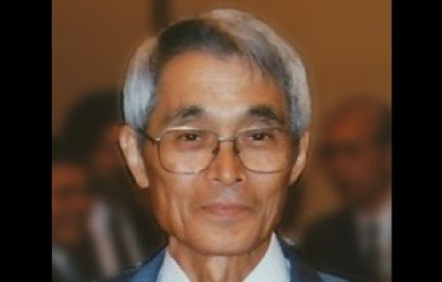
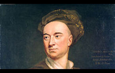

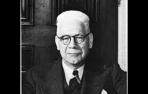


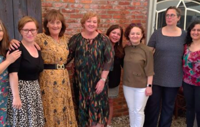


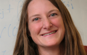


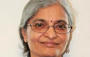


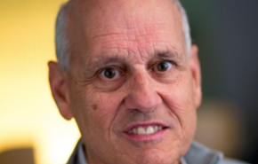


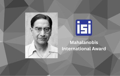


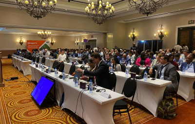


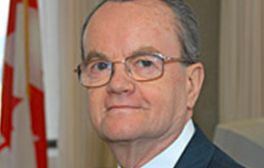


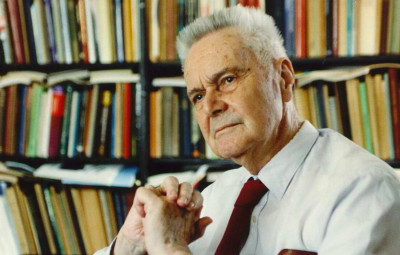


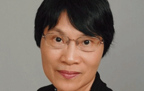
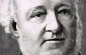
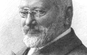


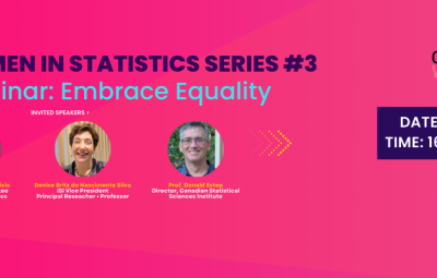

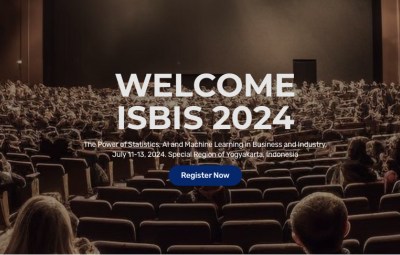


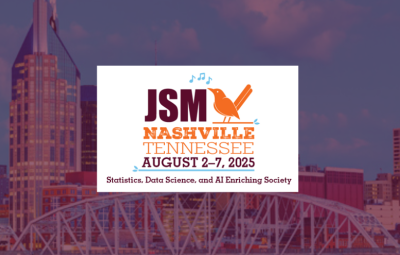


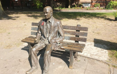


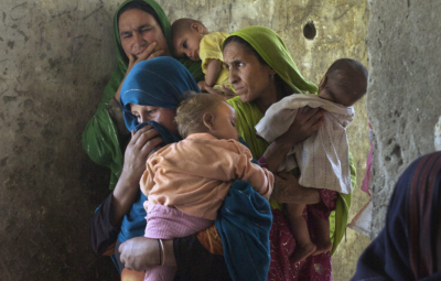


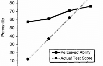

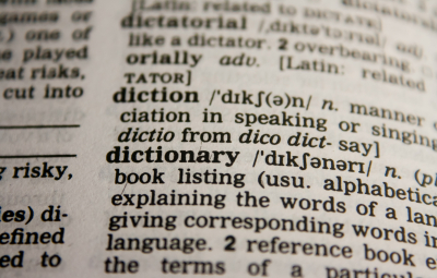


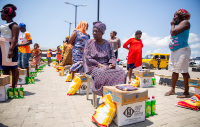
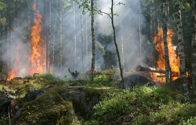


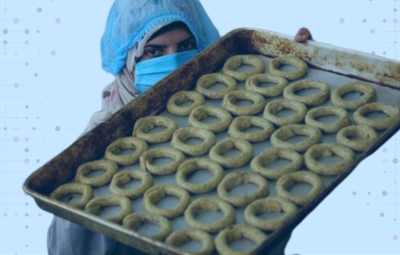


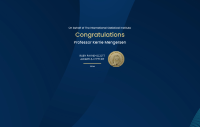


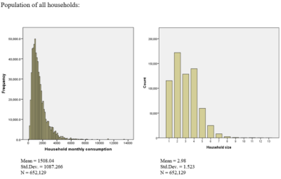


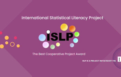


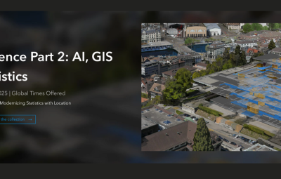


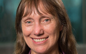


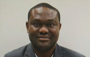


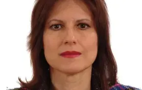


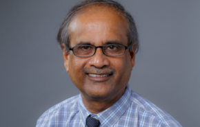


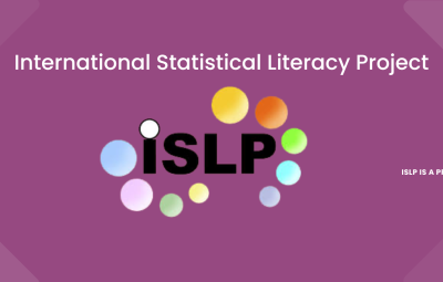


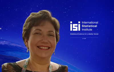
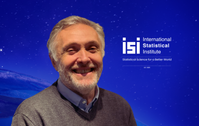
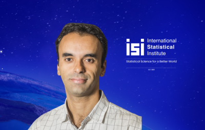


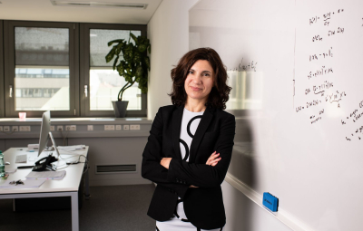


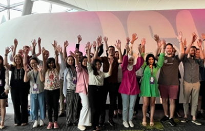


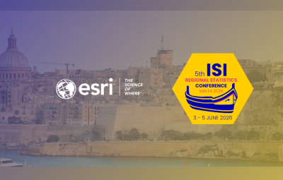


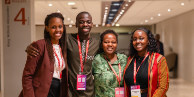


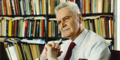


